
Scan the QR code and open PeakVisor on your phone
Virgin Islands National Park has 25 named peaks. The highest is Bordeaux Mountain at 390 m. Other notable peaks include Bordeaux North Hill, Mamey Peak and Camelberg Peak.
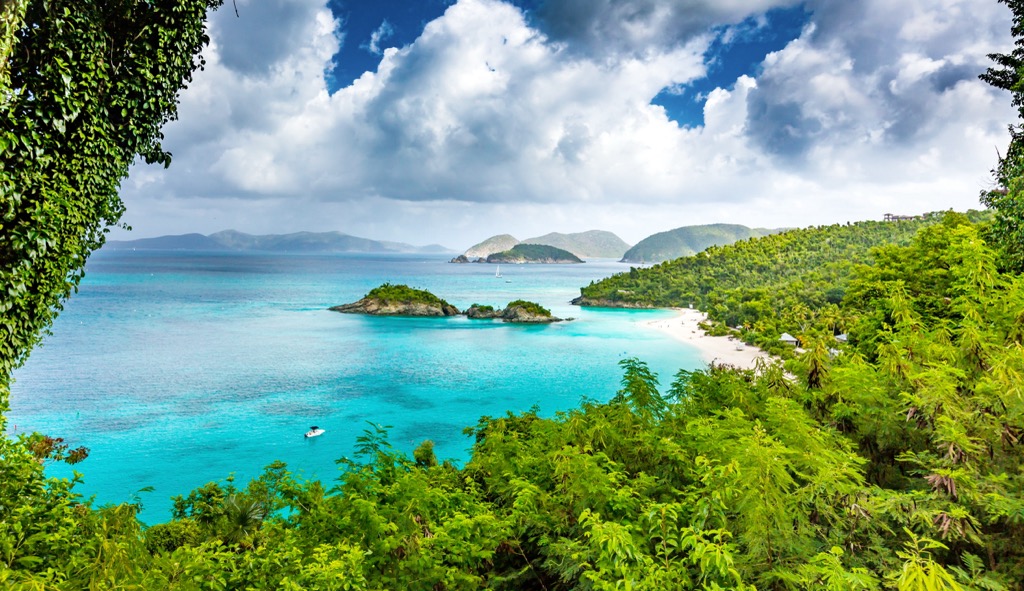
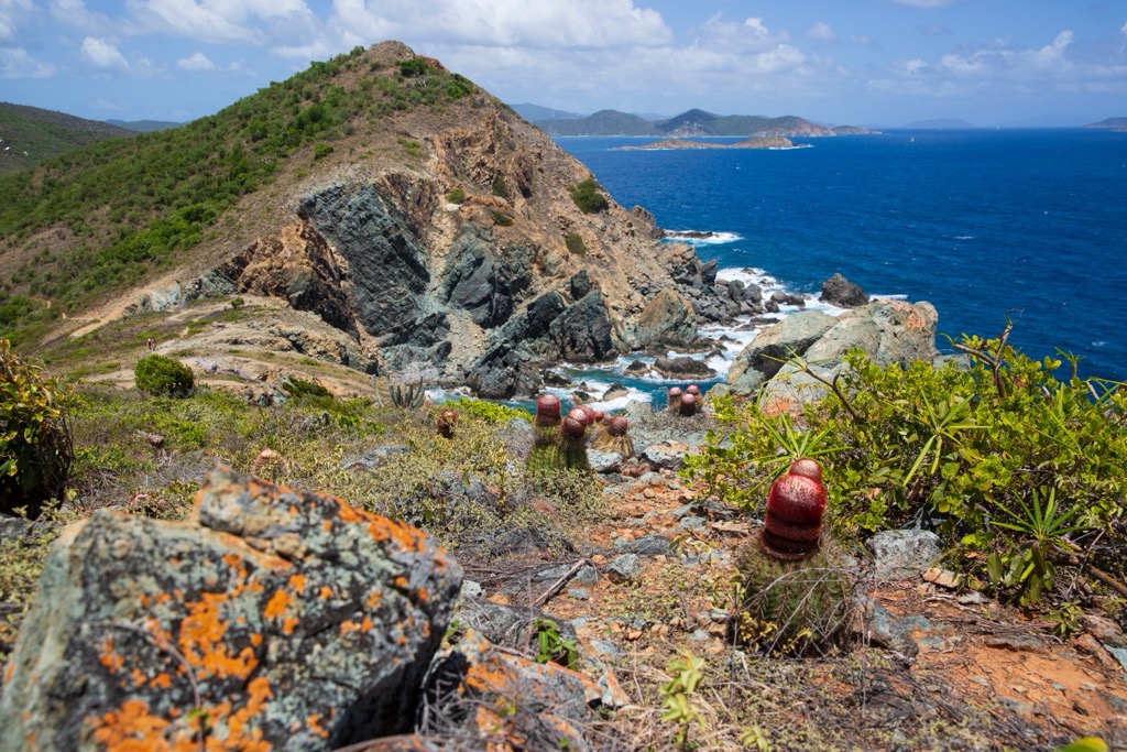
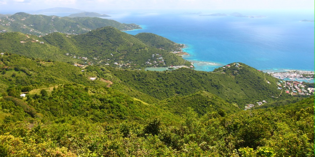
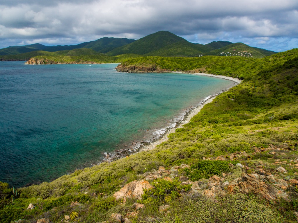
With more than 7,250 acres (2,930 hectares) of land and 5,650 acres (2,286 hectares) of mangroves, reefs, and ocean, Virgin Islands National Park offers mountain trails, pristine beaches, and an abundance of wildlife, both terrestrial and marine. There are 25 named mountains within the park. Bordeaux Mountain is the tallest and most prominent, rising 390 m (1,280 ft) from sea level to summit. The park is located within the United States Virgin Islands.
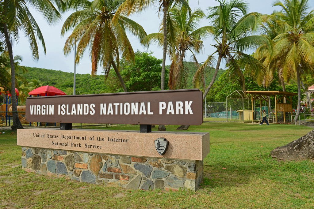
Virgin Islands National Park was established in 1956 and covers more than two thirds of the island of St. John and includes Hassel Island. In 1976, it was designated an International Biosphere Reserve site by UNESCO.
The park includes 7,259 acres (2,938 hectares) of terrestrial habitat and 5,650 acres (2,286 hectares) of surrounding waters. From the mountains to the reefs, the park protects vital habitat and feeding grounds for tropical and migrating birds, fish, corals, marine mammals, and around 750 species of plants.
The national park lies within the United States Virgin Islands, east of Puerto Rico and northwest of Antigua and Barbuda.
St. John is a volcanic island, part of a submarine mountain range that extends from Cuba to Trinidad. St. John is situated on the northern edge of the Caribbean plate, on a microplate it shares with Puerto Rico, Haiti, Cuba, the Dominican Republic, and St. Thomas. The Caribbean plate borders the North American, South American, and Cocos plates.
The oldest rocks date back 100 million years from the late Cretaceous period. After a long period of undersea mountain building, several ridges and peaks broke the ocean surface. Next came episodes of explosive volcanism, interspersed with coral reef deposits, changing sea levels, and future intrusions.
There were five formative geological periods in the creation of the island of St. John. The first is known as the Water Island Formation. During this time, lava flowed out along the ocean floor and as it hardened, formed pillow lava. The second is called the Louisenhoj Formation. This was a period of explosive volcanism, in deep and shallow waters. It left behind tuffs and other rocks made of compacted volcanic ash.
The Outer Brass Formation came next which saw sediment from coral and plankton skeletons accumulating on the island’s slopes. The Tutu Formation followed – a period of intense tectonic activity that created steeper slopes beneath the ocean’s surface and exposed rocks from the Louisenhoj Formation.
The final formative episode is the Hans Lollik Formation. This was the island’s third wave of volcanic activity and created intrusions of stocks and dikes via contact metamorphism. As the Caribbean Plate continues to slide under the North American plate at a rate of less than 1 in (2.5 cm) per year, it creates a transform fault boundary. This results in earthquakes in the region every few years.
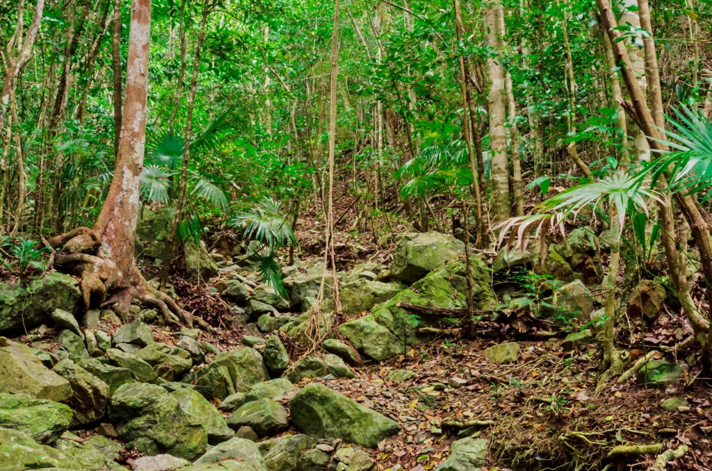
Virgin Islands National Park protects some of the last remaining tropical dry rainforest in the Caribbean. It became a UNESCO International Biosphere Reserve site in 1976, one of only 30 of these sites worldwide with both marine and terrestrial ecosystems.
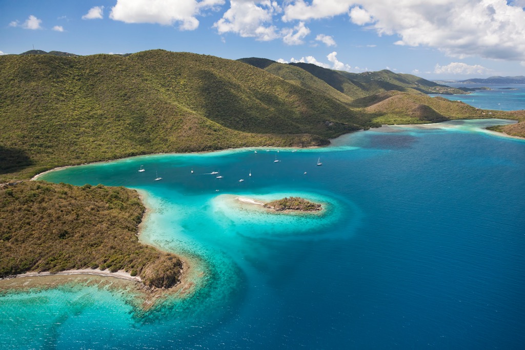
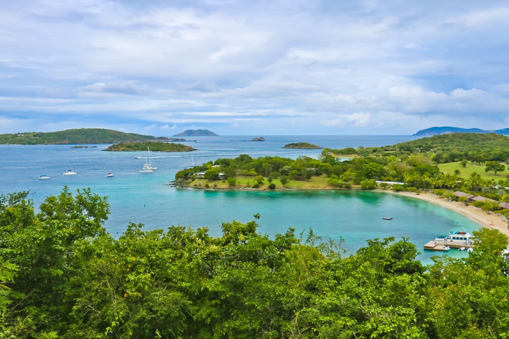
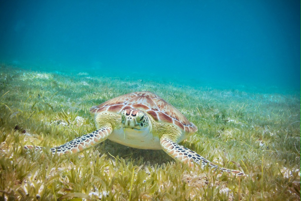
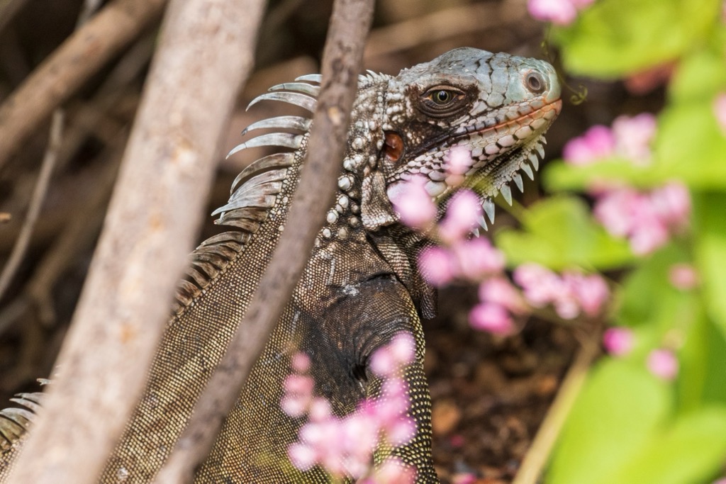
Roughly 40% of the park is underwater and includes mangroves, seagrass beds, fringing and patch reefs. The park is home to 138 bird species, nearly 400 reef-associated fish species, 17 whale and dolphin species, more than 200 invertebrates, 13 species of reptiles, and a variety of coral and sponges.
The park supports ongoing research on seagrass monitoring, sea turtle nest monitoring, fish counts, marine habitat studies, and coral disease.
Much of the land cover is recovering secondary forest. Of the approximate 750 species of trees and plants that grow on the island, 642 are native species that arrived by wind, water, or birds to the island.
Dry tropical forest is the dominant vegetation cover and common trees in this forest type include turpentine, water mampoo, wild frangipani, gris gris, and genip. The second most common vegetation cover is shrubland, marked by heiti heiti trees, manchineel, pipe organ cacti, and agave.
About 10% of the island’s forests are moist tropical forest, home to some of the tallest trees on the island reaching heights of nearly 100 ft (30 m). Wetlands comprise 1.8 % of the land cover and contain three types of mangroves – red mangrove, black mangrove, and white mangrove.
The only native mammals to the islands are bats. But due to human inhabitation, deer, goats, sheep, donkeys, cats, dogs, mongoose, and pigs have all been introduced.
Humans have been present on the Virgin Islands as far back as 840 BC when it was home to nomadic hunter-gatherers. Over time, the hunter-gatherers were replaced by chiefdoms, and shortly thereafter complex ceremonial sites appeared.
Archeological evidence remains on the islands to this day, helping to paint a clearer picture of the conditions that led to the rise of the Taino, an Arawak people, who occupied the island as far back as 1,300 years ago until the arrival of Christopher Columbus in 1493.
Between 1,300 and 1,000 years ago, populations on the island began to increase rapidly, marking the rise of the Taino. They established villages at Cinnamon Bay, Coral Bay, Caneel Bay, and Lameshur Bay. They lived in communal villages, used stone tools, grew cotton for clothes and hammocks, and etched petroglyphs into rocks that can still be seen today.
Columbus’ arrival marked an abrupt change in the island’s history. As Europeans vied for economic control of the islands and brought enslaved Africans to work on their plantations, the island quickly became a melting pot of diverse cultures, albeit a dark one with brutal treatment of enslaved workers.
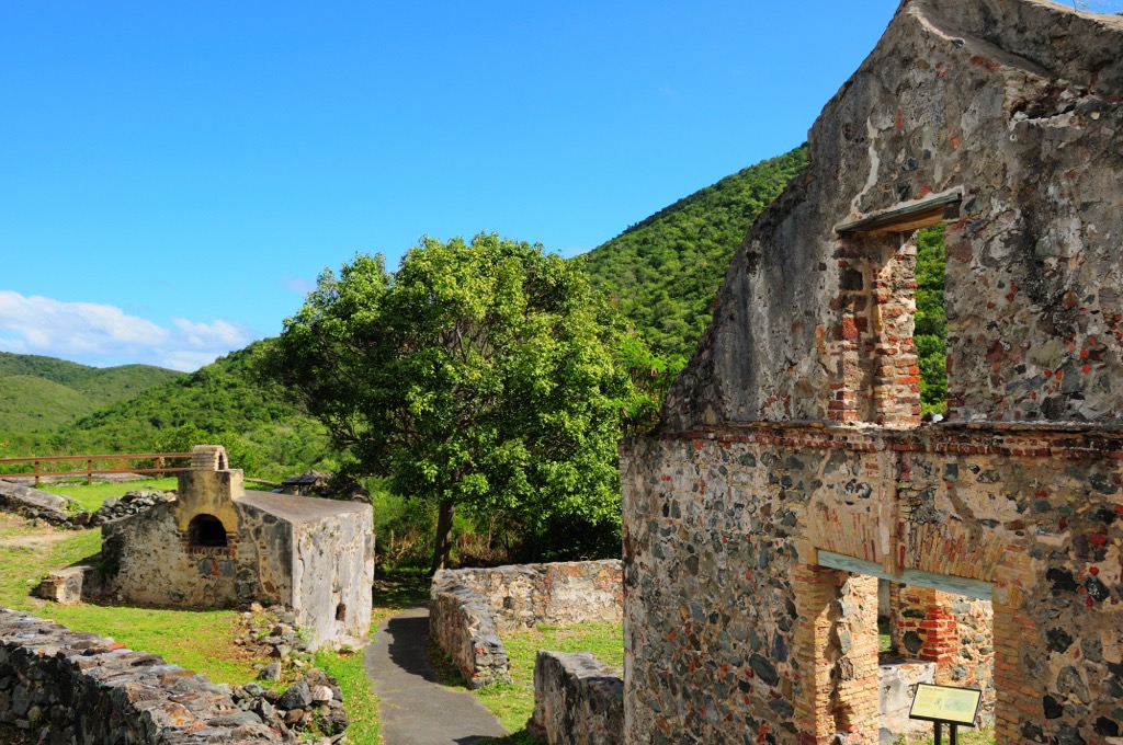
The Danes established their first settlement on the island in 1718 as part of the Danish West Indies. They went on to clear the land for sugarcane and cotton, removing up to 90% of native land cover in the process. By the mid-1800s, plantations were in decline, giving way to charcoal and rum production. Although forests began to grow back as plantations fell out of use, imported livestock and non-native plants competed with the recovering native vegetation.
The US purchased the islands in 1917 and established Virgin Islands National Park in 1956.
In addition to scenic mountain trails with vistas across bright blue bays, the national park can, and should, be enjoyed from the water. There are many opportunities to swim, snorkel, paddle, dive, and go boating along the coast.
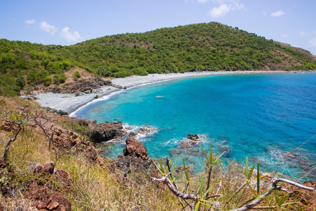
Those wanting to stretch their legs can choose from over 20 mi (32 km) of trails. From accessible boardwalks to sandy beaches to rugged forests, the trail system here has it all.
The trail to the tallest peak in the park is 2 mi (3.2 km) out and back and you’ll gain just under 1,300 ft (395 m) along the way. There are a few good look outs from the trail. Although the top is not spectacular as the trail intersects with a road, you can follow the trail to Yawzi Point with great views out over the surrounding bays. The trail is mostly forested so you’ll have shade for most of the hike.
A 4.4 mi (7 km) out and back hike that gains almost 1,200 ft (365 m) in elevation, the trail takes between two and four hours and is a good pick for those looking to get up close to historical sites. On the way to the beach, the trail passes the remnants of a historic Danish sugar plantation and petroglyphs left behind by the Taino.
This 2.3 mi (3.7 km) out and back trail with 300 ft (90 m) of elevation gain is very popular for its incredible views and ease of access. From the trail you’ll pass beaches, a salt pond, pristine blue bays, and take in sweeping views of the surrounding mountains.
The Johnny Horn Trail is a 3.1 mi (5 km) out and back trail that gains about 1,000 ft (305 m) in elevation. For those looking for a good workout, the trail is considered strenuous and passes historic stone sites and sweeping views along the way. There is not much shade on the trail so it’s best to come prepared with a hat, long sleeves, and plenty of water. It typically takes two to four hours to complete.
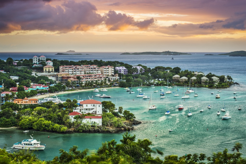
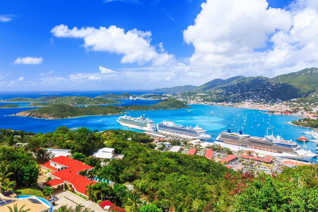
Cinnamon Bay Campground is located within the park. It has everything from bare tent sites to eco-tents and cottages. There are no major cities on the island of St. John. To arrive at the national park, one must fly into St. Thomas Cyril E. King Airport on the neighboring island of St. Thomas.
St. Thomas measures 32 mi2 (83 km2) and has a population of 42,500 people. Anyone planning to go to Virgin Island National Park must first land in St. Thomas, whether by flight or cruise ship. From there, a 45 minute ferry will take you to the nearby St. John.
The island hosts spectacularly colored bays, sandy beaches, and surrounding green hills. The harbor of Charlotte Amalie has plenty of fine dining and nightlife, as well as the reputation of being the shopping capital of the Caribbean. In addition to eating, partying, and shopping, there are more than enough ways to get out and explore the tropical island – snorkeling, boating, swimming, diving, and windsurfing.
The island has many hotels and the option to rent a vacation home or villa. The food tradition on the islands is rich and you will find everything from food trucks to gourmet dining. With fresh seafood, local spices, and a rich Caribbean culinary tradition, you won’t be at a loss for what to eat here.
Puerto Rico’s capital is only a 35 minute plane ride away from St. Thomas and home to 327,000 people. With dancing, old castles, rum distilleries and tasting tours, and museums celebrating the island’s rich history and culture, fully experiencing the urban center could take days.
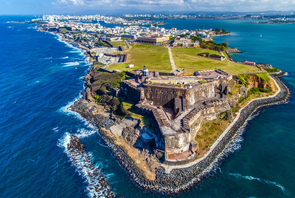
If you’re hoping to catch a breath of fresh air, you can find a beach near the city, or venture a bit further around the island to find quiet bays, go hiking, or visit the nearby El Yunque National Forest – the only tropical rainforest within the United States’ national forest system.
If you’re looking for accommodation in San Juan, you’ll find a range of hotels from budget to boutique to historic resorts, or can opt for a more personal vacation rental. There are plenty of restaurants to choose from offering fresh seafood and a taste of Puerto Rican specialties.


The highest peak in Virgin Islands National Park is Bordeaux Mountain, at 390 m.
Notable peaks in Virgin Islands National Park include Bordeaux Mountain, Bordeaux North Hill, Mamey Peak, Camelberg Peak and Doubloon Hill.


