Scan the QR code and open PeakVisor on your phone
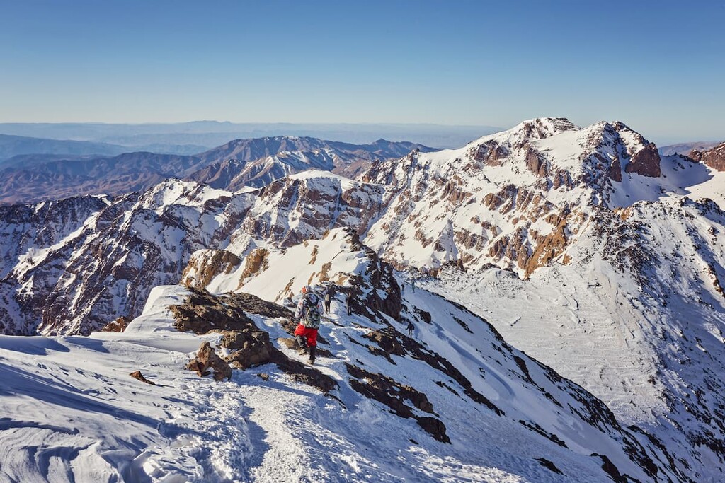
Toubkal National Park is a protected area located in west-central Morocco that’s known for its rugged peaks and spectacular hikes. The park encompasses some of the tallest peaks in the Atlas Mountains of North Africa. There are 38 named mountains in the park. The tallest and most prominent is Toubkal at 4,167 m (13,671 ft) with 3,757 m (12,326 ft) of prominence.
Toubkal National Park is situated in west-central Morocco in the region of Marrakech-Safi. Located in the High Atlas mountains, the park is centered around the range’s tallest peak, Toubkal.
Both the northern and western sides of the peak drain into the Mizane Valley. The Ikhibi North and Ikhibi South valleys provide access to those wishing to trek to the summit of the tallest peak in North Africa.
The High Atlas mountains are a subrange of the Atlas Mountains which extend throughout the park, traveling northeast into the rest of Morocco and toward northern Algeria.
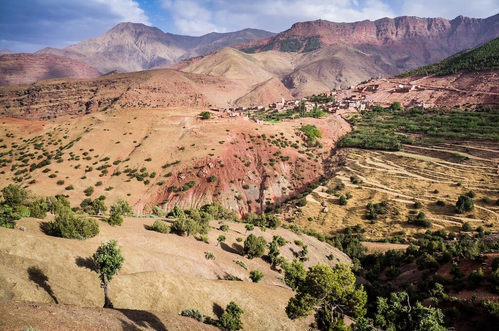
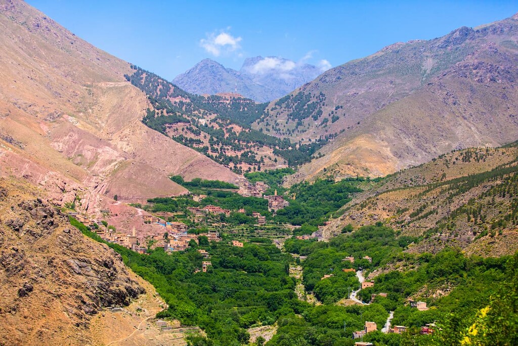
Toubkal is located near the center of the park. In total the national park spans 380 sq km (147 sq miles) across the region. Arid mountain landscapes dominate much of the park with steep and barren hills located throughout.
About 15 percent of the park is forested, though the park’s major peaks are often quite exposed. The cliffs of these peaks are met with high mountain plateaus and deep river valleys. Glaciers and snowmelt in the park create the headwaters for the rivers within the region.
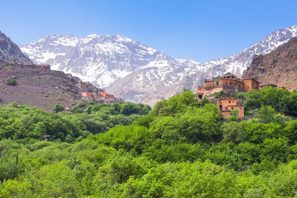
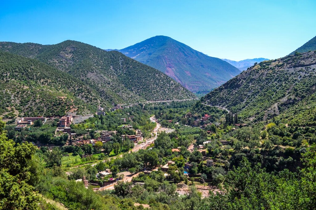
The rocky hillsides in Toubkal National Park feature hiking paths that travel across rock fields and steep cliffs on their way to some of the region’s best viewpoints. The rural village of Imlil is nestled within the mountains and acts as a popular stop for those trekking in the region.
Additionally, Toubkal National Park is located somewhat near other parks in the country. These places include Haut Atlas Oriental National Park, Khénifra National Park, and Ifrane National Park all located to the northeast.
The mountains within the Toubkal National Park are part of the High Atlas range, also known as the Grand Atlas. This subrange contains the highest peaks in the Atlas Mountains.
The peaks within the Atlas Mountains formed during two different geological periods. A large Paleozoic Massif separates the western peaks from the central and eastern peaks. Two massive rift episodes, dating back to the Late Sinemurian and Pilensbachian periods, formed the rest of the peaks in the range.
As the Eurasian and African plates collided with one another, the peaks were uplifted. Today, the range is marked by its horst and graben topography.
Millions of years of erosion have created the jagged peaks and rough ridgelines within the park, distinguishing it from other subranges in the Atlas Mountains. Deep valleys mark the western peaks while the central and eastern High Atlas have more gentle foothills.
The bones of a Atlasaurus dinosaur was discovered in the eastern mountains of the park. It’s believed that the fossils of the Atlasaurus date back 180 million years.
Major peaks within the park include Toubkal, Timesguida, Aiguille d’Ifni, Aksoual, Angour, and Ras Ouanoukrim.
The park helps protect numerous endangered species in the region. The mouflon is one of the most prevalent species in the park as it thrives despite the arid mountain landscape.
Other common animals include 13 species of raptors, such as the booted eagle, Bonelli’s eagle, royal eagle, and short toed eagle. The Barbary macaque, Barbary sheep, and bearded vulture are all endangered species whose populations are beginning to recover thanks to the park.
Trees and forested sections are scattered throughout Toubkal National Park, though they are not common. At lower elevations visitors can see juniper, holm-oak, cedar, aleppo pine, argan, carob, and barbary thuya trees. At higher elevations, trees give way to low growing endemic shrubs and grasses who attain water through a network of underground springs.
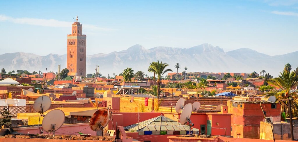
The Toubkal National Park is situated just 70 km (43 miles) south from the city of Marrakesh. Humans have inhabited Marrakesh for thousands of years. The city itself was established in 1070 CE as the capital of the Almoravid dynasty.
During the twelfth and thirteenth centuries, the city was often in rebellion and acted as a semi-autonomous state. During this time, there were few villages located near the modern park boundaries. However, some small communities existed in the region.
Much of Marrakesh was rebuilt during the nineteenth century after it was conquered by French troops. The first recorded ascent up Toubkal took place in 1923, though it is thought that it had been climbed earlier. The park was established in 1942, making it one of the first protected regions of present-day Morocco.
The country of Morocco gained independence from France shortly afterward in 1956. The park was established to protect the mountainous landscape and endangered species. Small communities, such as Imlil, were established more recently to accommodate tourists and visitors who hike and trek in the mountains.
Toubkal National Park is home to numerous trails and other opportunities for outdoor recreation. Here are some of the most popular trails in the park:
The most prominent trail in the park is the trek up to the summit of Toubkal. The trek often takes two days and is labeled as non-technical since a rope is not needed to reach the summit.
However, the trek is best done with a local guide and some mountaineering gear may be required depending on how much snow coverage there is. Proper research should be completed before attempting this challenging route.

The trail to the Radio Tower leaves from the town of Imlil. The tower can be seen throughout the town and the hike to it takes less than one hour. From the tower, hikers can look out over Imlil as well as other small communities in the nearby valleys.
The hike from Imlil to Asni is 17 km (10.6 miles) long and it follows along the river that connects the two towns. The route is often completed in one direction before getting a ride back to the starting point.
This route is not as common as others in the area since it leads away from Toubkal, which is the reason many hikers visit the region. The major highway between the two cities is nearby, allowing hikers for easy access to shorten the distance.
Looking for a place to stay near Toubkal National Park? Here are some of the best cities and villages to check out in the region:
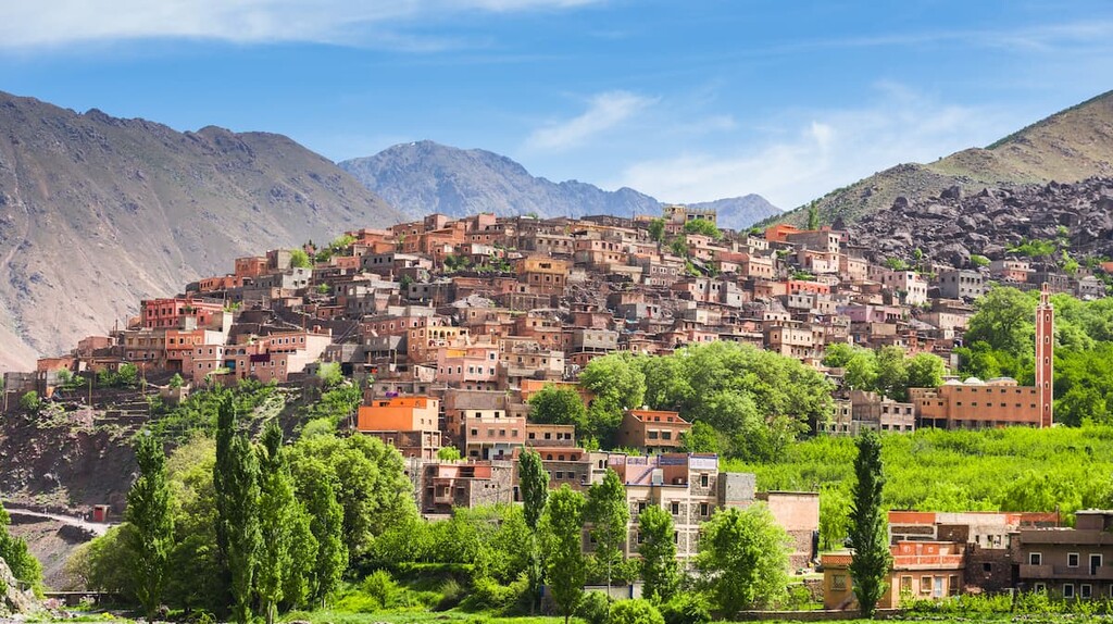
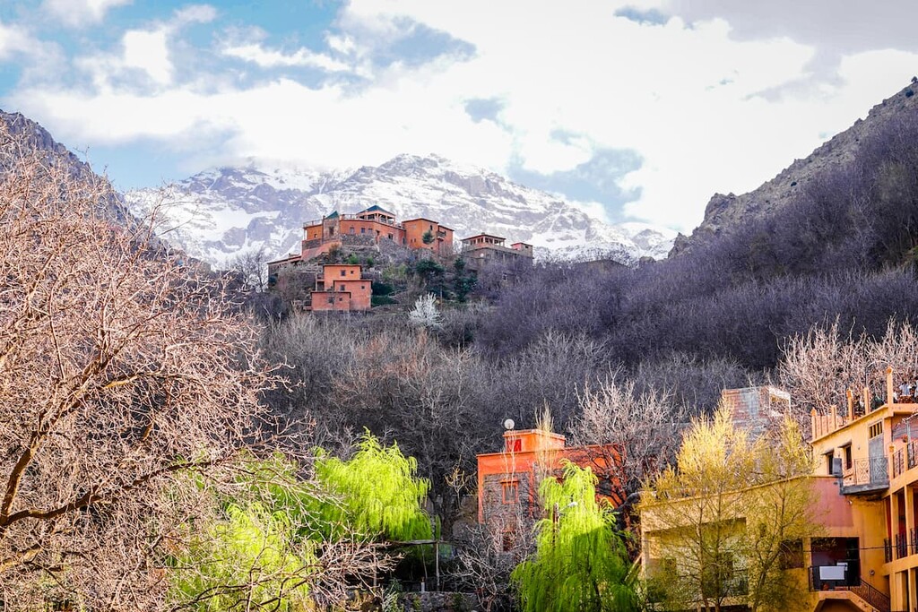
The community of Imlil is located near the base of Toubkal, offering the most direct route up to the summit. Situated at 1,800 meters (5,900 ft) above sea level the village acts as a base camp for many ventures into the park. Local guides can be found in the village for those wishing to summit the mountain.
Though small, Imlil is known throughout the country for being a leader in mountain tourism and excursions. The construction of the village is quite new as it was built in order to support the influx of tourists.
Located just an hour and a half drive north of Imlil lies Marrakesh. With a population of nearly 1 million people, Marrakesh is the fourth most populous city in the country. Today the city’s history is apparent through its fortified walls accompanied by local shops and vendors.
The Heritage Museum, Jardin Majorelle, and Le Jardin Secret are popular spots for both locals and tourists, alike. The Medina is known for its narrow streets full of local vendors, markets, and artists. The rooftop cafes in the area allow for views of the bustling streets down below.