Scan the QR code and open PeakVisor on your phone
Ifrane National Park is a forested park located in central Morocco that’s known for its high levels of biodiversity and stunning landscapes. The park is also a vital habitat for many endangered species. There are 46 named mountains in the park. The tallest and most prominent is Jebel Hebri at 2,112 m (6,929 ft) in elevation with 211 m (692 ft) of prominence.
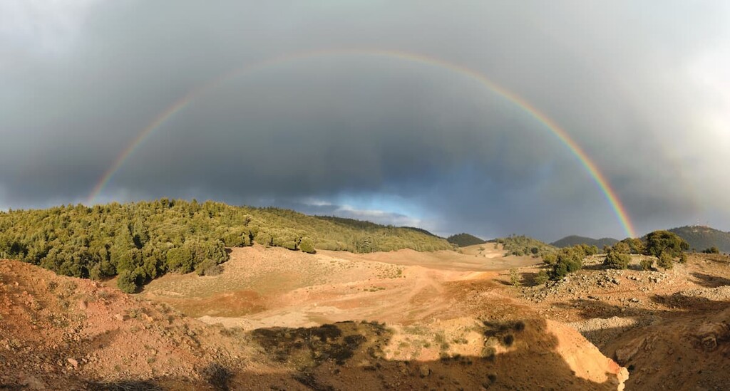
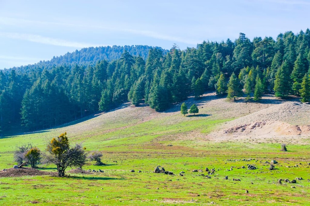
Ifrane National Park (المنتزه الوطني إفران) is situated in central Morocco in the region of Fez-Meknes. Located in the Middle Atlas mountains, the park is home to an expansive forest landscape. The park spans 500 sq. km (193 sq. miles) with elevations ranging from 1,300 to 2,400 m (4,590 to 7,874 ft) above sea level.
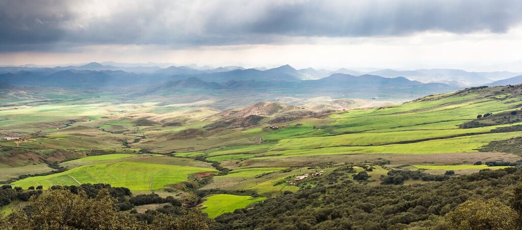
The Middle Atlas mountains are a subrange of the Atlas Mountains that extend throughout the northern part of Africa. The Atlas Mountains extend to the northeast into the rest of Morocco and northern Algeria. To the south of the park lies the High Atlas subrange which is home to the highest peaks in northern Africa.
A majority of the park is densely forested with Atlas cedar. It is estimated that one-tenth of the world’s Atlas cedar is found along the rolling hills in the park. Meanwhile, wetlands accompany the high altitude forests.
Both Lake Afennourir and Aguelmame Tifounassine are located within the park boundaries. The two lakes are known as important wetlands amidst the Atlas cedar forest. Other small lakes are also scattered throughout Ifrane National Park.
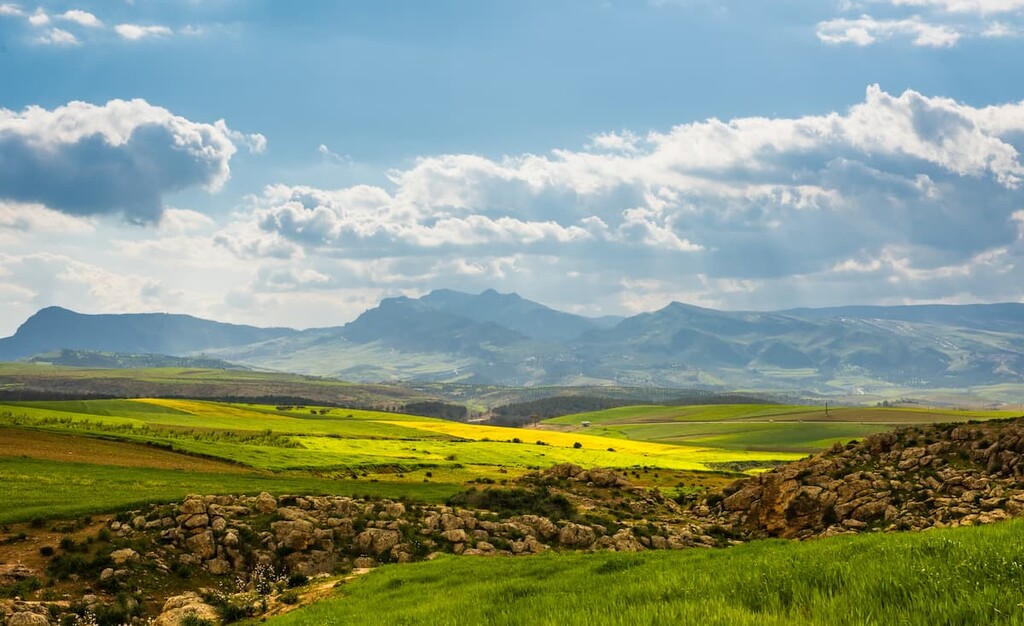
The expansive forest that dominates the region begins to thin along the park’s boundaries, giving way to a more barren mountain landscape. Elevations steadily rise in the southern end of the park as the peaks begin to transition into the High Atlas range.
Additionally, Ifrane National Park is located somewhat near other parks in the country. These places include Khénifra National Park, Toubkal National Park, and Haut Atlas Oriental National Park to the south, and Tazekka National Park to the northeast.
The mountains within the Ifrane National Park are part of the Middle Atlas range, the second tallest subrange within the Atlas Mountains. The Middle Atlas subrange spans beyond the park boundaries, totaling 350 km (220 miles) in length.
The Atlas Mountains began forming when the Eurasian and African plates collided with one another. The immense pressure associated with this collision resulted in the uplifting of much of the range.
Peaks within the park are composed mainly of limestone, along with various other sedimentary rocks. Millions of years of erosion carved out both the rolling hills and rugged peaks of the region.
Outside of the forest, the Middle Atlas subrange is marked by numerous volcanic plateaus. Continually folding has given way to the unique features of this subrange.
Major peaks within the park include Jebel Hebri, Bou Ikhitene, Ikhef Agmar, Ich Ouharrok, and Jbel Aaoua.
One of the reasons that Ifrane National Park was originally established was to protect the biodiversity of the region. Over 1,000 plant species have been documented within Ifrane National Park, alone.
The Atlas cedar is one of the defining plant species of the park. Other common trees include Algerian oak, maritime pine, Spanish juniper and evergreen oak. The dense forest provides a protected landscape for the park’s flora.
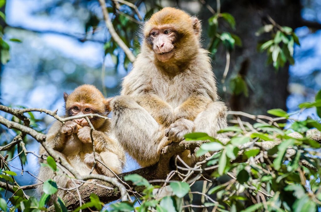
It is estimated that 25 percent of the world’s population of the endangered Barbary macaque lives within the park boundaries. The species was once widespread across northern Africa and even Gibraltar, yet today, it relies on parks, such as Ifrane National Park, to avoid extinction.
The forest also provides habitat for Barbary boars, golden jackals, red foxes, hyenas, European otters, European rabbits, cape hares, and crested porcupines. Birds such as snipes, egrets, and fulicas, can often be spotted near Afennourir Lake.
Human history in Morocco dates back thousands of years. The Phoenician colonization of the region took place around the eighth to the sixth centuries BCE. Additionally, the region has been inhabited by the Berbers for at least the last 10,000 years.
The Berbers, and later the Phoenicians, ruled what is now present day Morocco until around 40 CE, when the Romans arrived. By the sixth century CE, the Byzantine Empire was in control of the region until the Muslim conquest of the Maghreb.
The city of Fez lies to the north of the forest and was founded in 789 CE. Idris I was founder of the Idrisid dynasty and established the city. Throughout all of this, the Berber continued to live in their ancestral homelands, however, by this time, they had mostly adopted Islam.
Arab immigrants began coming to the city in the ninth century. In the eleventh century, the Almoravid dynasty took over and Fez became known for religious devotion. In the centuries that followed, the Jewish population in the region also grew, partially as a result of the Reconquista in what is now Portugal and Spain.
The region that is now Morocco was then “carved out” into protectorates by the French and the Spanish in the early twentieth century. This led to a period of colonization in Morocco and the region until Morocco regained its independence from France in 1956.
The forest within Ifrane National Park has long been respected by the local community. The idea of establishing a park began in the 1980s. During the 1990s, Morocco became more involved with protecting important and delicate ecosystems.
The park was officially established in 2004 in order to protect both the flora and fauna species and to help prevent further exploitation of the region’s natural resources.
Ifrane National Park is home to numerous trails that offer hiking and biking opportunities. Here are some of the most popular trails in the park:
The Panorama Loop Trail is an easy route through the park. The trail is 3.4 km (2.1 miles) long with 100 m (328 ft) of elevation gain. The gentle winding trail provides hikers with views of wildflowers as well as opportunities to spot macaques and go birdwatching.
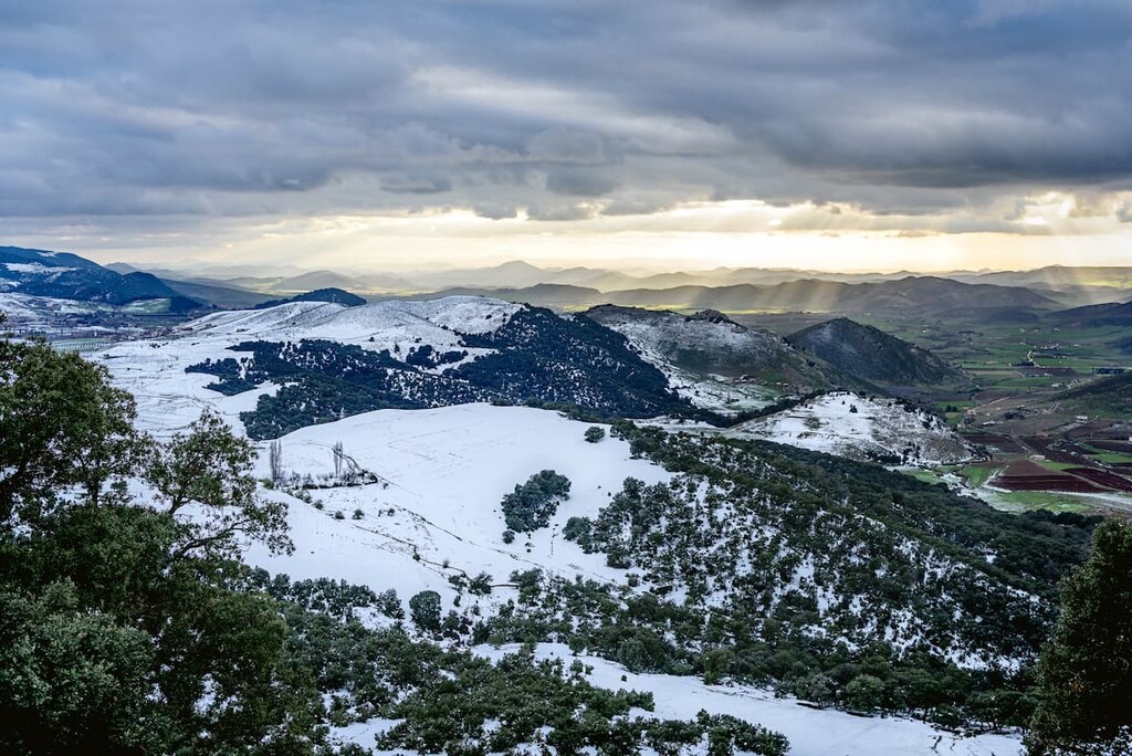
The Link Loop Trail is slightly longer at 5.8 km (3.6 miles) in length. The trail has 142 m (465 ft) elevation gain and provides views of the nearby snow-capped hills during the cooler months of the year.
Much of the route travels through the region’s dense cedar forest, providing hikers with the chance to see macaques as well as fox and wild boar.
Commonly referred to as the Monkey Trail, this loop travels 7.4 km (4.6 miles) with 245 m (803 ft) elevation gain. As one of the most popular trails in the park, this loop often takes hikers around 2.5 hours to complete.
True to the hike’s name, the trail is often an accessible way to spot the famous macaque of the park. Other wildlife can be spotted along the way throughout both the forest and the more exposed sections of trail.
Looking for a place to stay near the Ifrane National Park? Here are some of the best cities and villages to check out in the region:
Nestled on the western boundary of the park lies the city of Azrou. Known as a market town, Azrou has a population of around 82,000 people. The city is popular amongst tourists and hikers looking to explore the national park.
The Grand Cedar, an 800 year old cedar tree, is another popular tourist attraction of the area. A large volcanic outcrop sits at the center of the city for which Azrou was named after. The streets are often full of busy and bustling markets from local vendors.
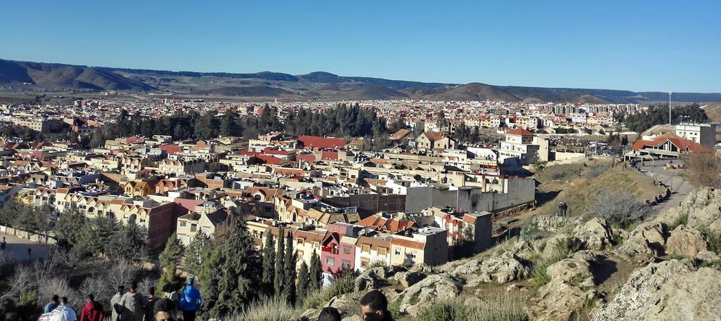
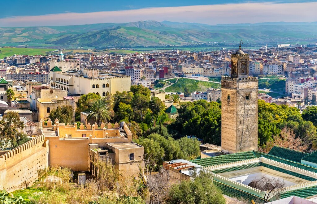
Located just an hour and a half drive north of Azrou lies Fez (Fes). With a population of over 1.2 million people, Fez is the second largest city in the country. The city is often referred to as the cultural capital of Morocco.
The city’s Al Quaraouiyine Mosque was built back in 859 BCE and is still open to the public for visits. Chouara Tannery is also located within the city and is known for being the oldest currently operating tannery in the entire world. Just north of the city lies Jbel Zalagh, which offers hiking trails to the summit.