
Scan the QR code and open PeakVisor on your phone
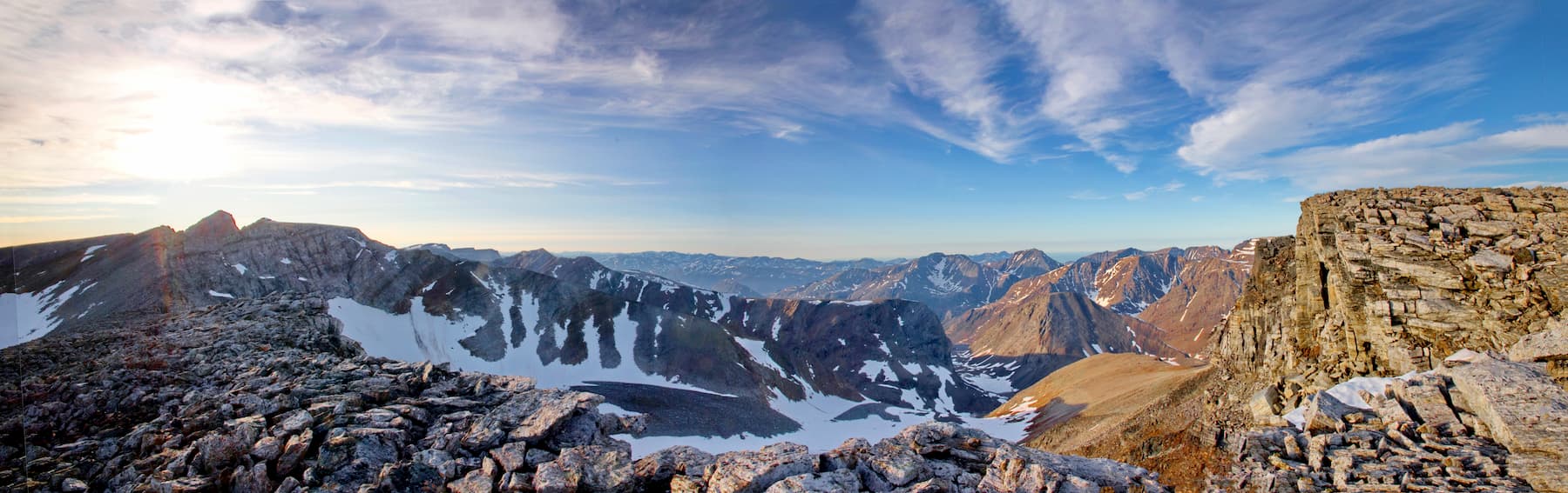
Home to Newfoundland and Labrador's loftiest summits, Torngat Mountains National Park encompasses over 2 million acres between Northern Quebec and the Labrador Sea. The park extends from Saglek Fiord in the south, including all islands and islets, to the very northern tip of Labrador and stretches from the Quebec border in the west to the Labrador Sea in the east.
Torngat Mountains National Park earned its name from the Inuktitut word Tongait, which translates to “place of spirits” and is accessible only by boat, making it one of the last unspoiled, wild places in the world.
Established in 2008, Torngat was created to protect important heritage resources and to allow visitors to experience and appreciate the splendor of the Northern Labrador Mountains. Despite being Canada’s youngest park, conversations about forming a park in northern Labrador began as early as 1969.
The Torngat Mountains have long been a cherished Inuit homeland. In fact, the park’s formation wouldn’t have been possible without the consent and cooperation of Labrador and Nunavut Inuit. Though the development of a park was initially seen as a potential threat to the natural landscape and cultural value of the region, Labrador and Nunavut Inuit eventually recognized the park’s potential to protect this critical part of their ancestral homeland. There are hundreds of archaeological sites in the park, including tent rings, stone caribou fences, and burial sites. Some of these archaeological sites date back roughly 7,000 years.
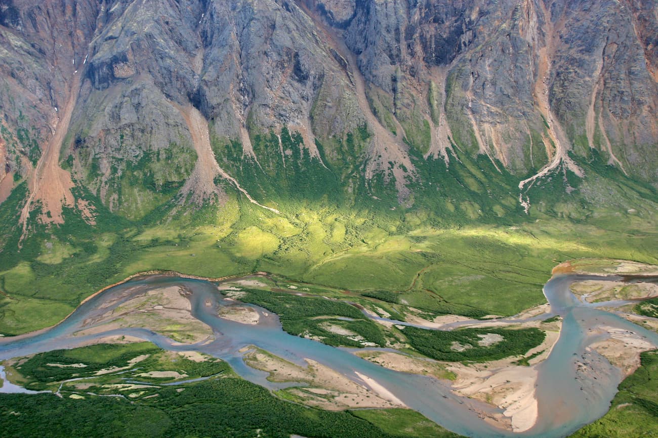
Torngat also encompasses some of the highest and most rugged mountains in eastern North America. The park protects an area of spectacular Arctic wilderness and contains four ecosystems: tundra, freshwater, coastal, and glaciers/icefields. The park contains roughly 57 named mountains and over 86 small glaciers.
Torngat is home to a variety of wildlife, including a small caribou herd, wolves, Arctic fox, and several species of Arctic birds. Polar bears and a unique population of tundra-dwelling black bears are also known to frequent the area. To keep visitors safe, armed Inuit bear guards often lead excursions.
There are no designated trails, roads, or signs in Torngat Mountains National Park. However, hikers with remote backcountry skills, including route finding, will appreciate the park’s acres of unmarked hiking routes and Inuit travel routes. Guided and unguided hikes and interpretive trails, overnight and multi day backpacking treks, and technical rock-climbing are popular activities in the Torngat Mountains.
The Torngat Mountains Base Camp and Research Station can provide visitors with helpful information related to day hiking routes and backcountry travel. Topographical maps outlining existing routes are also available. Visitors to Torngat Mountains are urged to bring a map, compass, and GPS.
Due to the park’s relative isolation, careful planning is required to visit Torngat Mountains National Park. The park contains no campgrounds and is not near any major cities or resorts.
Located on Saglek Fjord, outside of the park, the Torngat Mountains Base Camp is the main access point to the park. Inuit Bear Guards greet visitors at the Saglek Airstrip and provide transportation to a nearby Zodiac and passenger boat. After 40 minutes on the water, visitors will reach the Torngats Base Camp. The Base Camp and Research Station hosts international researchers, Inuit elders and youth, as well as visitors from around the world. Visitors can book a guided adventure through the Base Camp or opt to use the Base Camp as starting point for a backcountry adventure.


