Scan the QR code and open PeakVisor on your phone
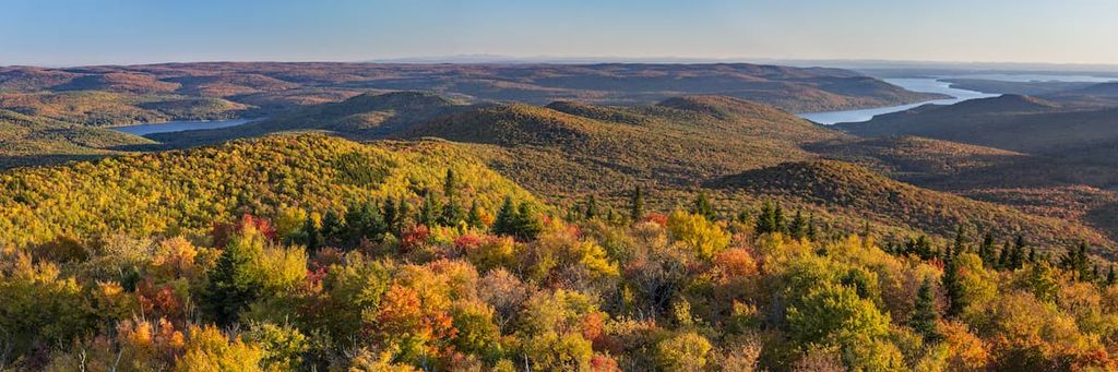
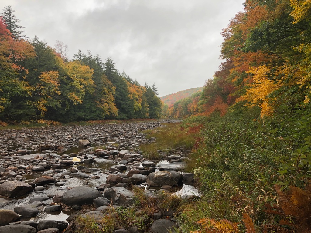
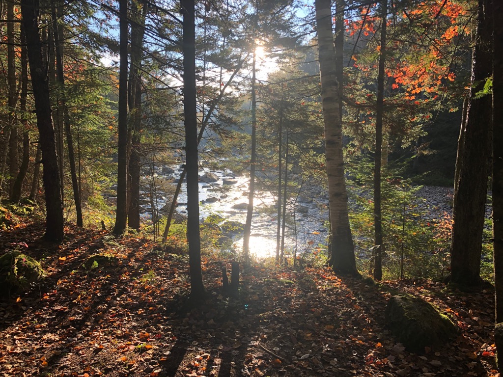
Shaker Mountain Wild Forest encompasses a quintessential Adirondack landscape of forested low mountains and valleys, crisscrossed by streams and dotted with ponds and lakes. The 40,500-acre (16,390 ha) wild forest is in upstate New York in the United States and is the southernmost unit in the Adirondack Forest Preserve within Adirondack Park. An extensive trail system weaves through the forest. Of are 17 named mountains, Pigeon Mountain is the tallest (2,789 ft/850 m) and the most prominent (863 ft/263 m).
The 40,527-acre Shaker Mountain Wild Forest is the southernmost unit of the Adirondack Forest Preserve, one of only two constitutionally protected landscapes in the world (the other is Catskill Park in southern New York). The Adirondack Forest Preserve is a unit of Adirondack Park, a 6-million-acre patchwork of public and private land in upstate New York. About 1.3 million acres (525,000 ha) of the Adirondack Forest Preserve is public land classified as wild forest, where motorized vehicles are permitted.
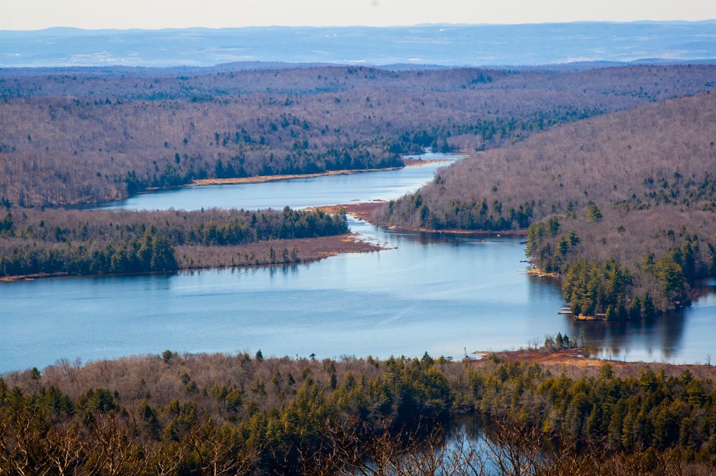
Most of the Shaker Mountain Wild Forest is in Fulton County, but a small portion of the forest also extends into Hamilton County. The Shaker Mountain Wild Forest sits just north of the Adirondack Park “Blue Line” boundary and shares about 140 miles (225 km) of its border with private property. It’s also surrounded by publicly owned land, including the Ferris Lake Wild Forest and Lake George Wild Forest to the west and the Silver Lake Wilderness to the north. Great Sacandaga Lake (previously named Sacandaga Reservoir) and the Wilcox Lake Wild Forest are just east of the forest.
The tallest peak in the forest is Pigeon Mountain (2,789 ft/850 m). Kane Mountain (2,185 ft/666 m) has a 60 ft (18 m) fire tower on its summit, a notable relic of upstate New York’s historical forest management. For most of the 1900s, a series of fire towers erected on mountaintops served as lookout points for early detection of potential wildfires. Initially constructed in 1925 and used until 1988, the tower was renovated in 2003 and is now open to the public.
Although the Kane Mountain summit is fully forested, sweeping views from the top of the tower take in the Canada Lakes region, Caroga and Peck Lake, Silver Lake Wilderness to the north, and Ferris Lake Wild Forest to the west. Further away and visible on clear days are the Mohawk Valley, the Catskill Mountains in the south, and the Helderbergs in the southeast.
The Shaker Mountain Wild Forest is highly accessible due to its proximity to public roads and trails. NYS Route 10 and 29A provide highway access to the western area of the forest, and NYS Route 30 provides access to the eastern region.

The Shaker Mountain Wild Forest is part of the Adirondack Mountains, a dome-shaped mountain range that covers about 5,000 square miles (13,000 sq. km.) of upstate New York. Unlike the elongated Appalachian Mountains, the Adirondacks form a circular dome around 160 miles (257 km) wide and 1 mile high.
Though the dome emerged about 5 million years ago, the rocks of the Adirondacks originated roughly two billion years ago as thick sediments at the bottom of a sea near the equator. Geologists believe tectonic forces uplifted the area about 1.5 to 1 billion years ago in a mountain-building episode known as the Grenville orogeny. The rocks constitute part of an extension of the Grenville Province of the Canadian Shield. Over time erosion has cut through younger, flat-lying sedimentary rocks to expose one-billion-year-old metamorphic rock.
Ice has heavily influenced the topography of the Adirondacks. Around 2.5 million years ago, during the Pleistocene Epoch, colossal ice sheets advanced and retreated several times across the Adirondacks. Shifting glaciers weathered mountaintops, wore away bedrock, deposited soil and loose sediments, and carved impressive river valleys into deep troughs.
Today, topography in the Shaker Mountain Wild Forest is primarily low, rolling forested hills with a maximum elevation of 2,780 feet (847 m) at the summit of Pigeon Mountain. The lowest elevation in the forest is about 880 feet (268 m) along West Stony Creek in the town of Benson.
The Shaker Mountain Wild Forest lies at the southern end of the eastern forest-boreal transition ecoregion. Therefore, the forest is a transitional zone between coniferous Boreal Forest and mostly deciduous broadleaf forest. Most of this ecoregion lies in eastern Canada, but a portion stretches south into the Adirondack Mountains. The Adirondacks are home to diverse habitats, including boreal, bog, wetland, and alpine. Summers in the region are typically short and cool, and winters are long and cold. Annual precipitation ranges between 45 and 50 in (114 to 127 cm).
There are several dominant forest types found within the Shaker Mountain Wild Forest. Northern hardwood forests typically grow up to 2,500 ft (762 m) elevation on sites with decent drainage. They contain sugar maple, American beech, yellow birch with eastern hemlock, black cherry, white ash, red oak, and red maple. Hobblebush and striped maple grow abundantly in the understory.
Red spruce and balsam fir dominate the mixed coniferous and deciduous forest. This forest type occupies the elevations about the third primary forest type – lowland coniferous forest. The lowland forest grows where the soil has high moisture content and poor drainage. It contains predominantly balsam fir, red spruce, and sometimes eastern white pine.
Vegetation in the Shaker Mountain Wild Forest was heavily impacted by logging during the 19th century. Because of logging in the 1800s and 1900s, only a few sections of older hardwoods remain. The forest mainly consists of younger second-growth hardwoods.
Featuring pristine habitat typical of the Northern New England region, Shaker Mountain Wild Forest is a bastion of biodiversity.
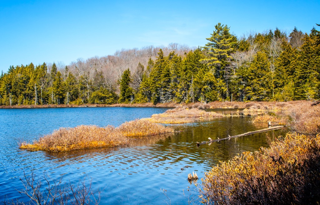
The forest houses many birds, both residents and migratory birds passing along the Atlantic Flyway. The most common birds associated with water are loons, grebes, great blue herons, American bitterns, mallards, American black ducks, wood ducks, hooded mergansers, and common mergansers.
Numerous songbirds thrive in the forest. These include ovenbirds, red-eyed vireos, yellow-bellied sapsuckers, black-capped chickadees, blue jays, downy woodpeckers, brown creepers, wood thrushes, black-throated blue warblers, pileated woodpeckers, and black and white warblers. The forests and waterways draw in several birds of prey, such as barred owls, great horned owls, eastern screech-owls, northern goshawks, red-tailed hawks, sharp-shinned hawks, and broad-winged hawks.
The region's main mammals that occupy forests are white-tailed deer, black bears, coyotes, bobcats, raccoons, red foxes, gray foxes, fishers, minks, muskrats, river otters, beavers, moose, porcupines, striped skunks, snowshoe hares, and American martens. A handful of amphibians and reptiles make their home in the forest, including several species of toads, frogs, salamanders, newts, snakes, and turtles.
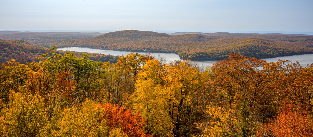
Nearby, the 24,707-acre Great Sacandaga Lake contains many different fish species, including largemouth bass, smallmouth bass, northern pike, walleye, brown trout, rainbow trout, yellow perch, black crappie, channel catfish, brown bullhead, redbreast sunfish, rock bass, and common carp.
Human history in the Adirondacks dates back about 11,000 years to the Paleo-Indian period. Following the Paleo-Indian period came the Archaic period, which supported a series of cultures from approximately 8,000 to 1,000 BC. Laurentian Culture marked the early Archaic period and saw humans practicing a semi-nomadic, hunting-gathering lifestyle. They used spears and bone harpoons for hunting. Subsequent cultures evolved, eventually transitioning into the Early Woodland Period, where pottery first appeared.
The Iroquois arrived between 4,000 and 1,200 years ago. The area that is Shaker Mountain Wild Forest today was part of Mohawk (Kanienʼkehá꞉ka) territory, one of the tribes within the Iroquois Confederacy. There was competition in the region with the Mahicans, an Algonquin-speaking group. While neither tribe lived in the mountains, they frequently competed over resources in and along the valleys and waterways. Iroquois tribes established semi-permanent settlements, and their principal crops were corn, beans, and squash.
The arrival of Europeans ushered in an era of disease that rapidly wiped out more than half the Native population. During the Revolutionary War, the Mohawk sided with the British. After the war’s conclusion, many evacuated the area and relocated to Canada.
The Adirondacks received their colonial name from geologist Ebenezer Emmons in 1838, but the term “Adirondack” is believed to be a Mohawk term for “bark eater” or “those who eat trees.” It’s theorized that the Mohawk used this term in a derogatory way to describe the neighboring Algonquins.
The French were the first Europeans to arrive in the Adirondack region. In 1609, French colonist Samuel de Champlain led an expedition to the long, narrow lake nestled between the Green Mountains and the Adirondack Mountains, just north of the present-day Shaker Mountain Wild Forest. Today, the lake still bears his name. Over the next several decades, the land would change hands several times – from the French to the British and finally to the American colonies. Almost immediately after the Revolutionary War, thousands of settlers moved into the Champlain Valley.
During the 19th century, the area experienced intensive logging. Shaker Mountain Wild Forest continued to be logged longer than some other neighboring forests because it was outside the original boundaries of Adirondack Park.
Needing money to settle war debts, the newly established state of New York sold millions of acres of Adirondack wilderness to loggers and farmers, leading to rapid deforestation and overhunting. Early logging targeted overstory pine and spruce for sawlogs and hemlock for bark. Leather production was essential to the local economy and demanded lots of oak and hemlock for processing and tanning.
Around 1880, there was a shift to harvest spruce pulpwood. The cutting of softwoods for pulp left behind flammable debris. In several instances, sparks from trains ignited this debris and started fires that damaged parts of the forest.
During the mid to late 19th century, the Adirondacks saw a significant influx in tourism, particularly among wealthy individuals from New York City. With this influx in tourism came a growing concern about the destruction of Adirondack forests. A series of legal actions led to the creation and protection of forests in the Adirondacks. The Forest Preserve was established in 1885. In 1892, the federal government created Adirondack Park. Shaker Mountain Wild Forest was born in 1972 as part of the Adirondack Park State Land Master Plan.

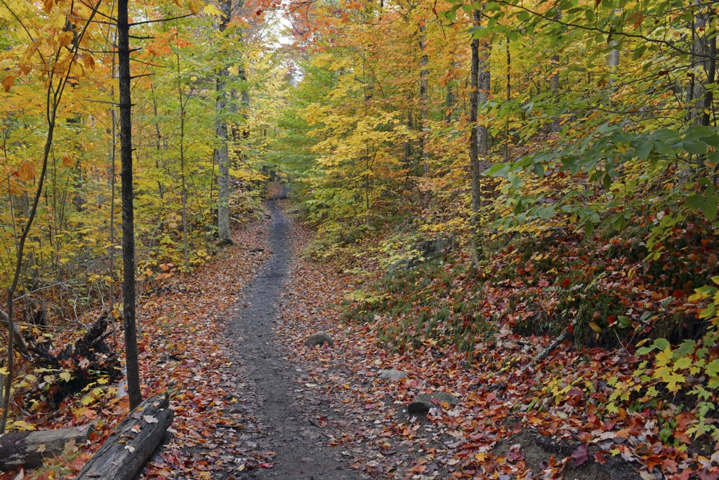
Shaker Mountain Wild Forest contains miles of trails for hiking, biking, horseback riding, snowshoeing, cross-country skiing, and snowmobiling. Ponds and lakes can be boated, paddled, and fished. There are six primitive tent sites and two lean-tos. Several primitive campsites can accommodate small campers, but there are no hook-ups for water or electricity. Prospective visitors can find a complete list of trails, campsites, and outdoor recreation opportunities on the state’s website.
The 60-foot (18 m) Kane Mountain fire tower once provided defense in preserving the Adirondack Forest Preserve from the hazards of forest fires. Constructed in 1925, it’s now a scenic destination for day hikers, allowing visitors to appreciate sweeping views of the surrounding wilderness.
Several trails lead to the summit. The shorter, well-trafficked east trail follows an old jeep road, climbing about 560 feet (171 m) in less than a mile. The north trail is a bit longer at 1.2 miles (1.9 km), but the grade is relatively mild. Hikers can combine these two trails to complete a 2.1-mile (3.4 km) loop.

8.6 mi (13.8 km) of the longer Northville-Placid Trail runs between the Woods Lake Trailhead and the Collins-Gifford Valley Road Trailhead. The southern end of the Northville-Placid Trail starts at the Waterfront Park Trailhead in the village of Northville.
Hikers must travel 3.5 mi (5.6 km) on roads between Waterfront Park and the Collins-Gifford Valley Road Trailhead. Those planning to hike this trail should note that until a footbridge is constructed, hikers will have to ford West Stony Creek. It is possible to cross during low flow but may be impassable during high flow.
The 4.5-mile Stuart Lake and Indian Lake trail is a popular hiking trail that climbs 460 feet (140 m) from the Kane Mountain trailhead to two secluded southern Adirondack lakes. The trail provides an excellent opportunity for visitors to view wildlife and is accessible year-round.
The Chase Lake trail extends for about 5.3 miles (8.5 km) from the trailhead. Chase Lake is a popular day-hiking destination but also suitable for camping. The main trail leads to a lean-to site at the north shore of the lake, about 2.6 miles (4.2 km) from the trailhead. At 1.7 miles (2.7 km), hikers can either follow red trail markers to the lean-to site or follow yellow markers for about .8 miles (1.3 km) to a tent site.
The Pinnacle Valley trail climbs 895 feet (273 m) through the valley of Pinnacle Creek toward the high plateau west of Pigeon Mountain. The trail then descends 100 feet (30 m) toward the eastern shore of County Line Lake, a small and secluded pond that sits along the boundary of Fulton County and Hamilton County. County Line Lake is one of the area's highest-elevation lakes and an excellent destination for hikers seeking solitude in the southern Adirondacks.
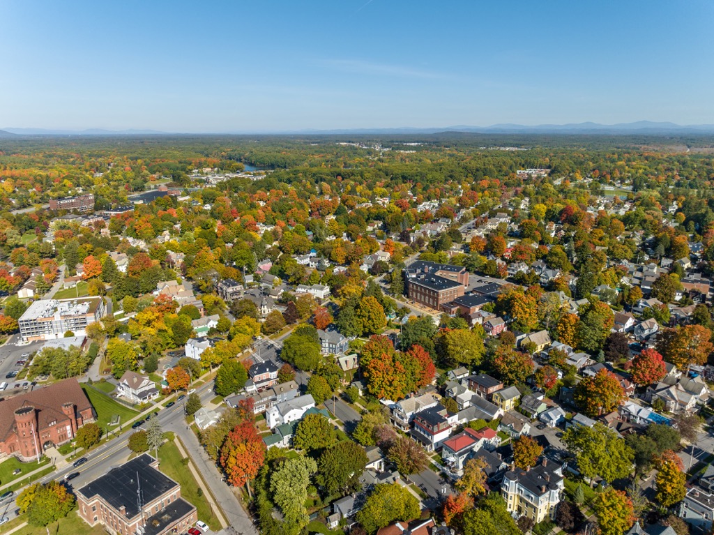
One hour's drive to the east, Saratoga Springs is best known for its horse race tracks. The small city has a population of 28,000 and, in addition to the races, also offers visitors the chance to watch rodeos, go for horseback rides, golf, or go rafting and tubing in nearby lakes and rivers.
Agrotourism in the area lets people experience the down-home roots of upstate New York with activities such as goat yoga, visiting apple orchards, or hiking with llamas. Saratoga Lake is just outside the city and offers a perfect summer escape for swimming, boating, and waterside dining.
The city has diverse eating options, from fancy, fine dining to comfortable pubs and grills and a modest mix of ethnic options. Lodging runs the gamut from historic and charming B&Bs and hotels to scenic rental cabins, campsites, and RV parks in the woods.
Just over an hour’s drive away, New York’s capital has a population of 97,000 people. Top sites to see in the city include the capitol building, the Egg Performing Arts Center with its one-of-a-kind architecture and Washington Park. If you’re looking to explore outside, check out the Albany Pine Bush Preserve, a 3,200 acre (1,295 ha) nature preserve with over 18 mi (29 km) of trails, go for a cruise along the Hudson River, or explore underground at Howe Caverns.
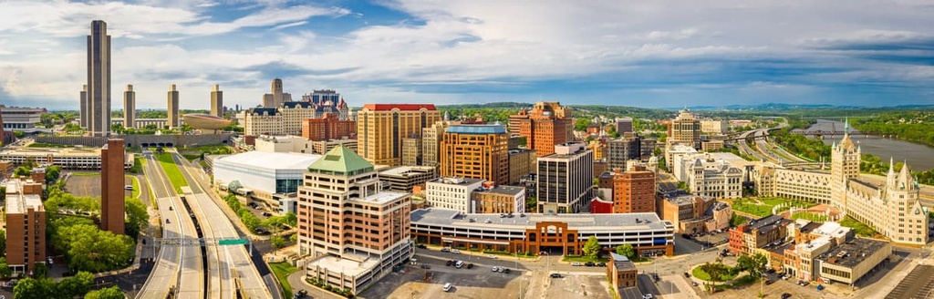
The city has a decent restaurant selection with options for world cuisine, American classics, and vegan and vegetarian options. There are hotels conveniently located both downtown and near the airport, as well as B&Bs, vacation rentals in the great outdoors, and campsites near the city.
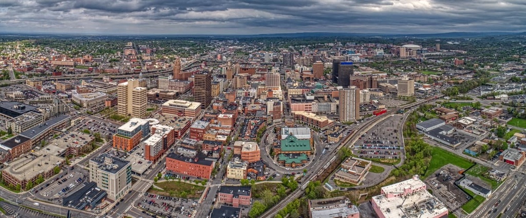
About two hours west, Syracuse has a population of 143,000 and much to offer. Visitors can plan to visit during a food festival, go on boat tours on Skaneateles Lake, visit Onondaga Lake Park, or enjoy the Great New York State Fair during the summer. Learn more about the area at the Erie Canal Museum or the Salt Museum, which explains how the city grew from the salt industry and supplied salt across the nation.
There’s a big farm-to-table focus in the city. Options range from tapas to vegan to local specialties like salt potatoes and chicken riggies. The Salt City Market food hall lets you choose from numerous cuisines under one roof. Accommodation is widely available, ranging from hotels to B&Bs and cabins.
Looking for a place to stay locally during your Shaker Mountain Wild Forest trip? Here are some of the closest villages to check out:
Caroga Lake is a small, unincorporated community with less than 600 people. Despite its modest size, Caroga Lake is a popular destination for outdoor enthusiasts exploring the southern Adirondacks.
The city is located on a peninsula between two beautiful lakes, West Caroga Lake and East Caroga Lake, making it the perfect place to enjoy a variety of aquatic recreation, including boating, canoeing, kayaking, and fishing. The city also hosts a winter carnival and is near the Royal Mountain Ski Area.
Home to less than 6,500 residents, Mayfield was one of the first towns established in the area. Mayfield sits along the southwestern shore of Great Sacandaga Lake, a large reservoir tucked in Adirondack Park. Visitors can enjoy various water sports on Great Sacandaga Lake in the summer, including swimming, boating, and fishing. During cooler months, the area offers ample opportunities for winter sports, including ice fishing, snowshoeing, and snowmobiling.
Northville is a small, historical village that was first settled in 1786. Pioneers initially built the village on high ground between the Sacandaga River and Hunters Creek, but when the river was dammed in 1930 to form Great Sacandaga Lake, the river valley became an arm of the lake. Today, Northville sits on a peninsula surrounded by the lake.
Northville is home to various accommodations, including secluded campsites, lakeside bed and breakfasts, and hotels. The village also features a beautiful waterfront park and its lake (Little Lake), where visitors can walk, read, picnic, or jump on a local hiking trail.