
Scan the QR code and open PeakVisor on your phone
Sciorella has 12 named peaks. The highest is Monte Monega at 1,887 m. Other notable peaks include Poggio Fearia, Rocca dell'Agnello and Poggio Pian del Latte.
With its mountain landscapes and proximity to the Mediterranean Sea, Sciorella protected area offers hikers an interesting mix of biodiversity in the Ligurian Alps. There are 12 named mountains in Sciorella. Monte Monega is the highest point. The most prominent mountain is Carmo di Brocchi.
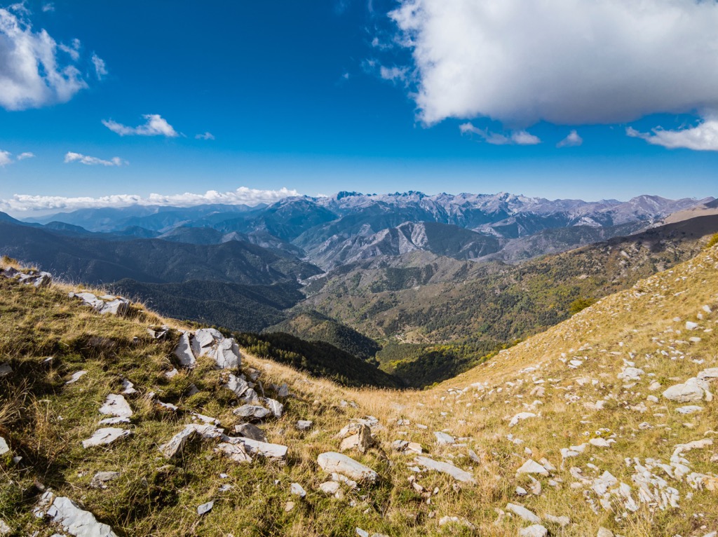
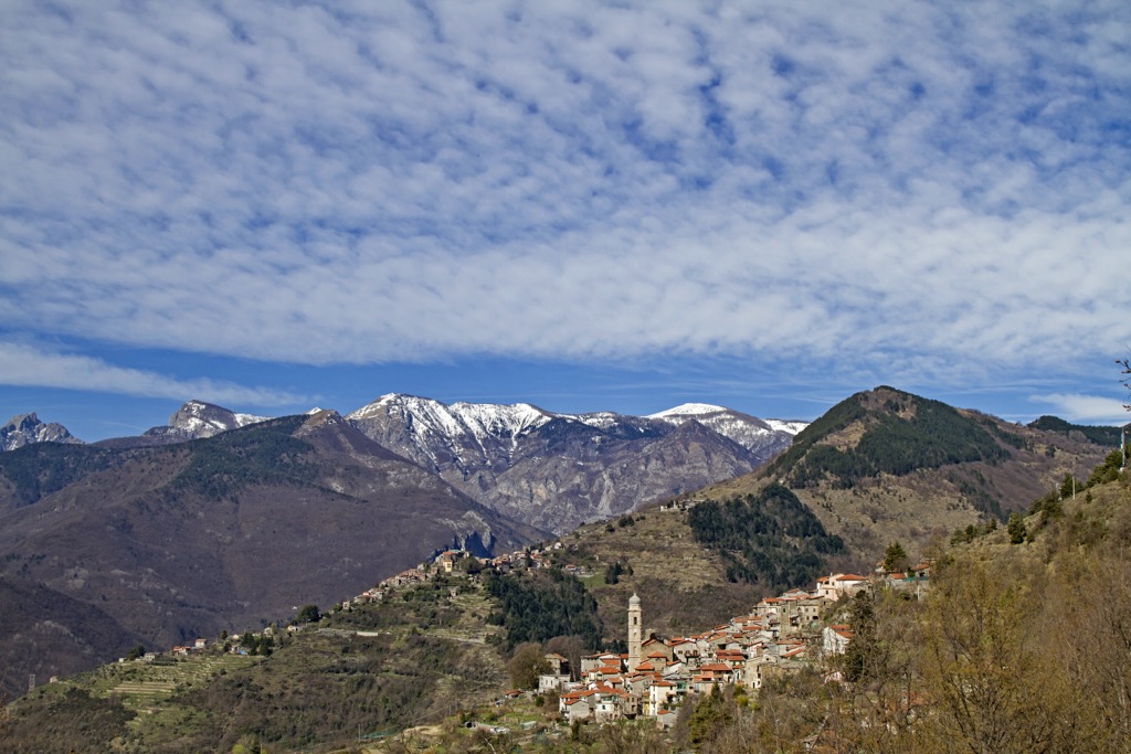
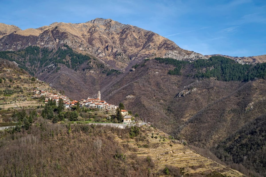
Part of the Ligurian Alps Natural Regional Park, Sciorella is a small protected area covering around 15 sq. km (6 sq. mi) located in the province of Imperia in the Italian region of Liguria. The protected area lies close to the French border and the border with the Italian region of Piedmont, encompassing the municipalities of Molini di Triora, Montegrosso Pian Latte, and Rezzo.
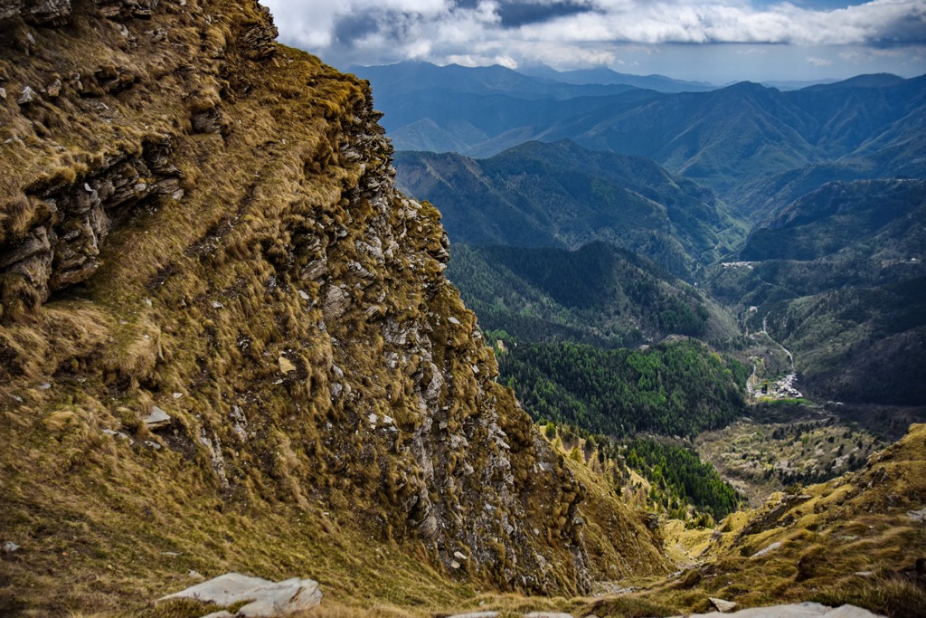
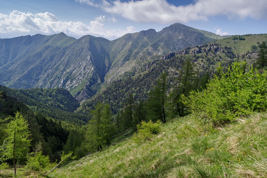
The highest point is Monte Monega (1,887 m/ 6,200 ft) which sits at the convergence of three different valleys: the Argentina valley to the west, the Giara di Rezzo valley to the southeast, and the Arroscia valley to the northeast.
Along with the rest of the Ligurian Alps, the Sciorella protected area was formed around 200 million years ago from sediments in the ancient Tethys sea. Between 65 and 2.6 million years ago, the land began to emerge in the Alpine orogeny, when the African and Eurasian tectonic plates collided and thrust and folded ancient marine sediments into the mountain peaks we see today.
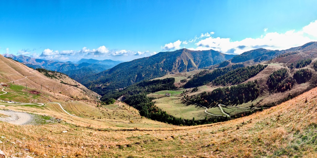
When hiking in the area, you’ll notice ridges and rocky spurs, summits, and vast grasslands. In the northwestern part of the upper Argentina valley, there are surface karstic phenomena and sub-vertical walls, such as the cliffs of Realdo and Loreto, as well as gorges.
The Ligurian Alps are made up of helminthoid flysch from the Maritime Alps that alternates with shale, sandstone, marly limestone, and dolomitic limestone.
Sciorella is a Natura 2000 protected area thanks to its habitats of priority interest, birds of community interest, and numerous endemic and protected species.
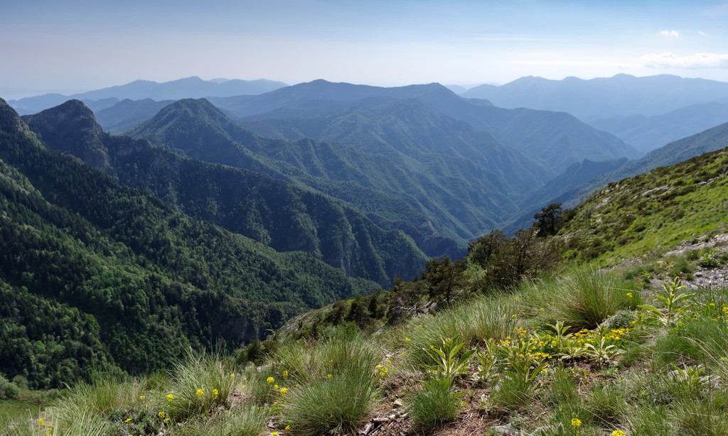
The site lies in a mountainous area divided between vast grasslands and deciduous woods such as the beech forest of Rezzo. The area is made up of different habitats including dry heaths, grasslands dotted with a variety of orchids, lowland hay meadows, and rocky slopes.
The area is home to 36 protected bird species, including important birds of prey such as the golden eagle, eagle owl, honey buzzard, sparrow hawk, and white-tailed eagle. The area is also home to skylarks, rock partridges, tree pipits, goldfinches, rock buntings, robins, and grey wagtails, to name a few.
Other protected species in the area include two species of bats: the greater horseshoe bat and the lesser horseshoe bat.
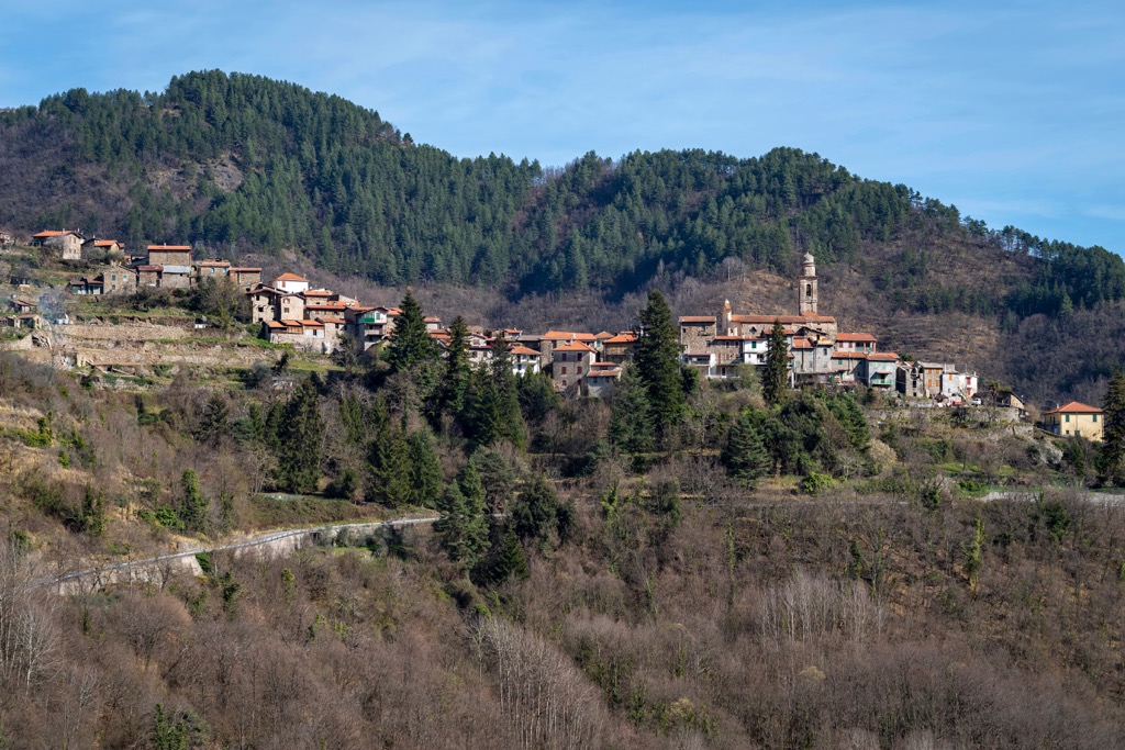
Centuries of human history have influenced the surrounding area in the Ligurian Alps and can be traced back to prehistoric times. Prehistoric archeological findings have been found in both Rezzo and Realdo.
Human influence is seen in the landscapes and in the many different villages where you’ll come across many churches, stone bridges, and different local museums highlighting traditions of the past.
The chestnut trade has been part of the area’s economy for centuries and its history is recounted in nearby Montegrosso Pian Latte, where you can find a museum highlighting the traditions of this ancient trade.
The Ligurian Alps allow you to enjoy the best of both worlds with wild mountain scenery and an interesting mix of biodiversity thanks to its proximity to the mild Mediterranean Sea.
Monte Monega’s summit can be reached along ancient transhumance routes from both Colle del Garezzo and Passo della Teglia. There are a few different routes you can take, all of which allow you to escape into the greenery of the vast grasslands and the dense beech forest of Rezzo. The best time of year to visit the area is in late spring and early summer to enjoy the colorful blooms.
A point of interest in the area is the Sotto di San Lorenzo, a sinkhole with an altar that was used in ancient times for animal sacrifices.
Hike to the top of Monte Saccarello from Verdeggia for a demanding route up to the roof of Liguria. You can also hike to the top of Monte Saccarello via Monte Monega and Monte Frontè, starting from Colle del Garezzo and taking in some of Liguria’s highest peaks. This route will also take you along part of the Ligurian High Route (Alta Via dei Monti Liguri).
The Ligurian High Route, also known as Alta Via dei Monti Liguri, is a long-distance hike that starts in Ventimiglia. It follows along the Ligurian Alps and into the Ligurian Appennines until Ceparana, close to the Tuscan border.
Sections five and six of the route pass close to the Sciorella protected area, from Sella d'Agnaria to San Bernardo di Mendatica. Each section takes around 4-5 hours to complete and is suitable for anyone with a good base level of fitness.
Section five is around 15 km (10 mi) and section six is about 10 km (6 mi) so you can squeeze them into one long hiking day or break them up to enjoy a weekend’s hiking with a stopover at a nearby rifugio.
An interesting route is nearby Sentiero degli Alpini (the path of the Italian Alpine soldiers). Although it’s not in the immediate area, it’s still in the Ligurian Alps and is worth checking out. This route sits on the border between Italy and France and is carved into the slopes of both Monte Toraggio and Monte Pietravecchia.
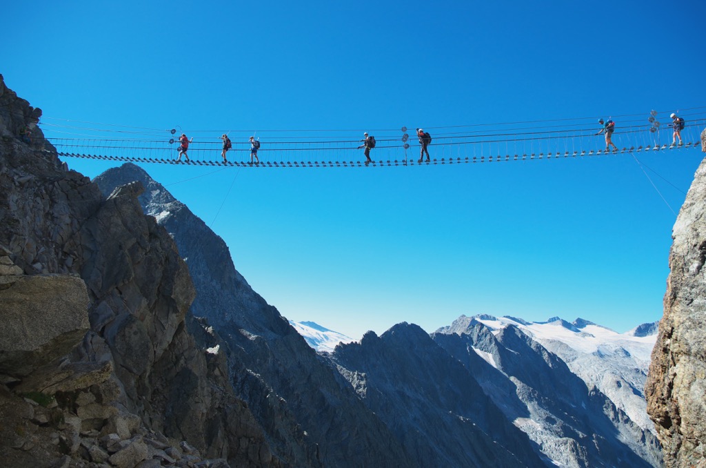
The hike starts close to rifugio Allavena in Colle Melosa where you can park your car and follow signposts to Fontana Italo and rifugio Grai, taking you to the start of the Sentiero degli Alpini trail. Part of the original path is closed after Gola dell’incisa due to a landslide, but you can continue on an alternative route along the nearby Ligurian High Route instead.
As the name suggests, the route was constructed by Italian soldiers during the second world war as a safe route to transport soldiers, materials, and food. This route offers breathtaking views, however, you will need experience and a head for heights as it’s often very exposed without any protection.
Experience the best of the Italian Riviera and Ligurian Alps when visiting Sciorella and the surrounding mountains. Here are some of the main towns and cities to check out in the nearby area.
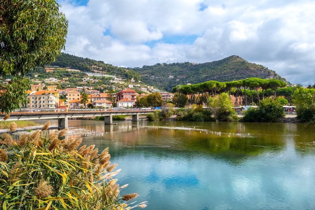
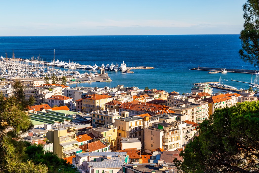
Located between Ventimiglia and San Remo, Imperia is a popular summer seaside town well-known for its flower and olive cultivation. Enjoy the town's pretty ports, taste the local cuisine at a variety of restaurants, or chill out on one of the many nearby beaches. You’ll need a car to reach the Sciorella protected area and surrounding mountains, which will take you around an hour from Imperia.

Ventimiglia lies on the border between France and Italy and dates back to Roman times. Visit Roman ruins, the nearby Balzi Rossi caves, or the beautiful Hanbury botanical gardens. It’s easy to hop across the border and enjoy the nearby French Riviera and spectacular hiking in the nearby Maritime Alps. Or stick to the equally beautiful Italian side and reach the Ligurian Alps in just over an hour.
Located on the western Italian Riviera, Sanremo is located near the French border. Founded in Roman times, the city is now better known for activities such as the popular Sanremo music festival and Milano to Sanremo bike race.
There’s plenty to see and do here, including visiting historical monuments and churches, biking along a 24 km (14 mi) cycle path that follows an old railway line along the coast, relaxing on the nearby beaches, or gearing up for some hiking in the nearby Ligurian Alps.


The highest peak in Sciorella is Monte Monega, at 1,887 m.
Notable peaks in Sciorella include Monte Monega, Poggio Fearia, Rocca dell'Agnello, Poggio Pian del Latte and Poggio d'Alpette.


