
Scan the QR code and open PeakVisor on your phone
Roxborough State Park has 1 named peak. The highest is Carpenter Peak at 2,182 m.
The state of Colorado has 41 state parks that are scattered all over an area of approximately 100,000 square miles of this varied state. Almost half of the state is flat prairie and grassland, rich in agriculture and frontier history. The rest is mostly mountains and high plateaus. Interstate Highway 25 runs 310 miles from New Mexico to Wyoming, almost straight south to north, and defines the boundary between the flatlands and the high country. Roxborough State Park is one of the 41 parks – it lies entirely within Douglas County, about 28 miles from the center of Denver. It is the only state park named as a National Natural Landmark by the U.S Department of the Interior.
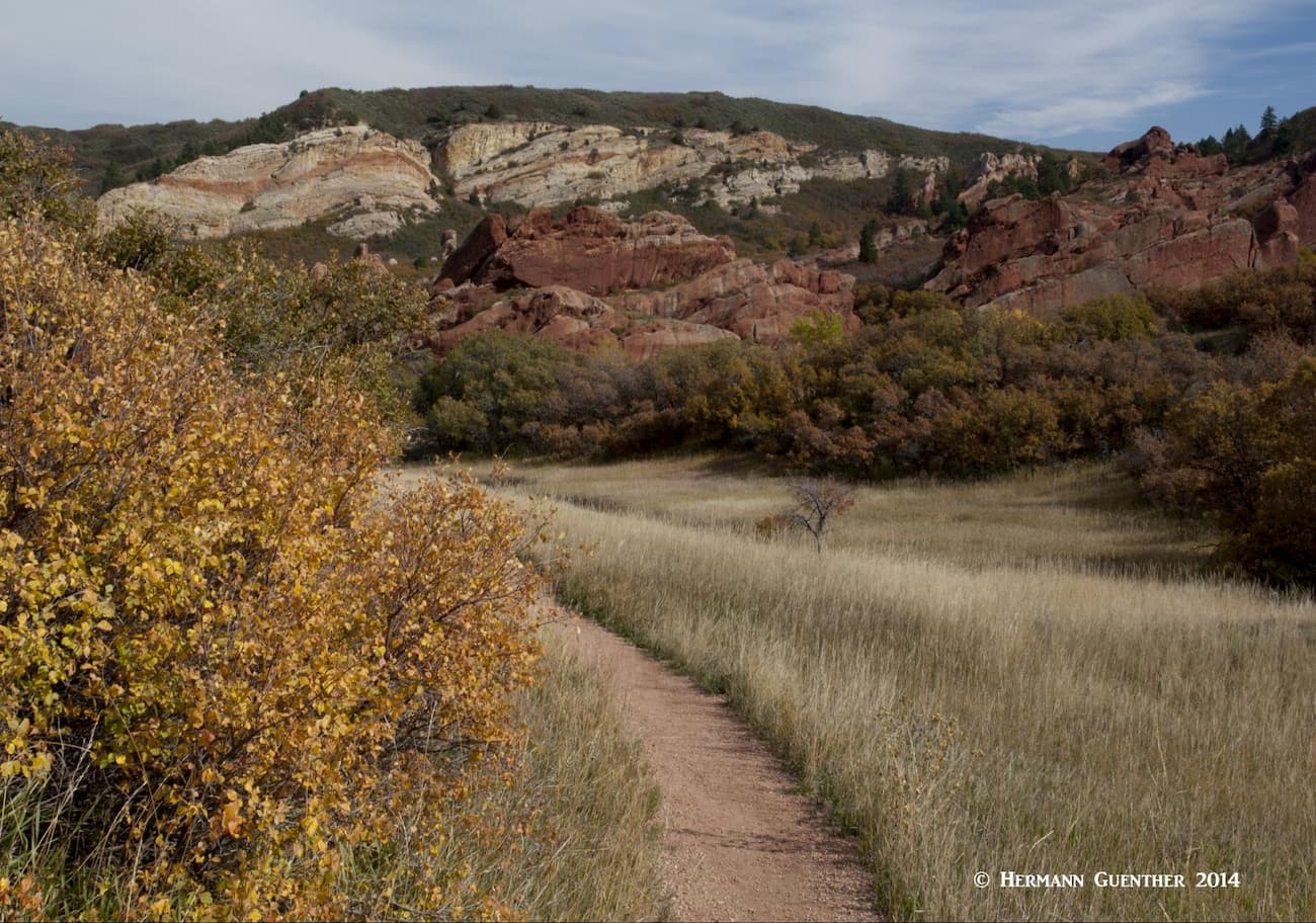
The park is located where the eastern plains meet the foothills zone of the Rocky Mountain region, with elevations varying from just over 6,000 feet to a high of 7,159 feet at the summit of Carpenter Peak, the only named mountain in the park. But that should not discourage those who want to hike in this wonderful creation of nature. The park has eight trails totaling 14 miles. Some of these trails connect to other trail systems including Douglas County Open Space, Pike National Forest, Waterton Canyon and the Colorado Trail. We hike there often, although not in the summer when it is generally too hot at those low elevations. Also, this place is famous for rattlesnakes and poison ivy during the warmer months. The park has signs to warn you about that.
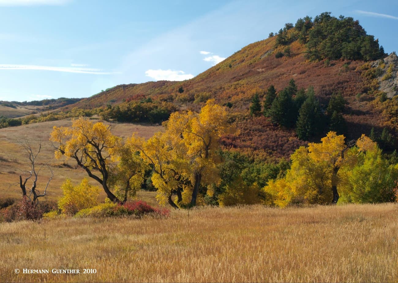
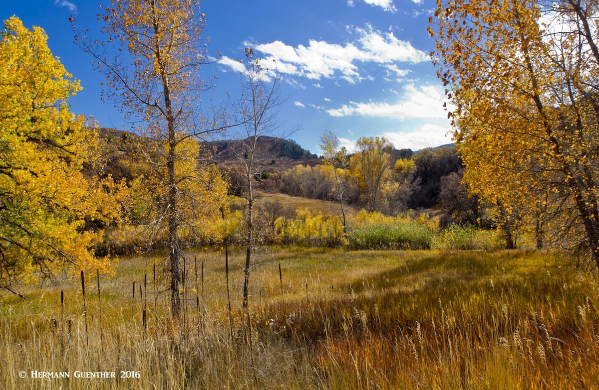
But hiking here is otherwise a real pleasure – there are no bikes or pets allowed, camping and horses are also prohibited. The park has no designated picnic area except a few small tables on the patio of the visitor center. Drones or fires are not permitted, and a Colorado favorite – marijuana – is banned here as well. Encompassing an area of almost 4,000 acres, this park is about nature – dramatic red-rock formations, distinct plant communities and a variety of wildlife including black bears, mountain lions, mule deer and many others. We particularly enjoy hiking here in the autumn when the colors burst into a variety of yellows, oranges and reds.
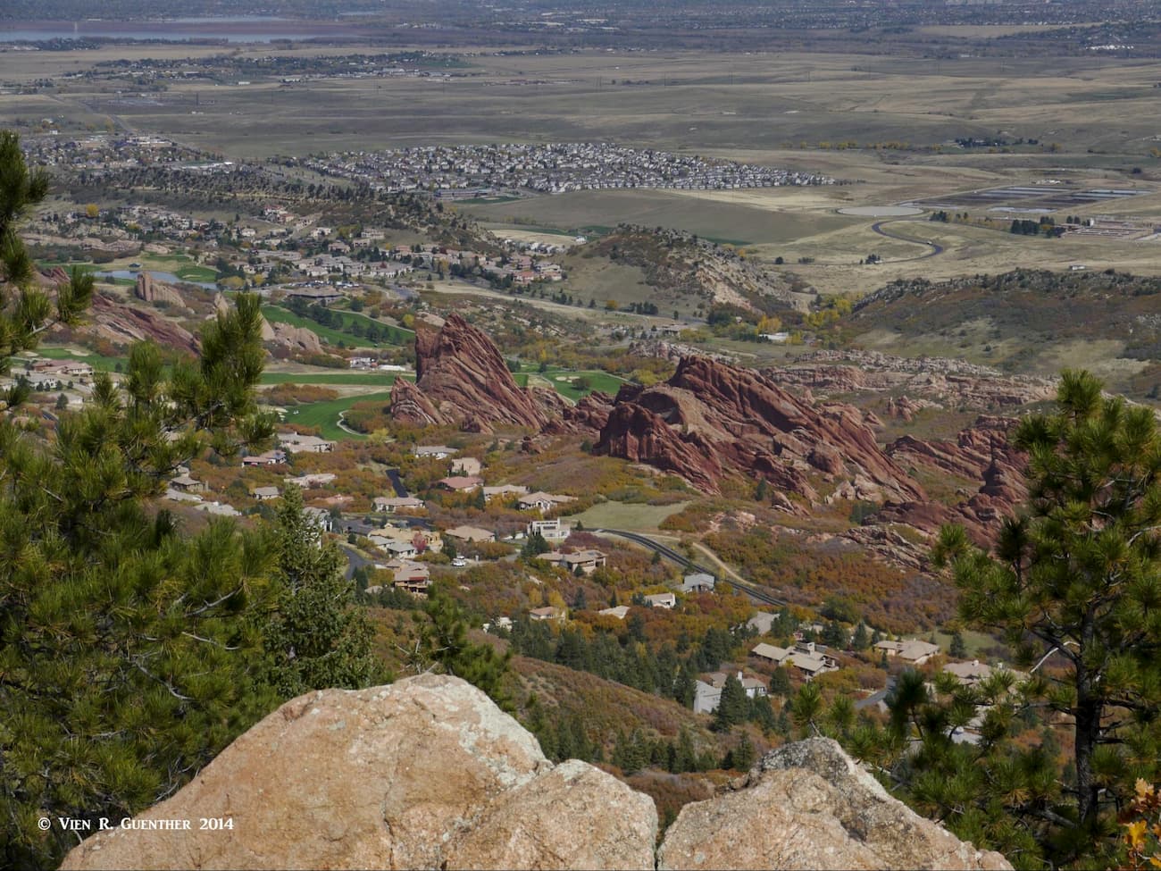
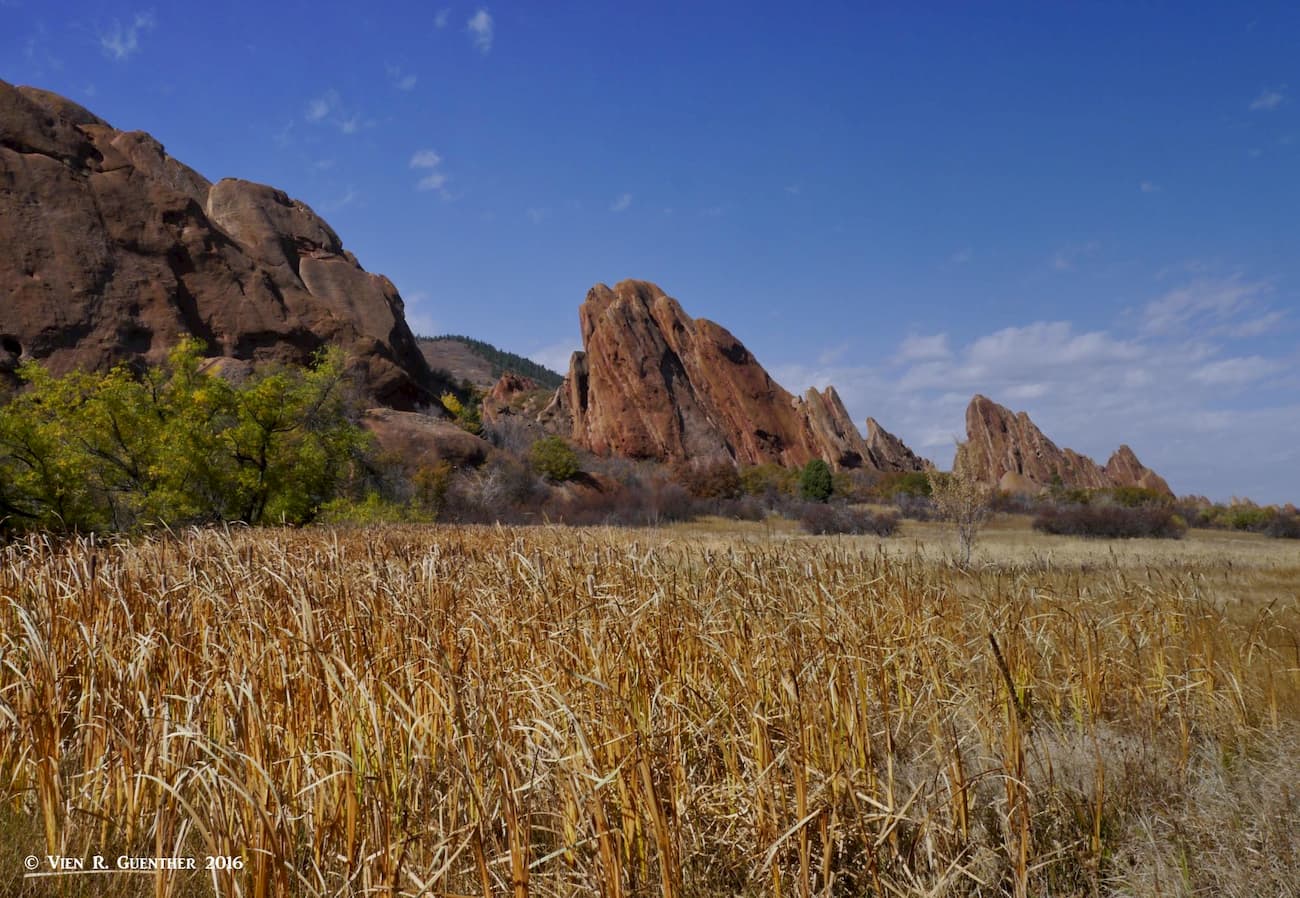
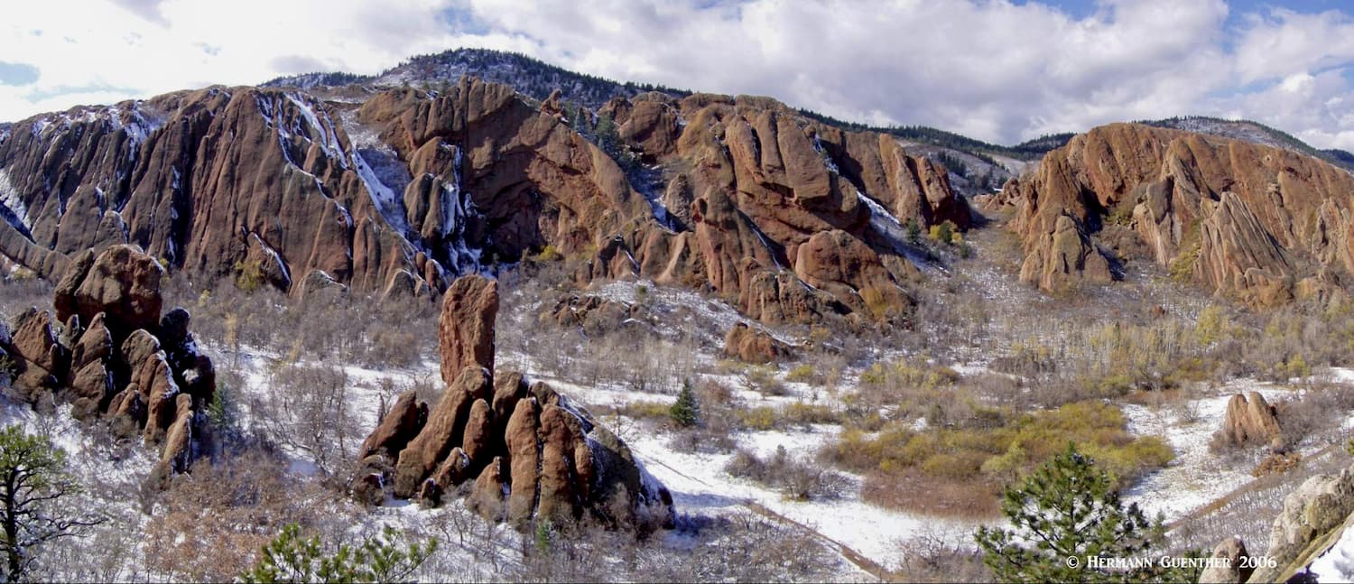
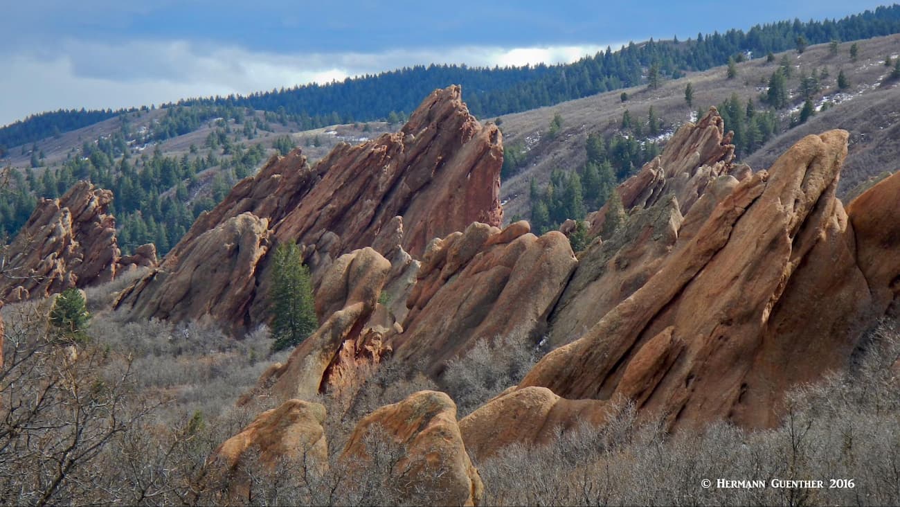
The geology of Roxborough is fascinating to say the least, something that would surely attract rock climbers. But even this activity is not permitted here. The most striking feature for visitors to the park is the dramatic Fountain Formation. This spectacular tilted sandstone began forming over 300 million years ago with the gradual erosion of the Ancestral Rocky Mountains. Today these red sandstone fins and monoliths stand beautifully at a sixty degree angle and are the result of millions of years of uplift and erosion. While there are many places in the park from which to view them, my favorite view of them is from the South Rim Trail where you can really appreciate the overall magnificence of the park.

The Colorado Department of Parks and Wildlife (CDW) is committed to keeping this place as pristine as nature created it. Even parking is limited to three parking lots (one of which is very small) that can easily fill up fast, especially on weekends, so be sure to arrive early. There is an admission fee charged to enter the park – it is valid for the entire day on which it is paid plus the following day until noon. So if you had a great day and want to see just a little bit more, you can come back the next day for a few hours. I have done this a few times – pretty convenient for us since we only live a half hour drive away.
Roxborough being just a relatively small park, there are not very many hiking trails, and several can easily be combined into one or more combinations so that a longer hiking experience can be tailored to your preferences. When we hike there, we usually do more than just one trail. Let’s have a look at a few of them.
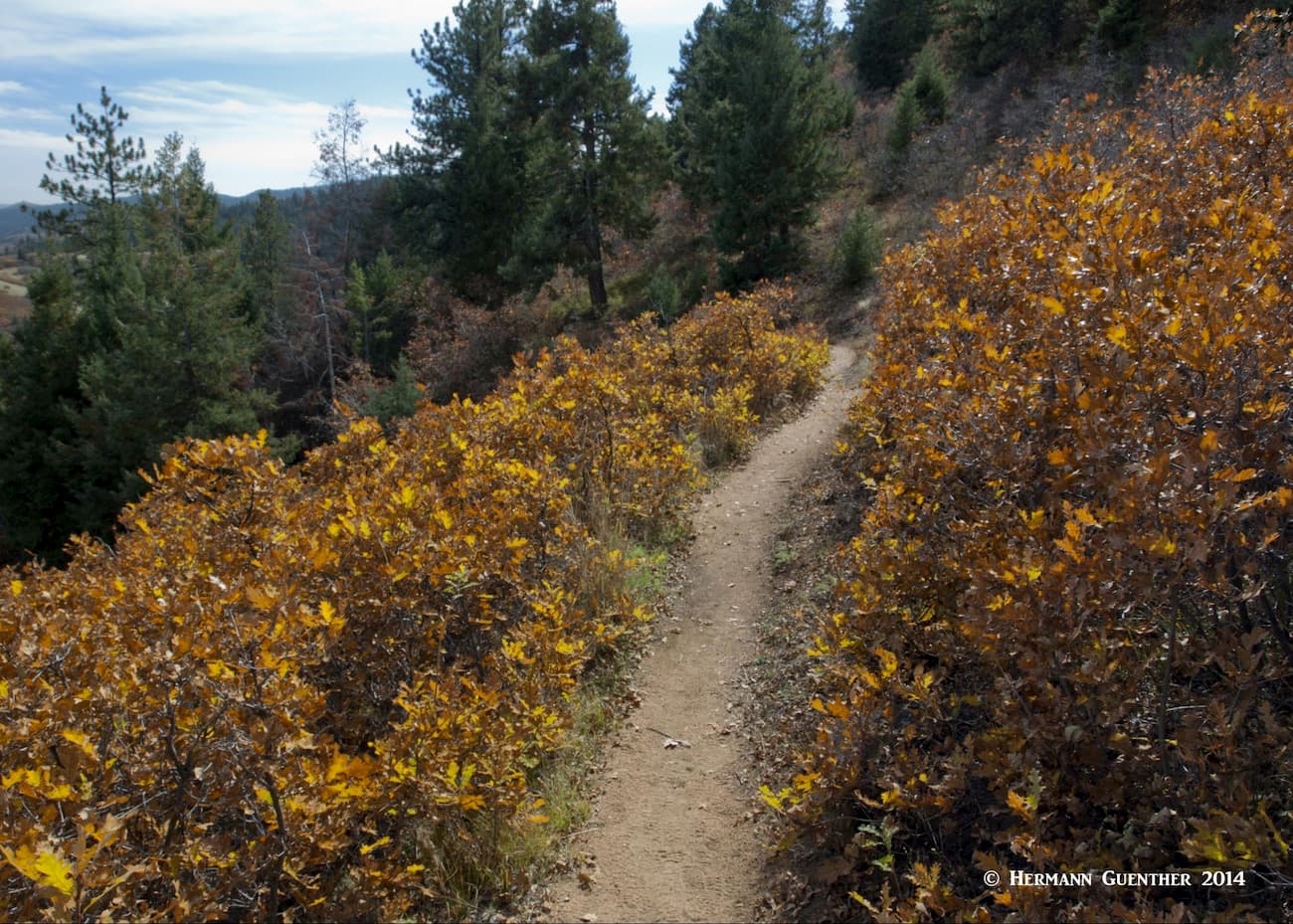
Carpenter Peak Trail – This 2.7-mile trail starts about a half mile from the visitor center, making a round-trip hike about 6.5 miles long. This is considered a strenuous hike according to the park’s official website. That may be true for visitors who are not used to hiking or are not conditioned to the altitude of the Front Range. I would call this hike moderate at most, but I am well-conditioned. It is a pleasant hike with an elevation gain of about 1,000 feet. The trail offers plenty of fine views all along its length, though parts of it are in wooded terrain, passing through wonderful stands of Gambel oak (also called scrub oak or oak brush), which turn a nice shade of reddish-brown in the autumn.
The summit of Carpenter Peak, which looks like a big pile of large boulders, affords great views in all directions including the southwesternmost suburbs of Denver, the eastern plains, the Pike National Forest and much of the park itself down below. Just near the summit is a junction with the Carpenter Spur that provides continuing trail access to Waterton Canyon, outside of the park, which is a favorite with fly-fishers.
Willow Creek Trail – This 1.5-mile trail is an easy loop that can be walked by almost anyone including families with small children. Elevation gains and losses are minor and at the right time of year plentiful wildflowers can be found here. A variety of birdlife is also to be found here. An interpretive trail guide is available in the visitor center. Hikers need to keep their children close at hand since there are pockets of poison ivy to be found along this trail. And don’t forget those rattlesnakes. We have even found mule deer bedded down right beside the trail. The trail can easily be completed in an hour at a leisurely pace. I never get tired of some of the beauty spots that can be found along this trail.
Fountain Valley Trail – This trail is one of our favorites if we just want to take a short walk simply to enjoy the natural wonders of the park. This is where we often take our out-of-state visitors when they want to do a short hike and experience some of what the foothills have to offer. The trail is a 2.5-mile loop that takes in two designated overlooks (Fountain Valley Overlook and Lyons Overlook). The total loop involves an elevation gain of about 250 feet, but if you also want to take in the Lyons Overlook, you may accumulate a total of 300 feet. Assuming you choose to do the hike in a clockwise direction (which we usually do since it saves the best for last) you will arrive at the Fountain Valley Overlook in just a couple of minutes’ walk from the visitor center. You will then continue along the valley and see all those impressive rock formations up close and personal.
At the northern end of the valley, where the trail makes a significant switchback, is a stone house homestead built in 1903 by Henry Persse who named the place Roxborough Park after his family’s estate in County Galway, Ireland. He used it to entertain guests to whom he wanted to promote turning it into a resort. Unfortunately, his dream fizzled out when he died in 1918 after he was struck by a trolley car near downtown Denver. Ultimately, the Colorado Division of State Parks bought the property and turned it into Roxborough State Park, which has been significantly expanded to its current size. The old house was restored in the late 1990s; the site also includes several other farm and ranch structures. The house, known as Persse’s Place is occasionally open to park visitors; the park conducts a free open-house on certain dates in the summer. We have never experienced that, although you can walk right up to the house and look inside through the windows.

After Persse’s Place, the trail heads south again and gradually rises in elevation through a grassy valley. You may often find a herd of mule deer here. About halfway up this valley, a side trail leads to the Lyons Overlook, which I think is the highlight of the hike. When you get to the overlook, there is a viewing platform from where you will get the iconic views of the entire valley and its stunning rock formations. From the overlook, it is less than one mile back to the trailhead and the visitor center, which is worth stopping to see.
South Rim Trail – This is one of my favorite places to hike in Roxborough State Park. Though the trail is only about two miles long, you do have to include part of the Willow Creek Trail in order to make a complete loop. That makes the hike about three miles with a total elevation gain of only about 550 feet. This hike is well worth doing as it affords fine views toward the north for almost the entire length of the park.

Given the fact that the trails in Roxborough State Park are mostly short, the longest being only 2.7 miles (one way), it is likely that many hikers might not be satisfied with just doing one short hike. I am one of those hikers, although my wife is quite content with keeping the distance down to something more relaxing. She does, however, participate in longer hikes since she is also quite well conditioned. Here are some ideas:
Combine the Fountain Valley Trail with the Willow Creek Trail for a comfortable four-mile double loop that is suitable for all levels of ability. Even people who have never hiked can easily accomplish this one, as long as they are otherwise healthy. This hike includes the Lyons Overlook
Combine the Carpenter Peak Trail with the West Rim Trail. This becomes a somewhat strenuous 9-mile hike more suitable for conditioned and experienced hikers who are properly equipped. I think that this is the best and most rewarding extended hike in the park. You get to see pretty much all the great views in the park from this hike, including far out into the eastern plains.

For a similar longer hike I would combine Carpenter Peak with the Fountain Valley Trail. This is also about nine miles in length, but it will not give all the long-distance views that the South Rim Trail affords. However, you will have a chance to enjoy the iconic view from the Lyons Overlook. Also to be recommended.
The ultimate combination would be to do Carpenter Peak, followed by the West Rim Trail and then wrapping up with the Fountain Valley Trail. We have not done that one – you would be pushing close to 12 miles to accomplish this one. Let’s not overdo it! If you live here as we do, you can always come back for more.
Since Roxborough State Park is conveniently positioned at the southwest extremity of the Denver Metropolitan area, it goes without saying that visitors to the park who are not locally based will find no shortage of places to stay and eat, find alternative recreation or indulge in unlimited shopping. You will not be disappointed. The park is just minutes from the C-470 freeway which connects with I-70 as well as I-25, the major east-west and north-south Interstate highways crossing the entire state from border to border. Just go slightly out of your way to visit this gem of a park. You will be pleasantly surprised.


The highest peak in Roxborough State Park is Carpenter Peak, at 2,182 m.
Notable peaks in Roxborough State Park include Carpenter Peak.


