
Scan the QR code and open PeakVisor on your phone
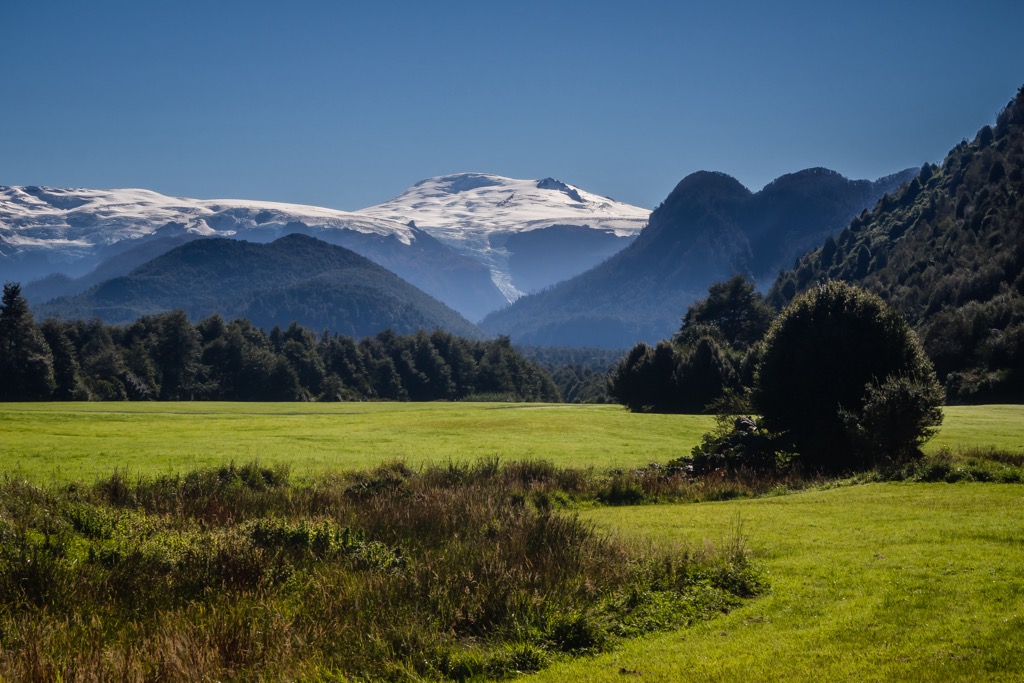
Pumalín Park, also known as Pumalín Douglas Tompkins National Park, is in the Los Lagos region of Chile. In addition to the stunning natural landscape, the park is notable for its foundation by a private American philanthropic group, Tompkins Conservation. The land, initially purchased by Douglas Tompkins in 1991, was gifted to the Chilean government in 2017 and became South America’s largest national park. The region covers 402,392 ha (994,332 acres) and contains 40 named peaks. Volcán Michinmahuida is the tallest (2,460 m / 8,071 ft) and most prominent peak (1,530 m / 5,020 ft).
Pumalín Park is a national park in the Los Lagos region of Chile. It falls within the Llanquihue and Palena provinces and is part of the Biosphere Reserve of the Temperate Rainforests of the Southern Andes. The park contains two biogeographical regions – the southern Andean province and the Valdivian temperate rainforest.
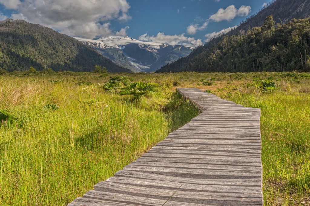
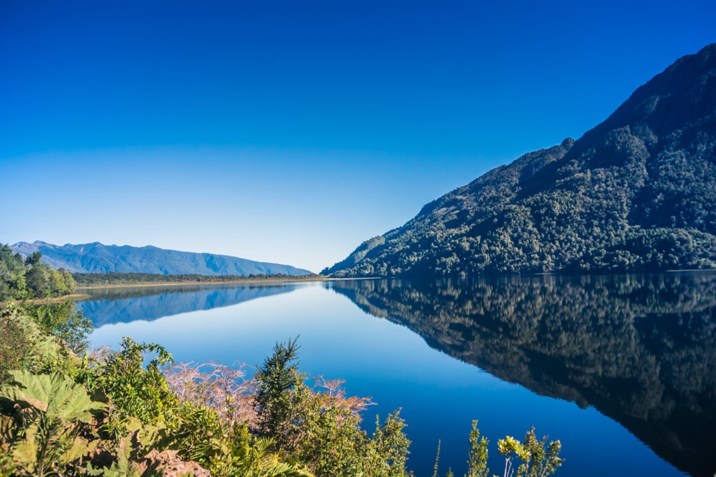
The 402,392 ha (994,332 acres) park contains dramatic landscapes, rich biodiversity, and high levels of endemism. It encompasses fjords, volcanoes, glaciers, Alerce forests, and the Andes Mountains. The lower portion of the park is accessible by car, while the northern region between Hornopiren and Caleta Procelan is accessible only by boat or kayak. The name ‘Pumalín’ comes from the indigenous Huilliche and means “place of water.”
Pumalín Park encompasses a portion of the Andes. The Andes formed during the Late Cretaceous as the Nazca tectonic plate subducted beneath the South American plate. The region’s valleys, fjords, and islands result from periods of heavy glaciation over the last two million years. Ice filled the park’s valleys during previous ice ages and created isolated environments, leading to the existence of today’s many endemic species.
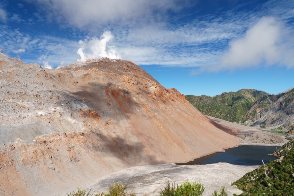
The zone lies within the Ring of Fire, a series of volcanoes and seismic activity sites near the Pacific Ocean's edge. The Chaiten volcano erupted in 2008. The damage caused the park (then a nature reserve) to close until 2010 to repair infrastructure and allow the landscape to regenerate naturally.
With the Andes to the east and the Pacific Ocean to the west and south, the region receives around 597 cm (235 in) of rain annually. It supports a biogeographic island of Valdivian temperate rainforest and is home to nearly 2,000 endemic vascular plants.
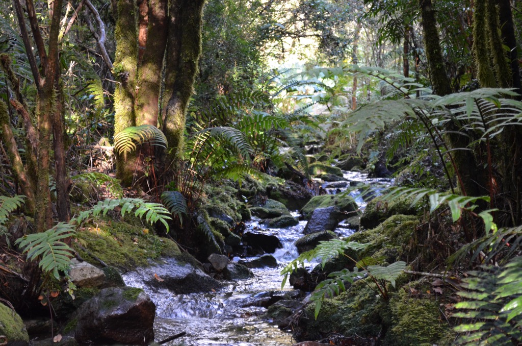
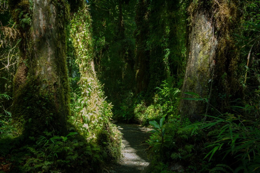
Amidst the region’s striking beauty, the larch (Fitzroya), or Alerce, forests are one of the most impressive features. These trees are the second longest-living species in the world, and the old-growth forests in Pumalín Park contain trees over 2,000 years old.
The forests include arrayán (Luma apiculata), tepa (Laureliopsis philippiana), canelo (Drimys winteri), tineo (Weinmannia trichosperma), tiaca (Caldcluvia paniculata), Chiloé coigüe (Nothofagus nitida), Magallanes coigüe (Nothofagus betuloides), ulmo (Eucryphia cordifolia). mañío macho (Podocarpus nubigenus), and Guaitecas cypress (Pilgerodendron uviferum).
The park is home to the mouse-eared bat, long-eared bat, long-tailed mouse, wooly mouse, the southern luchon, coypu, culpeo fox, quique, chingue, güiña cat, puma, huillín, chungungo, huemul, and pudú. Of note is the colocolo opossum or monito del monte (Dromiciops gliroides). This endemic marsupial is the only surviving species from the Microbiotheria order of marsupials. It’s the only remaining species of the taxon from which all marsupials in South America and Australia originated.
The area is home to a wide range of birds, including South American partridges, grebes, penguins, boobies, pelicans, cormorants, herons, condors, bandurrias, swamp crows, flamingos, swans, geese, ducks, jotes, harriers, dancing peucos, hawks, owls, turtle doves, hummingbirds, woodpeckers, swallows, thrushes, trenches, loicas, and diucas.
Fishing is not permitted within the park to conserve fish populations and the riverine ecosystems.

The Los Lagos region of Chile was home to the indigenous group called Huilliche. They are often grouped in with the Mapuche people. Both cultures remained autonomous until the Occupation of Arauncanía began in 1861, leading to the beginning of land grabs and displacement in the region.
The formation of Pumalín Park marked the most significant land donation ever by an individual to a state. Douglas and Kristine Tompkins originally acquired the land that became the park for conservation. It became a nature sanctuary in 2005 and a national park in 2017 after the Tompkins donated much of the land to the Chilean government.
The story began when Douglas Tompkins first visited the area in 1989. At the time, the land belonged to a handful of ranchers since the 1920s. Some sections were abandoned, while others were used for livestock and timber.
Beginning in 1991, Douglas and Kristine Tompkins began buying land to protect the local biodiversity from the growing logging industry. Initially met with controversy and doubt around their intentions, the land was declared a Nature Sanctuary in 2005 and a National Park in 2017. Documentary film directors Jimmy Chin and Elizabeth Chai Vasarhelyi explore the story in the documentary Wild Life (2023).

The park offers many recreational opportunities, from leisurely forest strolls to glacier climbing and mountaineering. There are campsites throughout the park, though wild camping is not allowed. It is best to visit between December and March, the warmer months, but be aware that some hikes may have inclement weather in the shoulder months, and it’s always best to be prepared for rain and wind - after all, this is a rainforest.
It is free to enter the park. Besides hiking, you can view the Comao and Reñihué Fjords by sea kayak, allowing you to spot sea lions, dolphins, and whales.
This 5 km (3.1 mi) round-trip trail gains over 457 m (1,500 ft) in elevation and is short but strenuous. The path ascends along a gorge and looks out across the Michinmahuida Volcano before arriving at Tronador Lake.
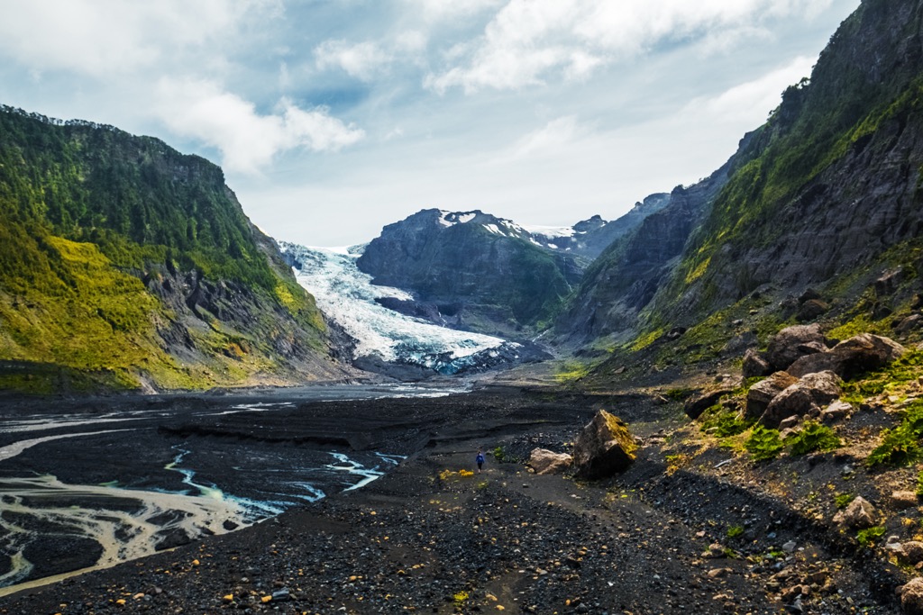
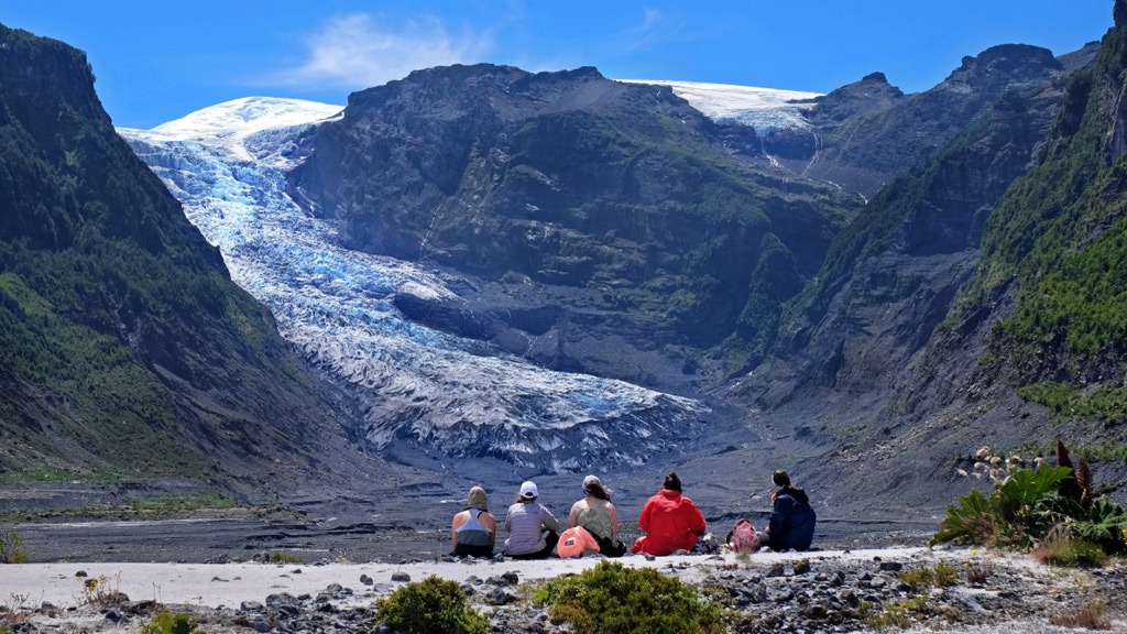
The trail to the Glacier Michinmahuida lookout point is a 7.9 km (4.9 mi) loop with a 488 m (1,600 ft) elevation gain. The route leads through Valdivian rainforest before arriving at a viewpoint with stunning views of the Michinmahuida Glacier. It is a popular trail for camping and hiking and passes two campsites along the way.
This 6 km (3.7 mi) out-and-back climbs 238 m (780 ft), making it a popular first hike for people arriving in the park. The trail winds through forest, rivers, and rocks before ending at an impressive waterfall. There is also a convenient campground at the trailhead.

The Ventisquero Trail is a 20.3 km (12.6 mi) out-and-back with 503 m (1,650 ft) of elevation gain. This challenging route begins at Ventisquero campsite and leads to the base of Michinmahuida Glacier (also known as the Amarillo Hanging Glacier) on the slopes of the Michinmahuida volcano. Although the trail is not too technical, some parts are poorly marked, and there are a few water crossings.
The Los Alerces Trail is 1.1 km (0.7 mi) out and back with only 24 m (80 ft) of elevation gain. This scenic trail winds through an ancient forest of Alerces trees, with some over 2,000 years old.
Chaiten Volcano is a strenuous 4.8 km (3 mi) out-and-back with over 610 m (2,000 ft) of elevation gain; it helps to aid this steep trail with hiking poles. Despite the challenge, the volcano is a popular climb, and the views from the top are well worth the effort. There may be flies in summer, so consider bringing insect repellant. The Chaiten Volcano last erupted in 2008.
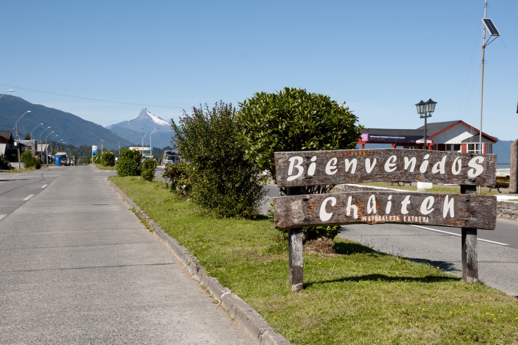
The southern portion of Pumaín Park is near the towns of Chaiten and El Amarillo. It lies along the Carretera Austral, Chile’s scenic Route 7, which runs between Puerto Montt and Villa O’Higgins. The easiest way to arrive at Chaiten is to take the ferry from Puerto Montt. Check ferry schedules before arriving because not all ferries run daily.
The park has campsites and accommodations, including the Lodge Caleta Gonzalo with cabañas and a restaurant.
Chaiten is a great spot to land on your way to or from Pumalín Park or the nearby Corcovado Park. The town is home to 5,000 people and has cabins, hotels, and hostels. There’s a modest selection of dining spots between restaurants, breweries, and cafes.
Take advantage of the surrounding area by visiting the sea lion colonies of Caleta Gonzalo and Playa Santa Bárbara or touring the Vilcun Caves on Santa Bárbara Beach with engravings and cave paintings from pre-Columbian times. You can find tour operators in town for horseback rides, bike trips, a visit to the hot springs, and other cultural experiences.
El Amarillo is a small town south of Chaiten at the southern entrance of Pumalín Park. It benefited from a significant improvement project after the eruption of the Chaiten volcano in 2008 wiped out much of the existing park infrastructure. The town hosts a supermarket, gas station, and a few accommodation and restaurant options.


