
Scan the QR code and open PeakVisor on your phone
Mauna Kea Forest Reserve has 46 named peaks. The highest is Mauna Kea at 4,205 m. Other notable peaks include Pu‘ukea, Pu'uwekiu and Pu‘uhau‘oki.
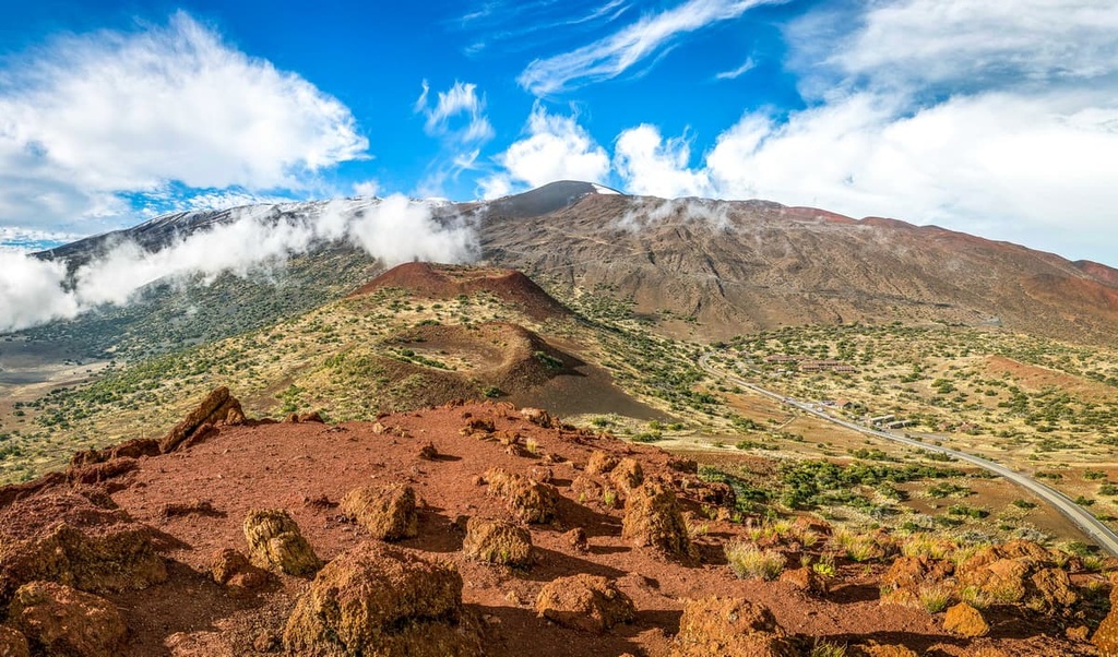
The Mauna Kea Forest Reserve is a protected area located on the eastern side of the Big Island of Hawaii, USA. There are 46 named mountains in the forest reserve. The highest and most prominent peak in the forest reserve is Mauna Kea, a volcano whose elevation and prominence are both 13,796 ft (4,205 m).
The Mauna Kea Forest Reserve encompasses 72,491 acres (29,336 ha) of land on the eastern side of the Big Island of the US state of Hawaii. It is the largest forest reserve in the state and received its status as a forest reserve in 1909.
Mauna Kea, which is located in the reserve, is the highest point in Hawaii. It is also the tallest mountain on Earth when measured from its base on the ocean floor. The peak rises 33,500 ft (10,211 m) from the ocean floor to its summit, surpassing even Mount Everest (elevation 29,029 ft/8,848 m) in terms of elevation.
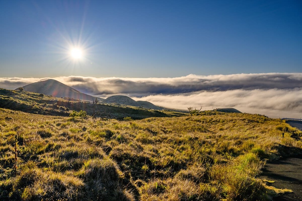
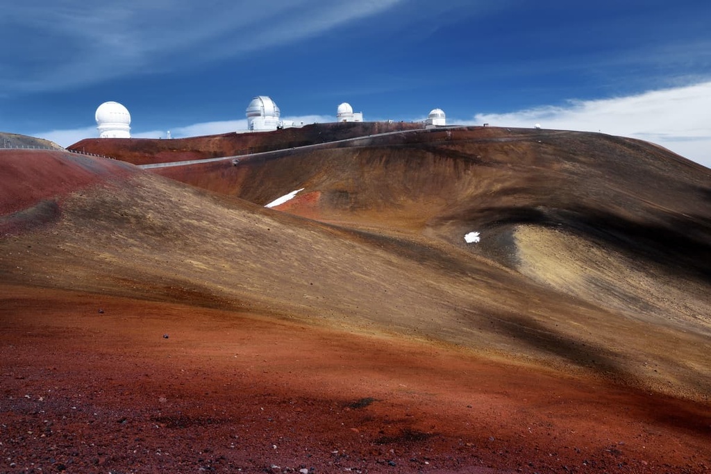
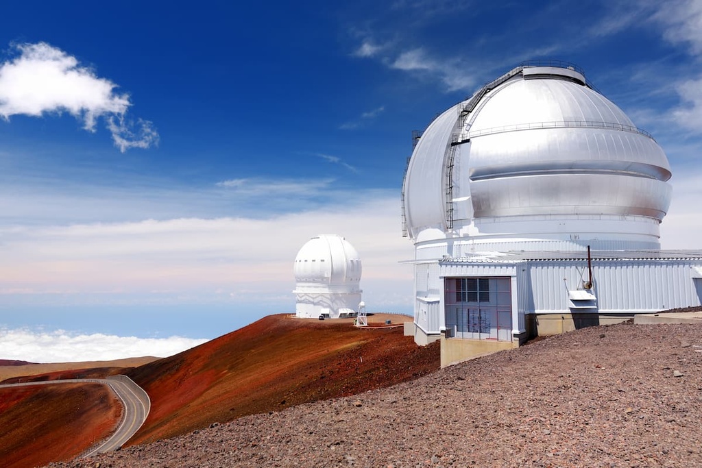
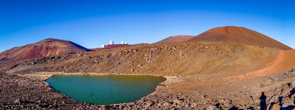
Mauna Kea shields the rest of the archipelago from storm systems and is a vital freshwater source for the Big Island. Due to its high elevation, low humidity, and low levels of light pollution, the summit of Mauna Kea features the ideal conditions for astronomical observations. As a result, the summit currently houses 13 telescopes operated by 11 countries.
Scientists estimate that Mauna Kea formed around one million years ago. For the next 800,000 years or so, the volcano experienced multiple eruptions during what is known as the shield stage of its development. This early period of eruptions was responsible for creating more than 90 percent of the volcano’s volume.
As the Pacific tectonic plate shifted away from the Hawaiian Hot Spot, the volcano entered its post-shield stage. Two subsequent types of eruptions produced more viscous lava, giving the volcano the steep sides and surface composition that we see today.
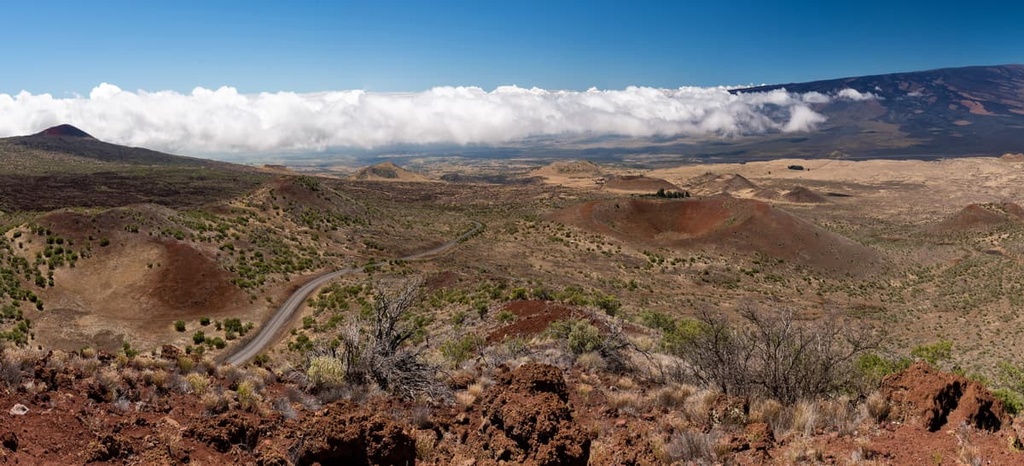
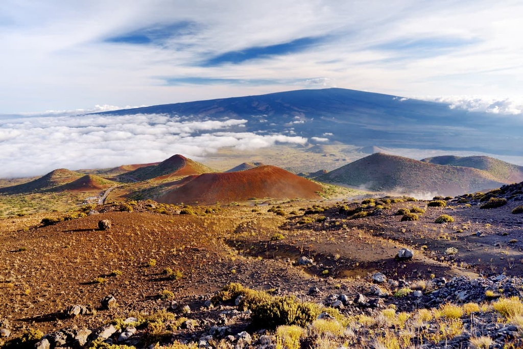
The first of these series of eruptions is known as the Hamakua Volcanics. These eruptions came from high-elevation vents on the mountain and they occurred roughly 250,000 to 70,000 years ago. They left behind basalt lava flows and cinder cones that we can see in the region to this day.
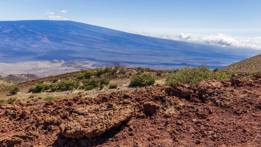
While these features can be found on other parts of the volcano, they are mainly concentrated on Mauna Kea’s summit and surrounding slopes. These eruptions were responsible for creating Mauna Kea’s steep slopes, which stand in stark contrast to the gentle slopes of nearby Mauna Loa.
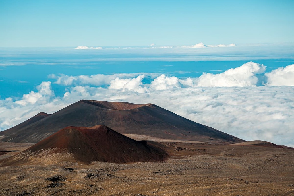
The second type of eruption that Mauna Kea experienced is known as the Laupahoehoe Volcanics. These began around 65,000 years ago, and the most recent eruption occurred sometime between 6,000 and 4,000 years ago.
The Laupahoehoe Volcanics produced prominent cinder cones and rough lava flows on Mauna Kea. In addition to this, the Laupahoehoe Volcanics generated large quantities of tephra, including ash, that landed beyond the cinder cones and are still evident along the exposed mountain surface to this day.
Scientists also found glacial deposits on the mountain. These glacial deposits indicate that Mauna Kea experienced three glacial episodes starting as far back as 200,000 years ago.
The eastern side of the Big Island of Hawaii gets significantly more rain than the western side of the island. Near the base of Mauna Kea, there is lush vegetation. However, the western side of the volcano receives less than 16 in (40 cm) of rain per year.
An important native habitat, the mamane-naio ecosystem, occurs at elevations between approximately 6,560 ft (2,000 m) and 9,350 ft (2,850 m) along the slopes of Mauna Kea.
Dominated by mamane (Sophora chrysophylla) and naio (Myoporum sandwicense), this forest ecosystem has been severely reduced in Hawaii by overgrazing from cattle and feral ungulates, as well as by fire. The largest intact swath of mamane-naio forest remains on the southwestern slope of Mauna Kea.
This habitat is vitally important to the endemic and critically endangered Palila (Loxioides bailleui), a species of Hawaiian honeycreeper. Approximately 96 percent of the population of this endemic bird species lives on the southwest slopes of Mauna Kea. The species relies heavily on mamane trees for both nesting and feeding.
Other endemic bird species that live in this habitat include Hawaii amakihi (Hemignathus virens), apapane (Himatione sanguinea), iiwi (Vestiaria coccinea), an isolated subspecies of elepaio (Chasiempis sandwichensis bryani), and the pueo or Hawaiian short-eared owl (Asio flammeus sandwichensis).
Particular threats to the ecosystem came historically from grazing cattle as well as from grazing by feral goats, sheep, mouflon sheep, and mouflon-feral sheep hybrids. Nowadays, hunting is allowed within the reserve to control the populations of these feral ungulates. Feral cats and mongooses continue to be a threat to bird populations on the island to this day.
A number of invasive grass species have changed the composition of the natural vegetation in the forest reserve. A few prominent species of introduced grasses in the region include fountain grass (Pennisetum setaceum), buffelgrass (Cenchrus ciliaris), and kikuyu grass (Pennisetum clandestinum) at lower elevations. These grasses can act as tinder and increase the risk of wildfires in the forest reserve.
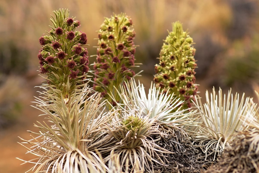
As the elevation increases in the forest reserve, the landscape transitions into montane shrubland. Here, one can find endemic plants such as Mauna Kea silversword (Argyroxiphium sandwicense) and alpine tetramolopium (Tetramolopium humile). Only ash, cinder, and other types of volcanic rock are found near the summit of Mauna Kea.
Also known as Mauna a Wākea (Mountain of Wākea), Mauna Kea is said to be the origin place of the Hawaiian people.
The genesis story of the Kānaka Maoli (Native Hawaiians) tells of a time when the Earth Mother (Papahānaumoku) and Sky Father (Wākea) met at the tallest peak and their union led to the creation of the Hawaiian people. The mountain is considered the piko (umbilical cord) that connects the island of Hawaii to the heavens.
Many Native Hawaiians return to the mountain on a regular basis to this day as a sacred place of worship along ancient trails that have been in use for generations. Scattered across the mountain are altars, shrines, burial grounds, and ceremonial sites.
The traditional Hawaiian spelling of the mountain’s name is Maunakea, which means ‘White Mountain,’ and it refers to this mountain specifically. Mauna Kea, written as two words, means ‘white mountain’ generically, and it can refer to any mountain that fits this description.
The Mauna Kea Forest Reserve was established in 1909. Game hunting is permitted in the forest reserve for birds including pheasants, quails, francolins, doves, and wild turkeys. Hunting is also allowed for mammals such as feral pigs, feral goats, feral sheep, mouflon sheep, and mouflon-feral hybrid sheep.
The summit of Mauna Kea has long been used for astronomical observations. Construction of the first telescope began in 1968, and 13 telescopes and observatories currently operate on the mountain.
In recent years, Mauna Kea has been a focal point in the fight for Indigenous rights. The construction of a new ‘Thirty Meter Telescope’ was planned for 2015 but Indigenous-led protests put the project on hold. Many of the people of Hawaii fear that building the enormous new telescope would compromise the cultural and ecological integrity of their sacred mountain.
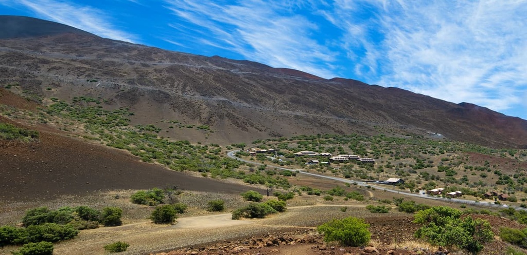
The greatest feature of Mauna Kea Forest Reserve is, of course, the volcano itself. Parking is available at the Visitor’s Information Station (elevation 9,200 ft/2,804 m), which is located just under half a mile (0.8 km) from the summit.
To reach the volcano, visitors should take the Saddle Road (Highway 200) from Hilo. Around the 28-mile marker (about 45 km), look for the turn-off and continue on for 6 miles (9.7 km) to reach the Visitor Information Station. Those hoping to drive to the top should have 4-wheel drive vehicles, and they should drive slowly as sections of the road are rough and steep.
With that in mind, here are some of the best hikes in the Mauna Kea Forest Reserve to check out the next time you’re in the region.
The Mauna Kea Summit Trail is 12 mi (19.3 km) long round trip and it has around 4,500 ft (1,372 m) elevation gain. For those hoping to get the full experience by adding the short Lake Waiau Trail and the Summit Hill Loop to their adventure, the total distance of this hike is 13.4 mi (21.6 km).
The first 2 miles (3.2 km) of the trail are steep and hiking poles are helpful as the trail traverses rough terrain and loose rock. For experienced hikers with good stamina, the hike takes about seven or eight hours to complete.
Hikers should look out for early signs of altitude sickness while on this trail. Remember that it’s important to take breaks on this hike to allow your body time to adjust to the elevation as you climb.
Lake Waiau is the highest elevation lake in Hawaii. In ancient times, royalty would bring the umbilical cords of their children to the lake as an offering in exchange for strength from the mountain.
A 4-wheel drive vehicle is necessary to access the trailhead for the Lake Waiau Hike. From the Visitor Information Station, drive up to Trailhead 1. Hike just over 0.5 mi (0.8 km) to intersect with the Humu’ula Trail. Stay on the Humu’ula Trail for a 0.10 mi (0.2 km) to reach the turnoff for the trail to the lake.
The lake, as well as other sites on the mountain, is sacred to the Hawaiian people, so visitors should be respectful while in the area. Visitors are not allowed to swim or disturb the lake due to its cultural significance.
Mauna Kea Forest Reserve is located on the eastern side of the Big Island, approximately 190 mi (300 km) as the crow flies from Honolulu on the island of Oahu. Listed below are three of the main towns on the Big Island where you can stay before or after your trip to the forest reserve.
Hilo is the second-largest city in Hawaii with a population of just over 45,000 people, and it is located on the eastern side of the Big Island.
This side of the island receives more rain than its western counterpart so it boasts lush vegetation, rainforests, and multiple waterfalls. The one downside of Hilo is that the beaches on this side of the island are somewhat lackluster compared to those on the western side, though they are beautiful nonetheless.
Those on a budget can find small hotels and hostels in the city and those looking for something fancier can choose from lodges and inns near Volcano Town. Hilo is less touristy than Kailua-Kona, so it is a good destination for those hoping to explore the nearby volcanoes and rainforest. Hilo also has a small international airport and good road connections to the rest of the island.
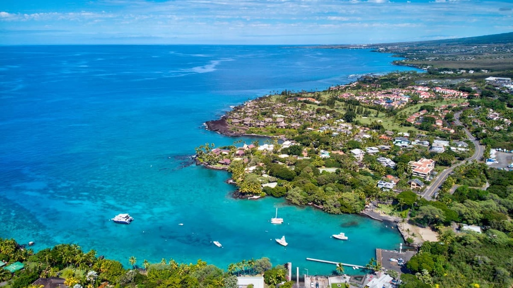
Although it is smaller than Hilo and it is home to just around 15,200 people, Kailua-Kona is a more touristy destination that also happens to be home to the main airport on the Big Island. Visitors to Kailua-Kona can enjoy a rich restaurant and nightlife scene and take tours that highlight the area’s rich culture and history.
Although the surrounding landscape around Kailua-Kona is mainly dry lava fields, the beaches near the town are pristine. These beaches offer spectacular opportunities for snorkeling, diving, sailing, deep-sea fishing, and wildlife viewing.
Accommodation options in Kailua-Kona range from small hotels and B&Bs to upscale luxury resorts and vacation rentals. From Kailua-Kona, day trips to Pololu Valley and Waipio Valley are popular activities as all of these places offer beautiful hikes and great opportunities to experience the culture of the island.
A small town of around 3,500 inhabitants, Volcano is a community located at the edge of Hawaii Volcanoes National Park on the east-central part of the Big Island.
Volcano is home to a small selection of hotels, hostels, and rental cottages. It is a prime stopover destination for travelers headed to the national park or for anyone looking to explore the Big Island’s southern shoreline.


The highest peak in Mauna Kea Forest Reserve is Mauna Kea, at 4,205 m.
Notable peaks in Mauna Kea Forest Reserve include Mauna Kea, Pu‘ukea, Pu'uwekiu, Pu‘uhau‘oki and Pu‘upoli‘ahu.


