Get PeakVisor App
Sign In
Search by GPS coordinates
- Latitude
- ° ' ''
- Longitude
- ° ' ''
- Units of Length

Yes
Cancel
❤ Wishlist ×
Choose
Delete
Trek through verdant forests and climb the highest mountain in Germany to the west of the Rhine at Hunsrück-Hochwald National Park. There are 29 named mountains in Hunsrück-Hochwald National Park. The highest and most prominent mountain is Erbeskopf (816 m/2,677 ft).
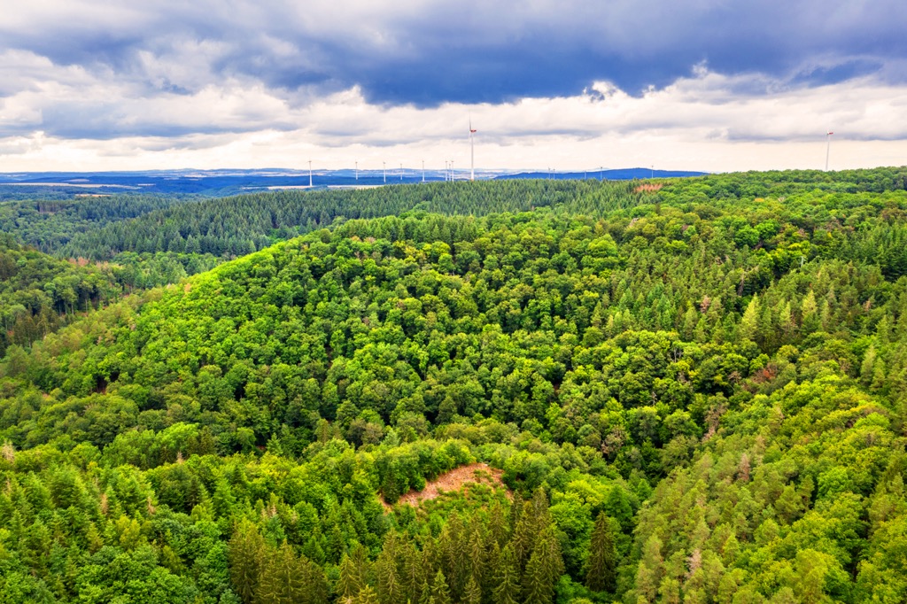
Established in 2015, Hunsrück-Hochwald National Park (Nationalpark Hunsrück-Hochwald) is Germany's newest national park. The park encompasses an area of approximately 101 sq km (39 sq mi) across the states of Saarland and Rhineland-Palatinate.
Hunsrück-Hochwald National Park centers around the highlands in the southwest of the Hunsrück region. These highlands contain Erbeskopf (816 m/2,677 ft), which is the highest mountain in Rhineland-Palatinate and the Hunsrück.
The highlands of the Hunsrück are called the Schwarzwälder Hochwald, which means "Black Forest High Forest." The Schwarzwälder Hochwald consists mainly of dense old beech forests interwoven with hillside bogs.
Despite having a similar name, the Schwarzwälder Hochwald is different from the famous High Black Forest (Hochschwarzwald) in Baden-Württemberg. Hunsrück-Hochwald National Park falls within the boundaries of the larger Saar-Hunsrück Nature Park (Naturpark Saar-Hunsrück).
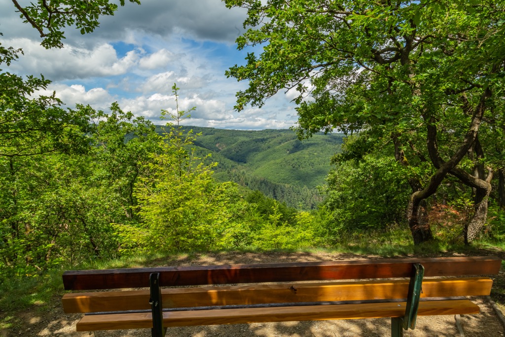
There are several other parks within driving distance of Hunsrück-Hochwald National Park.
Eifel National Park (Nationalpark Eifel) is located approximately 100 km (61 mi) to the northwest of Hunsrück-Hochwald National Park. North Vosges Regional Natural Reserve (Parc naturel régional des Vosges du Nord) is located approximately 90 km (56 mi) to the south, just across the French border.
Hunsrück-Hochwald National Park's headquarters are located in the town of Birkenfeld. Other significant settlements located in and around Hunsrück-Hochwald National Park include Idar-Oberstein, Nonnweiler, and Morbach.
Trier, the oldest city in Germany, is located approximately 40 km to the west of Hunsrück-Hochwald National Park.
The oldest rocks in Hunsrück-Hochwald National Park come from the Devonian period approximately 400 million years ago. The park's highlands form a part of the Rhenish Uplands, an extensive massif that stretches across western Germany, Luxembourg, eastern Belgium, and southeastern France.
During the Devonian period, Hunsrück-Hochwald National Park lay below a shallow ocean. Sediment deposited on the seafloor formed into mudstone and sandstone. During the late Devonian and following Carboniferous period, these rocks were folded and exposed to high levels of heat and pressure.
This heating and folding occurred due to the Hercynian orogeny, a mountain-building event caused by a continental collision between Euramerica and Gondwana approximately 300 million years ago. During this orogenic phase, the Hunsrück's sandstone turned into slate and its mudstone into quartzite.
Over the subsequent millions of years, wind and rain eroded the mountains to their current height. Quartzite, which is much harder than slate, withstood this erosion better.
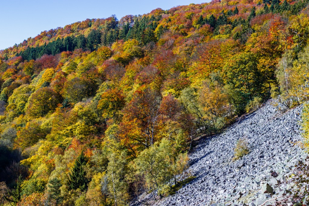
Hunsrück-Hochwald National Park has one of the highest concentrations of quartzite in the Hunsrück. As a result, it contains the region's highest summits, many of which exceed 700 m (2,297 ft) in elevation.
Aside from Erbeskopf (816 m/2,677 ft), notable summits in Hunsrück-Hochwald National Park include Dollberg (707 m/2,319 ft), Wehlenstein (672 m/2,205 ft), Wildenburger Kopf (671 m/2,201 ft), and Kahlenberg (576 m/1,890 ft).
With its untouched beech forests, Hunsrück-Hochwald National Park is home to a few nationally important flora and fauna populations. Read on to find out about the wildlife in Hunsrück-Hochwald National Park.
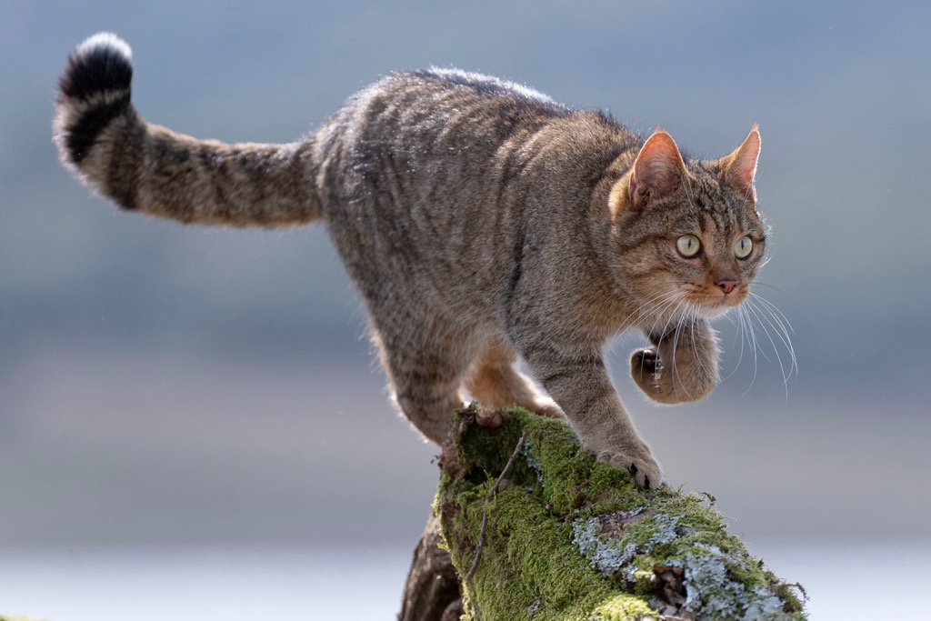
The most important resident of Hunsrück-Hochwald National Park is the European wildcat. The park is home to the largest density of European wildcats in Europe. There are roughly 100 wildcats that inhabit Hunsrück-Hochwald National Park.
Other notable mammals present in Hunsrück-Hochwald National Park include roe deer, beavers, wild boars, European beavers, and red foxes. The park is home to seventeen bat species, including barbastelle bats, great horseshoe bats, and Bechstein's bats.
Numerous rare bird species nest in the forests of Hunsrück-Hochwald National Park. This includes the rare and shy black stork, one of only two stork species that nest in Europe. Other notable bird species include black woodpeckers, great spotted woodpeckers, pygmy owls, and tree pipits.
The park's hillside bogs and open grasslands provide the perfect habitats for several amphibian and reptile species, including alpine newts, fire salamanders, slowworms, and smooth snakes.
Over 1,400 beetle species and 253 butterfly species have been identified in Hunsrück-Hochwald National Park. Anyone visiting Hunsrück-Hochwald National Park should watch for common copper butterflies, Arran brown butterflies, and northern emerald dragonflies.
There are a staggering 250,000,000 trees from 35 species within Hunsrück-Hochwald National Park. The most prominent species include European beeches, spruces, silver birches, and downy birches.
Approximately 850 fern and flower species grow within Hunsrück-Hochwald National Park. Some of the most common plants in the park include spignel and wolf's bane, which thrive in the park's nutrient-poor grasslands and meadows.
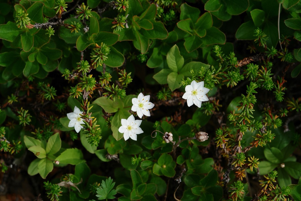
Common ferns and bushes in Hunsrück-Hochwald National Park include deer ferns, moor grass, and common cranberries. Some of the more intriguing plants include chickweed wintergreens and the carnivorous round-leaved sundew.
The park is home to some rare fungi and mosses, including two rare species of Verrucaria lichen, which were first identified in the Hunsrück. Other species include tinder fungi and peat mosses.
Humans have been inhabiting the Hunsrück since the Neolithic period, over 12,000 years ago. Most archeological evidence, chiefly stone ax heads, points to humans building permanent settlements in the Hunsrück in the Middle to Late Neolithic periods.
Larger scale settlement of the Hunsrück took place at the start of the Iron Age by the Hunsrück-Eifel Culture, an ancient cultural group with links to the Celts.
There's plenty of evidence of a Celtic presence in Hunsrück-Hochwald National Park, primarily the remnants of the Hillfort of Otzenhausen, one of the largest fortifications ever built by the Celts.
The Romans arrived in the region around 50 BCE. They built extensive road networks, the best known of which is the Via Ausonia. They also built several small farms and villages, including Belginum.
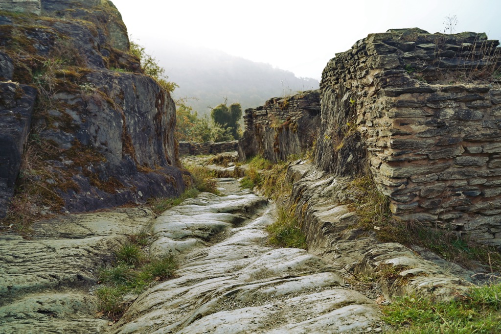
Throughout the Middle Ages, the territory of the Hunsrück was fragmented and involved in several wars. In the seventeen century, Louis XIV of France attempted to seize the Eifel and Hunsrück regions after the Thirty Years' War, resulting in the Nine Years' War.
Throughout the nineteenth century, the population of the Hunsrück dwindled due to widespread immigration. This was due partly to a famine in 1817 following the Year Without a Summer in 1816. The Brazilian government recruited many of these immigrants from the Hunsrück to help colonize Brazil.
Saar-Hunsrück Nature Park was established in 1980, covering an area of 2,000 sq km (772 sq mi). It wasn't until 2015 that Hunsrück-Hochwald National Park was created to help protect the natural environment of the Schwarzwälder Hochwald.
Hunsrück-Hochwald National Park offers hikers the opportunity to take a walk through some of the finest interrupted forests in western Germany.
Consider stopping by the park's visitors centers, like the ones in Hermeskeil or Hilscheid, for more information about possible hiking routes. The park's most popular trails, known as traumschleife (dream loops), are well mapped and easy to follow.
Read on to find out about the best hikes in Hunsrück-Hochwald National Park.
The Traumschleife Gipfelrauschen (Summit Noise Dream Loop) will take you across Erbeskopf's (816 m/2,677 ft) summit plateau, affording some of the finest views of the Eifel and Hunsrück regions.
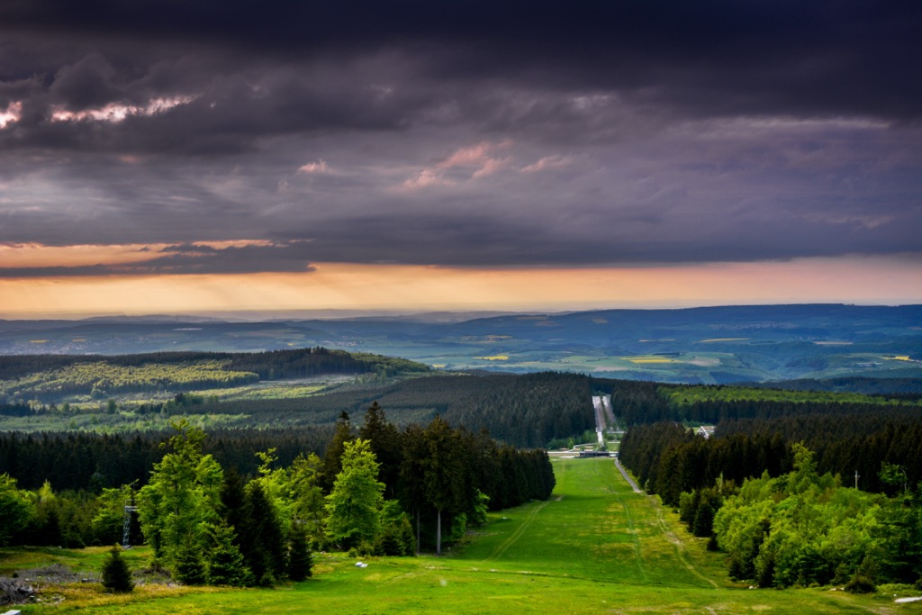
Erbeskopf has been heavily renovated since 2011, and its summit is now adorned with the Windklang, a sculpture and observation deck that provides views far into the Eifel region. Also atop Erbeskopf is the Erbeskopf Observation Tower (Aussichtsturm Erbeskopf), an 11 m (36 ft) tall observation tower built in the 1970s.
The starting point of the Traumschleife Gipfelrauschen trail is the Hunsrückhaus visitor's center. The trail is steep in places, so hiking boots are recommended. The Traumschleife Gipfelrauschen is 7.4 km (4.6 mi) in length and takes approximately 3 hours to complete.
The Traumschleife Börfinker Ochsentour (Börfinker Ochsentour Dream Loop) will lead you through the heart of Hunsrück-Hochwald National Park on a loop around the small village of Börfink.
This trail is ideal for green-fingered guests as it passes through the Ochsenbruch, one of Hunsrück-Hochwald National Park's largest hillside bogs.
The Ochsenbruch is home to an array of rare plants such as cranberries, sundews, and cotton grass. You'll have a chance to spot some of the park's rare fauna, including ospreys and black storks.
The starting point of the Traumschleife Börfinker Ochsentour trail is the Forellenhof Trauntal hotel-restaurant. The trail is 9.6 km (6 mi) in length and takes approximately 3 hours to complete.
On the Traumschleife Hubertusrunde (Hubertus Circuit Dream Loop), you'll learn about the Hunsrück's Celtic history.
The Traumschleife Hubertusrunde takes you through the outskirts of Nonnweiler to the Nonnweiler Dam (Nonnweiler Talsperre) overlooking the picturesque Nonnweiler Reservoir (Stausee Nonnweiler).
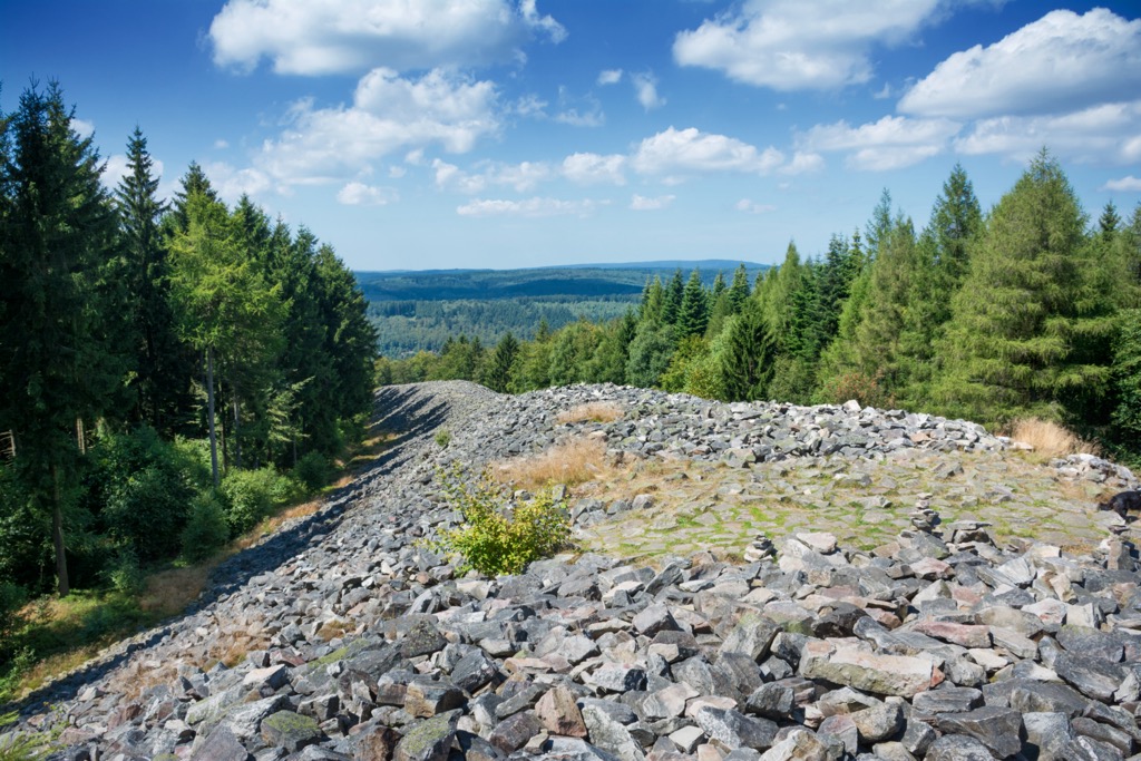
Along this route, you'll get to visit the ruins of the Hillfort of Otzenhausen atop Dollberg (707 m/2,319 ft), once one of the most impressive Celtic fortifications in Europe. Today, a recreation of the fort is located near the original site.
Along this path, you'll climb to the summit of Schankelberg (562 m/1,844 ft), which affords some excellent views of the surrounding countryside. You'll also skirt around the peak of Kahlenberg (576 m/1,890 ft) and over the summit of Mannfels (626 m/2,054 ft).
The starting point of the Traumschleife Hubertusrunde trail is the car park at Nonnweiler indoor pool (Hallenbad Nonnweiler). The trail is 10.4 km (6.5 mi) in length and takes about 3 hours and 30 minutes to complete.
Another popular hiking trail on the outskirts of Nonnweiler is the Traumschleife Dollbergschleife (Dollberg Loop Dream Loop).
The Traumschleife Dollbergschleife focuses on taking in the best features of Dollberg (707 m/2,319 ft). You'll pass the seventeenth-century Züscher Hammer, once the largest ironworks in the Hunsrück, and the Hillfort of Otzenhausen.
This walk takes you along the shores of the Nonnweiler Reservoir (Stausee Nonnweiler) after passing the Züscher Hammer. The starting point of the Traumschleife Dollbergschleife trail is the Köhlerhütte inn just outside Neuhütten. This trail is 11.2 km (7 mi) in length and takes roughly 4 hours to complete.
The Traumschleife Trauntal-Höhenweg (Trauntal-Höhenweg Dream Loop) offers some of the best views in Hunsrück-Hochwald National Park.
The trail takes you to the summits of Wehlenstein (672 m/2,205 ft) and Vorkastell (632 m/2,073 ft), both of which offer unique vistas. From Vorkastell, you can see the ruins of a Celtic fortification perched atop the mountain's quartzite spur. The view opens up after passing Vorkastell, with panoramas of the Hunsrück's heavily wooded mountains.
Towards the end of the Traumschleife Trauntal-Höhenweg, you'll pass the Luisenruh, a vantage point that affords excellent views of the park's unusual quartzite and slate rock formations.
The starting point of the Traumschleife Trauntal-Höhenweg is the Rinzenberg Pond Area (Weihergelände Rinzenberg). The trail is 13.9 km (8.5 mi) in length and takes around 4 hours to complete.
The Traumschleife Kirschweiler Festung (Kirschweiler Fortress Dream Loop) is ideal if you're searching for a leisurely walk through some of the finest woodlands in Hunsrück-Hochwald National Park.
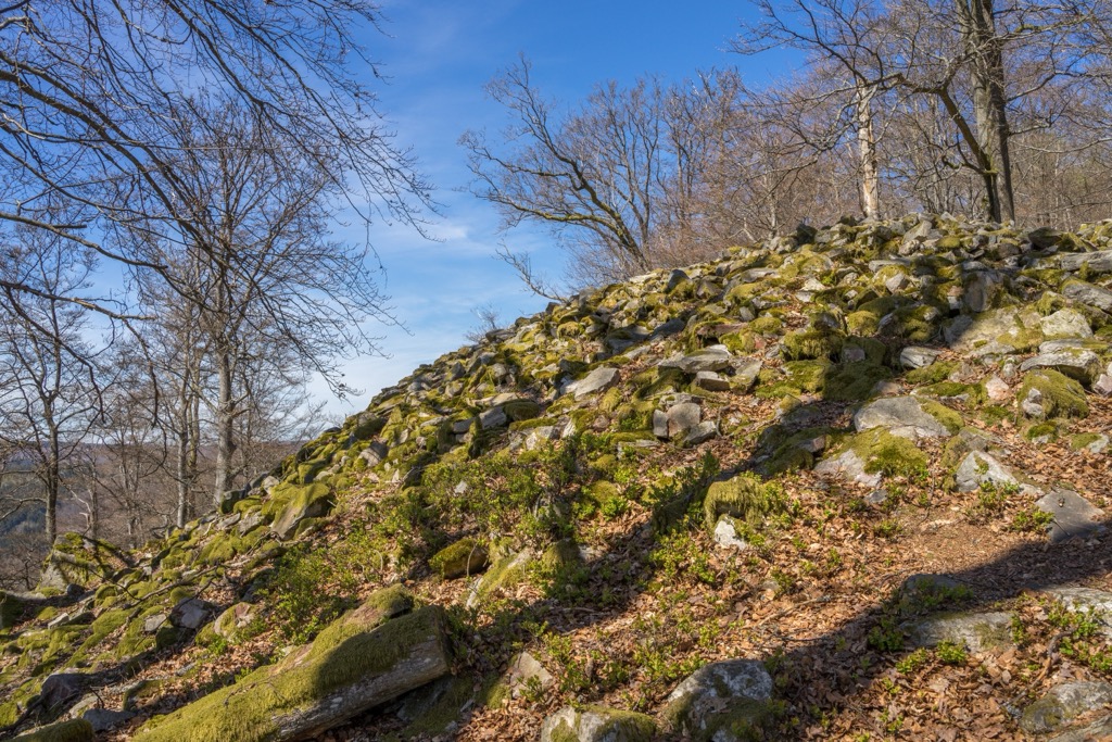
This simple looped trail will take you by the Kirschweiler Fortress, a nature reserve containing some of the park's best quartzite rock formations. You'll also get to see the ruins of the Celtic Ringskopf fortifications.
You should wear good hiking boots on this loop as part of the trail leads over a block heap at Ringskopf. The starting point of the Traumschleife Kirschweiler Festung trail is the Kirschweiler Golf Course (Golfplatz Kirchweiler). The trail is approximately 9.1 km in length and takes roughly 3 hours to complete.
Within touching distance of ancient cities and famous resorts, Hunsrück-Hochwald National Park is perfect for a relaxing getaway. Read on to learn about some of the main cities and towns near Hunsrück-Hochwald National Park.
Sat on the banks of the Moselle River near the Germany-Luxembourg border is the city of Trier. Trier is the oldest city in Germany, having been founded by the Celts in the fourth century BCE. Today, Trier is a UNESCO World Heritage Site home to stunning Roman ruins and fairytale fortresses.
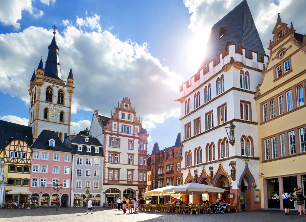
There's no shortage of historical attractions in Trier, from the Karl Marx House to the High Cathedral of Saint Peter to the Roman-era Kaiserthermen. One of Trier’s finest buildings is the Porta Nigra, a lavish Roman city gate constructed in the second century CE.
Trier is located less than 50 km (31 mi) from Hunsrück-Hochwald National Park, making the park easy to reach by car. Popular hotels in Trier include Best Western Hotel Trier, FourSide Hotel, and Hotel Roemischer Kaiser.
The small town of Birkenfeld is the largest settlement in Hunsrück-Hochwald National Park. Home to the park's headquarters, Birkenfeld is less than 10 km (6 mi) from several popular hiking trails, including the Traumschleife Trauntal-Höhenweg and the Traumschleife Börfinker Ochsentour.
When you're not hiking, Birkenfeld offers a few fun family-friendly attractions, like the Birkenfeld Zoo (Tierpark Birkenfeld) and Birkenfeld State Museum (Landesmuseum Birkenfeld).
Popular hotels in Birkenfeld include Hotel Oldenburger Hof, Vicinity, and Landgasthof Alt-Birkenfeld.
Located approximately 25 km (15.5 mi) to the east of Hunsrück-Hochwald National Park is Idar-Oberstein. Built atop the Nahe River, Idar-Oberstein is a gemstone town famed for its mining industry.
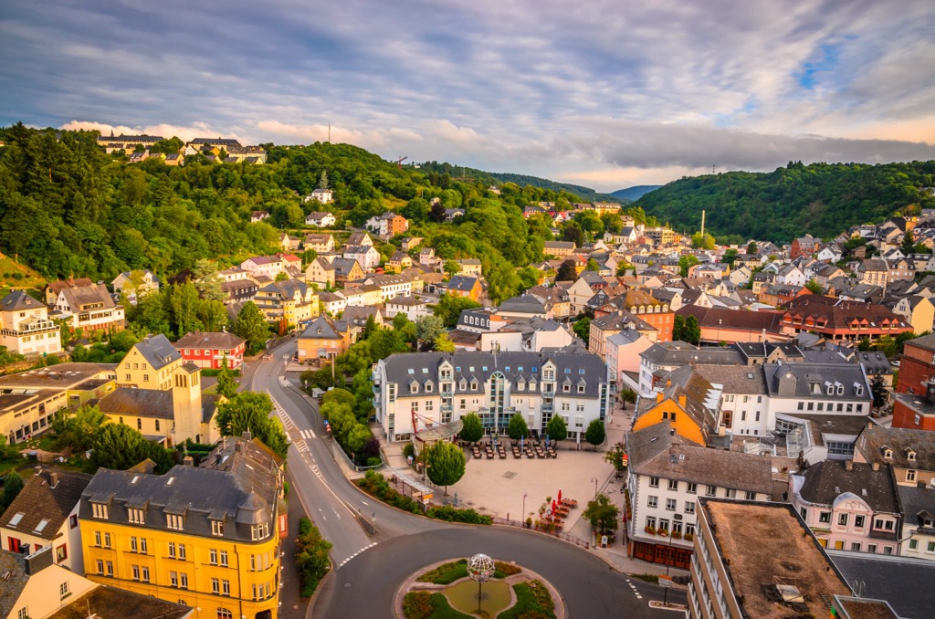
Idar-Oberstein is a picturesque town constructed at a narrow point between two rugged cliffs. Built into the face of one of these cliffs is the fifteenth-century Rock Church (Felsenkirche). You can only enter the church via a tunnel, and beneath it is an underground spring that flows out of the cliff face.
You'll find several other interesting landmarks in Idar-Oberstein, including the German Gem Museum (Deutsches Edelsteinmuseum) and the ruins of the fourteenth-century Château Oberstein.
Popular hotels in Idar-Oberstein include Diamanthotel Idar-Oberstein, Opal Hotel, and City Hotel Garni.
You'll find few places that make a better base for exploring Hunsrück-Hochwald National Park than Nonnweiler. This small town rests on the park's southern boundary and is close to some of its most popular attractions, including the Otzenhausen Hillfort and Nonnweiler Dam.
You'll find a few attractions worth visiting in and around Nonnweiler. Climb to the top of the nearby Grimburg Castle (Schloss Grimburg) for sweeping views of the Hunsrück. Or, take your kids for an adrenaline-fuelled day-out at Leisure Center Peterberg (Freizeitzentrum Peterberg).
Popular hotels in Nonnweiler include Hotel-Restaurant Parkschenke Simon and Landhaus Spanier.
Bosen-Eckelhausen is one of the top tourist destinations in Saarland. It rests on the Bostalsee, a reservoir famed for its sandy beaches and watersports opportunities. There's also a 6.8 km (4.2 mi) long hiking trail which circles the lake.
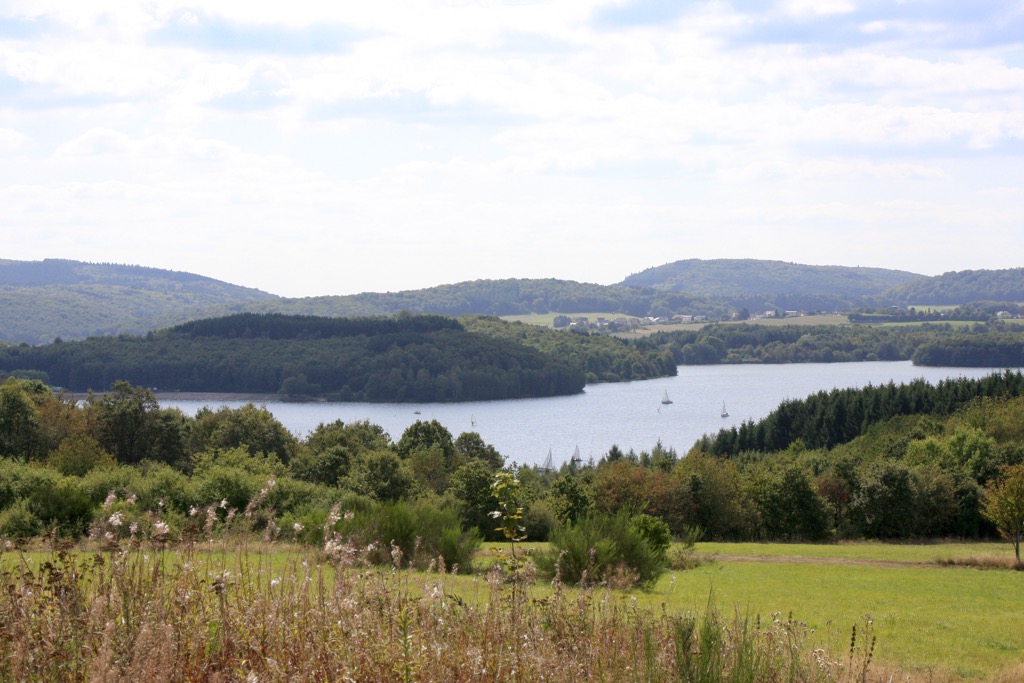
Bosen-Eckelhausen is popular with families and offers some great attractions for children, like the Bosiland amusement park. There's a Center Parcs holiday park on the shores of the Bostalsee if you're looking for somewhere family-friendly to stay.
Other popular hotels in Bosen-Eckelhausen include Victor's Seehotel Weingärtner, Seezeitlodge Hotel & Spa, and Merker's Bostal-Hotel.
Thalfang is the perfect place to climb the highest mountain in Germany west of the Rhine, Erbeskopf (810 m/2,677 ft). This spa town is less than 10 km (6 mi) from Hunsrückhaus visitor's center and the start of the Traumschleife Gipfelrauschen.
It's also close to another popular hiking destination, the Haardtwald, a forest renowned for its mineral water. During the winter, Thalfang is a hotspot for skiers and is a popular winter sports destination, thanks partly to the Erbeskopf Winter Sports Center (Wintersportzentrum Erbeskopf).
Popular hotels in Thalfang include Bahnhof Thalfang, Landhaus Thalfang, and Rosenhill B&B.
Explore Hunsrück-Hochwald National Park with the PeakVisor 3D Map and identify its summits.


