Scan the QR code and open PeakVisor on your phone
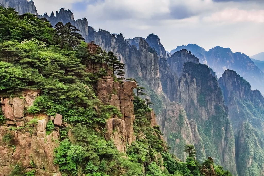
Huangshan National Scenic Area (黄山风景区) is one of the most popular nature reserves in China. Best known for its photogenic pine trees, unusual rock formations and sea of clouds, this UNESCO World Heritage Site in Anhui province has 110 named mountains, the highest and most prominent of which is Lotus Peak (1,864 m/ 6,115 ft).
Huangshan National Scenic Area is located in Huangshan City (黄山市) in Anhui (安徽) province, which is situated in eastern China. It covers about 160 square km (61.8 square mi) of land with an extra 490 square km (189 square mi) surrounding the reserve designated as buffer zone.
The area is located about 260 km (162 mi) south of the provincial capital, Hefei (合肥). The closest major city to the reserve is actually the capital of Zhejiang (浙江) province—Hangzhou (杭州)—which is located about 210 km (130 mi) to the east.
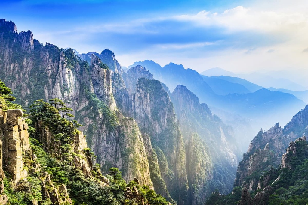
Situated at a latitude of 30 degrees North, Huangshan has a subtropical monsoon climate. However, the reserve’s mountains are generally about 10°C (18 °F) colder than the surrounding plains. The mountains also have higher humidity than the lower-lying valleys below, which often leads to the formation of the much admired “sea of clouds” phenomenon.
As it lies just outside the Yangtze River Delta Megalopolis, which is a group of cities that’s home to a population of 150 million people, Huangshan has excellent transport connections.
Located approximately 50 km (31 mi) away from the scenic area, Huangshan North Railway Station offers direct high-speed rail connections to Beijing, Shanghai, Guangzhou and Shenzhen among other major cities in eastern China.
Huangshan City has an international airport that’s located about 70 km (43 mi) from the scenic area. There are also express bus services that travel all the way to the scenic area from cities like Shanghai and Hangzhou.
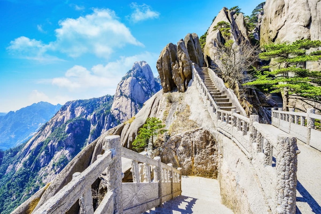
Within the scenic area, tourist infrastructure is well developed, and may seem excessively so to those who prefer wilderness destinations. Hiking trails are made up of endless flights of stone steps rather than dirt paths, and other ways to get around include shuttle buses, four lines of cableways, and even a sedan chair service.
Bright Summit Peak (光明顶 1,840 m/ 6,037 ft), the second-highest mountain in Huangshan, stands at the center of the scenic area. Places on the southern side of the peak are generally known as the “Front Mountains” (前山), while those on its northern and western sides are called the “Back Mountains” (后山).

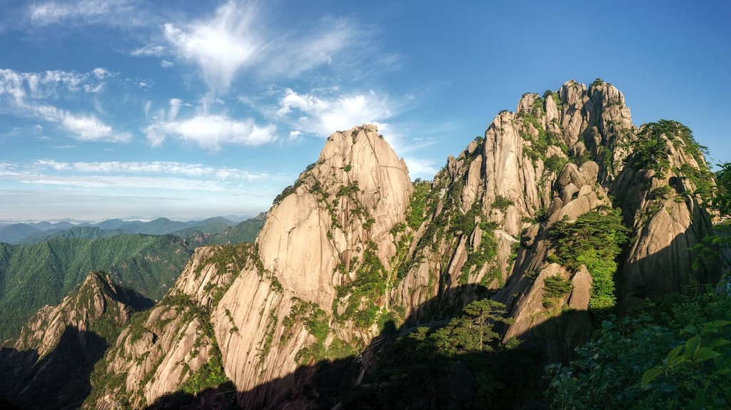
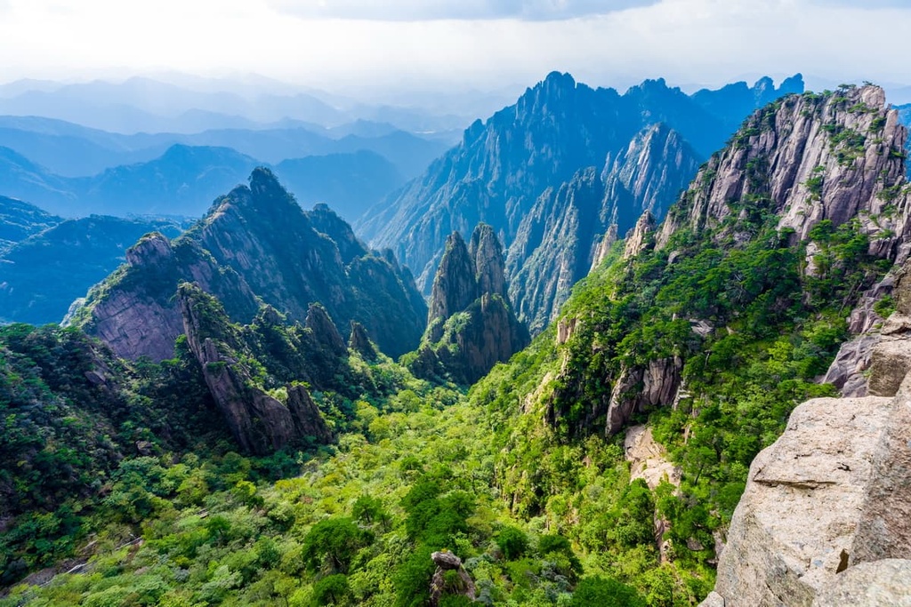
Huangshan is most renowned for its variety of granitic geomorphological landforms, such as peak clusters, stone forests, rock pillars and boulders. Many of these formations have fancy names like Flying-Over Rock (飞来石), Immortal Pointing the Way (仙人指路) and Monkey Watching the Sea (猴子观海).
The area alternated between towering above the ocean and being submerged below it until the Triassic period about 200 million years ago, when the region emerged from the sea and has since remained a continental area.
In the late Jurassic period about 140 million years ago, extensive magma intrusions led to the formation of the granite that would later become the region’s primary mountain-building material. Tectonic movements in the region produced fractures, joints, and overlapping in the granite even before it surfaced from underground.
About 65 million years ago, the mountain building events that started the creation of the Himalaya lifted the crust and pushed these granite bodies to the surface. Far from being a uniform rock mass, the granite body contained different compositions of minerals, crystallization and grain size.
Subsequent uplifts continued to raise the height of the mountains. Differences in lithology resulted in uneven weathering and erosion in the region, giving rise to soaring peaks, deep valleys and gaping canyons.
About 2.6 million years ago, there were several periods of glaciation that played a significant role in shaping Huangshan. It left behind glacial landforms such as u-shaped valleys, pyramidal peaks, cirques and arêtes.

Note that a cirque is an amphitheater-shaped hollow with steep sides at the head of a valley formed by glacial erosion. Meanwhile, an arête is a sharp rugged ridge formed between two cirques as they erode backwards on two sides of a mountain.
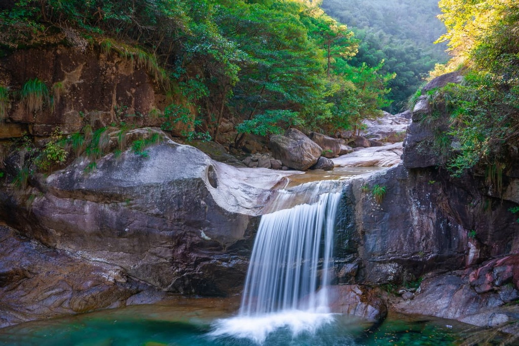
The area also has quite a few fluvial features such as streams, waterfalls, cold springs and hot springs originating from deep within the granite body. It serves as a watershed divide, too, separating the drainage basins of the mighty Yangtze to the north and Qiantang River to the south.
As one of the first nature reserves in the country, the Huangshan Scenic Area boasts a forest coverage of 85 percent. It is an important germplasm bank since it has preserved many ancient relic species of plants and animals from the Quaternary glacial period.
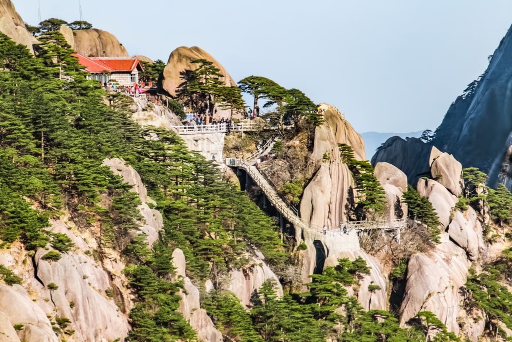
The vegetation cover in the scenic area is predominantly evergreen broad-leaved forest, even though Huangshan is widely known for its coniferous trees, especially the iconic Huangshan pine (Pinus hwangshanensis). This pine has a broad, flat crown and typically takes root in rocks rather than the soil.
Deciduous trees such as Chinese beech (Fagus engleriana) and Huangshan oak (Quercus stewardii) can be found from 1,100 m (3,609 ft) to the tree line at 1,800 m (5,906 ft) above sea level. Alpine grassland covers the peaks above the treeline.
The Huangshan pine is one of the 28 plant species named after the mountains. The area also harbors a third of the country’s species of bryophytes (mosses and liverworts) and more than half of China’s ferns.
In terms of fauna, the area provides sanctuary for about 400 species of vertebrates, including over 50 mammals and about 200 birds. Invertebrates are even more diverse and abundant, particularly butterflies and spiders.
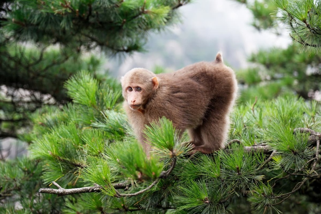
The wild animal most often seen in the reserve is probably the macaque. Other notable mammals include the Himalayan black bear, leopard, clouded leopard and Mongolian wolf. Among the bird species are the endangered Oriental stork, the vulnerable greater spotted eagle and Baikal teal.
In 2020, two species of white-toothed shrew in the area—Crocidura anhuiensis and Crocidura huangshanensis—were described for the first time. These “new” species are actually ancient creatures that were among the earliest mammals on Earth.
The mountains used to be known as Yishan (黟山) until 747 CE, when Emperor Xuanzong (唐玄宗) renamed them Huangshan (literally “Yellow Mountains”), reputedly after the mythical Emperor Huangdi (“Yellow Emperor” 黄帝). Since then, the mountains have become a mecca for poets and artists.
For more than a thousand years, visitors have expressed awe and appreciation of Huangshan through countless poems, articles, paintings, and now photos and videos as well. The great poet Li Bai (李白 701–762 CE) was the first among a legion of distinguished visitors who helped spread the mountains’ reputation far and wide.
With ethereal scenery that ticks every box in traditional Chinese aesthetics, Huangshan has been more than a popular subject for artists. It was the inspiration behind one of the most influential schools of Chinese landscape painting—the Huangshan School—which was founded in the late seventeenth century.
Hollywood director James Cameron said the floating peaks in his film Avatar were inspired by Huangshan. However, some Chinese people insist that they were modelled after the Zhangjiajie mountains in Hunan (湖南) province.
Huangshan has been a refuge for Buddhists and Taoists since the first Buddhist temple was built there in the fifth century CE. About a hundred temples have been built over time, but most of them were ruined or abandoned because of war and natural disasters. Only a few are still maintained.
Important cultural legacies can be found all over Huangshan, including 85 km (53 miles) of ancient hiking trails with elegant pavilions, bridges and some 63,000 stone steps.
In the old days, it was common for the literary and political elite to inscribe calligraphy on the rock faces. More than 300 inscriptions covering a total area of about 4,450 sq. meters (47,900 sq. feet) are protected historical monuments.
Nowadays, the scenic area has about 1,600 residents, mostly staff and their families. The buffer zone is dotted with plantations, many of which produce the highly-prized Huangshan Maofeng tea (黄山毛峰茶).
Widely recognized for its cultural as well as natural values, Huangshan is one of the few places to have received a dual World Heritage listing as it is also a UNESCO Global Geopark. It has formed sister relationships with parks such as Yosemite, Banff and Swiss Alps Jungfrau-Aletsch.
Given the vast number of attractions and the must-see sunrise on the region’s summits, many visitors stay at the hotels on the mountains in Huangshan National Scenic Area.
Camping is allowed at designated spots in the reserve with prior registration, but has been temporarily banned due to COVID-19. Be sure to check with reserve authorities before your visit for up-to-date information about regional closures and restrictions.
The scenic area can be divided into six zones. The following are the major attractions in each of them.
This is the zone closest to the South Gate, which serves as the entrance for most visitors. Its major attraction is the hot springs at the Huangshan Resort and Spa. The water retains a temperature of around 42°C (107°F), and there are outdoor springs as well as indoor springs.
The area also has a few waterfalls, including the 50-m (164-foot) long Renzi Waterfall (人字瀑). Not far away is the Ciguang Pavilion (慈光阁), a museum converted from a Buddhist temple, which was conferred the title of “the nation’s guardian temple” by the Emperor in 1606. It is the starting point for hiking uphill from the southern end.
This zone is next to the Hot Spring zone on the southern side of Huangshan, and is the most visited one in the scenic area. Among the mountains in this zone are the highest peak in Huangshan, Lotus Peak (莲花峰 1,864 m/ 6,115 ft), and the third-highest Tiandu Peak (天都峰 1,830 m/ 6,003 ft).
The summits are ideal for admiring the sea of clouds, which occurs all year round but is most spectacular in the winter. A billowing sea of white fluff adorned with seemingly floating peaks is worth the early morning rise.
People also come to Yuping to see the trademark pines of Huangshan. The seeds were sometimes carried by wind into rock crevices, and it can take hundreds of years for a tree to grow just a couple of meters, often in a gnarled and crooked way. More than 50 trees in Huangshan are more than a thousand years old.
The Greeting Pine (迎客松) is not only a symbol of Huangshan but also the most famous tree in China. It was so named because one of its branches stretches out as if reaching out to people with a welcoming gesture. It is so precious that it has its own full-time nanny/ bodyguard.
This zone is the hinterland of the scenic area, covering an open space of 1,300 hectares (3,212 acres) at about 1,600 m (5,249 ft) above sea level. It contains the second-highest mountain in the reserve, Bright Summit Peak (光明顶 1,840 m/ 6,037 ft) and a host of other mountains like Lion Peak (狮子峰 1,690 m / 5,545 ft) and Shixin Peak (始信峰 1,683 m/ 5,522 ft).
Qingliang Terrace (清凉台), which is located close to the summit of Lion Peak, is believed to be the best spot for watching the sea of clouds and the sunrise. Shixin Peak, which literally means “beginning to believe peak”, was named about 300 years ago after an official who didn’t believe all the hype about Huangshan went there himself. He rightfully found that the beautiful scenery lived up to expectations.
Beihai abounds in impressive rock formations and beautiful pine trees. The Flying-Over Rock (飞来石), for example, is a 12-m (39-ft) high stone pillar that somehow manages to stay slightly tilted on a flat surface.
Among the celebrity pines in the mountains are Black Tiger Pine (黑虎松) and Dragon Claw Pine (龙爪松). Just like the peaks and rocks, many trees in this zone have interesting stories behind them.
This zone occupies the northwestern part of the scenic area and is popular with serious hikers. The trail that starts from the North Gate follows Furong Ridge (芙蓉岭) to Qingliang Terrace (清凉台) at Beihai zone. It is a 8.5-km (5.3 mi) long route with over 6,500 stone steps and an elevation gain of 1,110 m (3,609 ft).
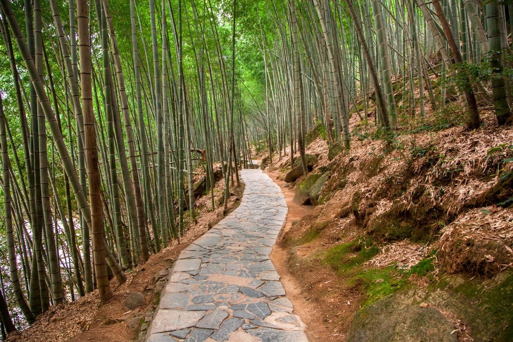
Sights along the trail include crystal clear ponds like the Emerald Pond (翡翠池) and the ancient Songgu Temple, which is almost a thousand years old. The scenery is further enhanced by bamboo groves, ancient trees and artistic rock inscriptions.
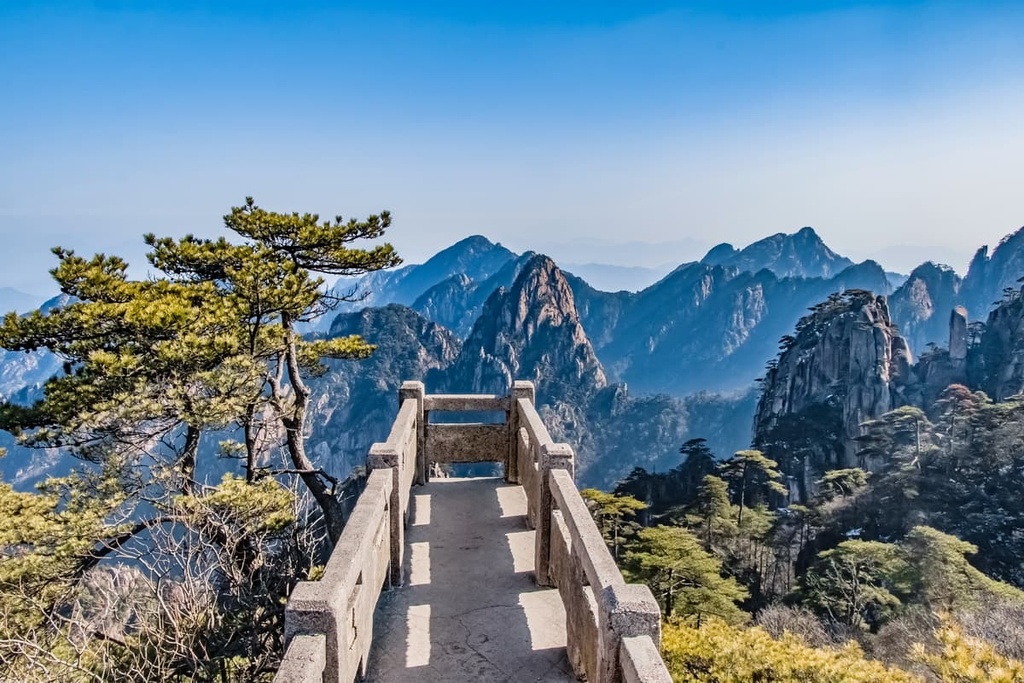
Situated on the western side of Huangshan, this zone covers an area of 1,655 hectares (4,090 acres). Its Fairy Walking Bridge (步仙桥) is one of the most amazing artificial structures in the mountains. With a width of just 6 m (19.7 ft), this stone bridge spans over an abyss between two opposing cliffs.
Xihai Canyon (西海大峡谷) is a recently developed attraction in Baiyun. Wedged between towering peaks for 15 km (9.3 mi), the canyon not only offers lush vegetation, peculiar rocks, deep caves and clear streams, but also a different perspective to marvel at Huangshan, as seen from the bottom. It has a 3.4-km (2.1 mi) long hiking trail that took five years to build.
Located on the eastern side of the scenic area, this zone consists of a valley that’s located at 890 m (2,920 ft) above sea level. It houses the remains of the ruined Yungu Temple, and now the Yungu Villa stands in its place. The villa is a modern hotel built in the traditional Hui style that’s typical of Anhui province.
There are a few waterfalls in the area, such as the Jiulong Waterfalls (九龙瀑), which literally means “nine dragons waterfalls” in Chinese, that’s made up of nine terraces of cascades. Another waterfall worth checking out is the 100-m (328-foot) long Baizhang Waterfall (百丈瀑).
Looking for a place to stay near Huangshan National Scenic Area? Here are some of the best cities and towns to check out:
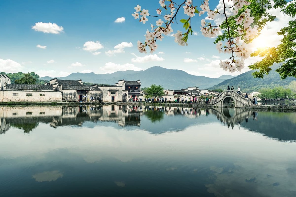
With a population of 1.3 million people, Huangshan City (黄山市) has been a cultural stronghold for millennia.
The area used to be known as Huizhou (徽州), and the Hui style of architecture, carving, cuisine and tea ceremony have important places in Chinese culture. It is also famous for Hui merchants who were among the most influential merchants in imperial times.

The ancient villages of Hongcun (宏村) and Xidi (西递) in Huangshan City are a UNESCO World Heritage Site. They often top the lists of the most beautiful villages in China. Ancient streets and buildings can be seen all over the city, making the whole place a most interesting living history museum.