Scan the QR code and open PeakVisor on your phone
Holstein Switzerland Nature Park is a hilly protected area located in the Schleswig-Holstein region of northern Germany that’s full of small lakes and rolling pastures. There are 19 named mountains in the park. The tallest and most prominent is Bungsberg at 168 m (551 ft) in elevation and with 148 m (486 ft) of prominence.
Holstein Switzerland Nature Park (Naturpark Holsteinische Schweiz) is situated in the northern stretches of Germany. The park spans 753 sq. km (291 sq. miles) and is the largest park within the country’s Schleswig-Holstein region near its land border with Denmark.
When compared to the mountainous parks in the Alps of southern Germany, Holstein Switzerland is relatively flat and it is marked by rolling pasture hills. Patches of trees are intermixed with small lakes throughout the park. The River Schwentine runs through the park and is the longest body of water in the area.
Small wooded areas are scattered throughout the region helping provide shelter for animals. Although not exceptionally tall, Bungsberg has become a popular tourist destination for sightseeing, hiking, and bird-watching.
Beneath the pleasant rolling hills of Holstein Switzerland lies a vast network of caves. Though not widely accessible, these caves are unique to the region and provide habitat for numerous animal species.
Additionally, Holstein Switzerland Nature Park is located near other parks in the country. Kreis Herzogtum Lauenburg lies to the southeast, Segeberger Staatsforst to the southwest, and Oldenburger Bruch to the northeast.
The hills of Holstein Switzerland Nature Park formed during the Saale glacial stage. Bungsberg is actually a terminal moraine that dates back over 150,000 years. During the glacial period that occurred just 10,000 years ago (known as the Weichselian glaciation), the peak stuck out above the glacier forming a minor peak known as a nunatak.
The park sits near the southeastern edge of the Jutland Peninsula, most of which is in Denmark. The gentle hills of the eastern part of the peninsula give way to the rugged cliffs along the straits of Kattegat and Skaggerrak that separate Denmark from Norway and Sweden.
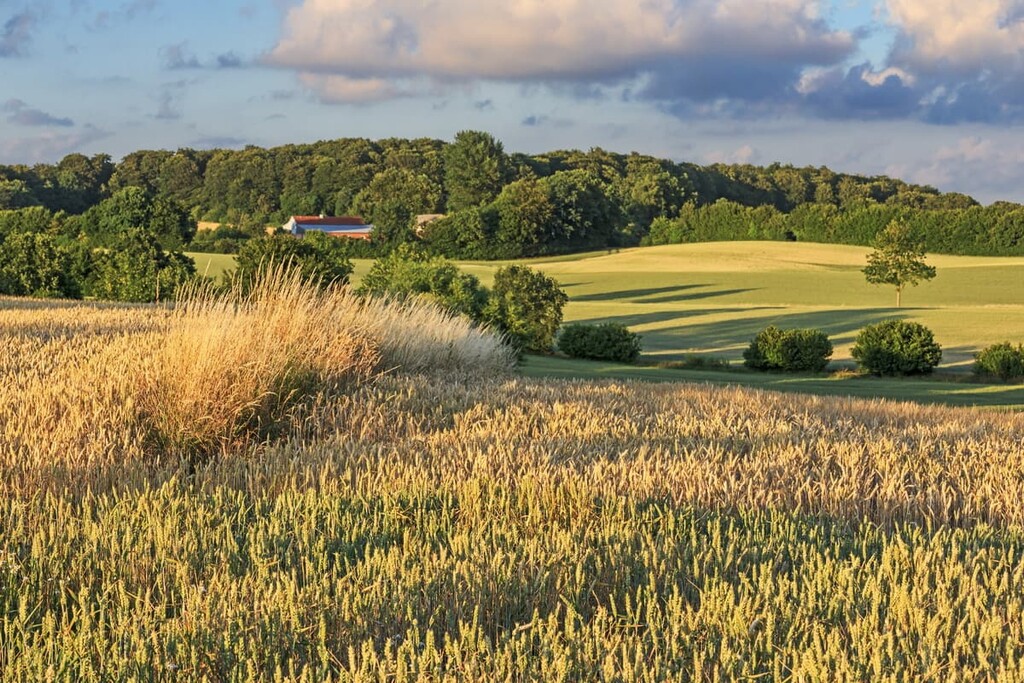
Today the land consists primarily of glacial and alluvial sediments. Moraines mark the edge of glaciers that once dominated the landscape. Sediment was moved forward along the glacier before being deposited at the edge of the massive ice sheet.
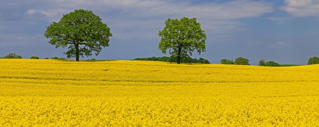
The rolling hills left behind were carved by glacial retreating. The fertile soil left behind has allowed forests, fields, and pastures to thrive in the region for thousands of years. Today, large sections of land in and around the park are used for farming and grazing.
Major peaks within the park include Bungsberg, Gömnitzer Berg, Holzberg, Kagelsberg, and Nehmsberg.
Holstein Switzerland Nature Park is a home to numerous species of both plants and animals. Some of the most common trees in the park include oaks, beeches, and elms. Fruit trees can also be found in the region. In fact, the oak tree is the national tree of Germany.
Wildflowers are sprinkled across the Holstein Switzerland Nature Park. Poppies, daisies, buttercups, and violets are common in the forested hills of the park.
Many of the lakes in the park help provide breeding grounds for land and seabirds. Common species include the grebe, coot, corncrake, and white-tailed eagle. Within the caves, there are an estimated 20,000 bats, accompanied by native salamander species.
Other small animals such as shrews and badgers can also be found in the park. Because farming and grazing is allowed within the park boundaries, populations of horses, sheep, and cows can be seen throughout the region.
Human history in the region dates back to settlements during the Stone and Iron ages, around 10,000 to 3,000 BCE. Small communities traditionally lived in the region and thrived as hunters, gatherers, and anglers.
During the Neolithic from 3,000 to 1,700 BCE, communities began farming the fertile land of Jutland. A few thousand years later, in 600 CE, the Slavs began replacing the early settlements made up mainly of Germanic tribes.
The Slavs ruled over the land for around 600 years. They built the “Limes Saxoniae”, a network of swamp lands and castles that was difficult for other communities to break through. Fighting between the Slavic and Germanic tribes lasted for hundreds of years.
Eventually, the land was colonised by the Frankish Carolingian Empire, after which it changed hands numerous times throughout the Middle Ages until it became part of the Kingdom of Prussia. It later became part of the Weimar Republic, then Nazi Germany, and West Germany before finally becoming part of the Federal Republic of Germany after reunification.
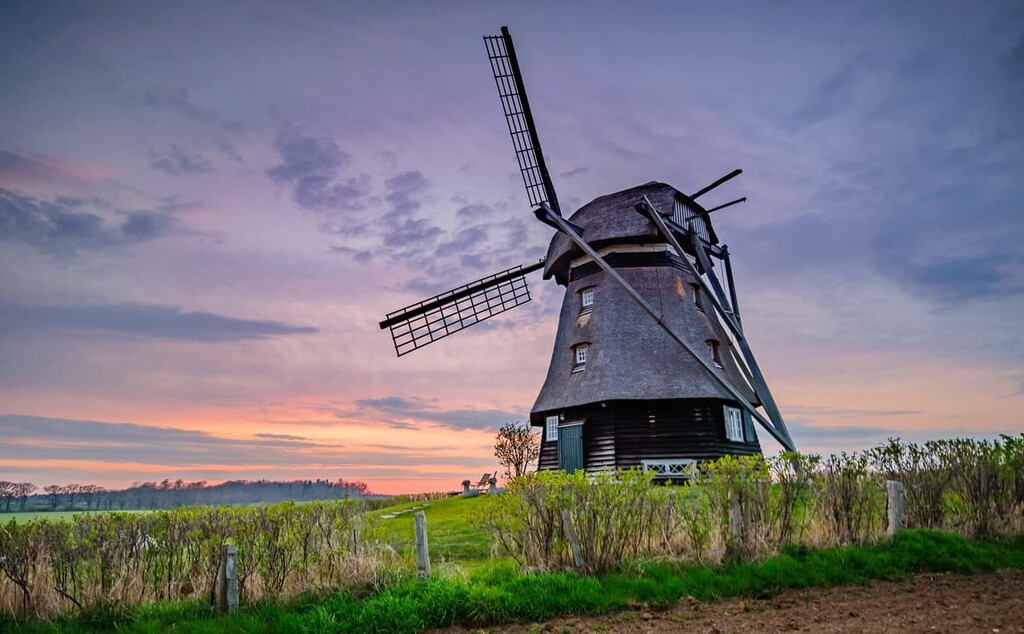
Today the park is full of fields, castles, churches, and small villages, all showcasing the region’s rich history. Though many smaller parks existed in the area, the Holstein Switzerland Nature Park was officially established in 1986. Many tourists visit the park for hiking, biking, canoeing, and even horseback riding.
Holstein Switzerland Nature Park is home to numerous trails for visitors to enjoy. Here are some of the most popular trails and regions in the park:
The Holstein Switzerland Way trail is a long distance trail that travels the length of the park. The trail is 53 km (32.9 miles) long with just 367 m (1,204 ft) of elevation gain.
This long route offers hikers a chance to witness nearly all of the varying landscapes the park has to offer. After passing along streams, lakes, and forests, the route leads up to the tallest peak in the park, offering views of the rolling hills below.
The Ihlsee Circular Route is 5.1 km (3.2 miles) with just 27 m (89 ft) elevation gain. This loop trail circles around Ihlsee while winding through a forested landscape. Throughout the year the trail is full of lush flora and active fauna.
Another popular hike in the park is the walk around Eutiner See. The trail is 8.6 km (5.3 miles) with 38 m (125 ft) elevation gain. The smooth trail circles around the lake often passing along the shoreline.
Other sections of trail enter the forest which surrounds the lake. Throughout the route, there are many viewpoints with access to the lake and views of the city of Eutin at the southern edge of the lake.
Looking for a place to stay near the Holstein Switzerland Nature Park? Here are some of the best cities and villages to check out in the region:
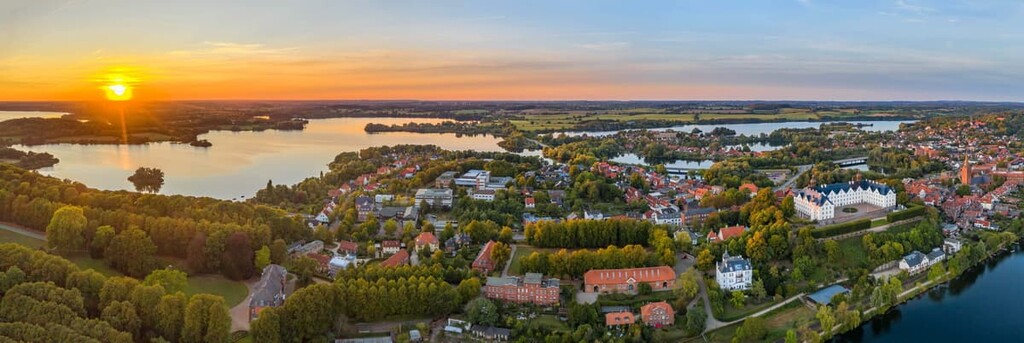
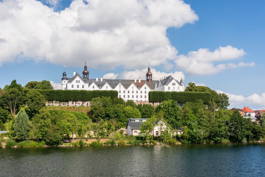
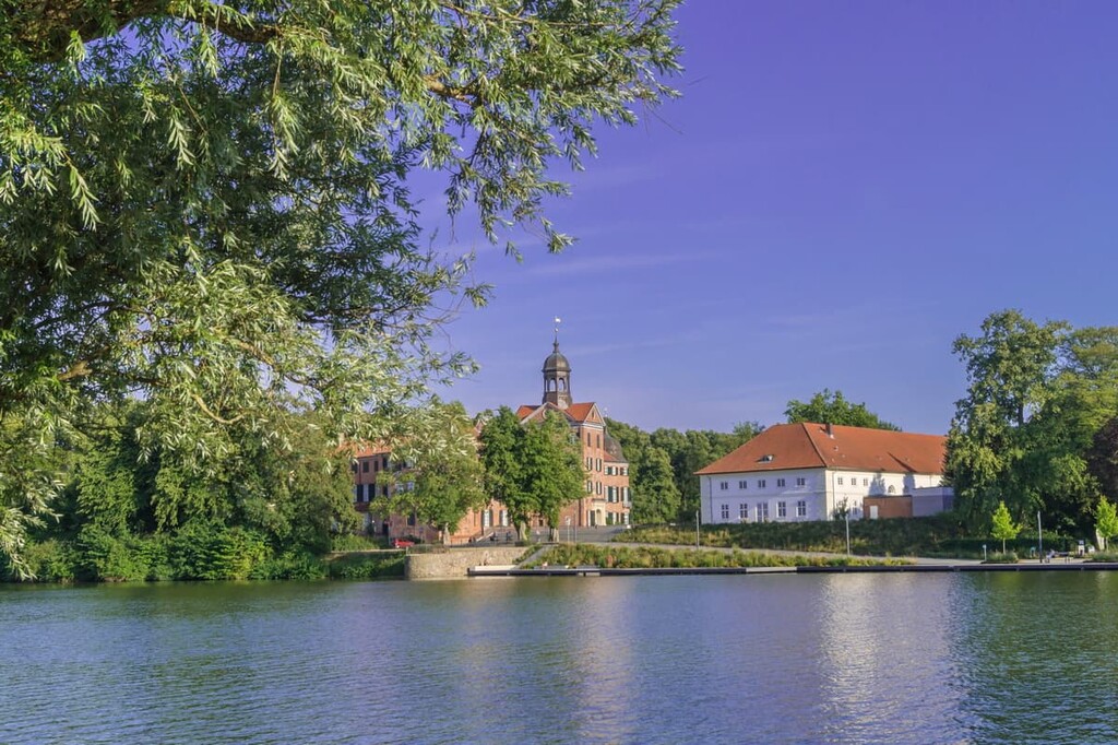
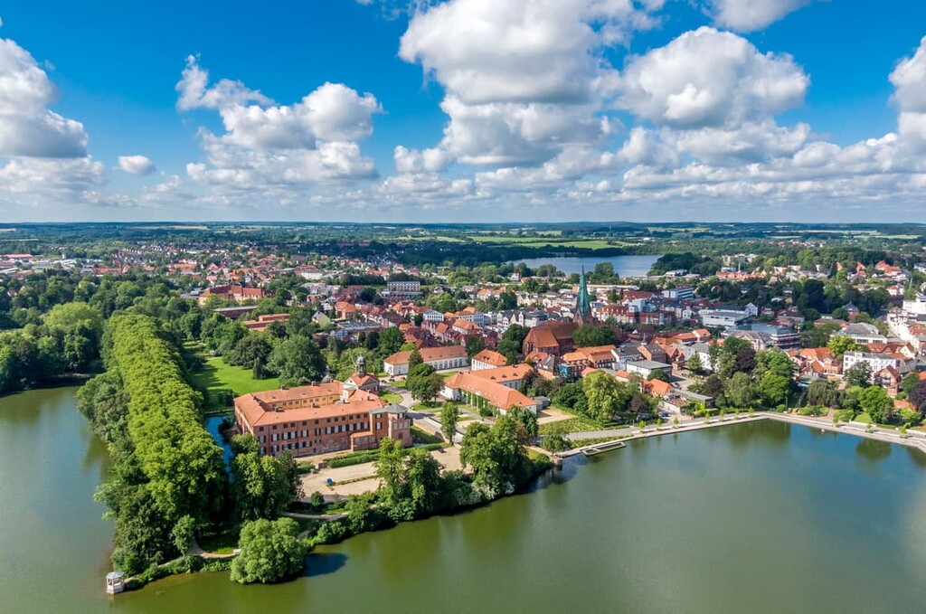
Located in the park is the city of Eutin. The city has around 20,000 inhabitants and is surrounded by lakes and hiking trails. Eutin is known for being the birthplace of the composer Carl Maria von Weber.
To honor his memory, the city is home to an open air theater located near the shores of the lake. Other popular attractions include Eutin Castle and the annual Eutin Theater Festival.
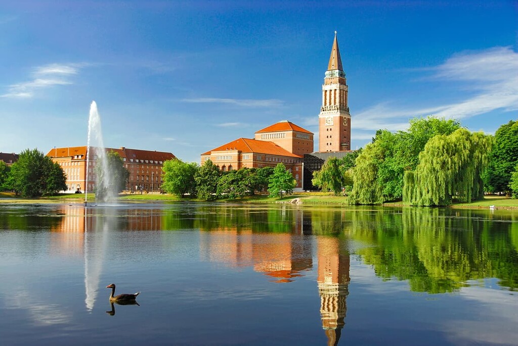
Kiel, the capital of Schleswig-Holstein, is located just to the north of the park. The city has a population of around 250,000 people, making it the most populous city in northern Germany. Kiel sits along the Kiel Fjord which stretches out for 17 km (10.6 mi).
Each year, the city hosts what is known as Kiel week, one of the largest sailing events in the world. Other popular tourist attractions include local restaurants, Schifffahrtsmuseum Kiel, Nikolaikirche, and Kunstehalle Kiel.