
Scan the QR code and open PeakVisor on your phone
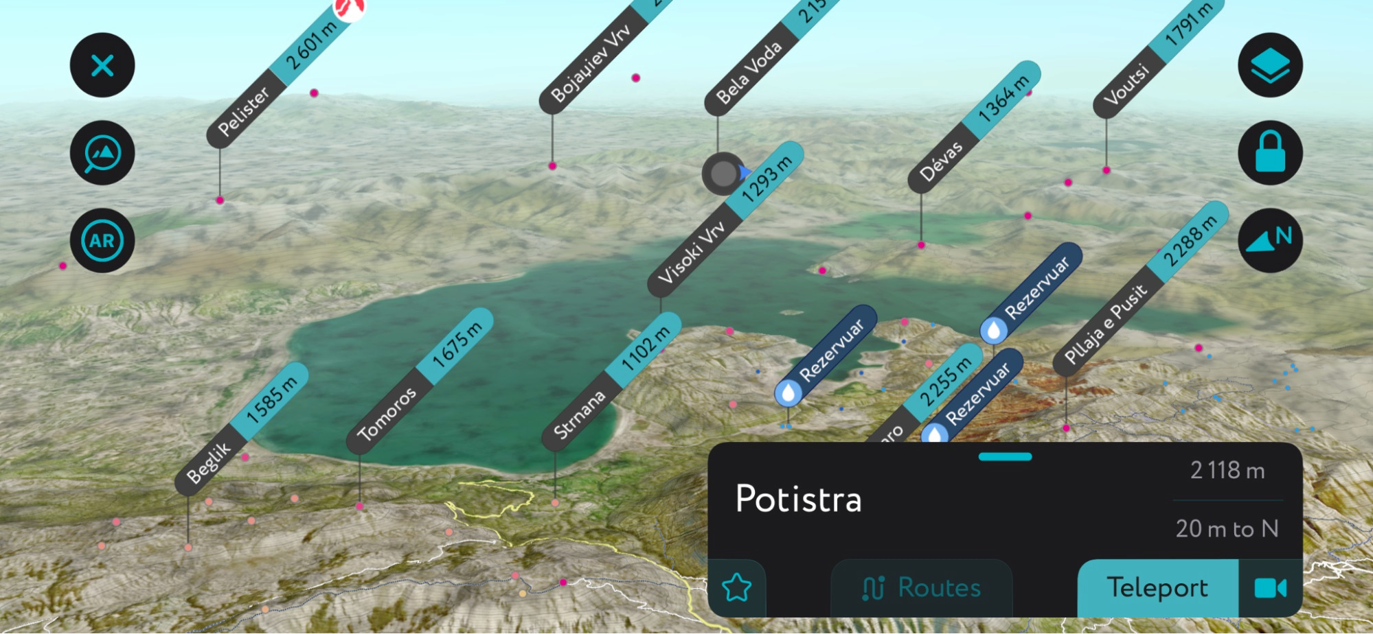
The Prespa Lakes have long served as a border between three Southern European countries: Northern Macedonia, Greece, and Albania. Historically, sparse development and population have preserved habitat and wildlife populations. Today, the area is protected under a tri-border national park. There are 11 named peaks in Prespa; Potistra (2,118 m / 6,948 ft) is the highest, while Frouria (1,145 m / 3,756 ft) is the most prominent.
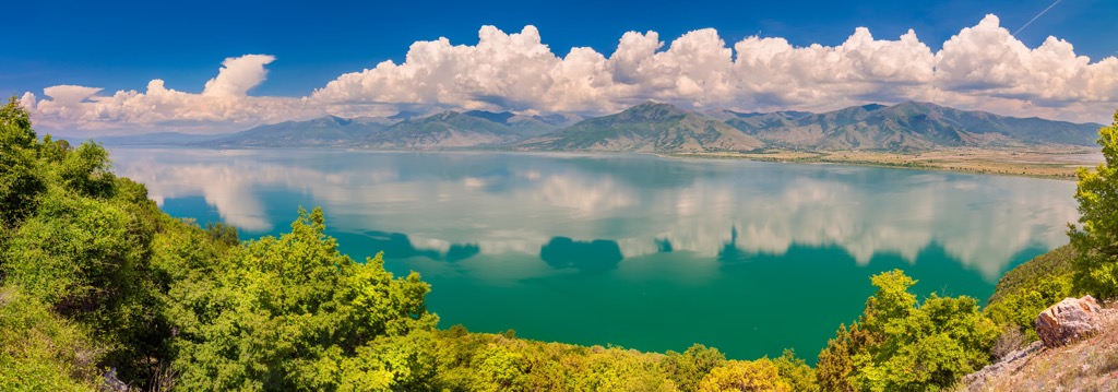
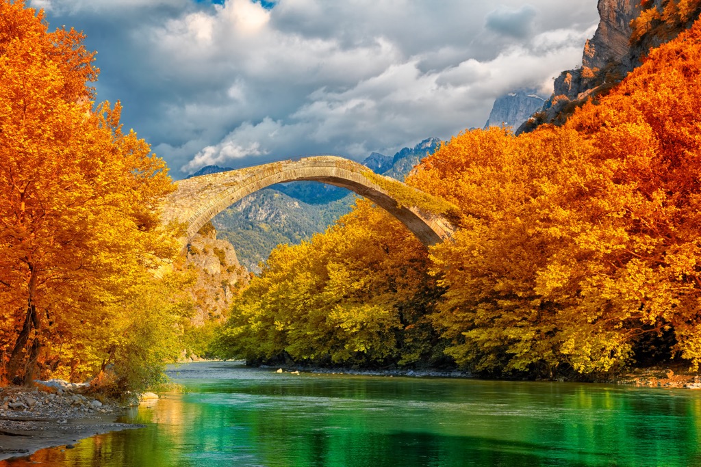
National Park Prespa, or Δρυμός Πρεσπών in Greek, is situated at the northern tip of the Pindos mountain range. The Prespa Lake system encompasses Lake Prespa and Small Prespa Lake, forming the tri-border region. Great Prespa Lake spans Greece, Albania, and North Macedonia, while Little Prespa Lake mainly lies within Greek territory. The park’s distinguishing features are its natural beauty, landscapes, village architecture, and distinctive Byzantine monuments.
There are “Prespa National Parks” in Albania and Greece. In total, the area boasts four National Parks: two areas protect Prespa Lakes in Albania and Greece, and Galicica and Pelister National Parks in North Macedonia. The lakes are some of the largest in the Balkans. They are also some of the oldest in Europe at over two million years old.
In Greece, the Prespa area is part of the Florina Prefecture, covering around 330 sq. km (127 sq. mi) and housing thirteen villages and hamlets, home to approximately 1,300 residents.
Administratively, the entire area also falls under the Ohrid-Prespa Biosphere Reserve and the transboundary Prespa Park of the Balkans. Prespa National Park and nearby Mount Varnoundas exist within the Natura 2000 protected area network. Furthermore, Lesser Prespa Lake is classified as one of Greece's 11 wetlands of international importance recognized by the Ramsar Convention.
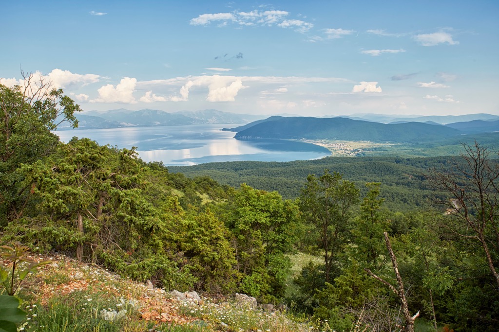
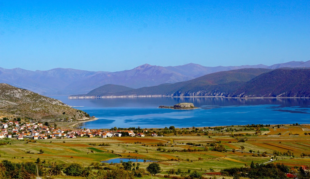
Nearby Lake Ohrid, one of the oldest in the world at approximately five million years old, also exists within this greater lakes region. Specifically, Galicica National Park straddles a strip of land between Lake Prespa and Lake Ohrid, offering access to both shores. Compared to the Prespa Lakes, Lake Ohrid is older and deeper, with more water clarity.
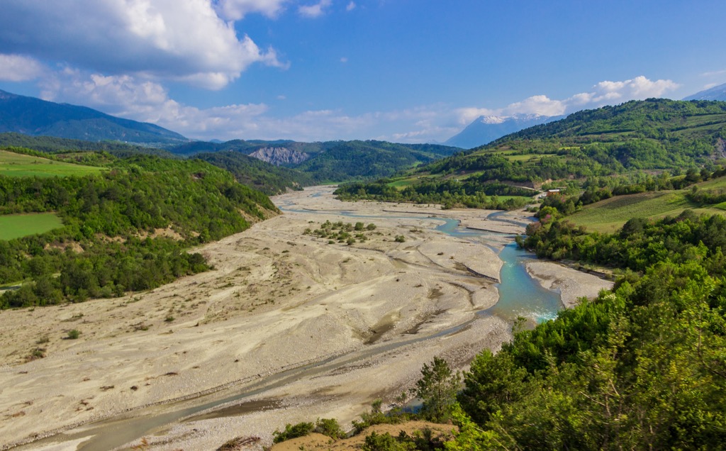
Lake Prespa and Small Prespa Lake are divided by a thin strip of land and surrounded by towering mountains. From the Prespa Lake region, North Macedonia governs an area of 172 sq. km (106 sq. mi), Albania 44.3 sq. km (27 sq. mi), and Greece 36.4 sq. km (22 sq. mi). Notably, these lakes are the highest in the region, with an elevation of 853 m (2,798 ft). Lake Prespa has a maximum depth of 54 m (177 ft)
The geological formation is characterized by calcareous massif rock formations, primarily present in Albania and North Macedonia, extending southward to Greece. Within this area, wetlands are dominated by trees and seasonal marshes, along with features like tidal creeks, freshwater springs, caves, and some farmland.

Tectonic lakes, like the Prespa Lakes plus Lake Ohrid, often form in seismically active regions when the earth's crust shifts, creating depressions. In turn, both underground and aboveground tributaries and streams feed these depressions, forming lakes. Tectonic lake regions are often seismically active, and the Prespa Lakes are no exception. Moderate earthquakes are common in the surrounding area, with the largest being a 6.6 magnitude quake in 1911.
Sitting approximately 150 m (492 ft) above Lake Ohrid, much of Prespa Lake's waters follow various karst underground channels before emerging from springs into its lower brother. These springs carry minimal sediment, one of the reasons Ohrid is much clearer than Prespa. The lake then drains westward through a narrow outlet, passing between mountains, and flows into the Devoll River. This river traverses Albania's central mountain range, ultimately reaching the Gulf of Vlora.

Many wild creatures call Prespa home, including 62 mammal, 11 amphibian, 22 reptile, and 23 fish species. Bird enthusiasts will delight in spotting over 270 bird species, with 143 nesting in Prespa.
The lakes also sustain the world's largest colony of Dalmatian pelicans, with over 1,000 breeding pairs, though this number has fluctuated recently. These pelicans are one of the largest freshwater bird species globally, boasting a wingspan of up to 3 m (10 ft). Distinguished by their striking white plumage, black flight feathers, and distinctive pouch beneath their long bills, Dalmatian Pelicans are known for their social behavior and cooperative hunting strategies. These pelicans predominantly inhabit lakes, rivers, and wetlands, and their diet primarily consists of fish, making them significant indicators of the health of their aquatic habitats.
In 2022, widespread incidence of H5N1 bird flu killed as many as 60% of the first 1000 individuals who arrived at the lakes for the season. The Spirit of the Wetlands is a magnificent essay addressing the recent crisis on Lake Prespa.
“For those who visit the colonies, seeing these birds soaring on wings so large that they eclipse the sun when passing in front of it, their bayonet bills strangely archaic for such elegant fliers, a deep-time association often surfaces swiftly. It’s like watching dinosaurs.” - Spirit of the Wetlands, Julia Hoffman

Prespa is a haven for biodiversity, hosting over half of Greece's bird, amphibian, and mammal species. In total, over 1,800 plant species exist within the park’s boundaries. The biodiversity in such a compact area underscores the park's ecological significance and is one of the main reasons for its heavily protected status.
Moreover, Prespa features a diversity of habitats. Administratively, roughly 26% of the total area of Prespa National Park falls under priority habitats, which ensures special protection. The area boasts 49 recorded habitat types.
This ecoregion occurs in the Pindus Mountains of northern Greece and southern Albania, forming part of the Palearctic ecozone, encompassing Europe. Unfortunately, human activities have severely degraded the region in the twentieth century, resulting in significant biodiversity loss due to agricultural conversion for intensive livestock farming and forestry plantations for fuelwood production.
The forests, covering half of the park’s land area, comprise coniferous and deciduous trees, hence the ‘mixed forests’ designation. The woods feature rare endemic species like Prespa trout, Prespa flower, and silver birch.
In addition to the Dalmatian Pelican, the lakes and surrounding wetlands also provide a habitat for other rare aquatic bird species, including herons and greylag geese. The forests are also a sanctuary for endangered mammal species like bears, wolves, and possibly the Balkan lynx.
Prehistory likely featured tribes of Neanderthals taking advantage of the Mediterranean climate. Anatomically modern humans (Homo sapiens) probably arrived around 40,000 years ago. However, limited evidence of these early pioneers exists.
During the Hellenistic and Roman eras, there is evidence of civilization in the region. Remnants between villages Milionas and Laimos and the establishment of Lyka, a Hellenistic settlement on Agios Achilleios Island, offer a window into this era.
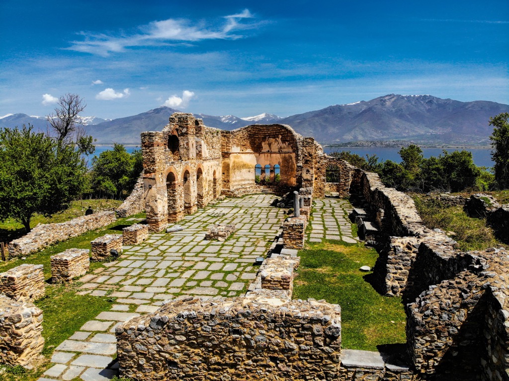
The archaeological remnants in Prespa primarily come from the medieval period, encompassing both Byzantine and post-Byzantine structures scattered across Prespa Lake’s surroundings. By the late ninth century, Prespa was under the dominion of the Western Bulgarian Empire.
After its dissolution in 971, Tsar Samuel, the son of the last emperor, sought refuge in this area, reorganized, and established Prespa as a base for expanding control into much of Greece. This supremacy persisted until Emperor Basil II reclaimed all lost Byzantine territories in 1018, marking the decline of Prespa’s prominence.
In subsequent eras, the seclusion of the region attracted monks and hermits during the Frankish and Ottoman periods. The area was sparsely populated during these times. The population faced significant challenges, and after the I World War, a substantial portion relocated to Eastern Bloc countries or Australia.
Consequently, the government offered vacant houses and land to Vlachs in a bid to maintain a presence along the frontier. The lakes remained almost empty and unprotected until the turn of the last century. In 1974, a portion of the 195 sq. km (75 sq. miles) area of Greek Prespa was designated a National Park, focusing on the strictly protected Lesser Prespa Lake. The original park did not encompass the entire Prespa Lakes or Mount Varnoundas as it does now.
In a surprising turn of events, despite historical border tensions, the leaders of the three bordering governments met in October 2000 and collectively designated Prespa as an international park, a notable achievement in the Balkans. In Greece in 2009, the protected area expanded to cover the whole lake basin (327 sq. km or 126.2 sq. miles). It was rebranded as the Prespa National Park (variously called Prespa National Forest by locals).
This short hike traverses the picturesque Prespa Mikri Lake or Small Prespa. For a more extensive walk, start your journey from the Treni archaeological site and follow the ancient dirt road.
The trail kicks off at the former military border post in Zagradec. From Zagradec, follow the main road as it descends north until you reach the dirt road alongside a nearby lake. Proceed eastwards to arrive at the former military blockade.
Embarking from the traditional settlement of Psarades, follow a road and then a path to the Roti Observatory. The vantage point offers an unparalleled view—the expansive Great Prespa stretches in the foreground while neighboring Albania and Northern Macedonia extend to the opposite side.
A 40-minute walk allows us to descend to the lake's shore, granting access to the Transfiguration of the Savior hermitage, dating back to the thirteenth century. A path continues further down to the lower banks of Great Prespa. Along the road, you will see two more hermitages: Little Ascension and the Panagia Eleousa, both constructed in the fifteenth century.
This hike commences from the charming Agios Germanos village. The circular route, 15 km (9.3 mi) in length, traverses the southeastern expanse of Lake Prespa.
Following the path along the northern slopes of the Agios Germanos River valley, the route eventually culminates in the village of the same name. The route takes a steep ascent towards the southern reaches of Mount Potistra (2,118 m / 6,948 ft), offering a mesmerizing vista.
These are the nearest cities to Prespa National Park in Greece:
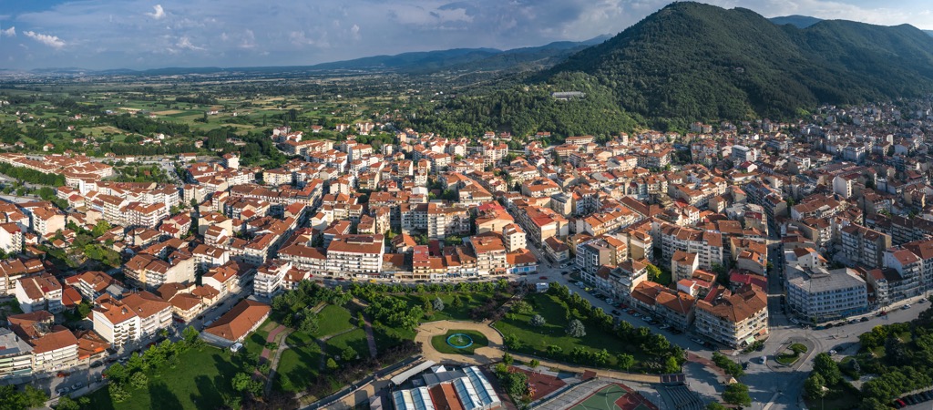
Florina is a charming northern Greek city that holds its own unique allure. Its distinctive identity and cultural richness make it a significant regional center. It is strategically positioned close to the borders of North Macedonia and Albania.
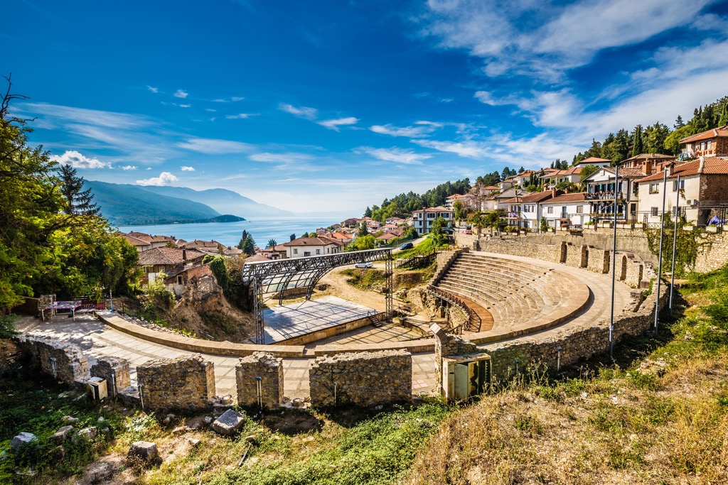
Situated within the Republic of North Macedonia, Ohrid graces the shores of Lake Ohrid. The city holds immense archaeological significance and has been continuously inhabited for 2,500 years. Originating from the vision of Philip II of Macedon, the father of Alexander the Great, Ohrid was established around 340 BC.
The city was initially named "Ochrida," derived from the Greek "Ochrēs," meaning "bright." With the turquoise hue of the lake, the green mountains, and the stone architecture, the city remains true to its name.
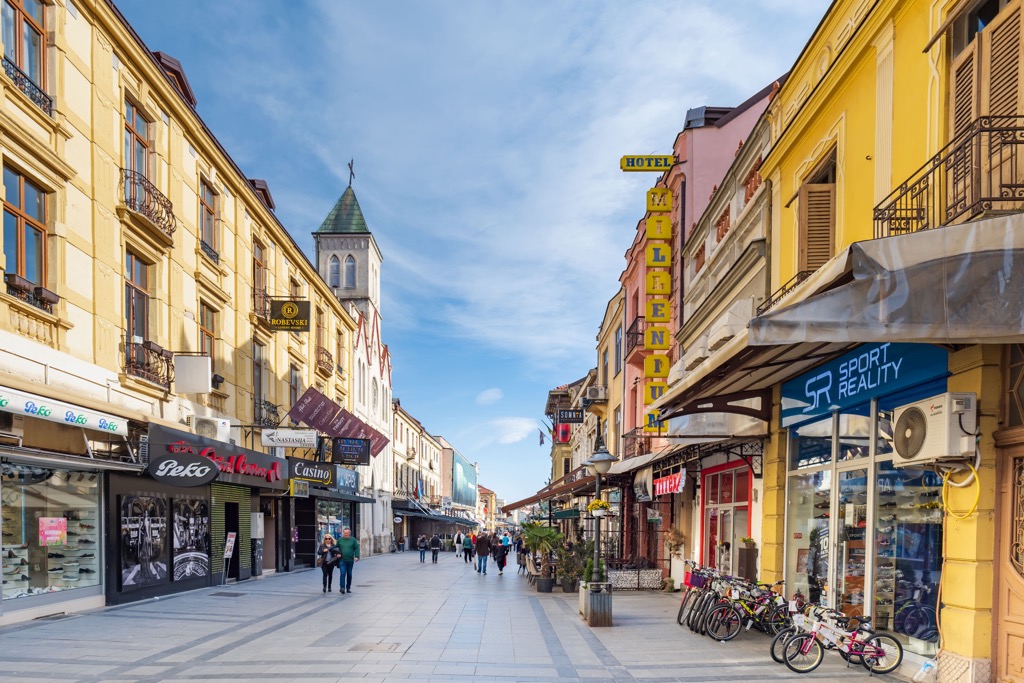
Bitola is in southwestern North Macedonia and is the country's second-largest city, with about 70,000 people. Its location near the borders of Greece and Albania makes it a strategic hub. The name "Bitola" finds its roots in the Slavic term "bistra," signifying "clear water."


