Scan the QR code and open PeakVisor on your phone
The Pindos Mountains are the largest mountain range in Greece and feature the nation’s second-highest peak. The Pindos National Park showcases lush grasslands, forests, and canyons. There are 131 named mountains in Εθνικό Πάρκο Πίνδου; the highest and most prominent is Smolikas (2,637m / 8,651ft).
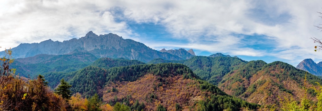
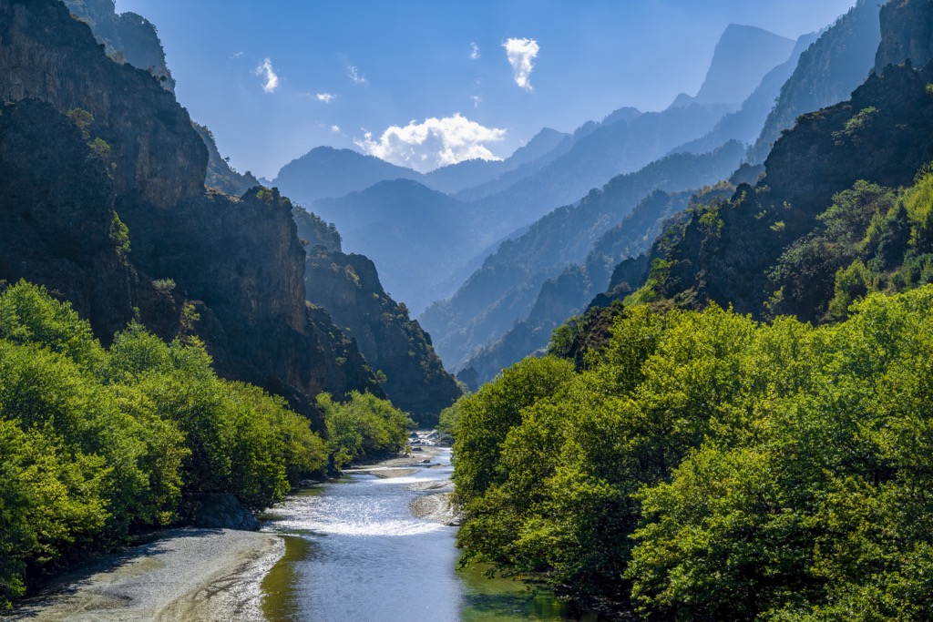
Pindos National Park (Εθνικό Πάρκο Πίνδου in Greek) is the largest park of the Pindos mountain range, also called the Pindus Mountains, which is the most extensive and prominent mountain range in Greece. It covers the massif’s northern section; therefore, it’s sometimes called the Northern Pindos National Park. It is located in northwestern Greece within the Regional Units of Ioannina and Grevena, stretching 230 km (143 mi) long and 70 km (43 mi) wide.
Smolikas, the second-highest mountain in Greece at 2,637 m (8,651 ft), is located within the park. Pindos is the country's largest national park, covering 797,125 ha (1,969,741 acres). The park includes Smolikas, as well as the Tymfi, Lygos, Vasilitsa, Mitsikeli, and other smaller mountains, all forming the Northern Pindos massif. Significant rivers like Aoos, Voidomatis, Venetikos, and Arachthos tributaries (Bardas and Zagoritikos) originate within the protected area.
One protected area within the park is Valia Calda, the Warm Valley in Aromanian, covering an area of 6,927 ha (17,120 ar). The second protected area is the recently named national park Vikos Gorge and the Aoos Ravine. The gorge was once contained within Pindos National Park, but the government recently designated it as a separate park.
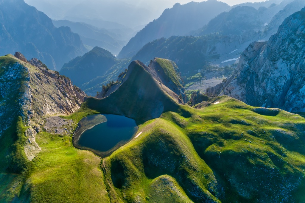
The Pindos National Park has peaks exceeding 2,000 m (6,600 ft), an elevation range of 1,076 to 2,177 m (3,530 to 7,142 ft), rocky ridges, fast-flowing streams, and mountain lakes. These peaks are found in the park’s northern and eastern parts and include Smolikas (2,637 m/ 8,651ft), Mosia, and Gamila peaks, where ophiolite rocks are dominant. These are sections of the Earth’s oceanic crust that have been uplifted and exposed.
On the other hand, limestone is prevalent in the southern and western parts, like Tymfi, Trapezitsa, and Mitsikeli, as well as in some areas in the central and north-northeastern regions. Tymfi's limestone mountain complex was shaped by water for millions of years, forming the region’s renowned gorges. In the Pindos National Forest (Valia Calda) area and its surrounding mountain peaks, volcanic rocks like peridotites dominate, formed about 170 million years ago.
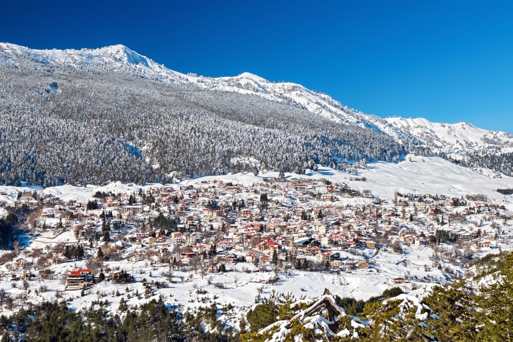
The protected area experiences a mountainous climate with lush forests, typical of high elevations, though the park features many microclimates that vary by altitude and aspect. The climate is a mix of Mediterranean and continental Europe, with cold winters and warm, humid summers.
The region receives the highest rainfall in Greece, resulting in extensive vegetation. In high altitudes, winters are harsher than the rest of the country, with frequent snowfalls and snow cover occasionally lasting from October to May. The climate is milder at lower altitudes, with shorter snow cover, reduced frosts, limited sunshine, and less summer rainfall. The annual temperature range is notably wide.
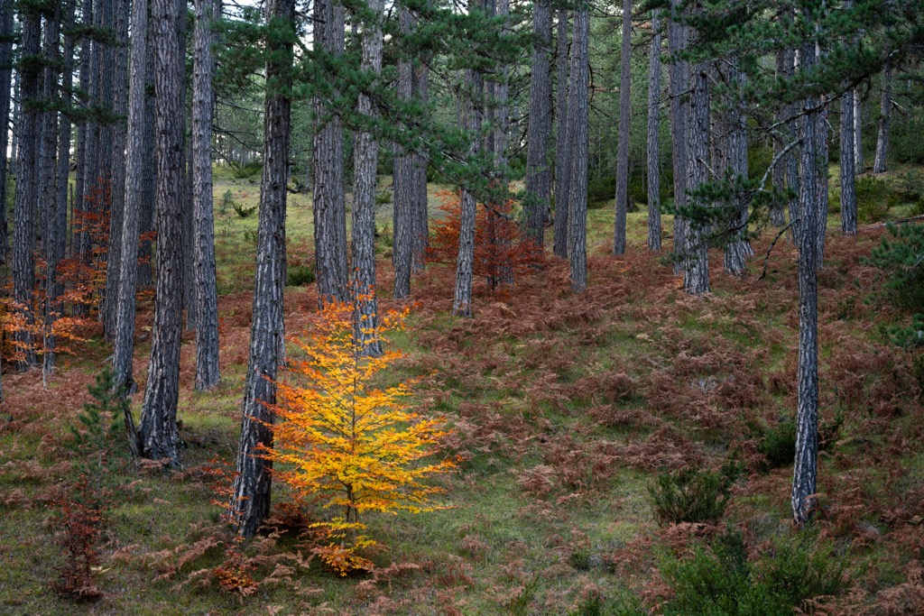
The Pindos National Park has 30 different natural habitats. Around 15 are forest habitats, including black pine, beech, fir, oak, and others. Additionally, there are shrubs, meadows, peatlands, rocky surfaces, and river habitats.
Seven natural habitats in the Pindos National Park are considered ecologically valuable and unique in Europe. These include the extensive black pine forests, juniper forests, canyon basswood and maple forests, silicate surface swards, and European alder forests.
The lower and middle altitudes of the park (1,000 to 1,600 m or 3,300 to 5,200 ft) are covered by European black pine and common beech forests, some over 700 years old. Bosnian pine woodlands dominate at higher elevations (1,600 to 1,900 m or 5,200 to 6,200 ft). Only specific types of bushes grow in the sparse alpine meadows at the highest elevations (1,900 to 2,177 m or 6,234 to 7,142 ft).
The park is home to many plants and fungi, totaling 415 plants and 86 mushroom species. Some flower species are endemic to the Balkans, while others are endemic to central and northern Greece. Various rare plant species still exist in the park’s most remote locales.
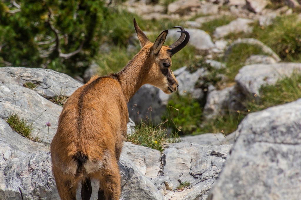
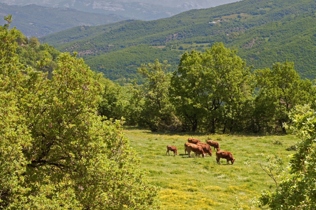
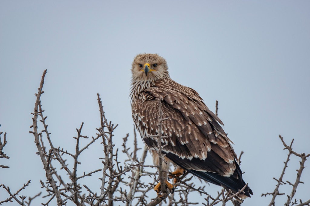
The national park houses a population of Eurasian brown bears, making it a significant conservation area for this species. Other large mammals include lynxes, roe deers, wildcats, wolves, beech martens, wild boars, and red squirrels. The Balkan chamois, an endemic subspecies, thrives in rocky and forested areas of the park.
Additionally, the park supports over 80 bird species, including rare eastern imperial eagles, golden eagles, Levant sparrowhawks, lanner falcons, shore larks, and great grey shrikes. Gorges make excellent habitat for several bat species, and the park’s clear rivers provide a well-preserved habitat for river otters.
The northern part of Greece is adorned with beautiful monasteries, sharing a unique architectural style with the Zagori villages. Some of these religious landmarks date back to the seventh century. These medieval stone monasteries often showcase vibrant frescos, wall paintings, and wooden carvings. Many are strategically positioned and offer stunning views of the lush hillsides and rugged peaks.
Although some of these monasteries are no longer active, they hold immense historical significance, harkening back to the medieval Byzantine Empire. The oldest monasteries date back to the reign of Emperor Konstantinos IV Pogonatos.
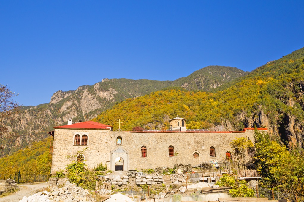
Currently, a few monasteries are still operational in the Pindos National Park region, including the Virgin Mary's Annunciation Monastery at Ano Pedina in Zagori, Virgin Mary's Assumption Holy Monastery (Votsas) in Greveniti, Stomiou Holy Monastery in Konitsa.
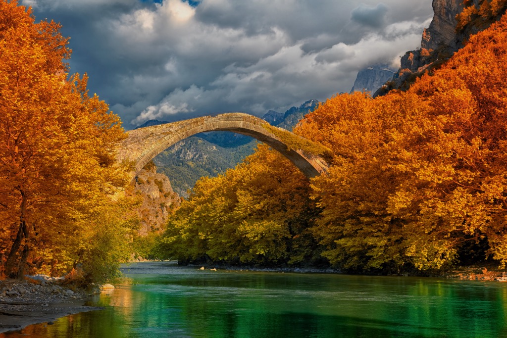
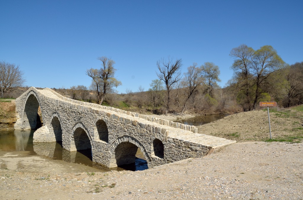
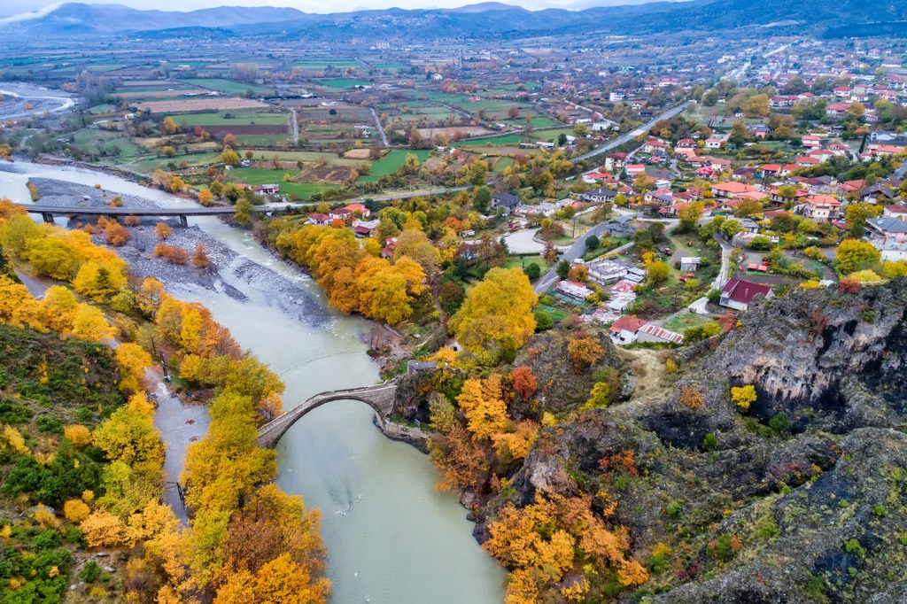
The locals have long utilized a well-organized network of paths for their daily needs in this region. The unique terrain, combined with the rainy, snowy climate and the numerous streams and rivers, necessitated the construction of stone-paved paths and bridges, offering communication and transportation between settlements.
The construction of these bridges required specialized skills, typically by experts from Konitsa and Voio villages. These bridges, built between the eighteenth and nineteenth centuries, were funded by Ottoman commanders, who named them after themselves. Around 80 bridges still stand in the park's area, showcasing exceptional craftsmanship.
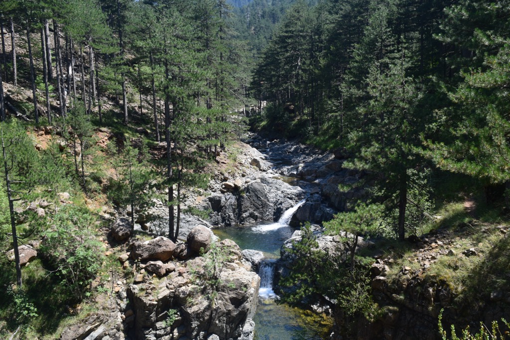
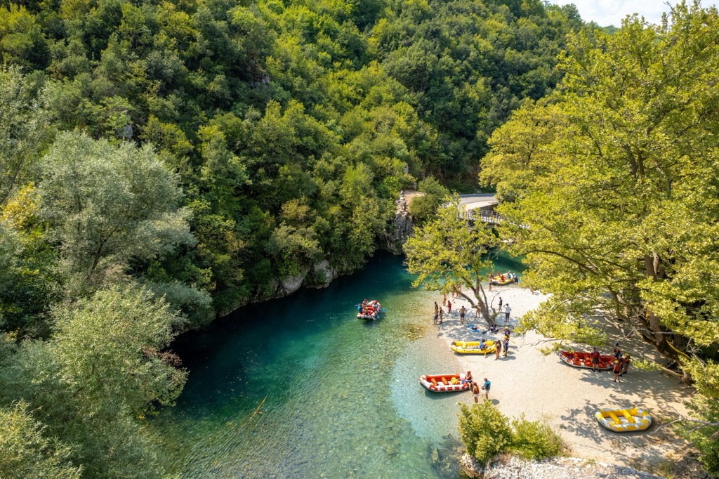
Voidomatis is a relatively easy hike spanning 9 km (6 mi) with a modest elevation gain of about 150 m (492 ft). The trail meanders through dense gorge forests, closely following the course of the Voidomatis River within the Aoos Gorge. Hikers are treated to tranquil woodland landscapes and clear, emerald waters along this pleasant route.
The Drakolimni Lake sits at 1,960 m (6,430 ft) amongst an alpine landscape. The name "Drakolimni," or dragon lake, originates in local folklore. Legend has it that two dragons residing on the peaks of Smolikas and Gamila engaged in a fierce battle, hurling rocks and logs at each other.
The lake is accessible through three distinct trails from various paths throughout the Vaila Calda.
Smolikas (2,637m / 8,651ft), Greece's second-highest peak, offers a challenging yet manageable hike without requiring technical climbing skills or gear. The trail starts from Pades village square near Munti Lodge, initially passing through the village and merging into a dirt road. As you ascend, the pine forest thickens and transitions to beech trees, eventually leading to the alpine zone.
The trail steepens after the dirt road ends, and the terrain becomes rockier, approaching Drakolimni or "Dragon Lake.” The hike is well-marked and safe, presenting views of the Pindos mountain range. The round trip from Pades village to Smolikas summit is about 10 km (6.2 mi) and takes 6-8 hours, covering elevations from 1,150 to approximately 2,637 m (3,438 ft to about 8,652 ft). The challenge is the elevation gain rather than the hike’s length.
Nestled in northern Greece, Konitsa is a quaint town known for its ancient stone bridge, proximity to Pindos National Park, and the ancient ruins of Kastro. The town has a rich history dating back to prehistoric times.
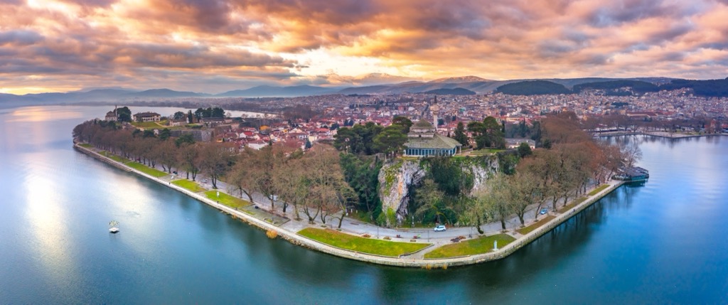
As the capital of the Ioannina regional unit, Ioannina is a bustling city with approximately 140,000 residents. The city was founded in 1209 and has deep historical roots; its name originates from Saint John in Greek, Ιωάννης (Ioannis).
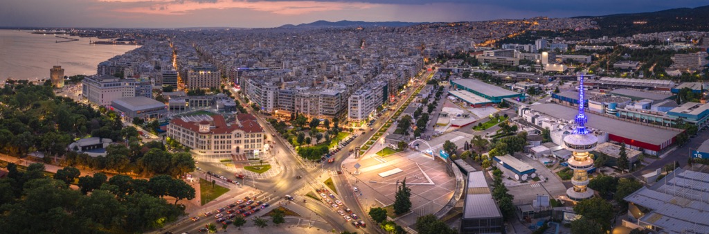
Thessaloniki is Greece’s second-largest city, a significant international port, and a commercial hub. Its history dates back to ancient times, but it flourished as a commercial center in the late nineteenth century. The city is renowned for its old town, recognized as a UNESCO World Heritage Site, and is home to numerous museums, galleries, and beautiful beaches nearby.