Scan the QR code and open PeakVisor on your phone
Pelister National Park is in the south of North Macedonia, in one of the country’s most breathtaking and water-rich regions. The park is nestled between two massive lakes and features lush forests and towering peaks. There are 56 named mountains in Pelister National Park; the highest and most prominent is Pelister (2,601 m/ 8,533 ft).
Pelister National Park is a protected area in the Municipality of Bitola, North Macedonia, and is the country’s oldest and second-largest national park. It’s within the greater Baba Mountain massif and covers 171.5 sq. km (66.2 sq mi). The park's elevation ranges from 927 to 2,601 m (3,041 to 8,533 ft) at Pelister’s summit. Despite the mountain’s impressive height, it is only the country’s third-highest peak.
Administratively, Pelister National Park falls within the municipalities of Bitola and Resen. Within the park boundary, there is only one inhabited settlement named Malovishte. Several larger towns, such as Kazani, Rotino, Capari, Magarevo, and Trnovo, are in the park's immediate vicinity.
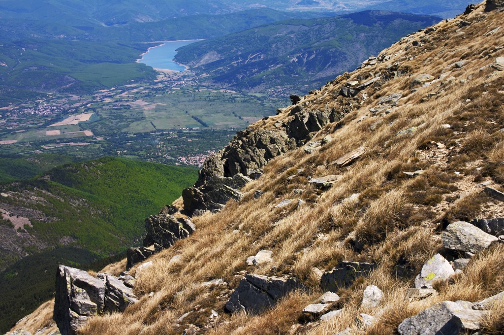
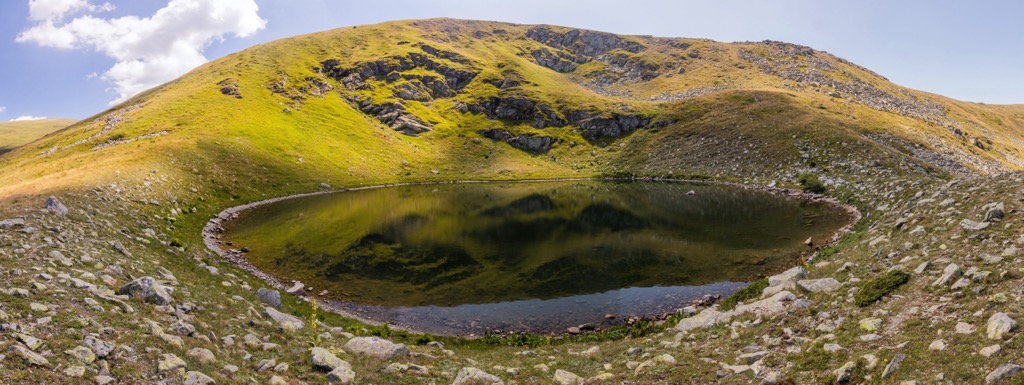
Pelister offers panoramic views of the Pelagonia Valley, Lake Prespa, and Ohrid, and the mountains Nidže, Galičica, and Jakupica, as well as the city of Bitola. Pelister is one of the southernmost mountains in the Balkans. The park is also famous for its two mountain lakes, called “Pelister's Eyes.” The larger lake sits at 2,218 m (7,277 ft), while the smaller is at 2,180 m (7,150 ft).
The regional road Bitola-Resen and Bigla Mountain are to the north, while the park shares its southern border with Greece. The eastern side is adjacent to the Pelagonide Valley and the city of Bitola, and the Prespa Valley and the city of Resen border the western side.
Pelister features a ski resort, attracting winter sports tourism alongside nearby resorts such as Ohrid, Prespa, Dojran, Popova Šapka, and Kruševo.
The Alpine Orogeny, which occurred between 64 and 2.5 million years ago, created most mountain ranges from the European Alps to the Himalayas, including the peaks of North Macedonia. The orogeny results from the African and Indian plates colliding with the Eurasian plate, forcing the crust upwards.
In many places, the orogeny is ongoing - namely, the Himalayas, because the Indian plate has only recently collided with Eurasia and continues to exert force on the crust. Pelister National Park comprises peaks of this vintage, although these mountains are older than the Himalayas and other ranges to the Far East.
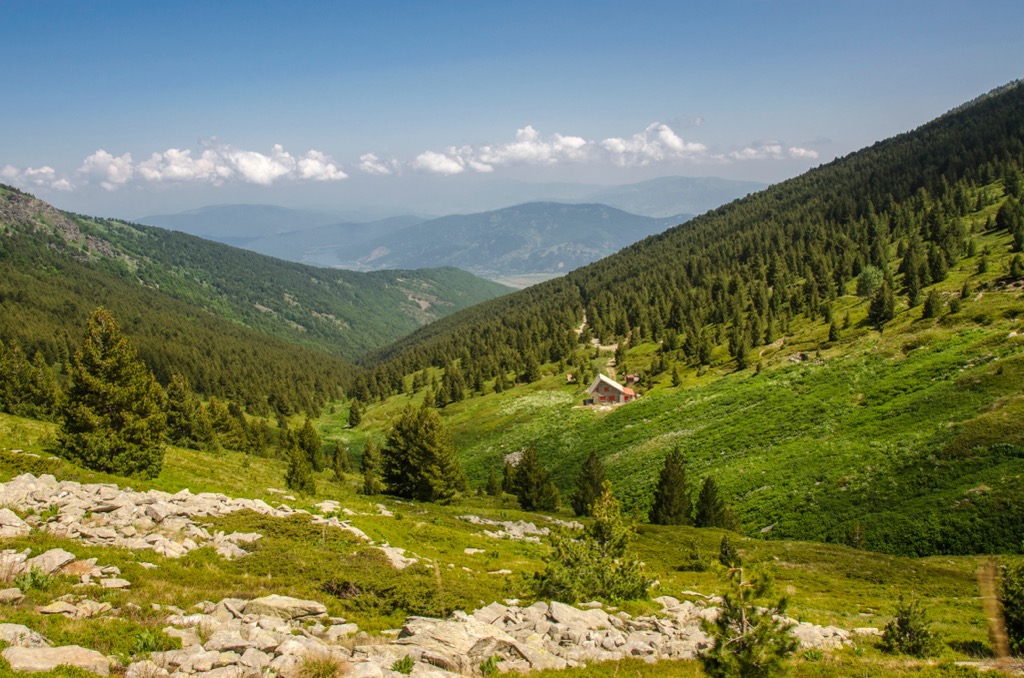
The presence of stone rivers defines the park and surrounding massif’s visible geology. Crushed rocks dominate the mountain's alpine landscape, including granite, dolerite, gabbro, and quartz schist. These scree fields formed over time due to erosive forces such as rain, wind, snow, freezing, and thawing.
Stone rivers are most prominent on the north side above the Red Rocks. Some can extend up to 3 km (1.8 mi) in length. These massive, flowing scree fields resemble glaciers advancing down the mountain and can extend well below the treeline.
Pelister exhibits traces of past glaciation, namely moraines. The massif also has a well-developed hydrographic network with numerous streams, mountain rivers, and two prominent lakes.
Pelister's location allows for a significant watershed divide. On one side, the waters flow towards the Adriatic basin, and on the other, towards Pelagonija and the Aegean basin.
An impressive number of picturesque mountain rivers - 23 river streams descend into the surrounding valleys - flow throughout the Pelister Massif, such as the Bistrit and the Leader. The most notable watercourse on Pelister is the Shemnica River, stretching for 46 km (28 mi).
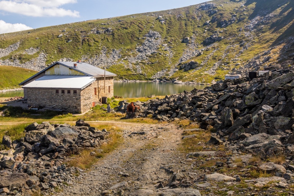
The Great Lake is the highest glacial lake in Macedonia. It extends north-south, covering an area of 4.2 ha (10 ar) with a depth of 14.5 m (47.5 ft). The Small Lake is approximately 2 km (1.2 mi) northwest of the Great Lake, with a depth of 2.6 m (8.5 ft).
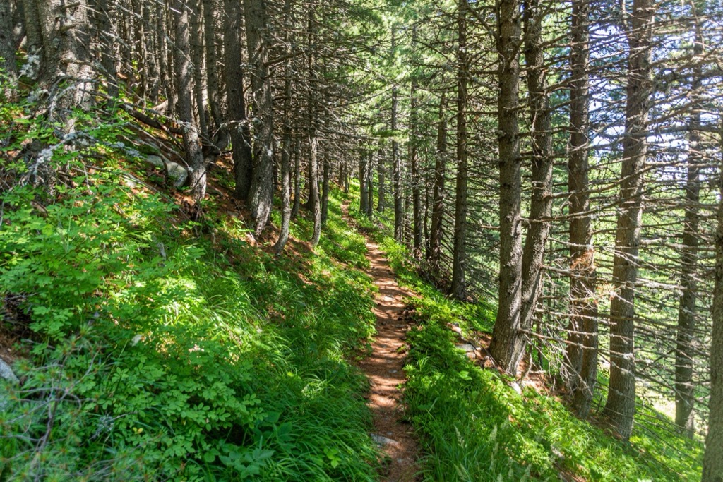
The mountain vegetation in Pelister National Park is incredibly diverse and is a valuable natural asset. The park is often called a "natural arboretum" due to its remarkable variety of plant life. About 88 species of trees are classified into 23 families, accounting for 29 percent of the total dendroflora in Macedonia.
One of the most significant tree species in the park is the Molika (Pinus peuce), also known as the Macedonian Pine, an ancient native species that has existed for millions of years and can reach heights of up to 40 m (131 ft). The botanist August Griesebach’s discovery of the five-needle pine Molika in 1839 was crucial in Pelister’s designation as a national park. Some Molika trees in Pelister are over 230 years old.
Due to its commercial value, the Molika holds significant importance among conifer species in the Balkan Peninsula. Its resilient wood is esteemed for its construction, furniture manufacturing, woodcarving, and cooperage applications. Molika exhibits remarkable adaptability to harsh mountainous climates, making it a valuable species for reforestation efforts on elevated terrains to prevent erosion. The local population utilizes Molika’s resin for respiratory issues, skin ailments, stomach disorders, varicose veins, and other illnesses.
Deforestation and harvesting have impacted the Molika’s population, and its conservation status is listed as “Near Threatened.”
Pelister National Park's forests and diverse flora support a wide range of fauna. The park is home to various wildlife species, including the endemic Balkan wild goat (Rupicapra balcanica).
The area’s diverse wildlife includes bears, wolves, stags, wild pigs, rabbits, eagles, deer, partridges, red-beaked jackdaws, and the endemic Macedonian Pelagonian trout. North Macedonia boasts an estimated wolf population of 1200 individuals, a testament to these mountains' wild and remote nature.
Hunting is strictly prohibited in most park areas, except for the eastern slope of Mount Baba, designated as a hunting zone.
The name Pelister originates from ancient times. It is believed to have been given by the Pelagonian and Lynkestide tribes, who resided in the Pelagonija plain below Mount Baba. According to local legend, the name is derived from the phrase "five leaves," referring to the cherished Mokila pine’s five needles.
North Macedonia’s human history is highly complex. Like most of continental Europe, the region’s prehistory likely featured tribes of H. neanderthalis beginning 40,000 years before the present.
By 1000 BCE, the region was generally part of the Kingdom of Paeonia. Over the next 2000 years, the territory comprising North Macedonia changed hands many times, contributing to the nation's rich and unique cultural patina. Greeks, Romans, Persians, Ottoman Turks, and Slavic peoples have all influenced North Macedonia.
The Baba Massif’s modern history is visible through local church architecture, many dating back to the twelfth century. The Church of St. George in Kurbinovo, from 1191, is the oldest and most significant church monument near Pelister National Park and was declared a cultural monument in 1952.
Within the borders of Pelister National Park, in the village of Malovishte, there are several notable church monuments. These include the impressive St. Petka Church, constructed in 1856, which houses a permanent gallery of icons spanning approximately 400 years. The Monastery of St. Ana is perched at an altitude of 1,410 m (4,625 ft), about 2.5 km (1.5 mi) southwest of Malovishte. Moreover, the Church of St. Spas is high on the mountain, near the Pyramid (Vrteska) peak, at 2,000 m (6,561 ft). Lastly, the Slivnica Monastery, named "Nativity of the Most Holy Mother of God," was constructed and painted in 1607 and is a breathtaking artwork to behold.
The best hikes in Pelister National Park include:
The trail starts from Big Lake (Golemo Ezero), passes by Small Lake (Malo Ezero), and ascends to Pelister’s summit. The route is 6.5 km (4 mi) long and takes approximately two and a half hours to complete.
The starting point is Big Lake, located at an altitude of 2,218 m (7,276 ft). The endpoint is Pelister Peak, with a total elevation gain of 383 m (1,256 ft). Along the trail, scenic viewpoints offer visibility to the Prespa Lowland after passing Small Lake and ascending the main road.
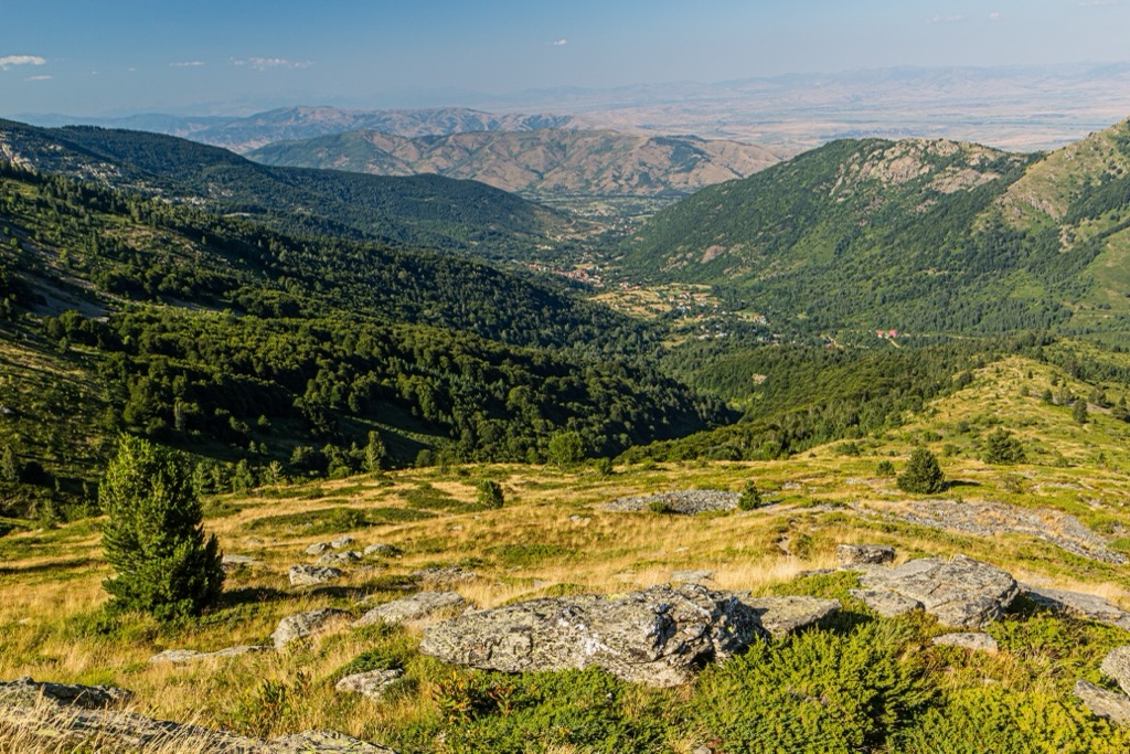
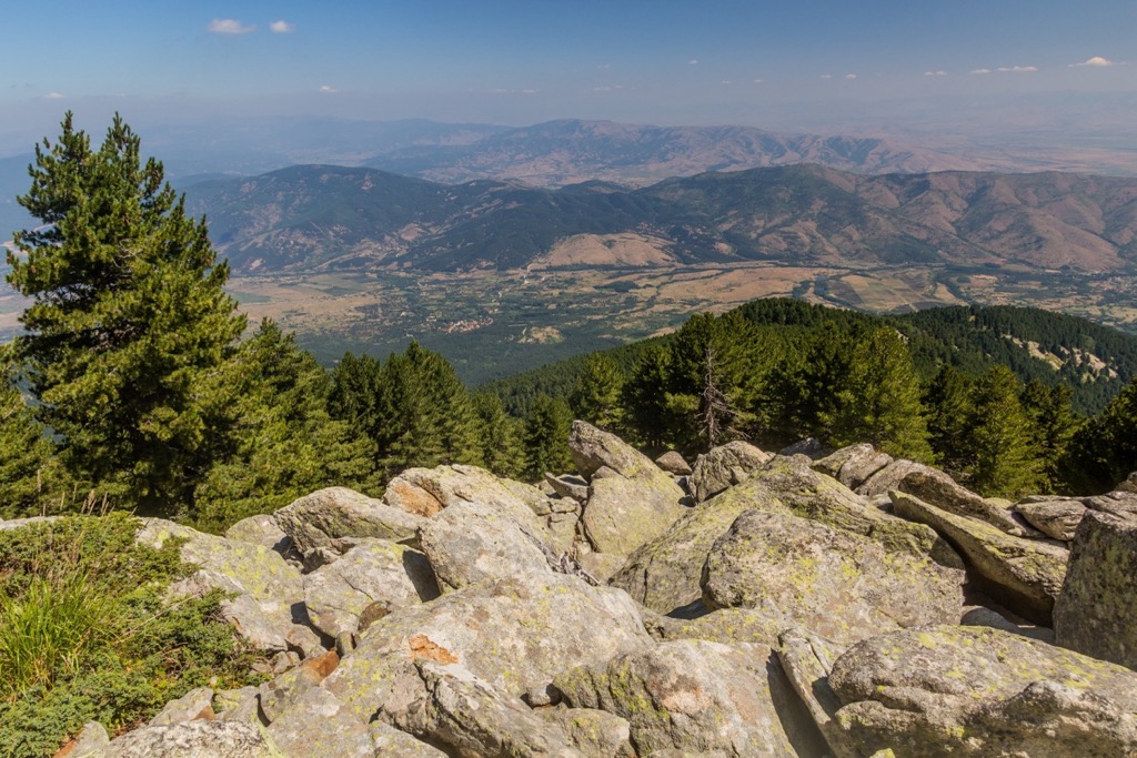
Here, you can enjoy panoramic views of Bitola and the Pelagonia Valley. The views become even more encompassing from Pelister Peak, where the Prespa Valley, Pelagonija Valley, the peaks of Baba Planina, the city of Bitola, and the mountains of Greece and Albania are all visible.
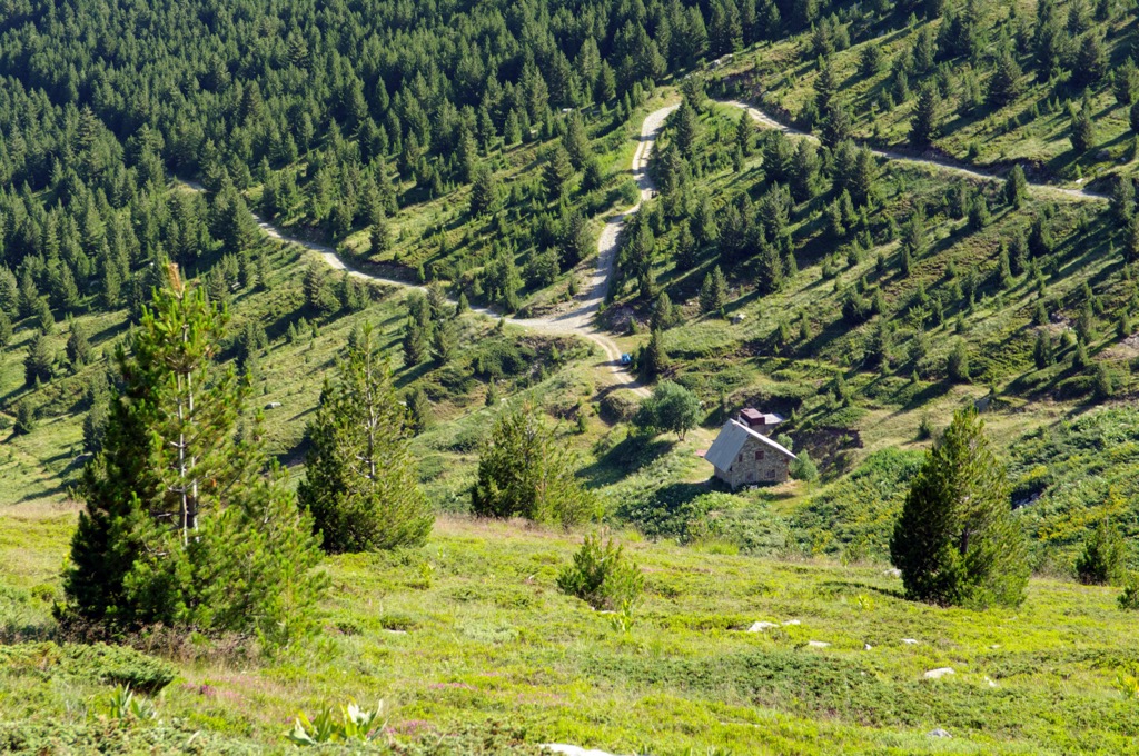
The trail is 8 km (5 mi) long and takes approximately 4.5 to 5 hours to complete. It starts from Hotel Molika, passes through the locality of Kopanki, ascends through rocky terrain to a viewpoint, continues along peaks and shelters, and finally ends at the Peak Pelister.
The trail is challenging and is geared toward visitors interested in climbing Pelister and passionate about mountaineering and alpinism. It is often referred to as the Rocky Trail, as a significant portion of the path traverses rocky terrain.
This section of trail from Hotel Molika to Kopanki is 1.2 km (0.7 mi) long and ends at the plateau of Kopanki at the Kopani Ski Center cable car’s top station.
The trail from Kopanki to Yorgo's Stone and Red Rocks spans 4.3 km (2.6 mi) and takes approximately one and a half hours to complete. It begins at Kopanki, continues to Yorgo's Stone (Jorgov Kamen), and then proceeds to Red Rocks (Crveni Steni).
The trail continues through a Molika forest, crosses rock slides and stone rivers, and ascends to Yorgo's Stone, providing a beautiful view of Bitola and the Pelagonija lowland. From Red Rocks, there are panoramic views of Debel Rid, Orlov Bari, and the valleys of the Sapundzica and Crvena Rivers.
The biggest cities near Pelister National Park include:
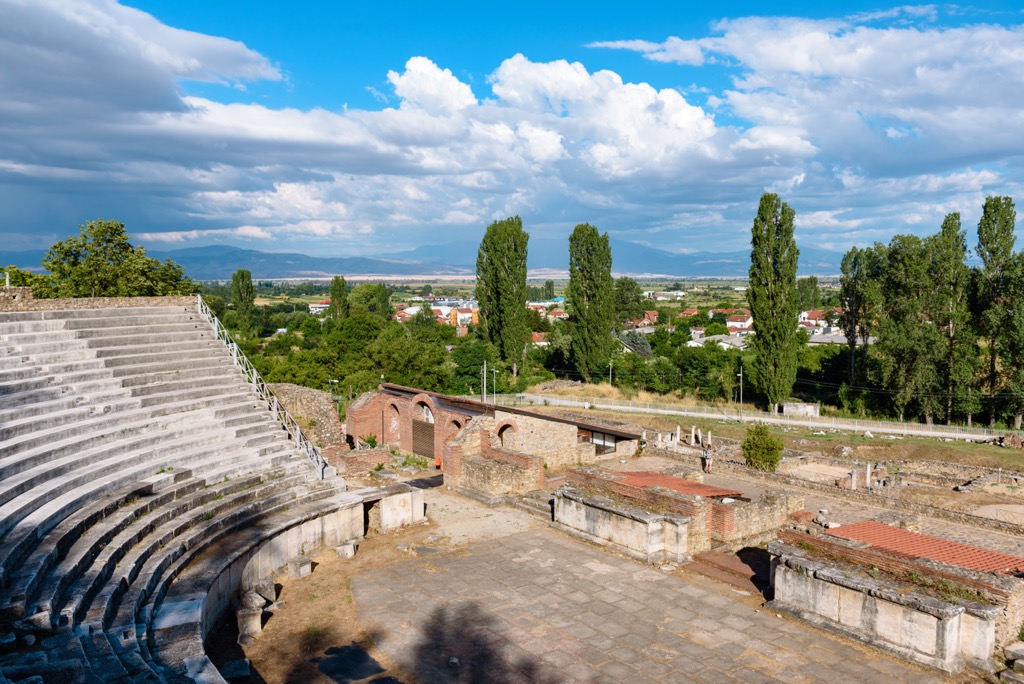
Bitola is a city in southwestern Macedonia, near the borders of Albania and Greece. It has a population of approximately 37,500 and is renowned for its rich history and cultural heritage, attracting domestic and international visitors.
The city is known for its charming streets, impressive architecture, and vibrant atmosphere. It blends Ottoman, neoclassical, and contemporary influences, creating a unique character. One of the notable landmarks in Bitola is the Heraclea Lyncestis archaeological site.
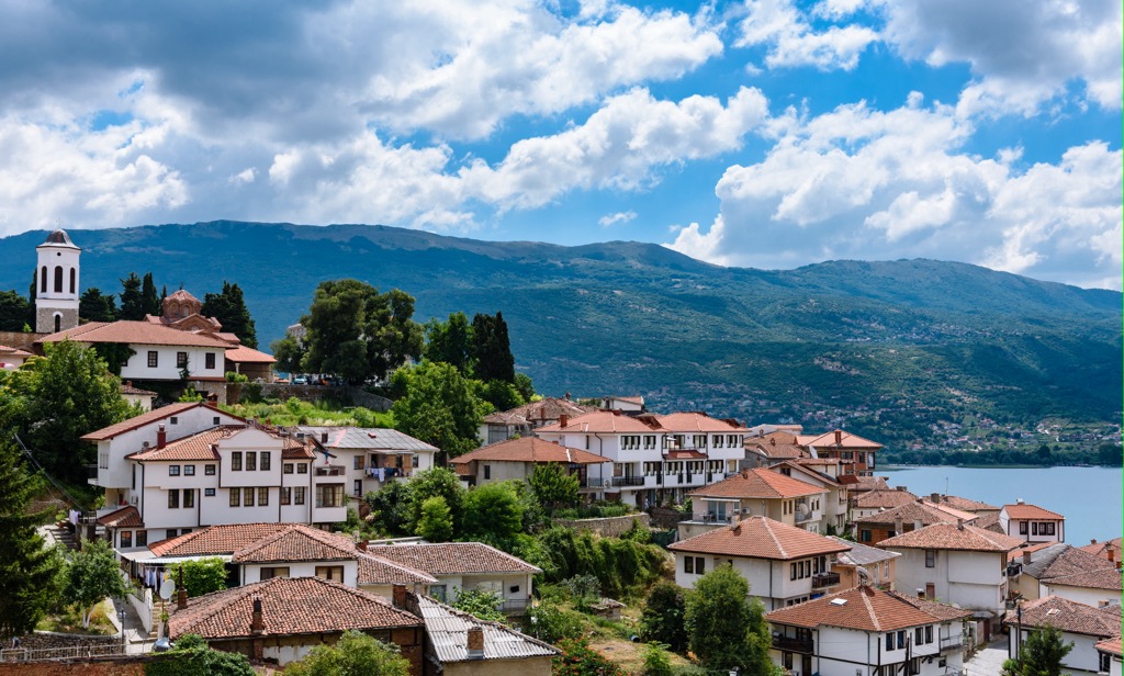
Ohrid is a city in southwestern Macedonia, situated on the shores of Lake Ohrid. It is a popular tourist destination known for its rich history, natural beauty, and cultural significance. The city has a population of approximately 42,000.
Ohrid is renowned for its stunning lake, one of Europe's oldest and deepest lakes. The crystal-clear waters of Lake Ohrid offer opportunities for swimming, boating, and fishing. The picturesque beaches along the lake's shores provide a perfect spot for relaxation and sunbathing.
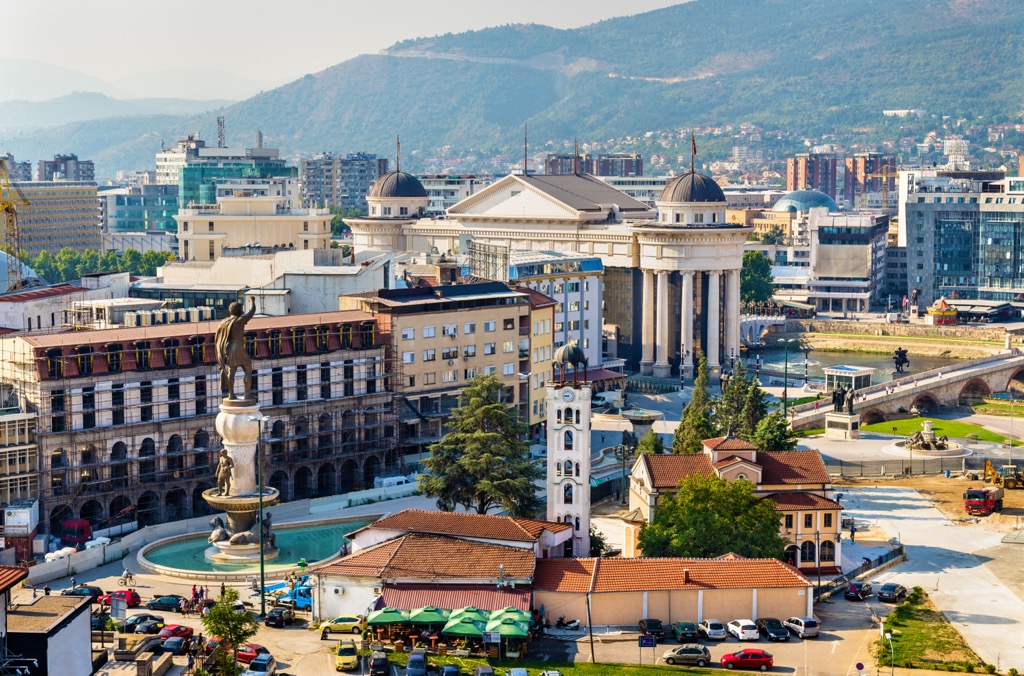
Skopje is the capital city of North Macedonia, located in the southeastern part of the country. It has a population of approximately 422,000. The city is situated on the Vardar River and is known for its rich history, diverse culture, and vibrant atmosphere.
Skopje offers a mix of modern and traditional elements, with an array of architectural styles ranging from Ottoman and Byzantine to modernist and contemporary. Skopje also boasts a lively cultural scene, with theaters, art galleries, and music venues hosting various performances and exhibitions. The cuisine in Skopje is diverse, influenced by Mediterranean and Balkan flavors.