Scan the QR code and open PeakVisor on your phone
Prespa National Park lies in the Southern part of Albania, bordering Greece and North Macedonia. It is the biggest protected area and one of the biggest lakes on the Balkan Peninsula. There are 63 named mountains in Prespa National Park. The highest and most prominent mountain is Mali i Thatë or Pllaja e Pusit (2,288 m/ 7,506 ft).
Prespa Park was established in 2,000, on February 2nd or World Wetlands Day, and it's the first transboundary protected area in the Balkans. It was created through a declaration by the Prime Ministers of North Macedonia, Greece, and Albania.
The entire park is included in the Ohrid-Prespa Biosphere Reserve and the transboundary Prespa Park of the Balkans. This is one of the first national parks established in Albania after the change of regime in 1992. It's home to several unique species, as well as beautiful landscapes and cultural treasures.
Prespa National Park in Albania covers about 27,750 ha (68,571 ar) and is the biggest park (when combined into the transboundary park) in the Balkans. It sits in southeastern to southern Albania, sharing its border with North Macedonia and Greece.
Prespa basin consists of two lakes, Small Prespa and Great Prespa, as well as the surrounding mountains. There are four National Parks in the area: Prespa National Park in Greece, Prespa National Park in Albania, and the Ohrid National Park and Pelister National Park in North Macedonia.
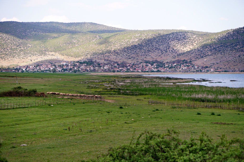
Prespa National Park includes twelve villages in the region of Korca, and lies in the Korca and Devoll Districts. The entrances to the park can be found in Zvezda, 25 km (15 mi) away from the border. The park’s borders align with the offcial state borders with North Macedonia, Greece, and in the south lie local mountains.
With no easy way to access it, a first-time visitor's impression of Prespa is of an isolated place in the mountains. This is where Greece ends and Macedonia and Albania meet, it's really in the heart of the Balkans.
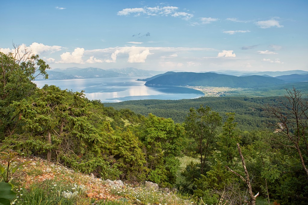
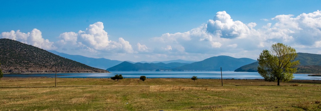
The geographic region of the Prespa Lakes is shared by three countries, Greece, Albania, and North Macedonia. When we talk about Prespa, it refers to the two lakes, Mikri and Megali Prespa or Great and Small Prespa, and the wider lake basin, which extends to the tops of the mountains surrounding them. The two lakes lie at an altitude of around 853 m (2,798 ft), with many surrounding peaks over 2,000 m (6,561 ft).
In the two lakes region, there are several settlements with an overall population of between 144,000 and 145,000. The Macedonian side houses most of that population, with 35% living on the Albanian and almost none existing on the Greek side of the lakes.
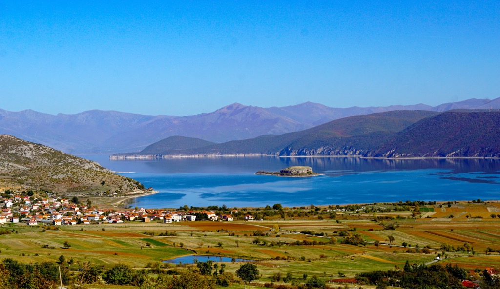
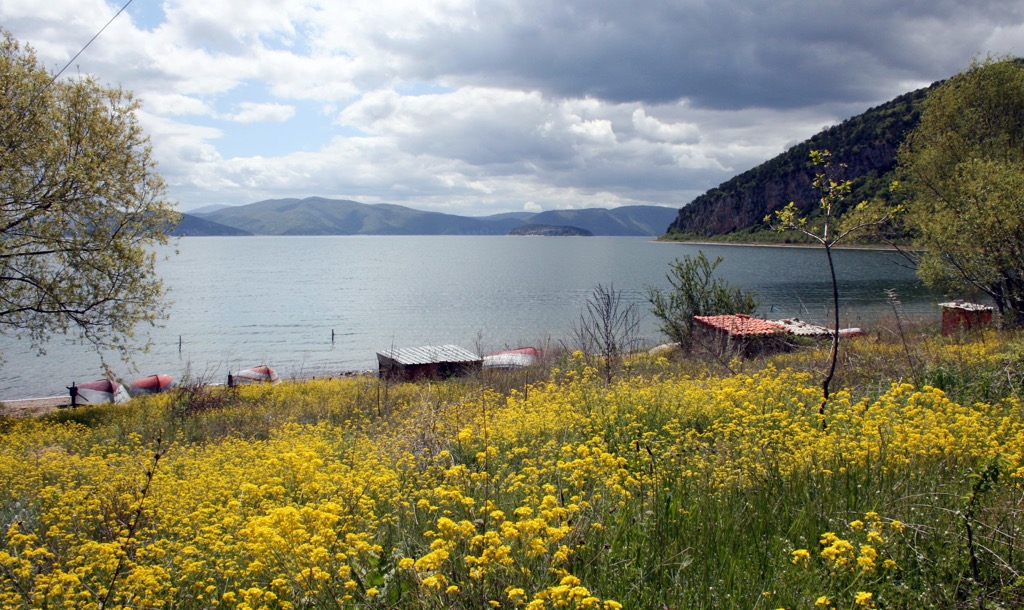
Travelers take joy in the peaceful nature of Prespa. To cross the pass between them is to step into a cradle of peace and harmony. The Great or Megáli Prespa holds the border of Albania and North Macedonia. Míkro Préspa is smaller but still massive in size and shares 98% of its surface located within Greece and only 2% or its southern end in Albania.
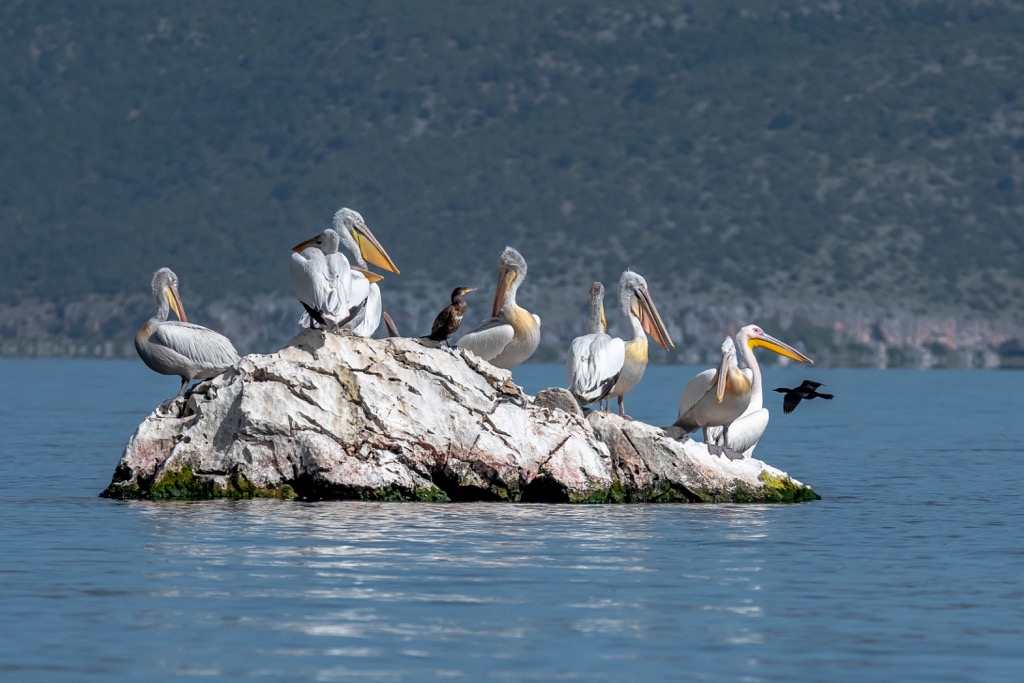
If you want to see an impressive animal, the Dalmatian pelican is the one to watch. It's critically endangered and one of the rarest species in the world, but you can find it in Prespa National Park. The new Transboundary Prespa Park aims to protect the ecological values of the area through collaboration between three countries, as well as promote economic prosperity for the local communities.
172 sq. km (106 sq. mi) of the region under consideration belongs to North Macedonia, while 44.3 sq. km (27 sq. mi) is in Albania and 36.4 sq. km (22 sq. mi) is in Greece. These lakes represent the region's highest lakes at 853 m (2,798 ft) elevation.
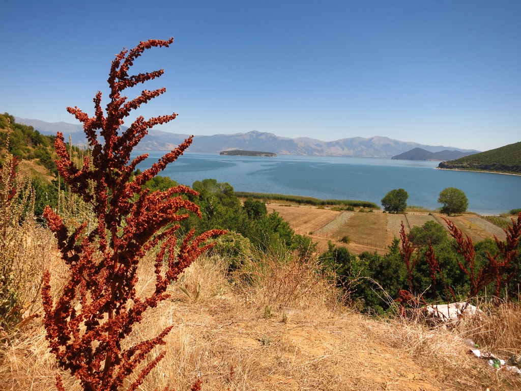
Prespa Lake is a freshwater lake that consists of 2 parts: Great and Small Prespa. Separated by an island and enclosed by imposing mountains, the lakes are shared between Greece, Albania, and North Macedonia.
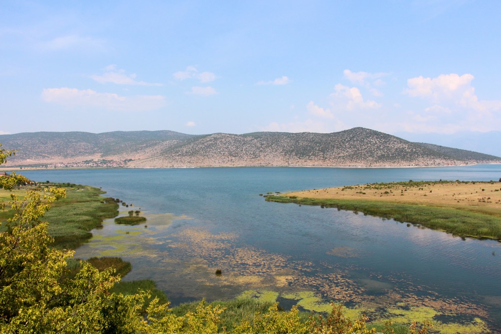
The site is home to tree-dominated wetland areas and seasonal marshes. It also includes tidal creeks and channels, freshwater springs, caves, and a small amount of farmland.
The Mali i Thatë or Pllaja e Pusit (2,288 m/7,506 ft) is a terrestrial ecosystem whose rock formations are dominated by the calcareous massif. This ecosystem is found in Albania and North Macedonia, and much of it extends south from the Albanian-Macedonian border.
The Lakes of Prespa is at a height of 853 m (2,798 ft) and have a depth of over 50 m (164 ft). They lie between North Macedonia, Greece, and Albania, while the small lake with a surface of 138 sq. km (85 sq. mi) is shared just by the Greek and Albanian part.
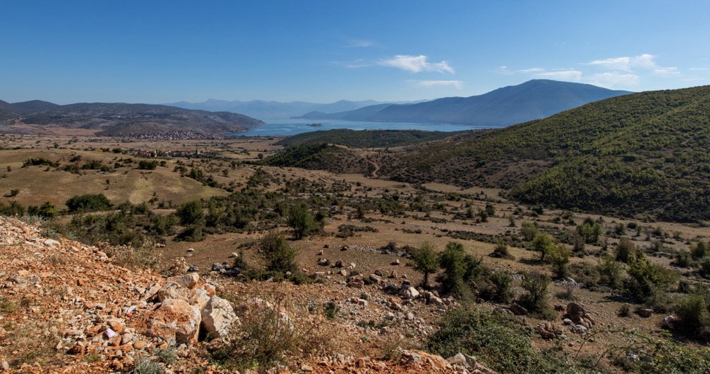
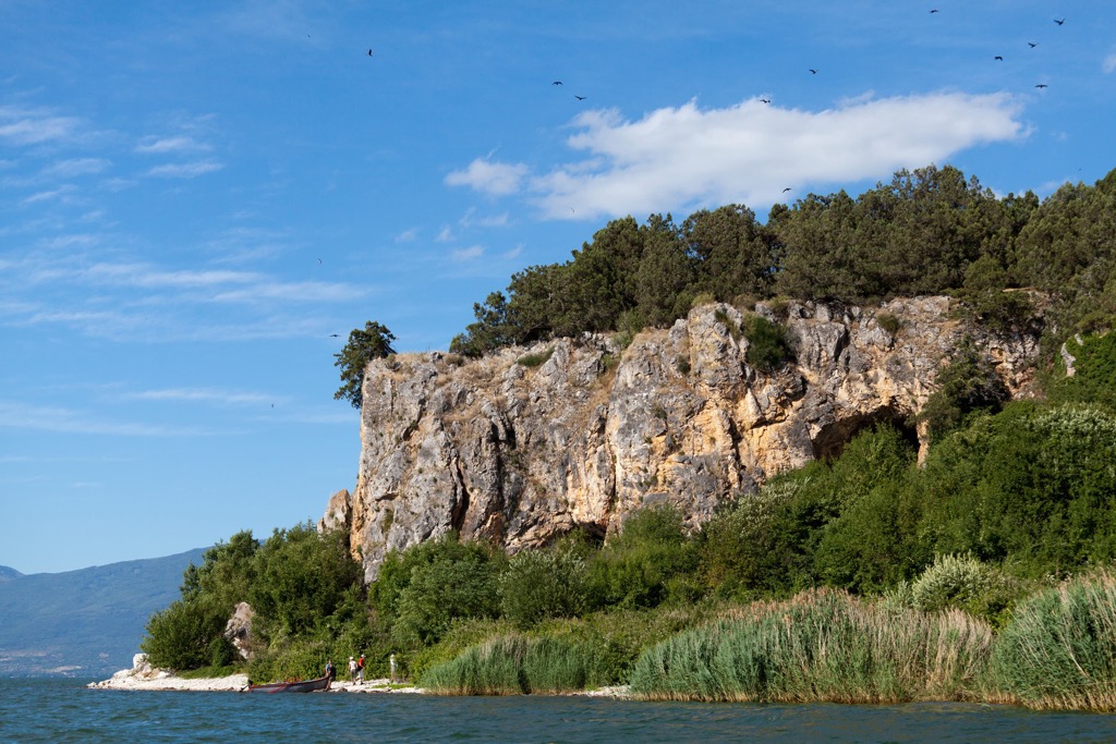
Great Prespa is the highest tectonic lake in southeastern Europe. It is fed by underground tributaries and streams and emerges into Lake Ohrid. Surrounded by high mountains, including Mali i Thatë or Pllaja e Pusit (2,288 m/7,506 ft) in Albania, it's a popular tourist destination.
Tectonic lakes are usually found in areas where there is a lot of seismic activity. These lakes can form when the earth's crust moves and creates a depression. Lakes that form in this way can often have an intense water table.
The lake empties between the mountains in the west, cutting through a narrow outlet before draining into the Devoll River. The river then flows through the central mountain range of Albania and finally discharges its water into the Gulf of Vlora.
Located about 150 m (492 ft) above Lake Ohrid, its waters pass through several karst underground channels and emerge from springs into the lake. Mali i Thatë or Pllaja e Pusit (2,288 m/7,506 ft) separates the Great Prespa from Lake Ohrid. These are the highest peaks in Prespa National Park:
The most important thing about Prespa is that it's home to so many types of life. Notably, rare species are concentrated in this area, and these are often unique to Prespa. For example, many endemic species live only in the area and aren't found anywhere else on the planet.
The slopes of Golo in Albania and North Macedonia are occupied by a subalpine and alpine forest and pasture. There are also some rare plants that are found in this area, which look attractive. The potential for ecotourism development is high.
The number of different birds, amphibians, mammals, and fish living in Prespa is impressive. According to a study made by the Bird Conservancy in 2007, 55% of all the species found in Albania can be seen here. Furthermore, 9 out of 23 fish species here are endemic.
Due to the variation in temperature and climate, the conditions in the park can be very different depending on where you are. The Pindus Mountains mixed forests terrestrial ecoregion is found here.
The Pindus Mountains mixed forests terrestrial ecoregion is a terrestrial ecoregion in the Pindus Mountains of northern Greece and southern Albania. It is a part of the Palearctic ecozone, which includes all of Europe.
The region has been severely degraded by humans during the twentieth century, with a significant loss of biodiversity, mainly due to agricultural conversion for intensive livestock farming and forestry plantations for fuelwood production.
The forests mostly consist of coniferous and deciduous trees covering 50% of the park, with over 1,130 plants. There are over 174 fungus species distributed throughout the park. There are 60 mammal species, 270 bird species, 23 reptile species, and so on.
In Prespa, there's a variety of habitats and wildlife for visitors to enjoy. From the lakes and wet meadows to forests of oak and beech in the mountains, there are many rare species of flora and fauna: Prespa trout, Prespa flower, and silver birch.
The avifauna is highly diverse with about 270 bird species in the Prespa Lakes axial. Recent surveys revealed 132 breeding birds within the boundaries of Prespa National Park. Additionally, during the winter season, more than 20 bird species winter here.
In addition, this country holds a wealth of natural resources. One example is the Dalmatian pelican, which nests only in this part of the world, or the great white pelican.
It's worth mentioning that Prespa is home to the largest Dalmatian pelican colony in the world, with around 1,000- 1,200 pairs. Prespa also has rare aquatic bird species: Herons and greylag geese, to name just a few.
The migratory birds start to fly away, and nature changes its colors over time, but the natural air and scenic landscape remains beautiful in every season. The winter is cold and white but breathtakingly beautiful. Snow covers the entire terrain during winter.
The Lakes and their surroundings are home to endangered mammal species, such as bear (Ursus arctos), wolf (Canis lupus), and most probably the Balkan lynx (Lynx Balkanika). If any records of the Euroasian nor Balkan Lynx could be found on the Albanian side of the Lake have not been found so far.
Prespa, a region rich in natural resources, lakes, rivers, forests, and fauna, has been occupied by humans since prehistoric times and still is not abandoned. Man has had a significant influence on the natural landscape since prehistoric times. For this reason, the area around Prespa is naturally rich in history, archaeology, and culture.
After years of research, the oldest remaining evidence of human population dates mainly from the Bronze and Iron Ages. This is best seen at Treni Cave in Albania, where archaeologists have also found items that suggest this area has been inhabited since 6,000 BC.
During the Hellenistic and Roman periods, it appears that people continued to inhabit the area. This is evidenced by the remains found between Milionas and Laimos, as well as the existence of Lyka, a Hellenistic town on Agios Achilleios Island.
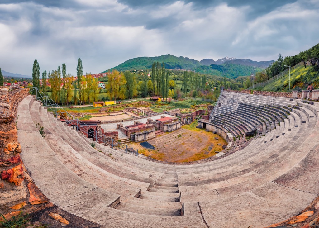
Most archaeological remains in Prespa come from the medieval period. They include both Byzantine and post-Byzantine monuments that can be seen throughout the territory of Prespa in all three countries.
The late ninth century was a pivotal period for the city of Prespa. At this time, it was part of the Western Bulgarian Empire, and when this fell apart, Tsar Samuel's son took refuge here and made it his base to seize an extensive area of Greece.
After the beginning of the tenth century, this area switched back and forth between being ruled intermittently by the Bulgarian leader, Simeon I and Byzantinum. The territory was occupied by both Byzantines and Bulgarians at different points. It was when Emperor Basil II regained all of the lost Byzantine territories that this area was abandoned.
Construction on the basilica of Agios Achilleios was completed in 986. The cathedral was built by Tsar Samuel, who established a new autonomous state and attempted to make it possible for Prespa to be the capital.
Life has never been easy for a large portion of the population, especially after the Civil War in Albania took nine out of ten people to the Eastern Bloc or Austria. In order to maintain stability in the country, the government wa giving away homes and land to Vlachs (meaning ethnic Romanians who arrived recently) in Prespa National Park.
Although the three countries had uneasy relations, they agreed in 2000 to designate Prespa an transboundary park to preserve its peaceful environment. The Society for the Protection of Prespa (SPP), founded in 1990 by a group of enthusiasts, is a key factor in ensuring the protection and enhancement of this biodiverse rugged, mountainous and wild freshwater ecosystem.
Summer is a great time to hike in the mountains and explore nature. While hiking, you might find signs of wildlife, like footprints and scats from brown bears.
This hike starts from Kallamas Village and is one of the most beautiful trips of Prespa National Park. It passes by Kalamas, an old settlement submerged under the water level. People believe it was initially expanded to this area when the lake level was at a lower point.
Hiking around the lake, you can visit the Shën Marena Monastery. The loop hike starts near the village entrance by taking the lower road next to the lake.
After a short amount of time, we will see houses leaving our view and soon there will be a stunning view of what is on top of Mali i Thatë or Pllaja e Pusit (2,288 m/7,506 ft), as well as the lake below.
This is a long but beautiful trail traveling through meadows and forests on the Albanian side. It also includes hiking by border military post that were used during communism and breathtaking views of Prespa Lake.
Head to the southernmost exit in Goricë e Madhe and take the first right. Keep walking until you see a bunker on your left, then take a right at the fork next to it to resume your hike in the direction of the peak.
The trail leaves the forest and heads for another large meadow. In order to get to Mali i Thatë or Pllaja e Pusit (2,288 m/7,506 ft), one has to head west. After a couple of kilometers, the trail splits into two, one road leading north and another heading south. The southern path will initially descend, providing a panoramic view from which you can see both lakes at once. The northern path will lead you to the peak.
This is a short hike that starts with a well-worn path leading to the beautiful Prespa e Vogel Lake or Small Prespa. For a longer option walk, you can start at the Treni archeological site and follow the old dirt road.
The trail starts at the former military border post in Zagradec. From Zagradec take the main road descending north for about 1km until you find the dirt road running along a nearby lake. Follow that eastwards for around 1km to get to the former military blockade.
Stop by the nearby military post for a drink and fill up your bottles. Take this trail for some beautiful views of Small PrespaLake.
These are the nearest cities to Prespa National Park in Albania:
Korca is a city in Albania. It is the capital of the Korce District and one of the largest cities in Albania. The city has a population of about 75,000 people.
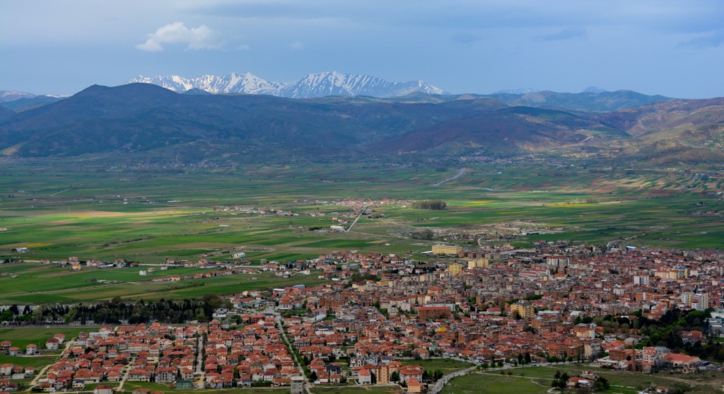
The city was founded by the Byzantine Empire in the sixth century and was known as "Korçë" or "Curce." It became part of the Ottoman Empire in 1479 and remained so until 1912, when it became part of Albania. You can reach the city via road and rail and stay here in economical accommodation.
Ohrid is a city in the Republic of North Macedonia. It is located on the shores of Lake Ohrid, one of the oldest lakes in Europe. The city has been inhabited since at least 4000 BC and is one of the most important archeological sites in North Macedonia.
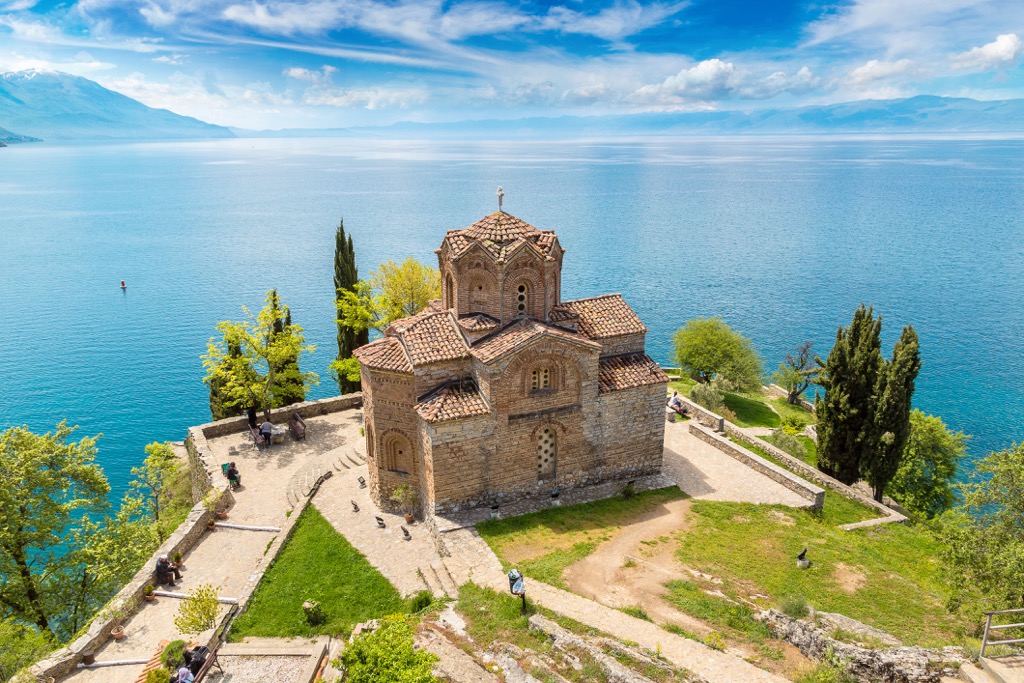
The city was founded by Philip II of Macedon, the father of Alexander the Great, around 340 BC. It was initially known as "Ochrida" (from Greek "Ochrēs" meaning "bright"). Since this is a popular tourist spot, you will be able to find all kinds of accommodation options. Also, one can reach this city via road and rail.
Bitola is the second largest city in North Macedonia. It is located in the southwestern part of the country, near the borders of Greece and Albania. The city has a population of around 85,000 people.
Bitola is a city on the southern edge of North Macedonia. It has an area of about 26 sq. km (16 sq. mi), and it is situated at an altitude of 541 m (1,774 ft). The name Bitola comes from the Slavic word "bistra," which means "clear water."