
Scan the QR code and open PeakVisor on your phone
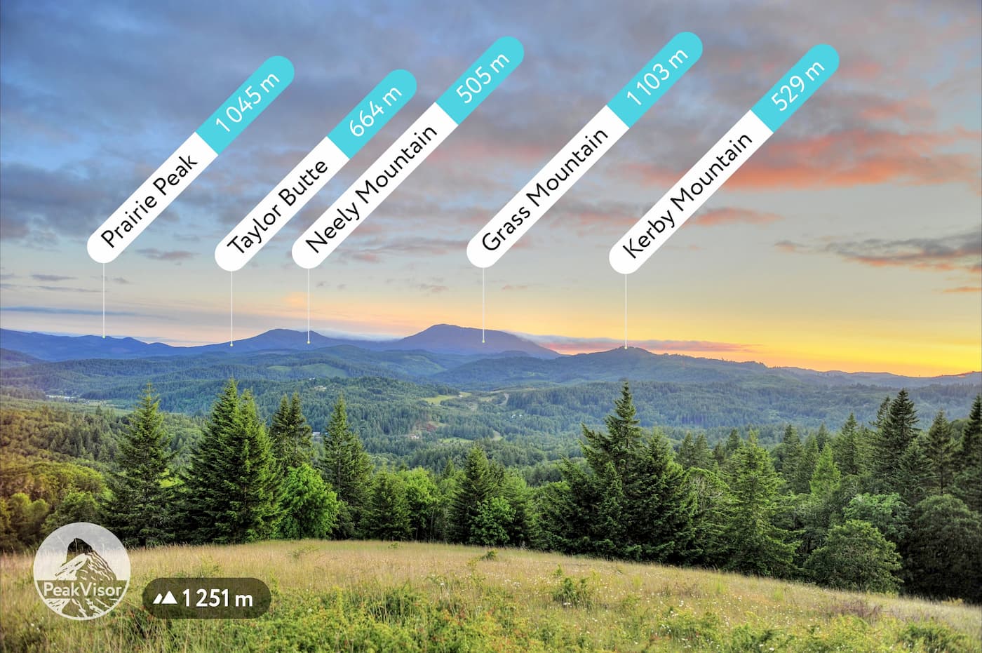
Corvallis Watershed has 3 named peaks. The highest is Marys Peak at 1,250 m. Other notable peaks include Franklin Ridge and Pioneer Butte.
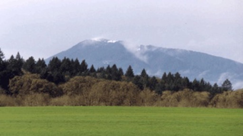
The Corvallis Watershed, also known as the Corvallis Forest, is located 16 miles west of the city of Corvallis in the state of Oregon. The forest consists of roughly 10,000 acres and is responsible for nearly half of the water supply for the city. There are 2 named mountains in Corvallis Watershed. The highest and the most prominent mountain is Marys Peak. Back in 1989 Mary’s Peak was classified as a Scenic Botanical Area due to the rich and diverse plant life. The city of Corvallis owns about a quarter of the land while the rest is managed by the United States Forest Service (USFS). This area is part of the larger Siuslaw National Forest.
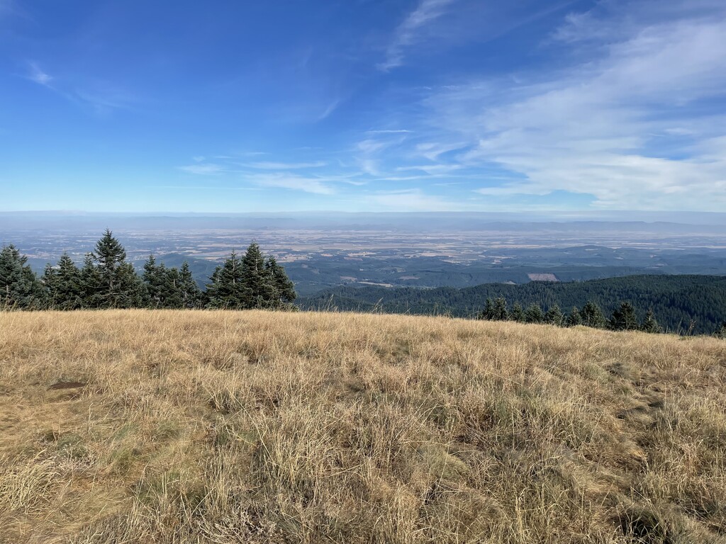
A majority of the watershed is closed or has limited access to ensure the water source is not contaminated. There is also a closed watershed that provides ample opportunities for learning. This closed watershed is used frequently by schools, colleges, and researchers to study forestry, hydrology, botany and other fields. While hiking within the Corvallis Watershed is limited, the surrounding Siuslaw National Forest is full of various hikes. The major hike that is available within the Corvallis Watershed also happens to be the highest point in the area; Mary’s Peak.
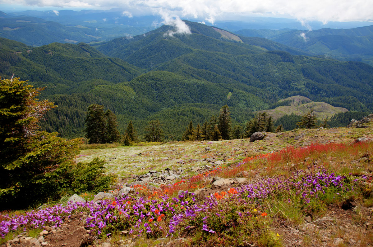
Standing at 4,097 feet, Mary’s Peak is the highest point within Oregon’s Coast Range. The unique peak stands between Salem and Eugene as the most prominent point west of Interstate-5. The peak is also known as Cateemanwi, “place of spiritual power” to the native Kalapuya tribe. Mary’s Peak was once used for spirit quests among the native populations.

The most trafficked trail on the mountain, the East Ridge Trail clocks in at 5.2-miles with 1,700 feet of total elevation gain. The out and back trail takes you through old growth forest before emerging near the summit of Mary’s Peak. At the top hikers are greeted with a meadow of wildflowers blooming late May to early July. From the summit, on a clear day you can see the Pacific Ocean to the west and Cascade Mountain Range stretching north to south out to east. To return to your car follow the same trail that you used to come up.
This 9.1-mile loop trail has over 2,030 feet of total elevation gain. While this trail is less trafficked than the short out and back option, it provides hikers, runners, and mountain bikers with the same breathtaking views of the valley below. The start of the trail is located near Philomath, Oregon and in the summer months, is full of a variety of wildflowers.
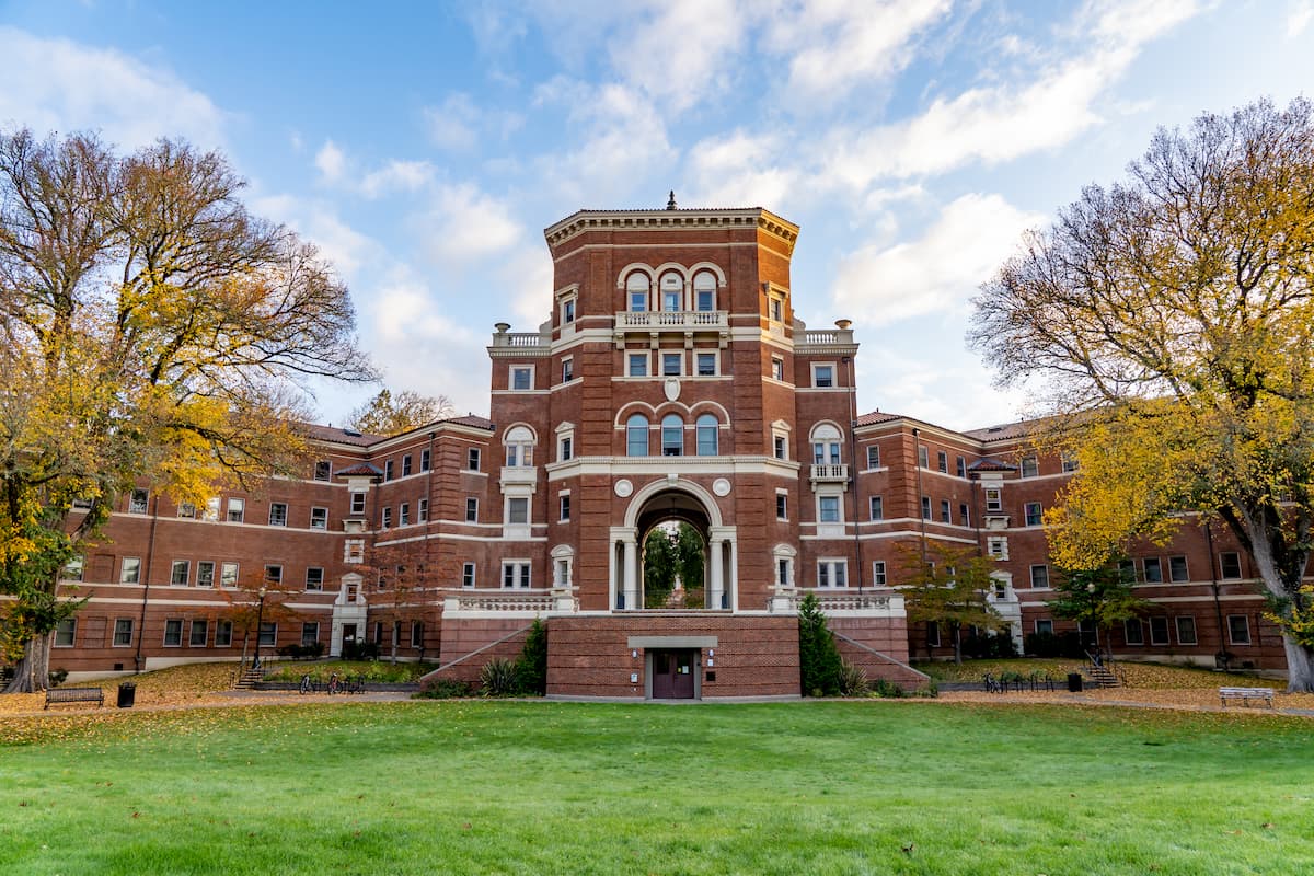
Located in central western Oregon, Corvallis has a population of approximately 58,000. The town is known for being the location of Oregon State University, one of the largest universities within the state. The term Corvallis means “heart of the valley” as the city is located within the Willamette Valley. The surrounding area is known for its hiking as well as its many wineries. As one of the major wine regions on the west coast, it is worth considering adding a wine tour to your list while visiting. The city of Corvallis sits 90 minutes south of Portland, the largest city within the state. The gorgeous, remote, and rugged Oregon coast sits an hour drive west of the city.
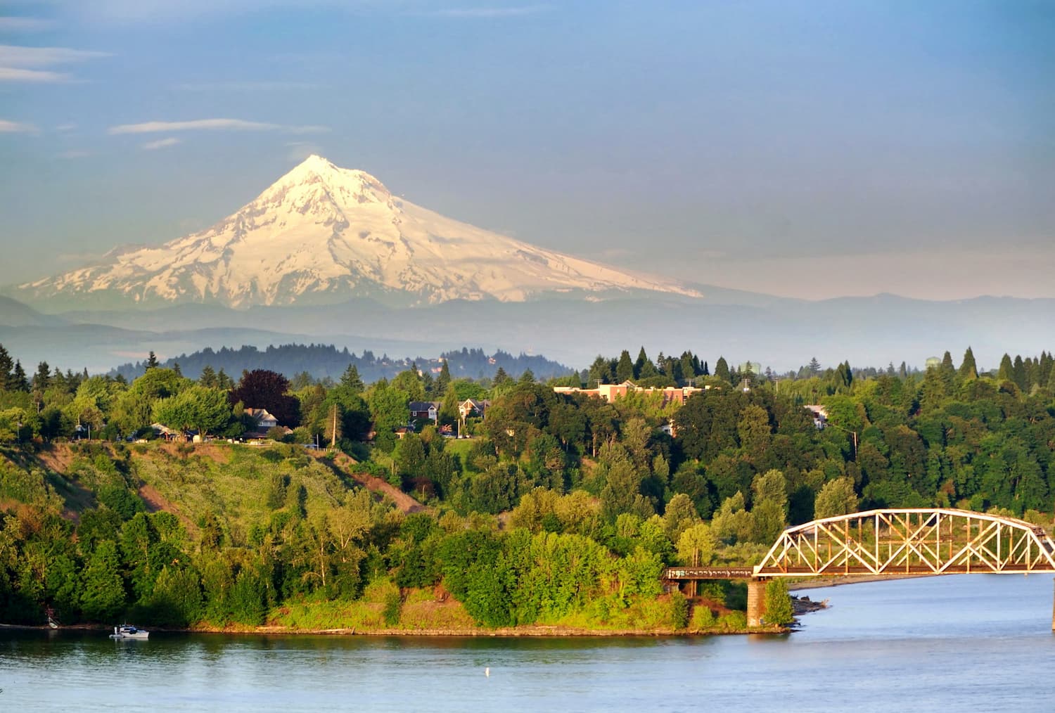
The city of Portland is 90 minutes north of the Corvallis Watershed. With a population of over 600,000 people, Portland is the largest city within the state of Oregon. Known for its vast food scene, many people often forget that Portland is also a hiker’s paradise. The city is home to Forest Park, 5,200 acres of trails within the city, it is just two hours away from both Mount Adams and Mount Hood, and an hour from Tillamook National Forest. Known for being a “hipster hub” the city has a plethora of quirky stores, coffee shops, and what seems to be a never-ending list of breweries.


_(benDA0137).jpg)
The highest peak in Corvallis Watershed is Marys Peak, at 1,250 m.
Notable peaks in Corvallis Watershed include Marys Peak, Franklin Ridge and Pioneer Butte.


