Scan the QR code and open PeakVisor on your phone
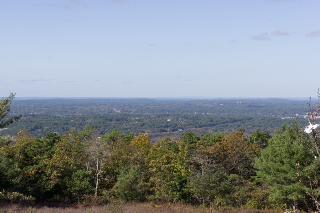
Blue Hills Reservation is a state park located in the eastern region of the US state of Massachusetts. The park marks one of the largest sections of undeveloped land in the Greater Boston metropolitan area. The tallest and most prominent peak in the park is Great Blue Hill at 633 feet (193 m) tall with 479 feet (146 m) or prominence.
Blue Hills Reservation is a state park situated in the southern portion of the Boston metropolitan area in the US state of Massachusetts.
The park spans roughly 7,000 acres (2,800 ha) across Norfolk County. Surrounded by numerous cities and towns, the park covers land in Milton, Canton, Braintree, Randolphm, Quincy, and Dedham.
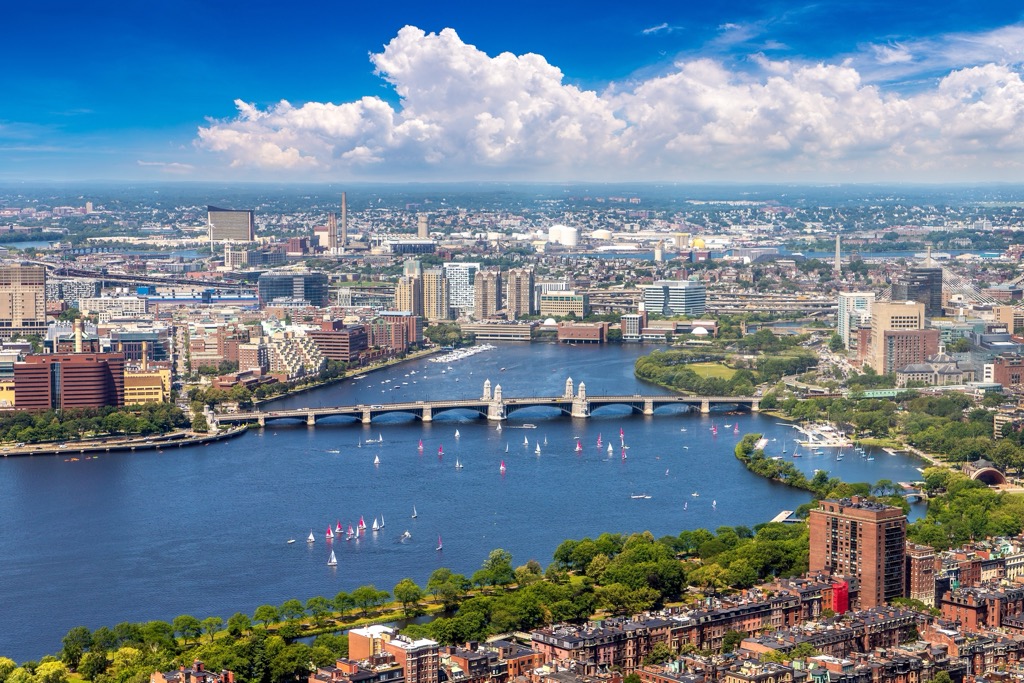
The city of Boston lies ten miles (16 km) north of the park with the Boston Harbor situated to the east. North of the Blue Hills Reservation lies the Neponset River, which flows east into the Boston Harbor.
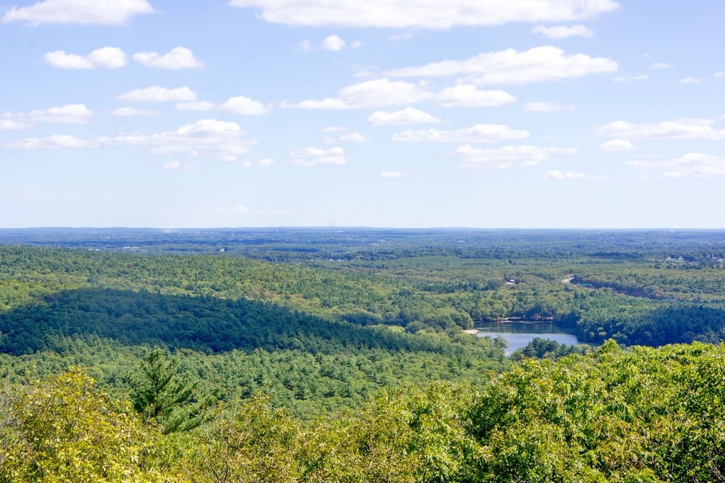
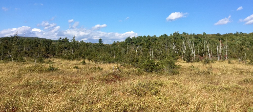
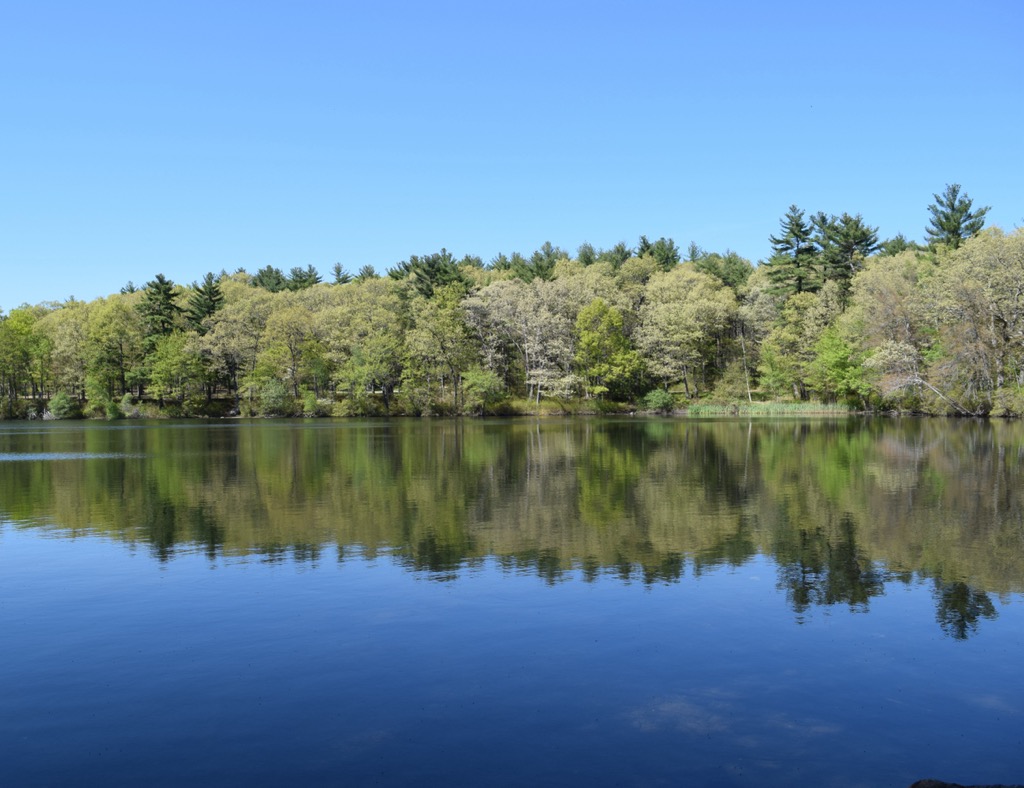
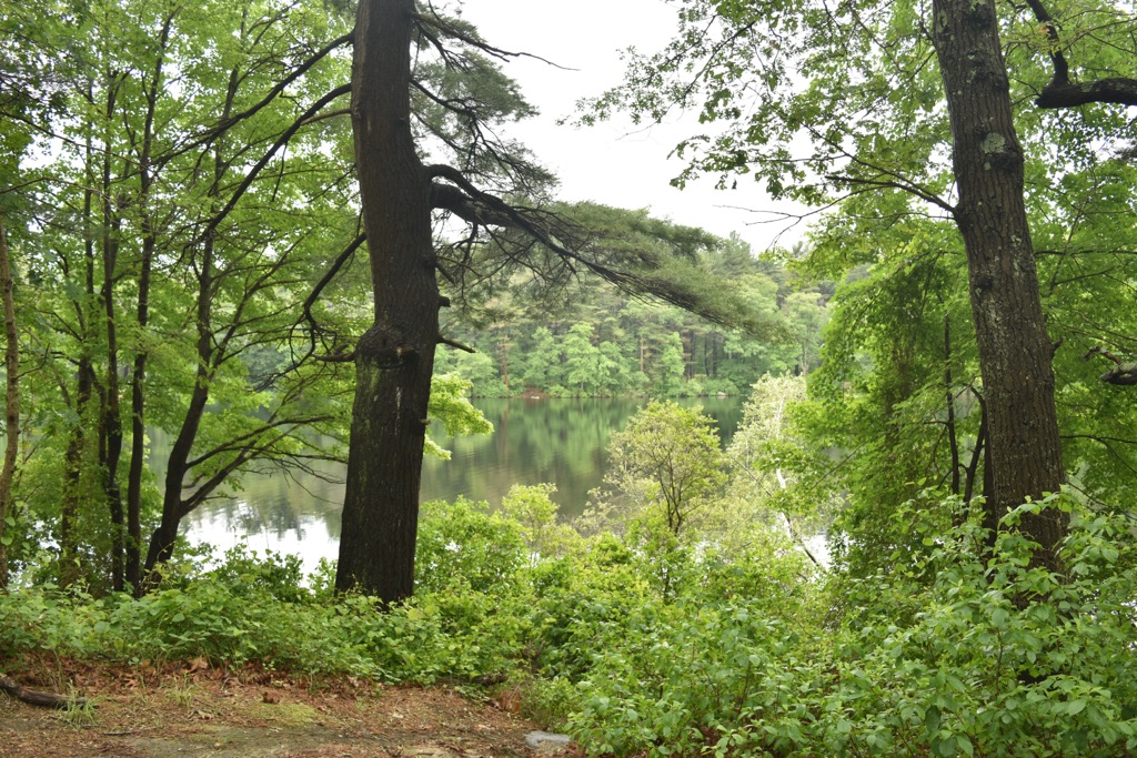
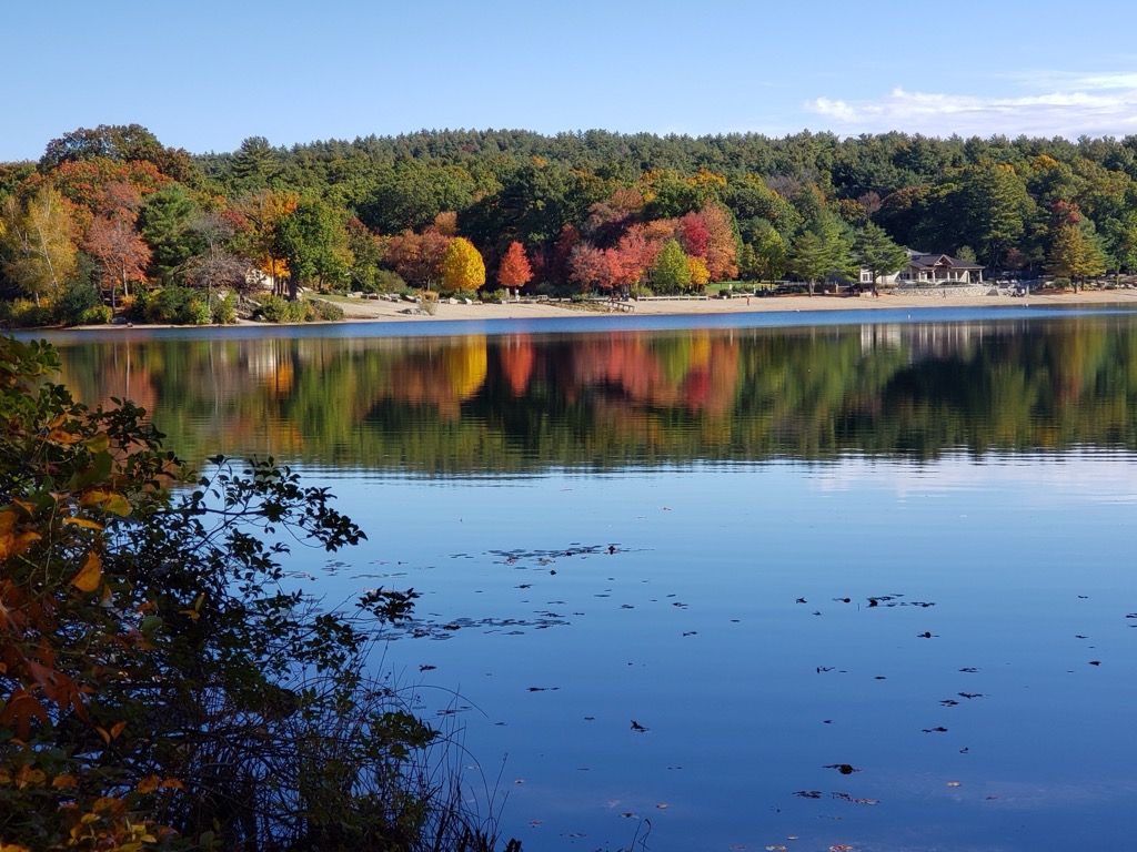
The surrounding region features a plethora of ponds and small lakes. Within the park lies Ponkapoag Pond, Houghton's Pond, Hillside Pond, and Blue Hills Reservoir. A vast majority of the park is forested with rolling hills and slopes along with sections of bog.
Throughout the protected area lie numerous points of interest, including the Chickatawbut Observation Tower, Eliot Memorial Bridge, Great Blue Hill Observation Tower, and Ponkapoag Camp of Appalachian Mountain Club, among others.

The Blue Hills Reservation marks an important recreation destination for the Boston metropolitan area. Other nearby protected areas include the Whitney & Thayer Woods along with the Wheelwright Conservation Area located to the east. To the south lies the Weymouth Street Conservation Area, South Randolph Conservation Area, and Fin, Fur, and Feather Conservation Area. West of the park is the Larabee Estate Conservation Area and Noanet Woodlands.
Bedrock found throughout the surrounding region consists of a variety of rock formations. The Cambridge Formation lies under most of the region, often called the Cambridge Argillite.
Formations of these rocks began between 570 to 550 million years ago as a rift valley in Avalon opened and was slowly filled with sediment. Around 200 million years ago the supercontinent of Pangea broke apart and the Connecticut River Valley opened as a regional rift.
Lava flows would go on to form the Holyoke Range near central Massachusetts. Widespread rifting occurred throughout the state, though this was more present in the western portions of the state.
Throughout the Ceozoic period, Massachusetts was entirely above water. Continual erosion from weather, rivers, and streams resulted in very few fossils of this time being preserved in the region.
The Laurentide Ice Sheet covered the region during the Illinoian period followed by the Wisconsinan glaciation, which marked the most recent glaciation in the region. As the glaciers retreated, they further carved out the landscape, leaving behind glacial lakes that slowly diminished in size.
Some of the major peaks that are found within the park include Great Blue Hill, Chickatawbut Hill, Buck Hill, Hawk Hill, and Hancock Hill.
Despite its relatively small size, the land within the Blue Hills Reservation features a diverse ecology, allowing for a variety of both flora and fauna to thrive.
Both upland and bottomland forests are present along with marshes, meadows, and a section of Atlantic white cedar bog. Some common species of plants include dogwood trees and lady’s slipper orchids.
Some of the endangered animal species that inhabit the park include the copperhead snake and the timber rattlesnake. Other animals include the white-tailed deer, red fox, coyotes, turkey vultures, and wild turkey.
Though the Boston region has played a vital role in American history, the land surrounding the Blue Hills Reservation was inhabited by humans long before the arrival of Europeans. This land marks part of the ancestral territory of the Massachusett Tribe.
The name of the Tribe translates to “At the Great Hills” which refers to the Blue Hills situated within the Blue Hills Reservation. The Tribe was traditionally semi-nomadic, living more inland during the winter months and along the coastline during the summer months.
In the early seventeenth century, the first people of European descent arrived in the region on the Mayflower, establishing the Plymouth Colony in present-day Massachusetts. A leptospirosis outbreak in 1619 decimated the Indigenous population of the region, followed by outbreaks of smallpox, influenza, and scarlet fever.
As the number of colonizers steadily rose, the Massachusett Tribe was forced onto less fertile lands with limited access to the coastlines. Throughout the seventeenth century, colonizers led by John Eliot systematically converted many of the Massachusett peoples to Christianity.
Tribal members were forced to assimilate to European culture and customs forced upon them by the colonizers. The Massachusett language likely became extinct by the beginning of the nineteenth century. Today, descendants of the Massachusett Tribe do not have a federally or state recognized tribe.
The city of Boston was founded in 1630, quickly becoming an important economic hub in New England. The Stamp Act, which imposed a tax on every single piece of printed paper, was enacted in 1765, leading to uproar in the colonies. This frustration stemmed from the fact that none of the tax collected would be redistributed to the colonies. Riots broke out in 1770 leading to the Boston Massacre and the dumping of British tea into the Boston Harbor.
The American Revolutionary War lasted from 1775 to 1776, resulting in the US gaining independence from Britain. Boston continued to grow throughout the following century. In 1893, the Metropolitan Parks Commission purchased the land surrounding the Blue Hills creating the Blue Hills Reservation. The park marked the first dedicated area for outdoor recreation in the state.
Today, the park marks one of the largest protected areas of land within the Boston metropolitan region. There are roughly 125 miles (201 km) of trails that are used for hiking and mountain biking. Some sections of the park are also used for rock climbing, cross country skiing, downhill skiing, and snowshoeing.
Blue Hills Reservation offers a multitude of hiking trails just outside the city of Boston. Below are a few routes to check out on your next visit:
Great Blue Hill marks the tallest and most prominent peak in the Blue Hills Reservation. The loop trail that leads to the summit passes along the summit of Hancock Hill and Hemenway Hill before reaching the summit tower.
After passing through the forested landscape, hikers are rewarded with views of the surrounding terrain with the Boston skyline visible to the north. Hikers can descend the same route or pass by the summit of Houghton Hill. The loop is 3 miles (4.8 km) long and features 813 feet (248 m) of elevation gain.
True to its name, this route takes hikers along some of the main ridgelines in the park. The route passes along the summits of Wampatuck Hill, Nahanton Hill, and The Crags, with options to extend the route and reach the summit of Chickatawbut Hill.
The loop features numerous small climbs and descents throughout along with views of the Blue Hills Reservoir and Furnace Brook. The loop is 5.4 miles (8.7 km) long and features 692 feet (211 m)of elevation gain.
The route to the summit of Buck Hill begins along the northern shores of Houghton’s Pond. There are a few steep climbs throughout the route with rocky sections of trail. From the summit, hikers have views of Boston to the north and the lush flat lands that extend to the south. The out and back route is 2.9 miles (4.7 km) long and features 643 feet (196 m) of elevation gain.
Looking for a place to stay near Indiana Blue Hills Reservation? Here are some of the best cities and towns to check out in the region.
The town of Milton lies along the northern edge of the Blue Hills Reservation. Home to just 29,000 residents, the town marks an affluent region in the Boston metropolitan area. Situated between the Neponset River and the Blue Hills, Milton provides easy access to nature despite its close proximity to the city.
Besides hiking in the Blue Hills, Milton features various points of interest. Some popular attractions include the Blue Hills Trailside Museum, Eustis Estate, and Forbes House Museum. The downtown streets are part of the Milton Centre Historic District.
The city of Boston lies a thirty minute drive north of the Blue Hills Reservation. With a population of 675,000, Boston marks the most populous city in the state and is an economic hub for the New England region.
Boston is the capital city of Massachusetts and features a wealth of museums and historical sites. Some of the most notable spots to visit include the Museum of Fine Arts, Boston Common, Faneuil Hall, USS Constitution Museum and Bunker Hill Monument, among various others.
The Freedom Trail is a historic route in Boston that showcases some of the history surrounding the American Revolution. Besides history, Boston also features a thriving food and arts scene. Each year the city hosts the Boston Early Music Festival and the Boston Arts Festival.