A Sanctuary Amongst France’s Écrins Mountains
From the village of La Grave, France, the Aiguille du Goléon is overshadowed by its larger and craggier brethren to the south. Heads turn south, rather than north, to gaze in awe at La Meije and the rivers of ice flowing from its flanks. The Goléon passes unnoticed by most tourists.
The Goléon is all about understated beauty. When you arrive, you will park in the hamlet of Les Hières. There’s no mountain glitz or glam here. At first glance, the tiny village exists just as it did 500 years ago. Indeed, Les Hières has taken on an uncanny relationship with its own name: hier means yesterday in French.
In other words, it’s perfect.
We strapped on our skins and prepared for human-powered takeoff, leaving our car along the road. Hopefully, the dirt road to Val Froide has held snow, and it’s all skinning from here. If not, you must walk the road until you hit snow.
If we can say Les Hières is perfect, Val Froide is but a dream. It’s inaccessible by car during the winter, and there are few, if any, permanent residents. The stone houses are not just old but positively medieval. Wooden doors and slated rooves were built for a time when people were shorter.
Skirting through the houses, we passed a bridge on the left. Here begins the climb, about 700 meters (2,300 ft) of elevation to reach the refuge. It's not a slog by any means, but the nature of the terrain makes for an exciting adventure.
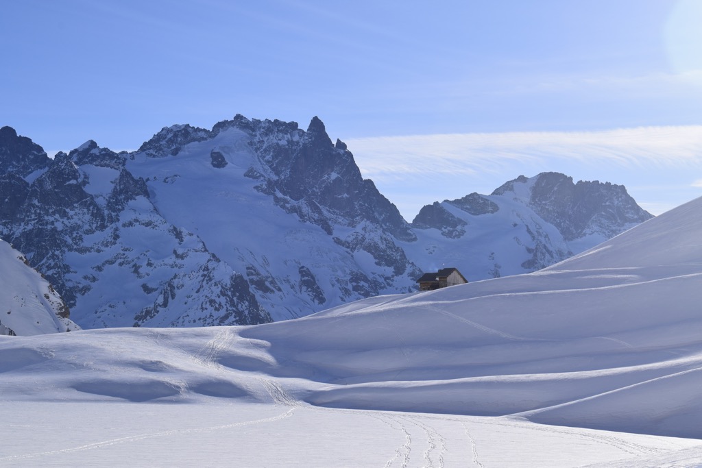
After Val Froide, the refuge almost comes into view; it’s perched atop the terminal moraine of the once-great Lombard Glacier, which has carved a massive valley and left a small lake, the Lac du Goléon. The refuge was our destination for the day.
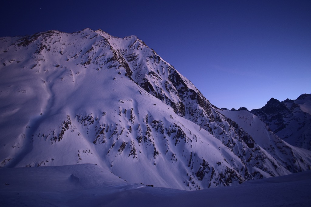
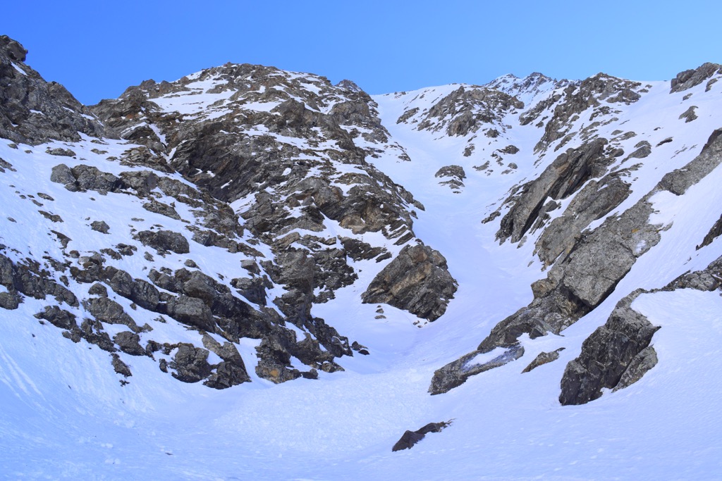
Slowly, Val Froide disappeared into the distance, and the valley tightened into a shallow canyon. Our mission, at the end of January, was blessed with unseasonably warm temperatures and rock-hard, refrozen snow. Ski crampons engaged, we scraped and clinked our way along, side-hilling on the right side of the snow-covered creek. To the right, massive avalanche paths had unleashed their load, and we carefully stepped over the frozen roller balls. Light blazed across the Roche de Casse at the opposite end of the canyon while our side remained ensconced in the shadow of Les Trois Évêchés. Finally, the canyon opened up into a face, and we kick-turned our way up the refuge.
The Refuge du Goléon is a handsome stone structure amidst a metropolis of peaks. It’s not just the Aiguille du Goléon and Les Trois Évêchés; in particular, the view of La Meije and the Écrins from here is the best you can get.
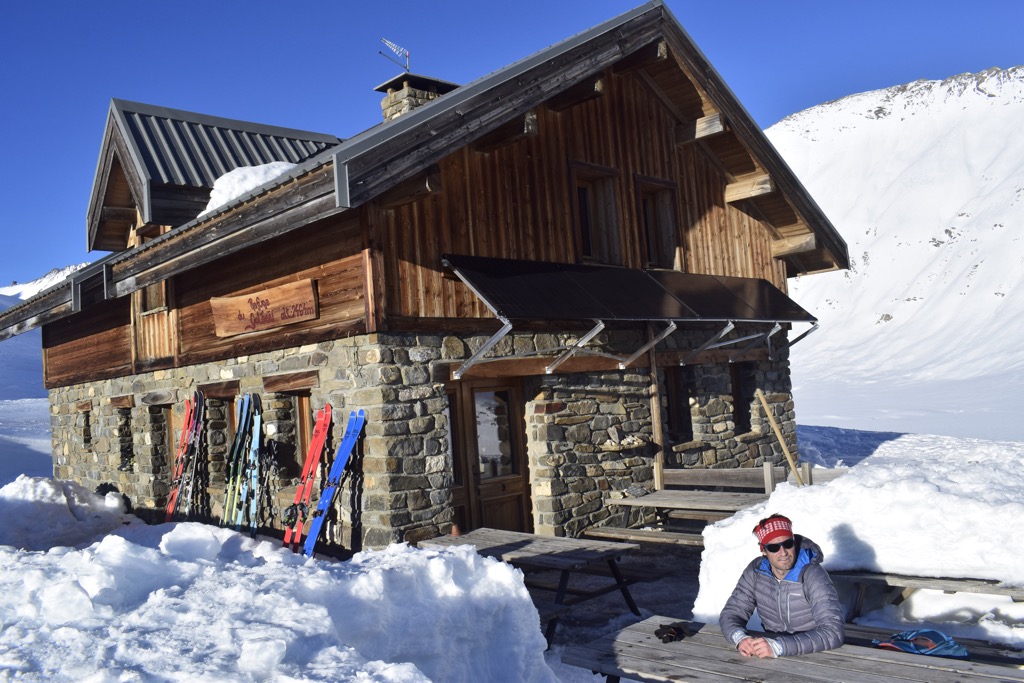
The guardians were a friendly couple who had purchased the refuge a couple of years back and renovated it with a grant from the French government (my French isn’t perfect; I think this was the gist of the story). They now keep it open about six months a year. We warmed our bones and gear by one of the largest pot-belly woodstoves I’ve seen and were served a delicious three-course meal for supper. I learned that a small cable car—remnants of an old mining structure—is used to bring food and supplies up to the refuge. No wonder this place was so well stocked! Six of us stayed at the refuge that night, so there was plenty of room to spread out. The refuge holds about 20 people and is mostly full each weekend.
Despite the day’s exercise and hearty dinner, sleep was fitful. For me, that’s just the nature of refuges; I never sleep very well.
We arose early the next morning, ate breakfast (also delicious), and set off. Our objective was the Aiguille d’Argentiere, one of the Goléon’s most classic lines. After a productive first half of the season, high pressure had settled into the region. The existing snow base had topped three meters in some protected alpine areas (it would reach five meters at its peak, a historic season in the Écrins), and we were looking to harvest some corn.
We zipped along the long glacial valley that was once the home of the Lombard glacier. The Lombard is one of those glaciers that never stood a chance after the mini ice age a few hundred years ago. There’s too much southern exposure and insufficient altitude; now, the remaining ice is confined to a little north-facing pocket atop the Aiguille du Goléon.

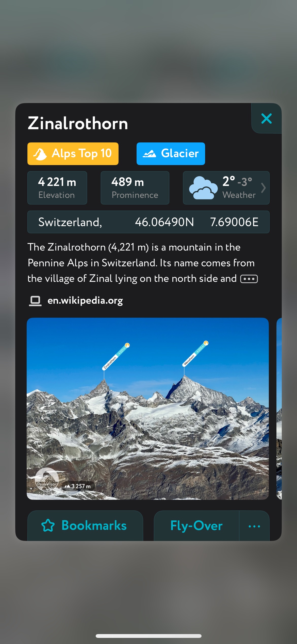
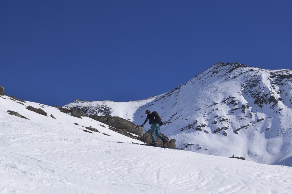
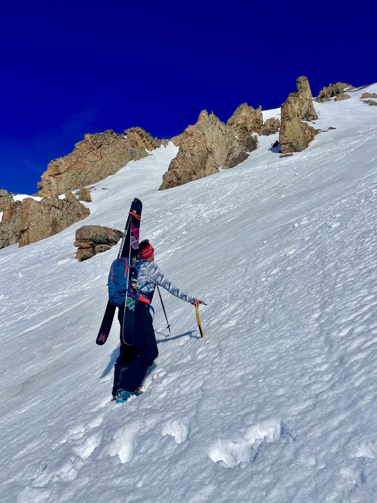
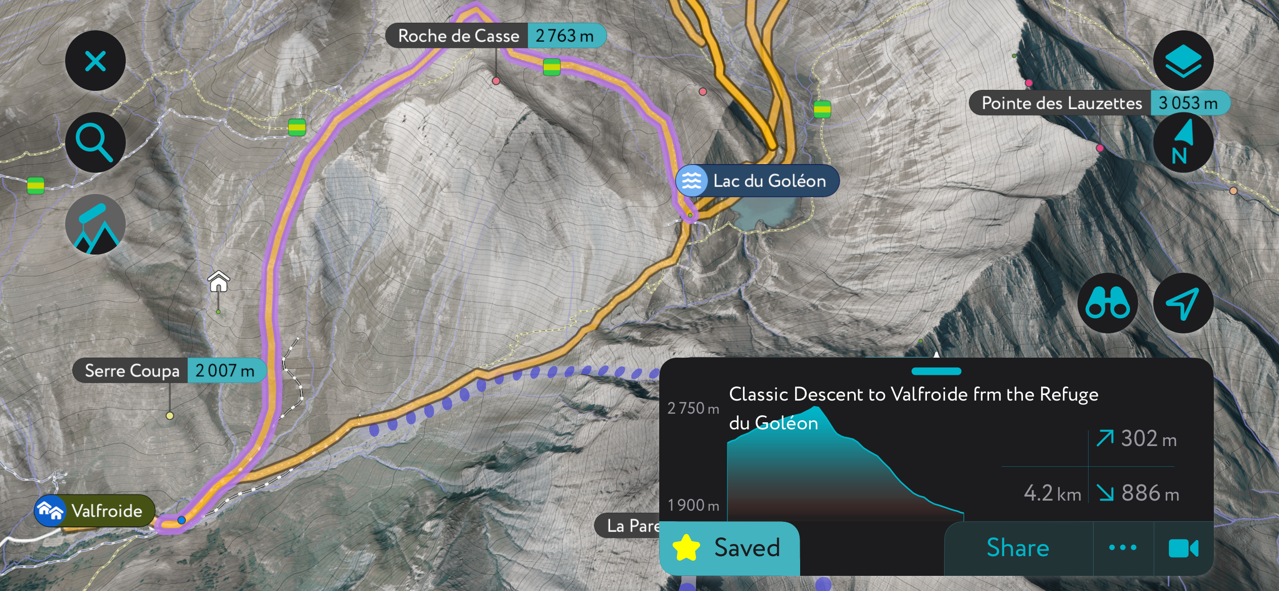
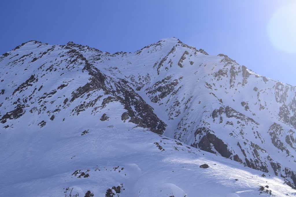
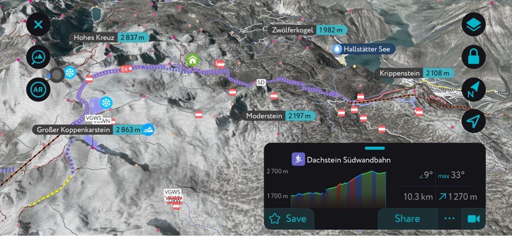
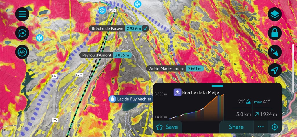
As you can see from the PeakVisor app screenshot, it’s a straight shot up the Aiguille d’Argentiere. Unfortunately, yesterday’s corn had frozen into a nasty ice layer. With both our ski crampons and core muscles engaged, we zig-zagged our way up this. There was a lot of swearing, but eventually we gained a slight shelf, where we hid behind a rock and readied for a bootpack to the summit ridge.
The bootpacking was a welcome respite from the skinning but also a suffer-fest in the rapidly warming sun. Roasting in the rising sun's rays, it felt tropical up there at the top of the Aiguille. There was hardly a chill in the air. You could hear ice crystals melting, morphing, and shifting all around. Eventually, small rocks began to break loose and indiscriminately zip their way down the wide couloir. Heads raised and on a swivel, we quickened our pace.
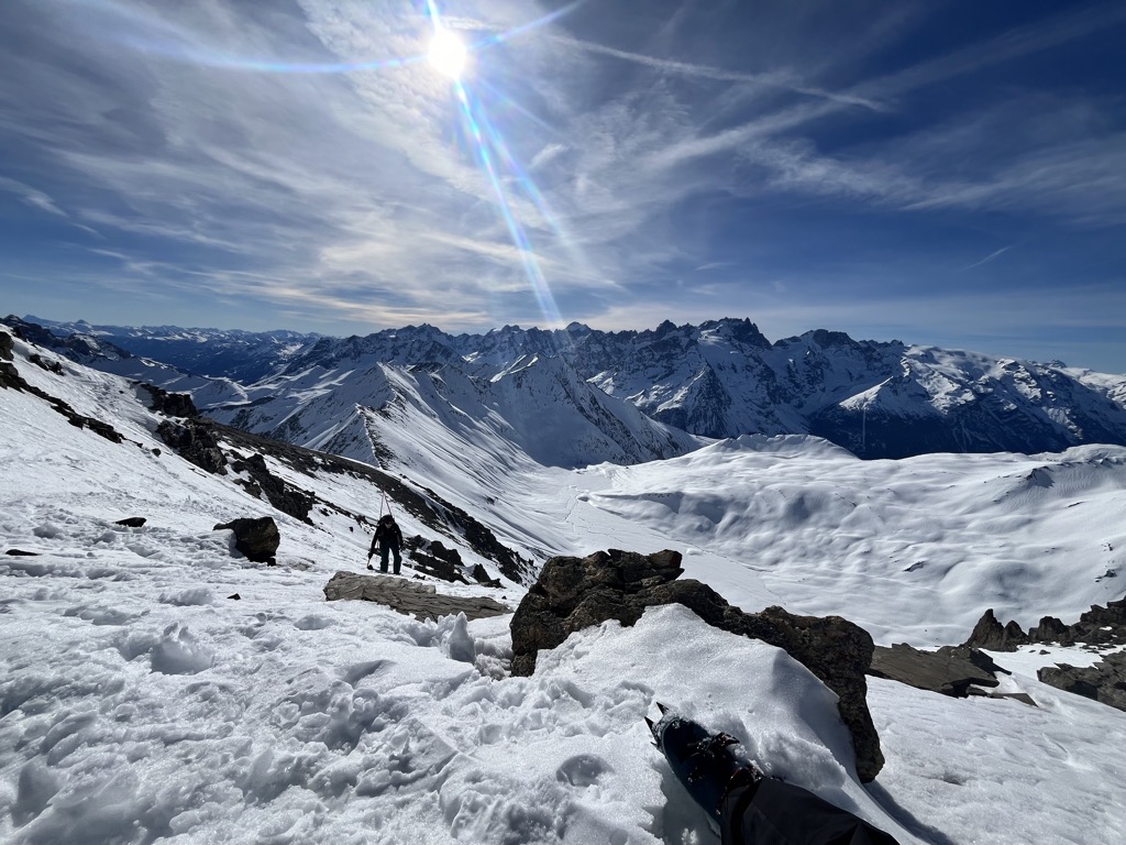
After pinning it for an hour or more, we finally reached the summit ridge. The rivulets of sweat running down my body began to dry up in the slight breeze. The weather was astonishingly perfect; there was hardly a cloud in the sky. We watched as the guardians of the refuge, who had started at least an hour after us and finished before us, dropped into a face on the other side of the Aiguille. Somewhere along their family lineage is a chamois; mere humans couldn’t move that fast.
Of course, the fact that it’s not hard to move faster than us hadn’t gone over my head either, and Anna and I began to hastily transition before the sun destroyed what it had just created: a vast canvas of perfect corn skiing.
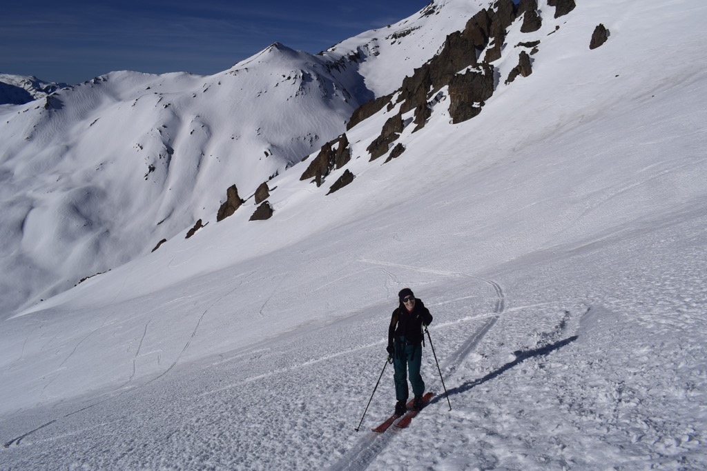
The top of the route was not in tip-top shape. It was a bit rutted out from small wet slides, and rocks peppered the surface, melting the snow around them and forming small holes. But as soon as the pitch began to moderate and open up, the corn harvest began. We skied well to the skier’s right of where we had skinned up. It was sweeping turns all the way to the valley, each one followed by the hissing of corn snow following us down the mountain.
We traversed back toward the refuge, all smiles, delighted that we had caught the run in such good condition. It was also reaffirming that the guardians, who know the area better than anyone, had also chosen the Aiguille d’Argentiere today. Other than fresh powder, we’d caught the best conditions you can get for a steep line.
Back at the Refuge, we sat on the deck and tossed a couple of sandwiches together. The sun was warm, and the south faces began to shimmer; the window of corn skiing had passed, and there was now a danger of wet slides. A short lunch was followed by (relatively) quick skin to a shallow col behind the Roche de Casse.
A quick glance at PeakVisor and we could see that Val Froide was just around the bend, embedded in the valley. It was late in the day at this point, and the snow was not ideal, but we loved this little pitch. Well, little by the standards of the French Alps; it was still a 900-meter descent (3000 ft).
Getting to the car, we knew it was time for a beer. Being January, the Castillon was still lurking in the three-month shadow that haunts La Grave each winter. But it was ok; we’d had enough sun for one day. Á bientôt, Refuge du Goléon!
Gallery
Using the PeakVisor App
Interested in skiing? Check out the PeakVisor App. PeakVisor has been a leader in the augmented reality 3D mapping space for the better part of a decade. We’re the product of nearly a decade of effort from a small software studio smack dab in the middle of the Alps. Our detailed 3D maps are the perfect tool for hiking, biking, alpinism, and, most notably in the context of this article, skiing!
PeakVisor Features
In addition to the visually stunning maps, PeakVisor's advantage is its variety of tools for the backcountry:
- Thousands of ski touring routes throughout North America and Europe.
- Slope angles to help evaluate avalanche terrain.
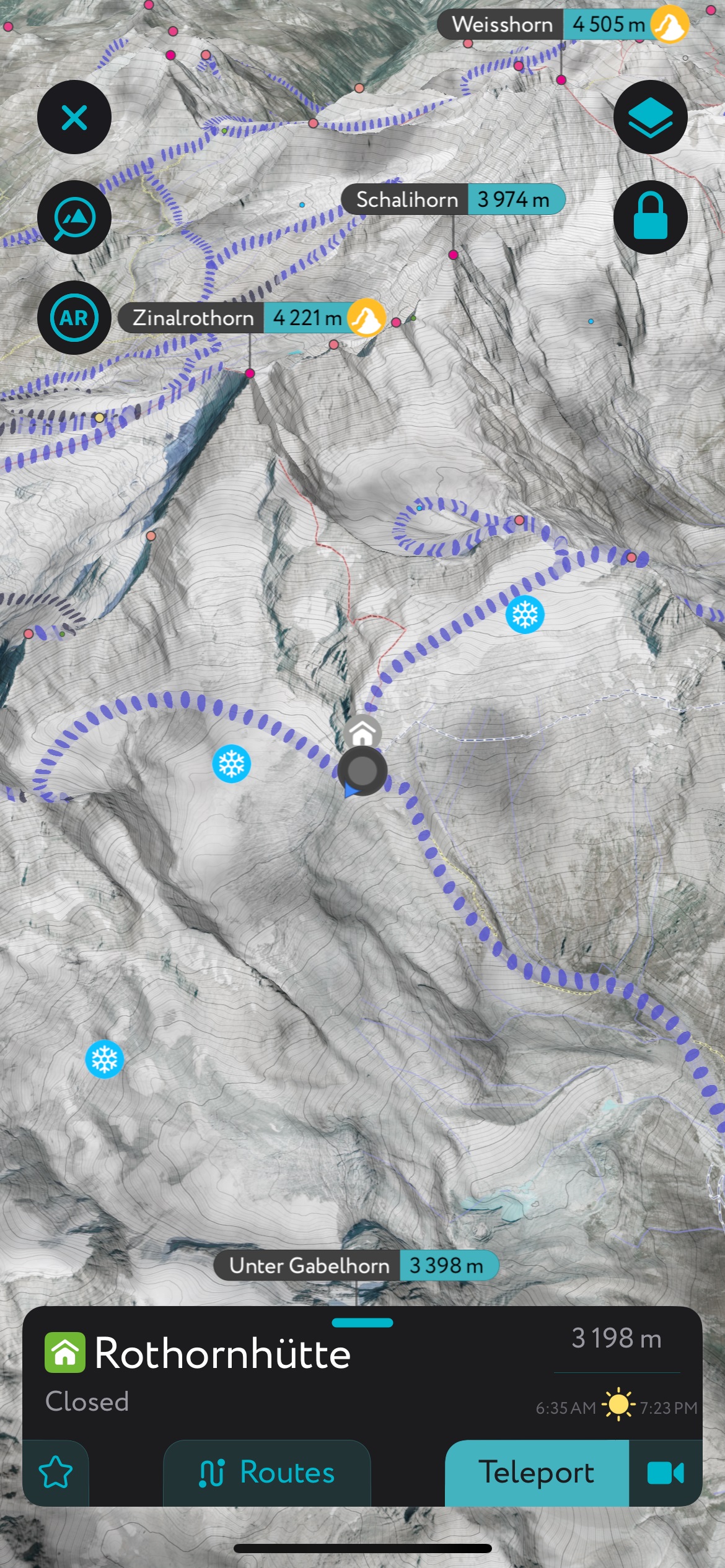
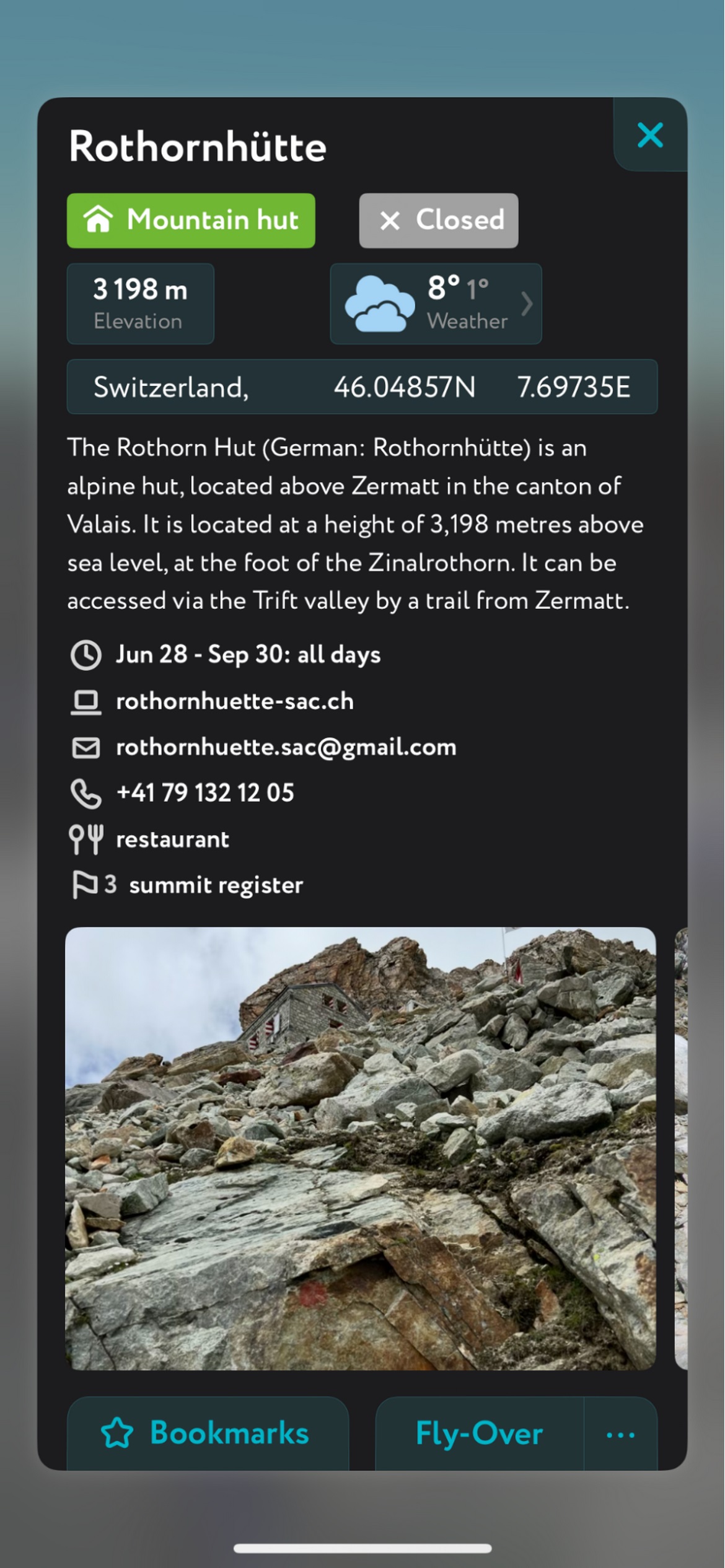
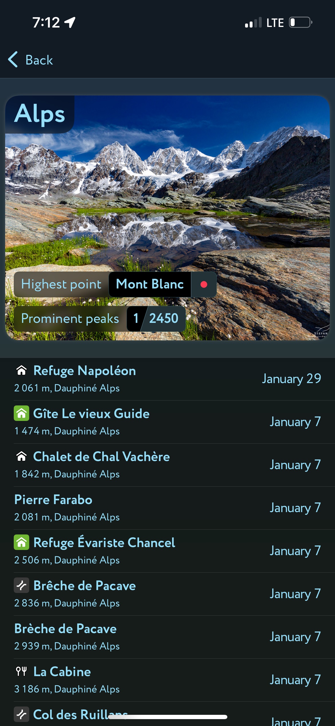
- Mountain hut schedules and contact info save the time and hassle of digging them up separately.
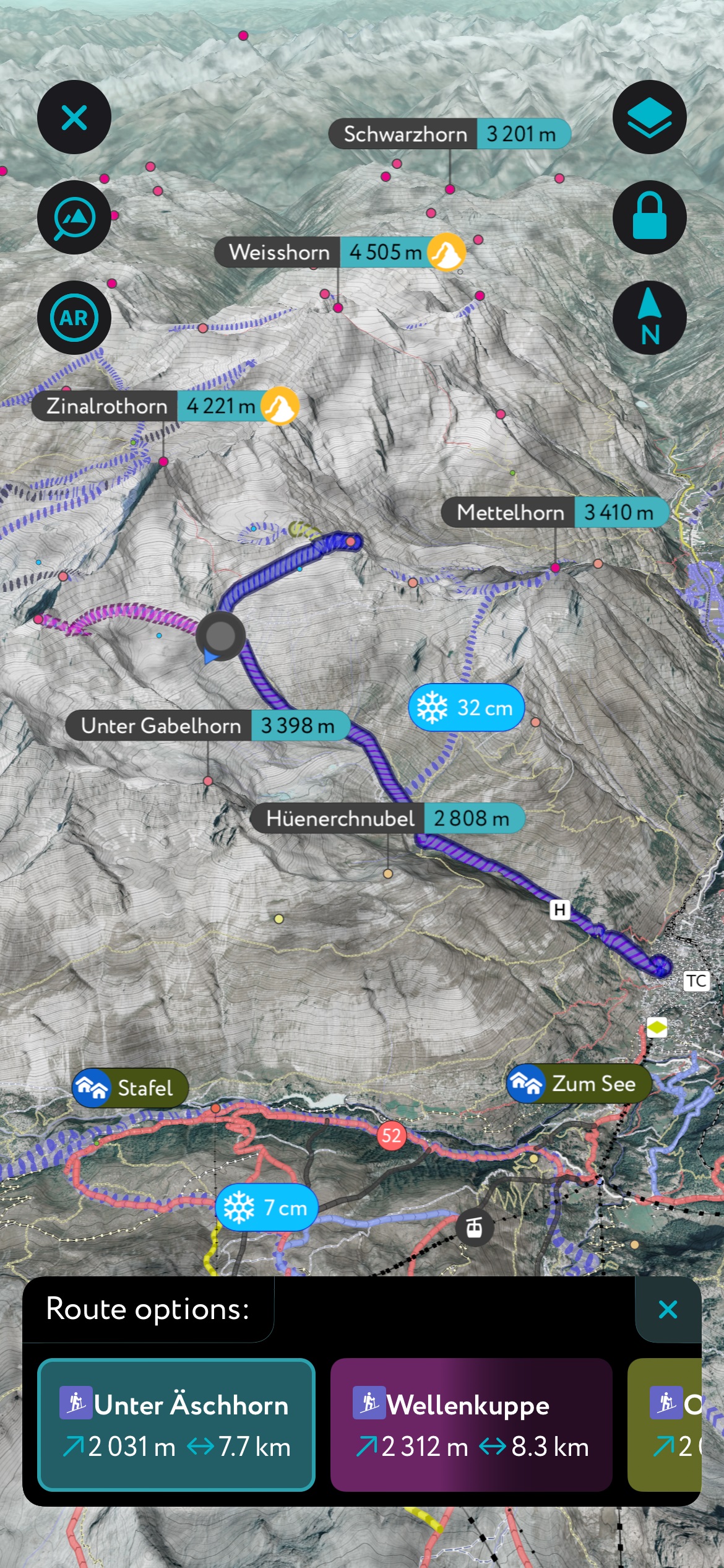
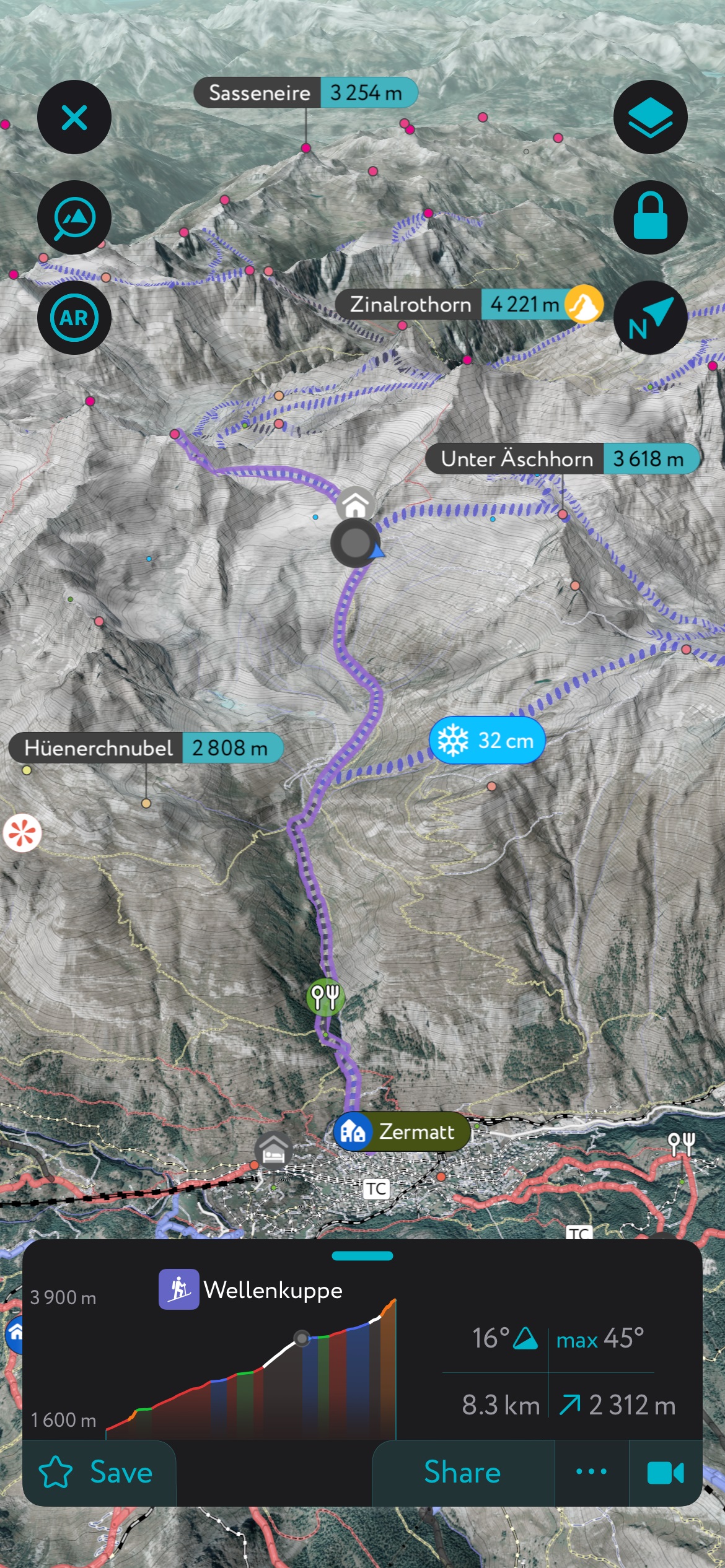
- The route finder feature generates a route for any location on the map. You can tap on the route to view it in more detail, including max and average slope angle, length, and elevation gain.
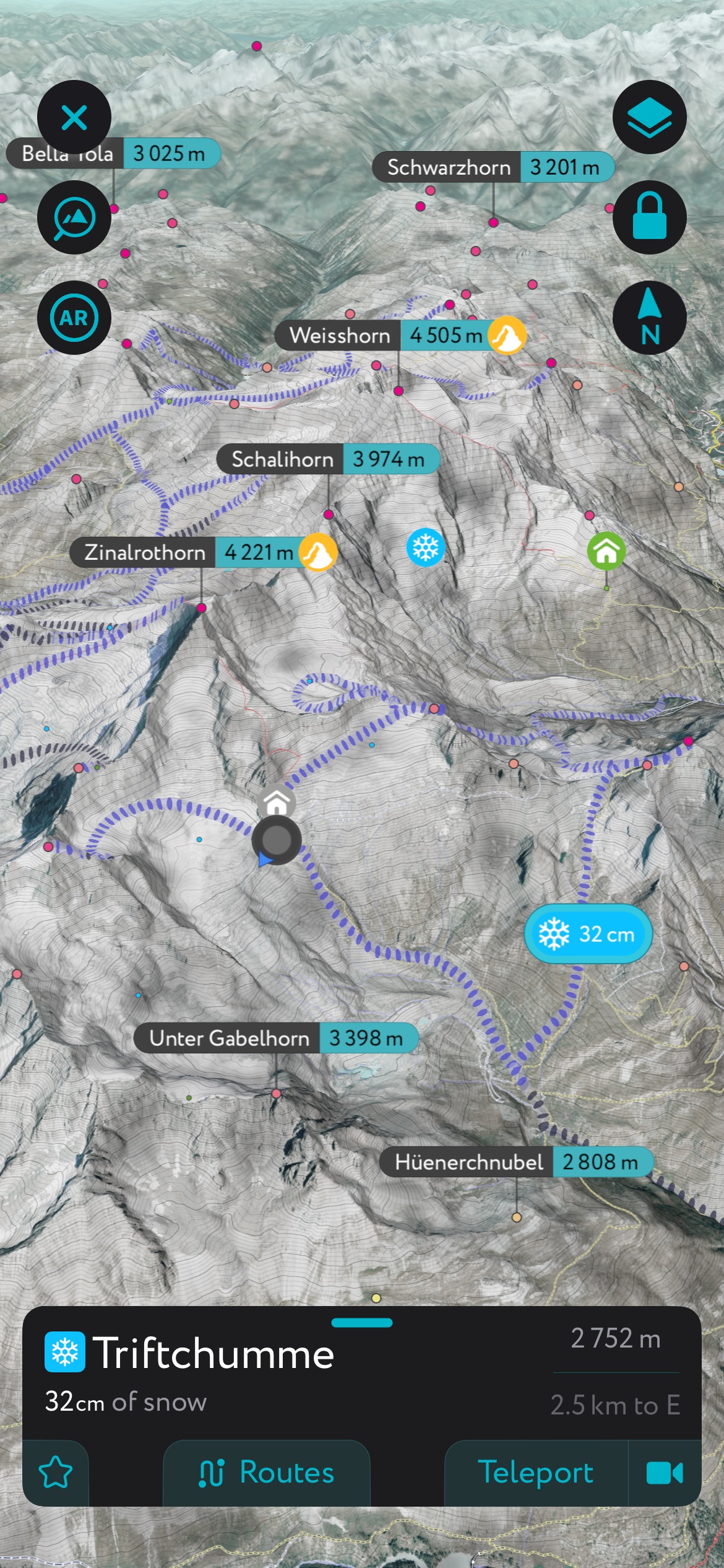
- Up-to-date snow depth readings from weather stations around the world.
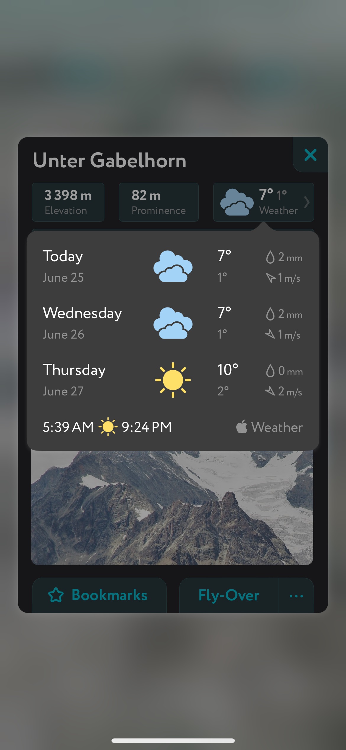
- A point weather forecast for any tap-able location on the map, tailored to the exact GPS location to account for local variations in elevation, aspect, etc., that are standard in the mountains.
- You can use our Ski Touring Map on your desktop to create GPX files for routes to follow later in the app.