Using the PeakVisor App to Plan Backcountry Ski Adventures
FATMAP is OUT…And PeakVisor is IN
On June 24th, 2024, industry titan Strava announced that it is shutting down FATMAP, a 3D mapping app predominantly used for winter sports like ski touring, on October 1st, 2024. Fortunately for mountain enthusiasts worldwide, there are still alternatives to Strava. Best of all, PeakVisor is offering a 50% discount on the first year when users migrate from FATMAP or Strava.
PeakVisor has been a leader in the augmented reality 3D mapping space for the better part of a decade. We’re the product of nearly a decade of effort from a small software studio smack dab in the middle of the Alps. Our detailed 3D maps are the perfect tool for hiking, biking, alpinism, and, most notably in the context of this article, ski touring! Our app crushes Strava and FATMAP in the route planning and tracking game in a number of ways:
- Our 3D engine is far superior.
- Our maps are more detailed with routes, trails, peaks, mountain huts, parking areas, and more worldwide.
- You can easily track activities and view them later on our visually stunning 3D template. You can also watch Video Flyovers of any route, whether you’ve completed it or not. This can help some users visualize a route before heading out, while others may revel in their glory.
- Our dev team (info@peakvisor.com) will promptly answer any of your questions about the app.
- Our company is less than 1/100 the size of Strava and consists of about a dozen employees based around the world with a shared passion for mountains.
- PeakVisor is a fraction of the price of Strava.
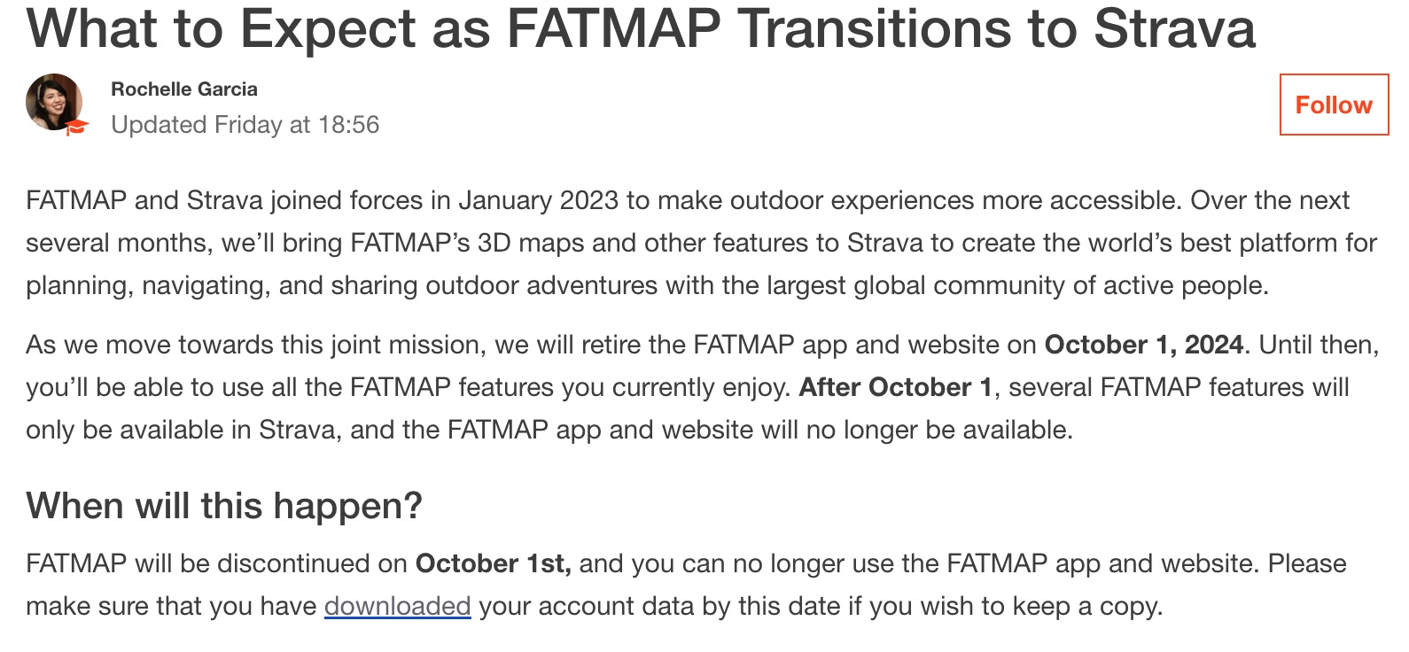
Last night, Strava sent out an email that started like this:
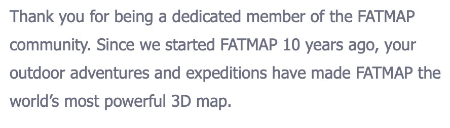
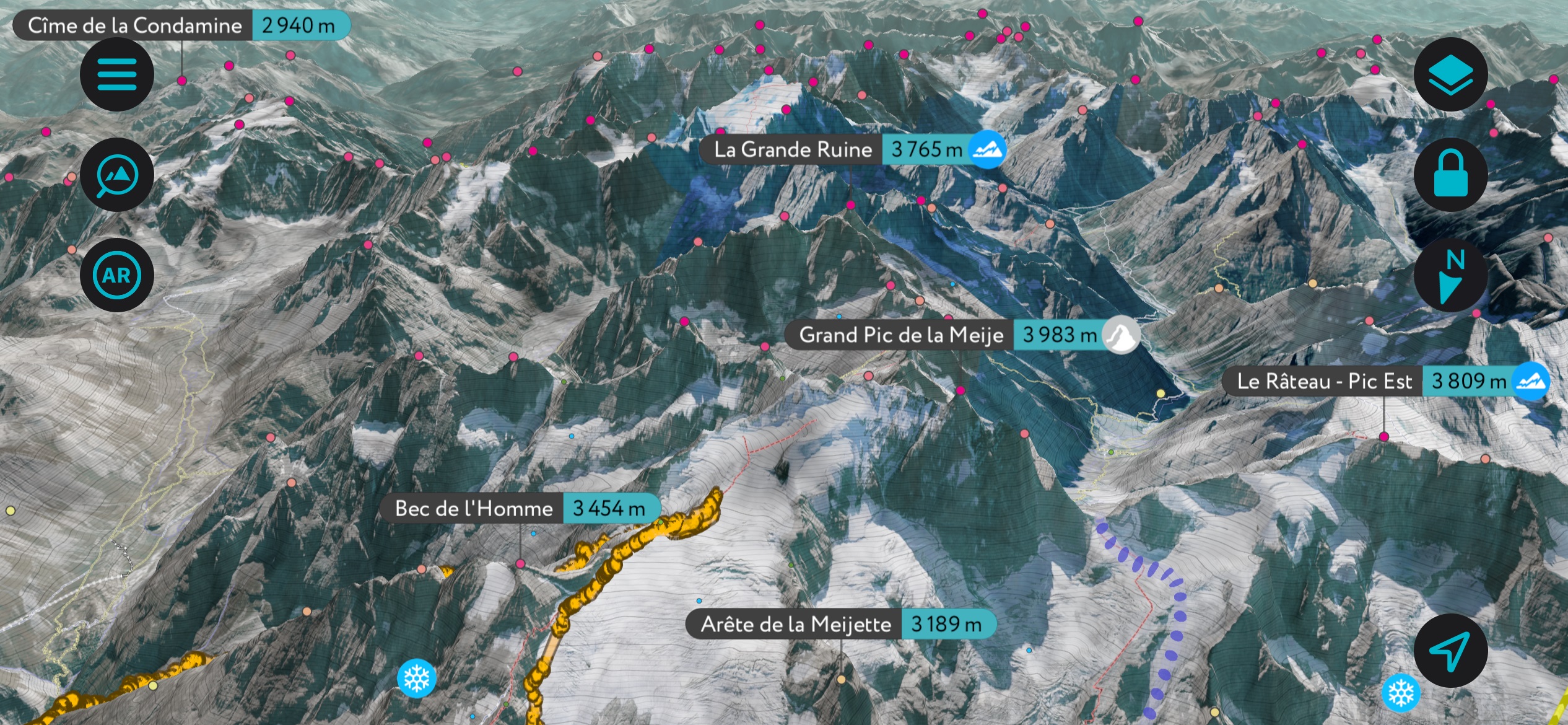
The idea that FATMAP is the world’s most powerful 3D Map is debatable. PeakVisor’s 3D engine is superior in direct comparison. Let’s take a look:
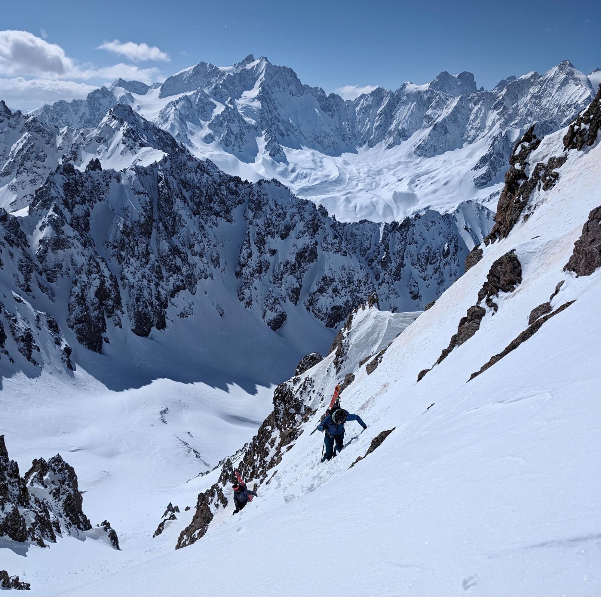
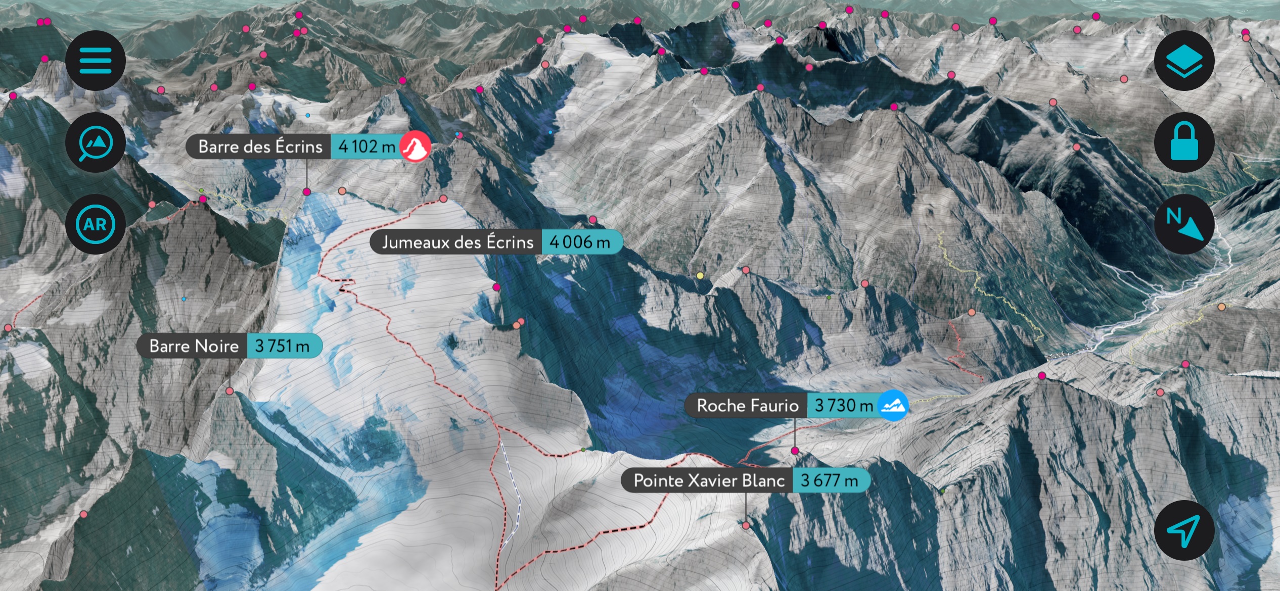
Here are some images of the legendary Écrins mountain range in France. We can start with an overview of the range:
Next, let’s turn our attention to the Barre des Écrins, the only 4,000-meter peak in France outside the Mont Blanc Massif:
Let’s compare the 3D capabilities of FATMAP vs. PeakVisor. FATMAP’s 3D is constantly getting distorted, unlike PeakVisor:
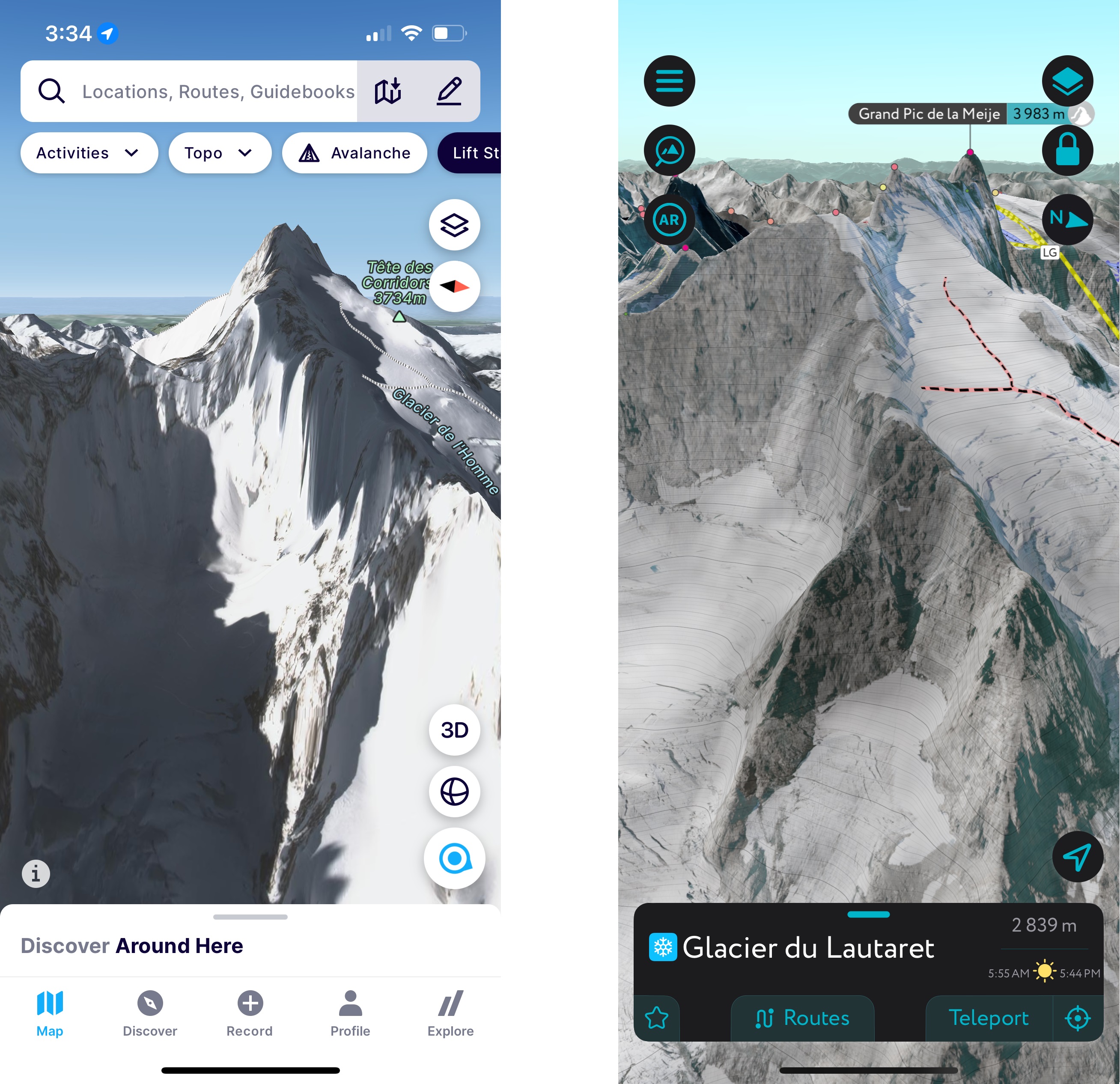
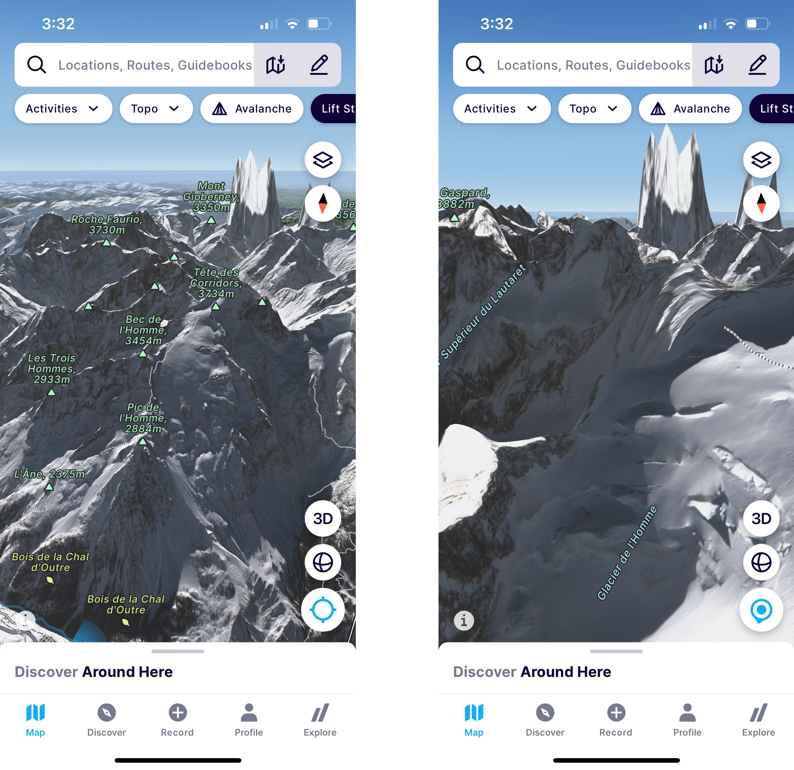
It’s impossible to demonstrate in photos, but the user experience (UI) in FATMAP is much less fluid. In addition to distortion, you’ll jump from one place to another when navigating or zooming in and out. Sometimes, the app just freezes in place. Their 3D engine is simply not as powerful as PeakVisor.
What is FATMAP good at, then? Well, it’s excellent for scouting precise ski routes. With funding, the company could purchase expensive, high-resolution winter satellite imagery and overlay it with its 3D maps, whereas PeakVisor uses summer satellite imagery. FATMAP also has summer satellite imagery. PeakVisor has more features and a better 3D engine, but FATMAP has better winter resolution for ski routes.
Additional PeakVisor Features
In addition to the visually stunning maps, the advantage of PeakVisor is the variety of tools you can use in the backcountry. These include:
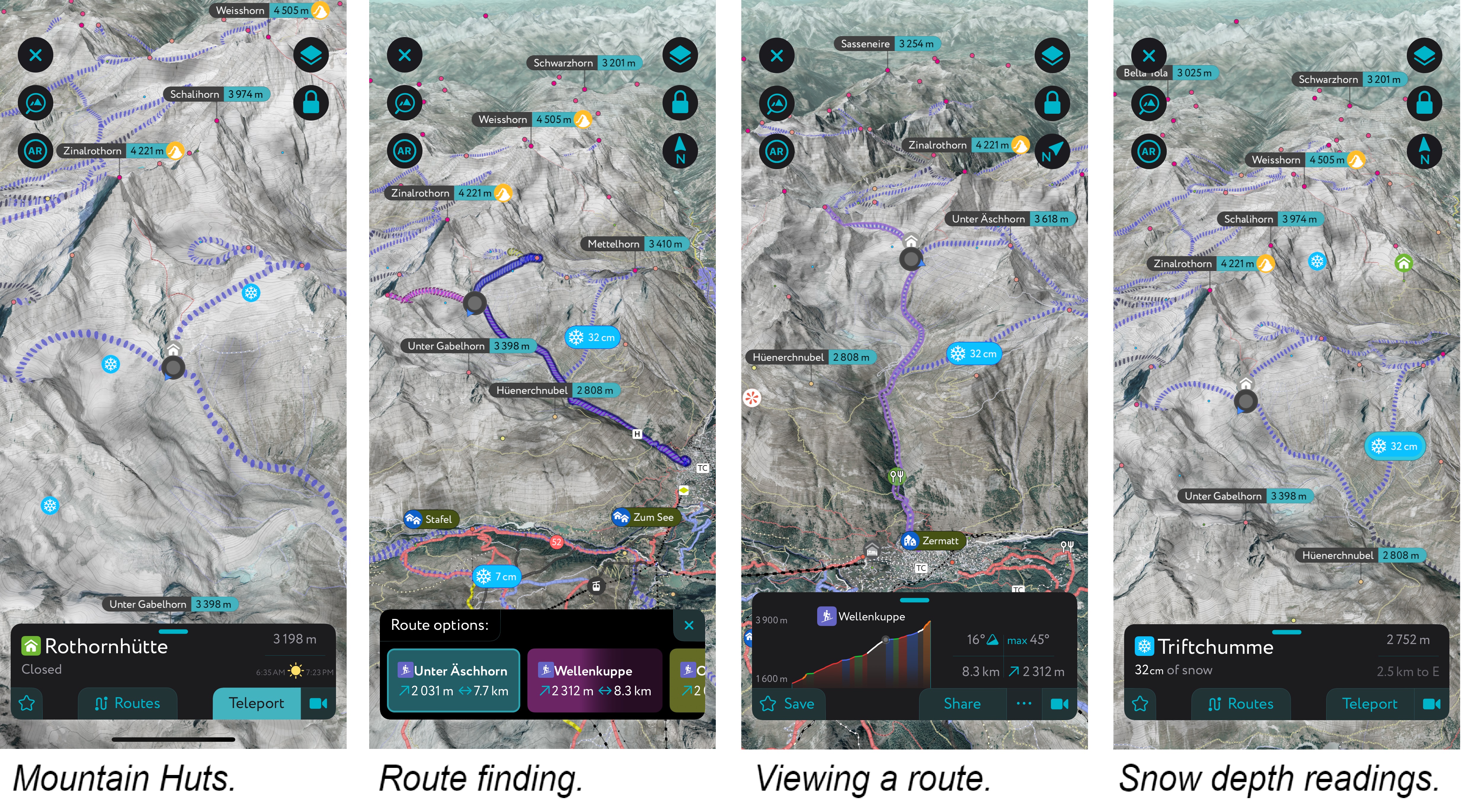
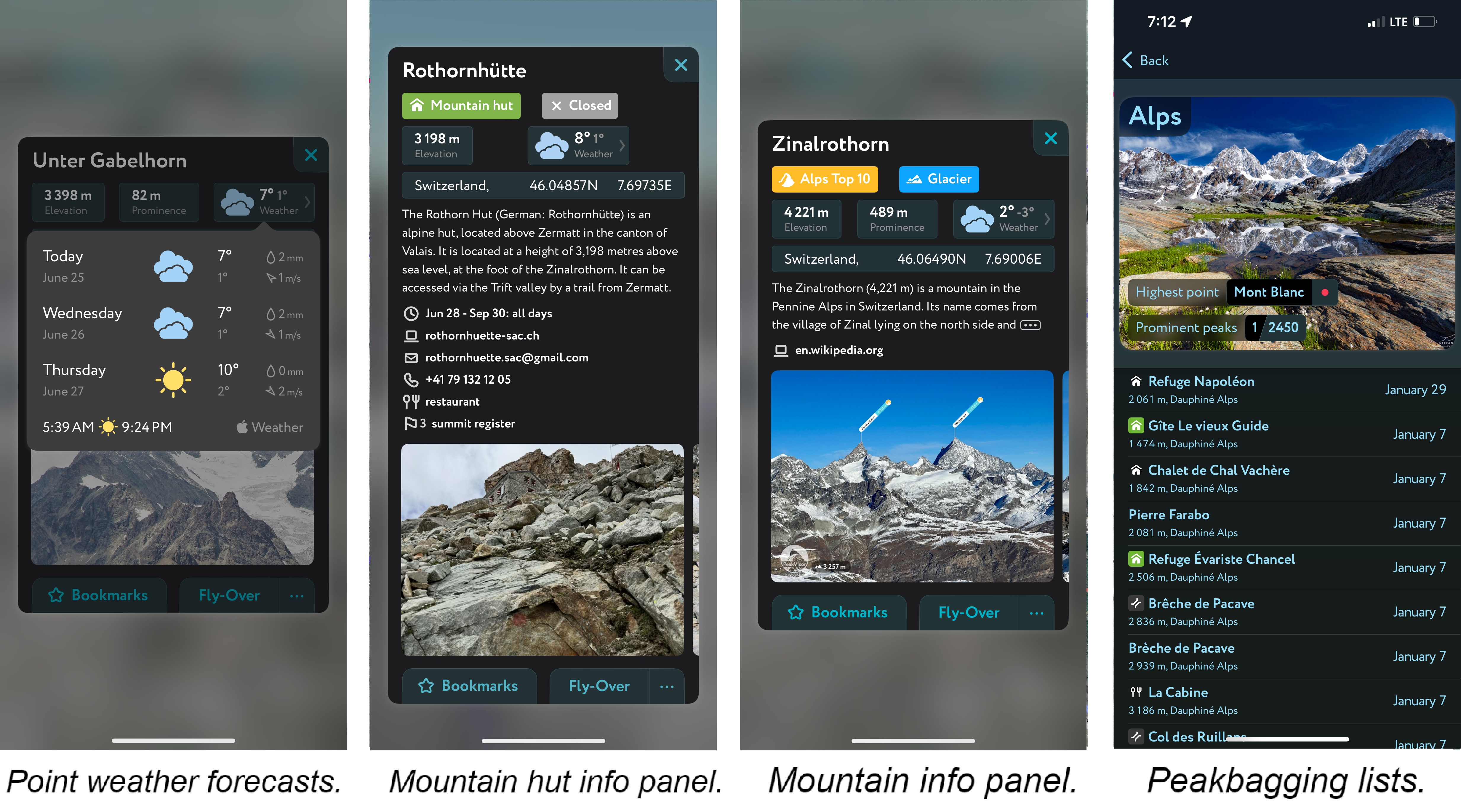
- Mountain hut schedules and contact info save the time and hassle of digging them up separately.
- The route finder feature generates a route for any location on the map. You can tap on the route to view it in more detail, including max and average slope angle, length, and elevation gain.
- Up-to-date snow depth readings from weather stations around the world.
- A point weather forecast for any tap-able location on the map, tailored to the exact GPS location to account for local variations in elevation, aspect, etc., that are standard in the mountains.
- Peakbagging lists for all of your saved regions.
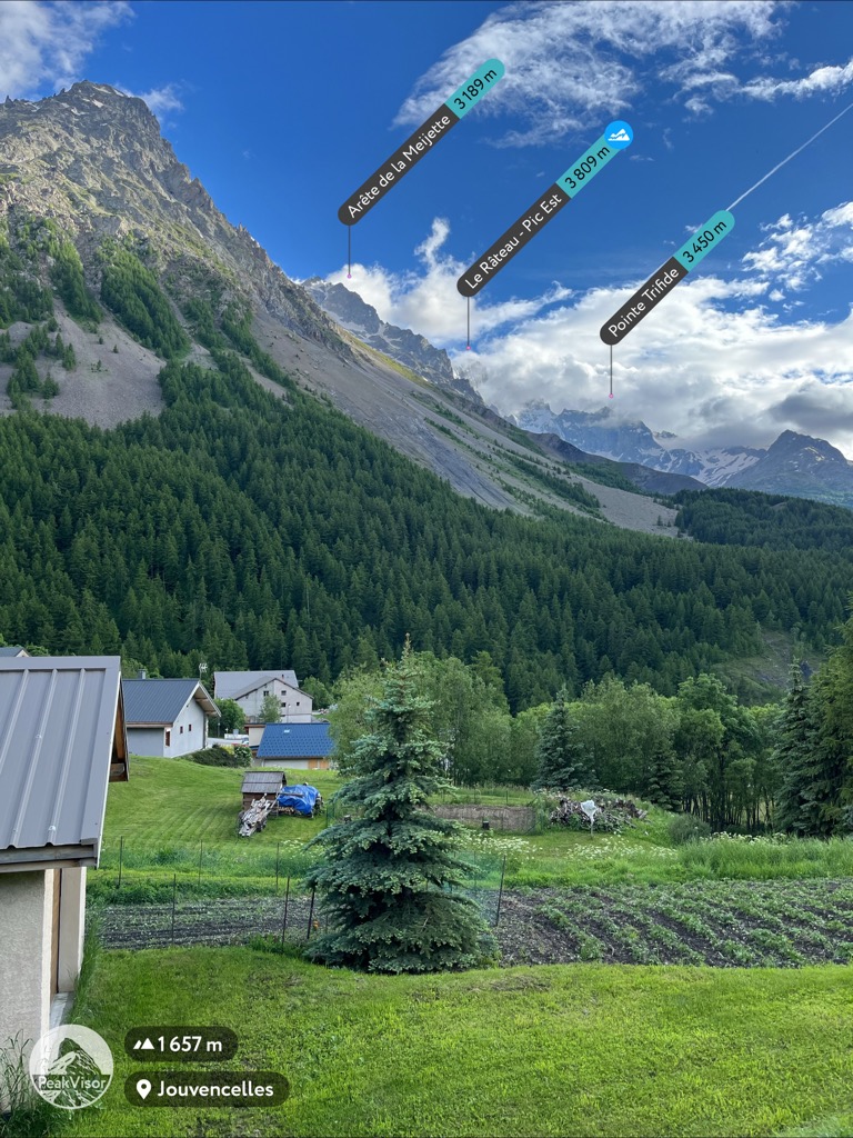
Last but not least is our original feature, Peak Identification. Just open the app and point your camera at the mountains to identify the name and elevation of any peak. We launched this phase of PeakVisor in 2016 before anybody was talking about Augmented Reality. It requires an exceptionally exact 3D model; otherwise, the app will be rendered useless with imaginary peaks.
Subscription Plans
Like most mobile apps, a limited version of PeakVisor is free. In our case, the main limitation is that you can only use the app in one location per day. Like most apps, we offer a subscription to access the full extent of the app’s features. There are slight variations depending on your country, but our subscription starts around $4.99/month, $29.99/year, or $89.99 for a lifetime unlimited subscription.
Compare that with Strava’s price tag (or any other advanced outdoor app). In the U.S., Strava is $11.99/month and $79.99/year. In Europe, it ranges from €8-10/month to €50-75/year. There is no lifetime subscription option. Any way you look at it, it’s far more expensive than PeakVisor.
Best of all, PeakVisor is offering a 50% discount on the first year when users migrate from FATMAP or Strava. Just follow this link!
Migrating Data
You can import GPX and KML files into PeakVisor, so all of your FATMAP routes from the database will be effortlessly integrated into your profile for future reference.
I just did this to ensure that it’s easy. Follow this link to the Strava/FATMAP transition page. The first subheading shows a link to download your information:
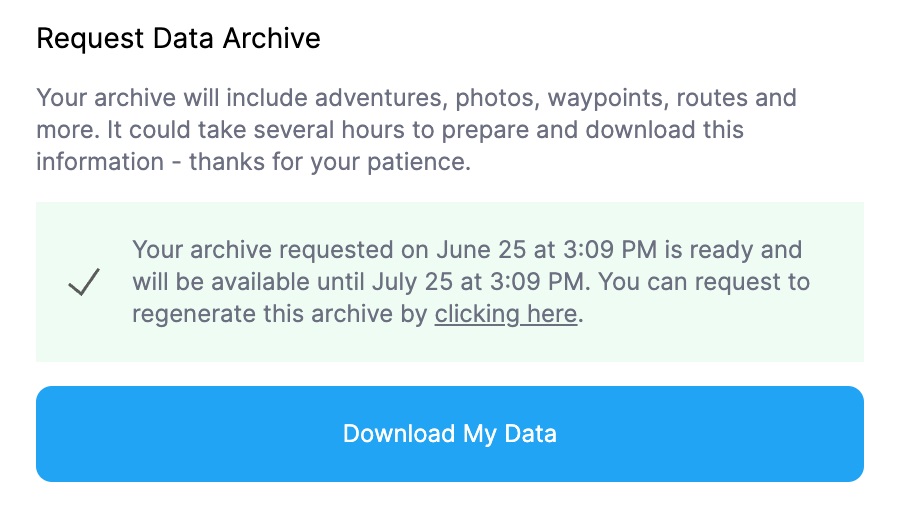
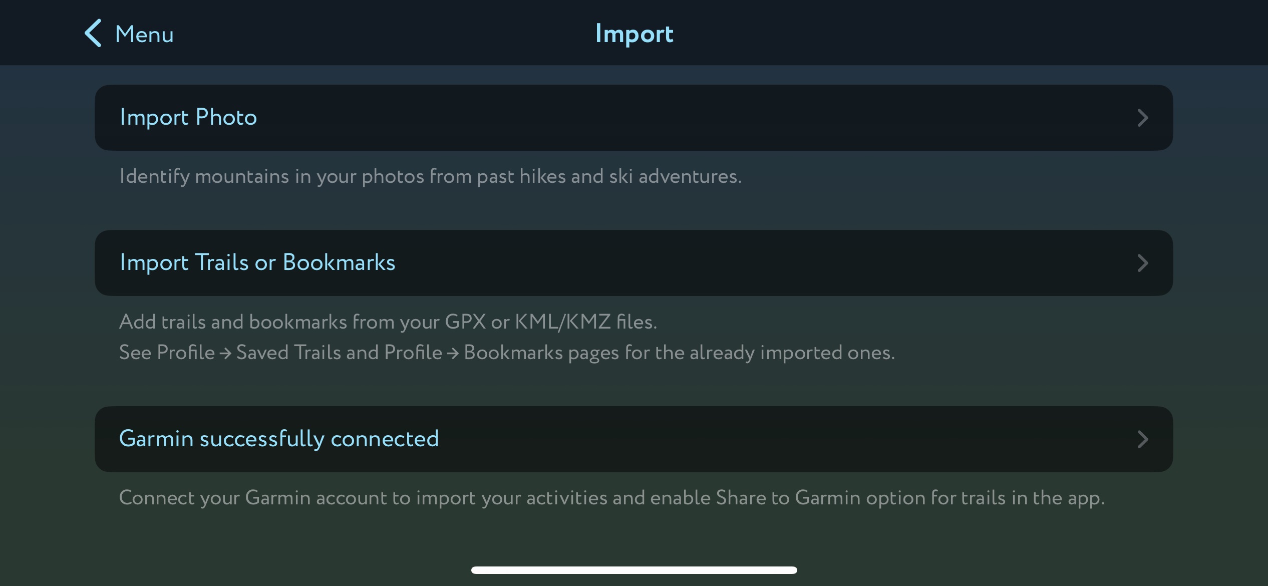
Your data will download as a zip file. Unpack the file and find the folder titled “activities.” These are in .gpx format, which you can then import to the PeakVisor app using the “Import” tab on the Menu page. Next, tap on the “Import Trails or Bookmarks” tab. Find the folder with your files, tap on one of them, then press “Select All” and “Open.” Your entire FATMAP (or Strava) database will now be on PeakVisor.
Users who still have questions about migrating their data can contact info@peakvisor.com to discuss the issue directly with our team of developers.
The Artist vs. the Factory
PeakVisor has a lot of respect for both FATMAP and Strava. These are both worthy competitors, and competition is what drives innovation in the space. However, the PeakVisor team is proud of having made an impact, amassing hundreds of thousands of subscribers, while maintaining their rank as a homegrown software studio. PeakVisor is the artiste continually fine-tuning their creation, while Strava is a factory with an assembly line.
FATMAP was already the product of $26 million of American seed funding. Strava has been floated by several VC funding rounds, the latest of which was a $110 million Series F led by Sequoia Capital.
Michael Horvath and Mark Gainey founded Strava with a desire to bring healthy competition into their training:
“My business partner and I wanted to recreate that feeling of being on a team even though we couldn’t physically train with our friends anymore. The impetus was trying to recreate that feeling of training with your friends to motivate you to new heights.” Outside Online
Indeed, Strava is a business idea that changed the game. Alas, there is something lost when Strava can buy out the competition and force users to purchase its expensive pro subscription. The garage start-up spirit of tinkering is replaced with the spirit of filling shareholders’ pockets and is indifferent to the user experience, so long as it generates more profits. We have to ask: can an app with everything from canoeing to indoor pilates workouts to roller skating—as well as a single social feed—satisfy the needs of all outdoor enthusiasts? At PeakVisor, we feel that Strava might not fulfill the needs of hikers and skiers because of this broad approach.
Backcountry ski enthusiasts, particularly those planning their own or following more complex routes, have expressed disappointment with the loss of FATMAP. Strava has claimed that it will incorporate FATMAP features into the Strava app. Still, it already acknowledges that you won’t be able to use the mapping features (as well as many other features) without the subscription ($50-80/year, depending on your country).
We’re a small company, and we don’t have to worry about corporate profit margins. That’s why we work day in and day out to make PeakVisor the ultimate adventure planning app.