
Topographic maps for hiking and skiing in the mountains have to be 3D. Realistic terrain modelling allows faster and easier understanding of the landscape, its complexities and pitfalls for a wider range of outdoor enthusiasts.
Our very first release of 3D maps happened merely a year ago at the end of 2018. Little did we know back then that it would take a year to adapt our technology for Android devices. Fragmentation of devices is the biggest challenge here, with performance and capabilities varying massively. What else could one expect from phones ranging from $100 to $1.500?! But today we are proud to present PeakVisor 3D maps available on the world's most popular mobile platform!
At the core, PeakVisor uses a high-precision Digital Elevation Model (1 arc-second DEM, ~30m grid) for landscape rendering. When you look at the mountains through PeakVisor camera this model is used to overlay the picture with mountain silhouettes and create the Augmented Reality experience, a total first-person view. The same data can be presented as a 3D map, in fact, the only difference is the point of view, which gives you a more distanced panorama.
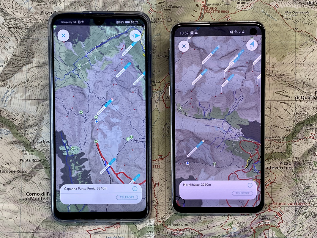
Android 3D maps are available all over the world now and they work offline just as other PeakVisor features. All you need is to have the maps of a particular region downloaded on your phone. Tap on the 3D button in the top right corner and a small compass in the bottom will unveil itself on the full screen.
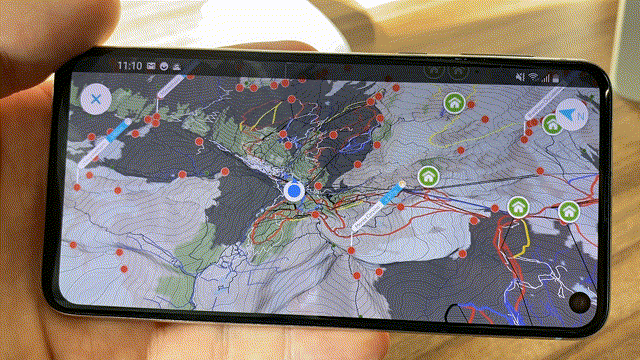
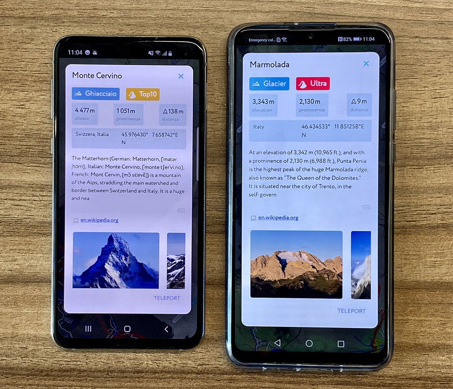
3D Maps are interactive, you can tap on any geographical feature to see the details, hop on a peak, step into a mountain hut, or visit a castle. There are other important points of interest as well: viewpoints and parking lots. This way we make sure you have a convenient start and don’t miss any vista along the way.
Taking into account the limited resources on a mobile phone, the app loads only the area in the radius of 40km (~25 miles) with high quality, farther 100km (~60 miles) are loaded in lower quality so you could still see mountains in the distance. In order to load a particular area in a high-precision 3D map, just teleport there. Isn’t that awesome to teleport stepwise between mountain tops and mountain huts to explore your next epic adventure?
This is the first public version of the feature. There’s a long road ahead. Here are just a few next steps which you can expect from the app over the course of the next 3 months:
- A winter style map
- Enriched satellite imagery
- Offline hiking trail routing
You can download PeakVisor 3D Maps from Google Play here or simply search for PeakVisor on your phone. We would like to hear your thoughts about this feature, any feedback would be highly appreciated.
Here's a loose web demo of 3D terrain model (there are much more details in the mobile app). The ultra-prominent Grigna, Italy.