Scan the QR code and open PeakVisor on your phone
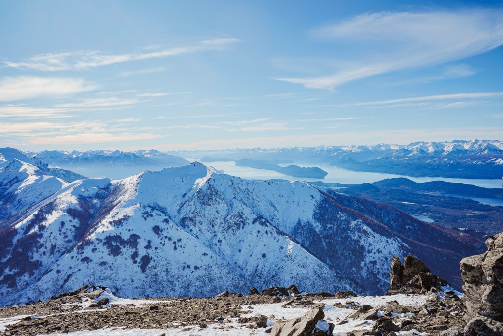
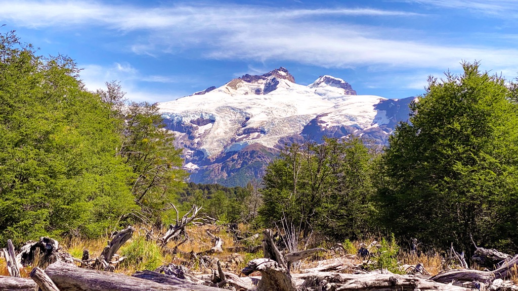
Rio Negro is one of Argentina’s twenty-three provinces, occupying the northern Patagonia region. The province spans across Argentina, from the heights of the Andes to the Atlantic Ocean. Of the nearly 31 named peaks in Rio Negro, Cerro Tronador (3,478 m/11,411 ft), an extinct stratovolcano, is the tallest and most prominent.
Located in the northern Patagonia region of south-central Argentina, Rio Negro is one of the country’s twenty-three provinces. Rio Negro borders Chile to the west and the Atlantic Ocean to the east. Neighboring provinces include Chubut, Neuquén, Mendoza, La Pampa, and Buenos Aires.
Rio Negro is part of a geographical area called the Argentine Patagonia, one of four regions for economic and social development in Argentina. Patagonia extends from southern Mendoza and La Pampa to the southernmost tip of Argentina. Climbers worldwide trek through Patagonia to summit some of the planet’s most spectacular mountainscapes.
There are nearly 600 named peaks in Rio Negro, of which Cerro Tronador is the tallest. Cerro Tronador is an extinct stratovolcano that sits 3,478 m (11,411 ft) above sea level and has a prominence of 2,648 m (8,688 ft). Its peak forms part of the border with Chile.
The province's namesake, the Rio Negro, is the main river in Patagonia, originating at the junction of the Limay and Neuquén Rivers. The Rio Negro flows to the Atlantic, and the provincial capital of Viedma is near the river’s outlet with the ocean.
The Limay River flows from the Andes and along much of the northwestern border of Rio Negro, separating it from the province of Neuquén. Rio Negro’s northern border with La Pampa is delineated by the Colorado River.
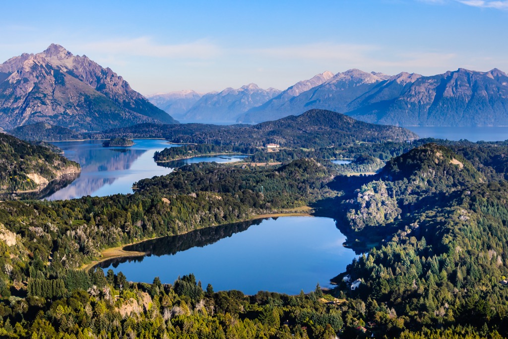
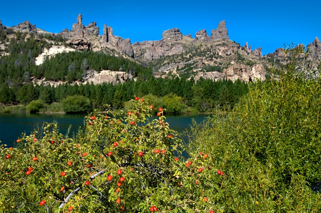
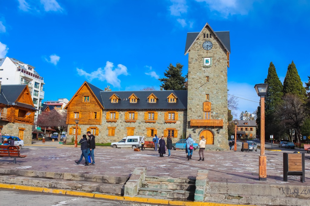
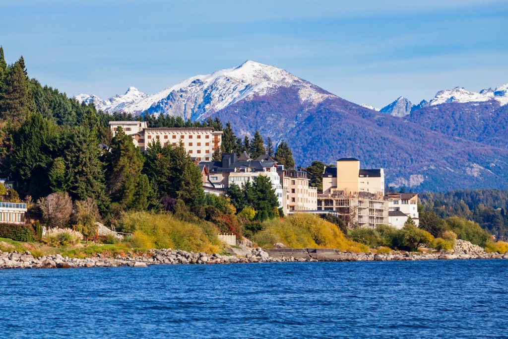
Rio Negro is the fourth largest province in Argentina; however, it has a population of less than 700,000. San Carlos de Bariloche (Bariloche) is the largest and most populous city, located in the foothills of the Andes on the southern shores of Nahuel Huapi Lake in Nahuel Huapi National Park.
Nahuel Huapi National Park is the only federally administered park in Rio Negro; however, there are many provincially managed parks. The protected areas in Rio Negro help preserve delicate landscapes and rare ecosystems and create wilderness recreational areas within the province. The following are some of the parks and protected areas in Rio Negro:
Rio Negro encompasses over 200,000 square kilometers (77,000 square miles) from the Andes Mountains to the Atlantic Ocean. The province contains many incredible geological features, from awe-inspiring canyons to volcanic fields, offering a glimpse of the geological processes that have shaped our planet for millions of years.
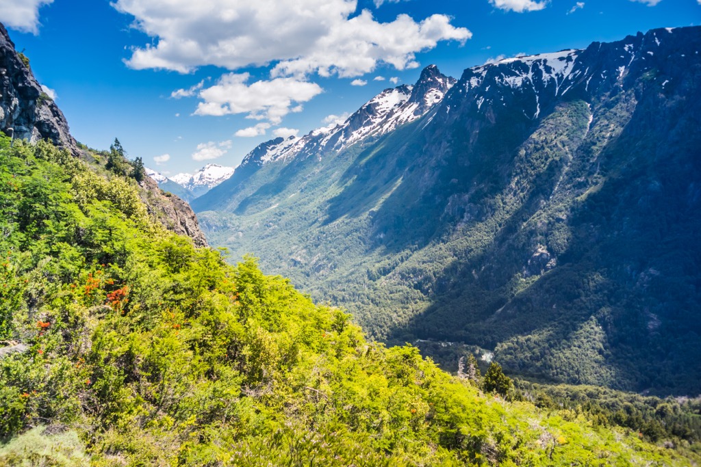
The most prominent feature of Rio Negro is the Andes Mountains along the Argentina-Chile border. These towering peaks result from the region’s most recent geological processes.
The Andes, including the famous Tronador, are composed of various rock types, such as granite, gneiss, and schist, each relating to the different processes that formed the mountain range. While the geological processes that formed the Andes have been ongoing for hundreds of millions of years, their primary formation has occurred since the Jurassic with the subduction of tectonic plates.
As oceanic tectonic plates subduct beneath continental plates, deformation and uplift of rock layers and volcanic activity occur along the subduction zone. Mount Tronador is one of many volcanoes found in the Andes, which formed as lava flowed through weaknesses in the Earth’s crust caused by subduction.
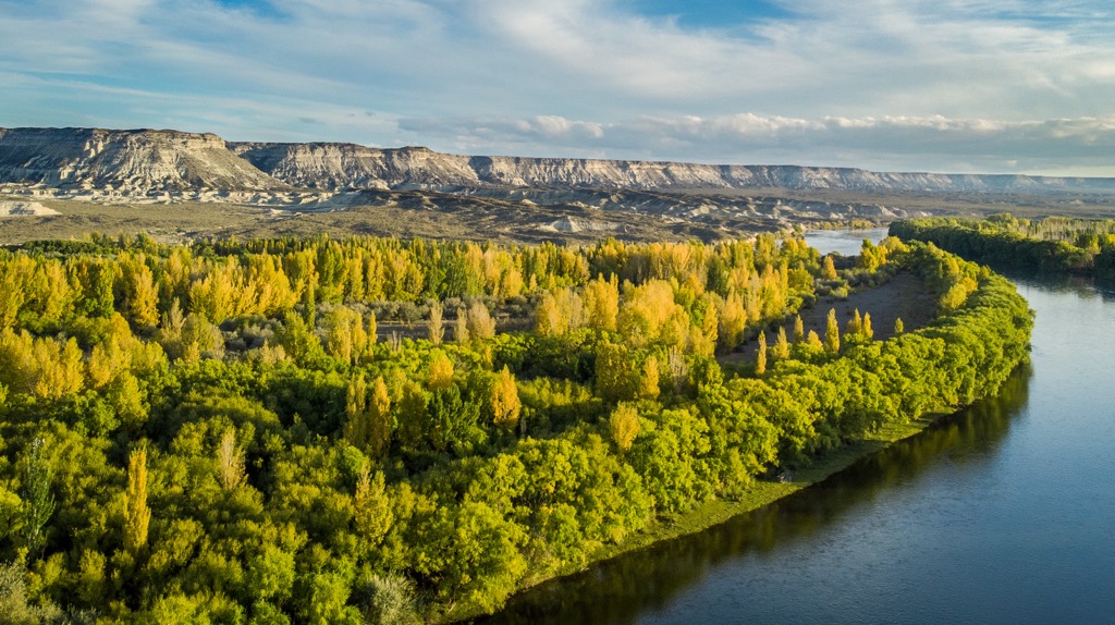
East of the Andes is the Patagonian Steppe, a vast plateau filled with mesas, buttes, and canyons. These rock formations across the steppe result from water and wind erosion for thousands of years. The region’s intermittent and heavy rainfall has proven to be particularly erosive, as large amounts of precipitation fall quickly, washing across the otherwise dry landscape.
The erosion of the steppe has also revealed the presence of fossils in Rio Negro. Ancient marine life, such as marine reptiles, ammonites, and bivalves, have been discovered in the province as well as the fossils of many dinosaurs, such as the Giganotosaurus, one of the largest carnivorous dinosaurs.
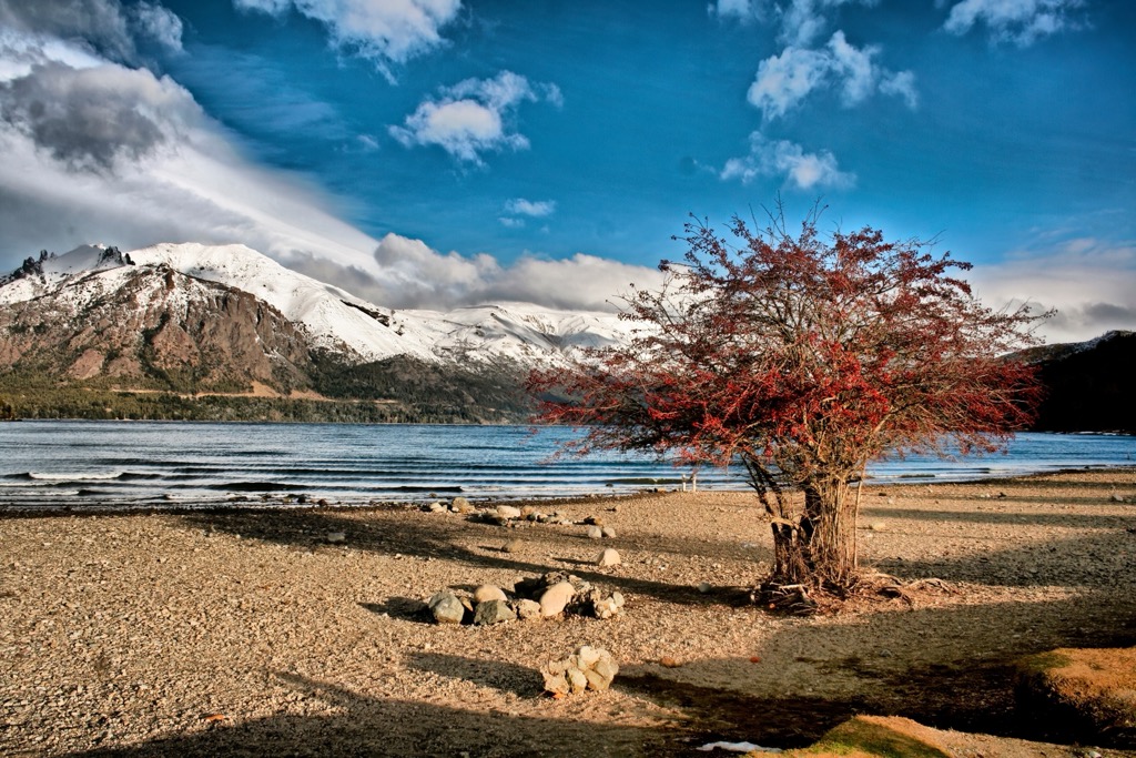
Plate tectonics have been acting upon the region for hundreds of millions of years. Ancient mountains have formed and subsequently eroded in the east, while the mountain formation continues with the Andes in the west. Erosion from glaciers, running water, wind, and rain continues to shape the province’s topography.
Rio Negro is one of the most ecologically diverse provinces in Argentina since it spans the width of the country, from the Andes to the Atlantic. As such, the remarkable diversity of flora and fauna makes it a significant hotspot for ecological studies.
The province encompasses a variety of ecosystems, including dense forests, expansive grasslands, wetlands, and high-altitude habitats. Each ecosystem supports a unique array of plant and animal species, contributing to the overall biodiversity and beauty of the region.
The province features temperate and subantarctic forests characterized by coihue, lenga, ñire, and cypress trees. The forests provide habitat for many bird species, mammals, and invertebrates.
Extensive grasslands cover the Patagonian steppe, where sparse vegetation covers the dramatic topography. Animals such as guanacos, rheas, and numerous bird species adapted to open habitats thrive across the plateaus.
The rivers and wetlands of Rio Negro are the province's lifeblood, and the most populated areas are along the rivers. Along with various aquatic plants, waterfowl, and amphibians that inhabit the waters of Rio Negro, are the many fish species that entice anglers, such as trout and salmon.
The high reaches of the Andes require adaptations for plants and animals to thrive in harsh conditions. Species like the llareta and cushion plants have adapted to the harsh climate. Senecio patagonicus, a succulent, has evolved to store water in its fleshy leaves.
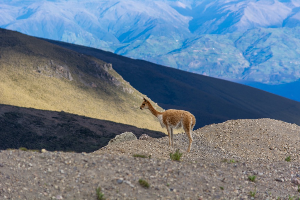
Animals like the Andean condor, vicuña, and huemul have adapted to high altitudes. The condors, with a wingspan of up to 3 m (10 ft), are important regional scavengers. Huemul is an endangered deer species in the southern Andes.
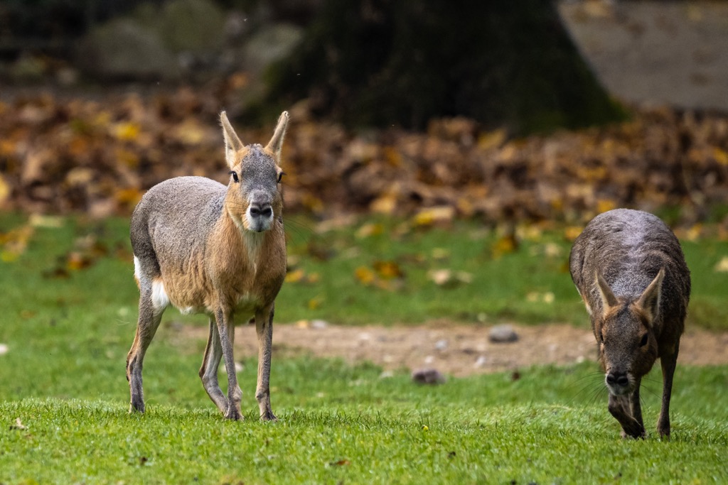
Along with the huemel, the southern river otter, also known as the huillín, is endangered in Rio Negro, as are the Andean cat and the hooded grebe. Some of the endemic species to the region are the Patagonian mara, a large herbivorous rodent, and the Patagonian peregrine falcon, a bird of prey.
Near Bariloche, the El Trébol archeological site has evidence of human habitation dating back about 10,500 years. The site is a cave-like rock shelter where ancient people left rock art and the remains of the ancient megafauna they had hunted.
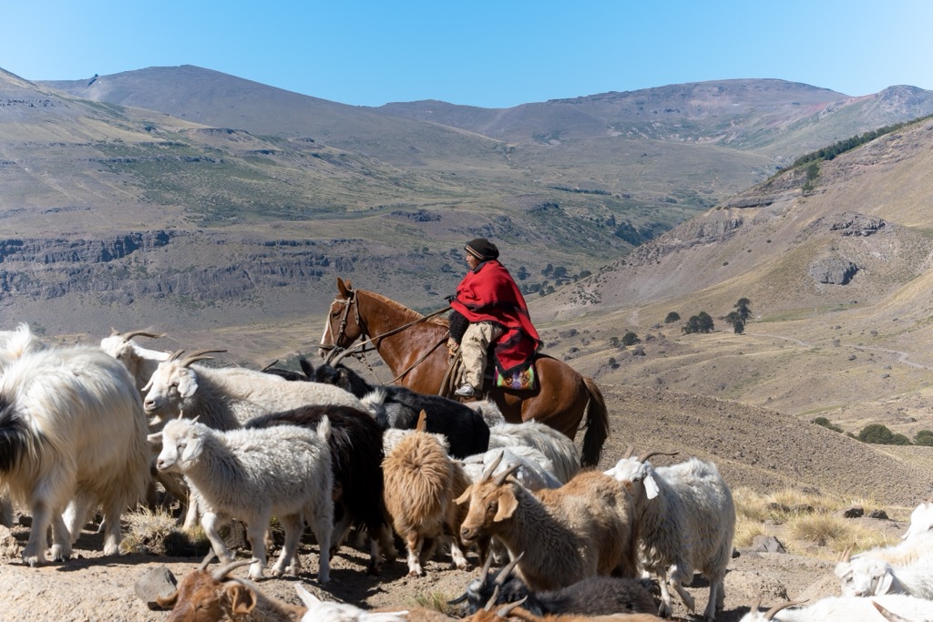
For thousands of years, indigenous groups inhabited the mountains, valleys, plateaus, and canyons of Rio Negro. They were typically hunting and gathering societies that lived a nomadic lifestyle while maintaining central villages according to the season. Indigenous people developed unique cultural identities and established intricate social structures to survive.
By the time Europeans arrived in the area of Rio Negro, the Rankülche, gününa küne, and Mapuches occupied the province. The Mapuche people were particularly influential in the region, making alliances and intermarrying with the other groups in a process called Mapuchinization.
The Mapuches, who originated in Chile, spread across the Andes during the eighteenth century in response to the colonization of Chile; however, they had been trading across the Andes since at least the seventeenth century. The Mapuches assimilated the existing tribes of Argentina into their own culture, whether by peace or violence.
In particular, the local Tehuelche people adopted many Mapuche customs, such as language, customs, and clothing. However, as part of the cultural exchange, the Mapuche in Argentina adopted the Tehuelche nomadic lifestyle, which would become important later for the survival of their culture.
From the sixteenth century onwards, conquistadores such as Francisco de Viedma and Juan de la Piedra expanded colonialism into the region. As colonial expansion took hold, the indigenous populations were subjugated and marginalized.
Colonial governments established Rio Negro as an Argentine territory, spurring waves of European immigrants. Encouraged by fertile lands, especially in the valleys where fruit orchards and vineyards would be productive, large groups of immigrants arrived in the province.
Many of the immigrants to Argentina were of Spanish and Italian ancestry. These people brought their customs, traditions, skills, and agricultural knowledge to the new world, shaping the province's future. The remaining indigenous also influenced the cultural tapestry of the province and the country. Like the cultural exchange between the Mapuche and the Tehuelche, the new immigrants began adopting parts of the indigenous cultures and vice versa.
The cultural exchange between the indigenous and European immigrants is especially prevalent in the livestock industry. As the indigenous groups were marginalized, many took to ranching to survive. The indigenous tradition of moving livestock between the high-elevation meadows in the summer and the valleys in the winter still thrives.
It was only in 1955 that the territory of Rio Negro was eventually sanctioned as a province of the Republic of Argentina. The incorporation took place nearly 300 years after Father Nicolás Mascardi established the Nahuel Huapi Mission on the shores of that lake and 175 years after Francisco de Viedma had established the capital city of Mercedes de Patagones, later renamed Viedma. By this time, the province had already created a rich cultural heritage that included some of the indigenous traditions mixed with those of the settlers.
There are many incredible wilderness areas in Rio Negro that showcase the diverse landscape, including mountains, lakes, forests, rivers, and coastlines. Whether you are looking for adventure, tranquility, or wildlife encounters, there are some spectacular places in Rio Negro to visit. The following are some of the province's major parks and wilderness areas.
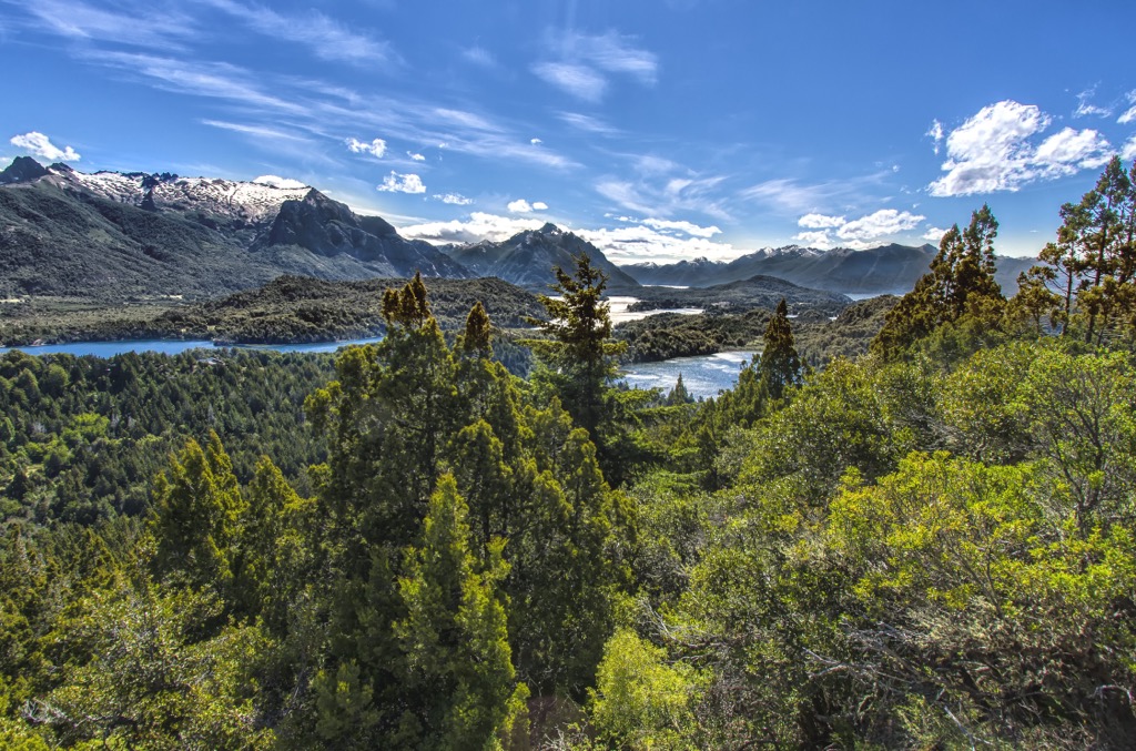
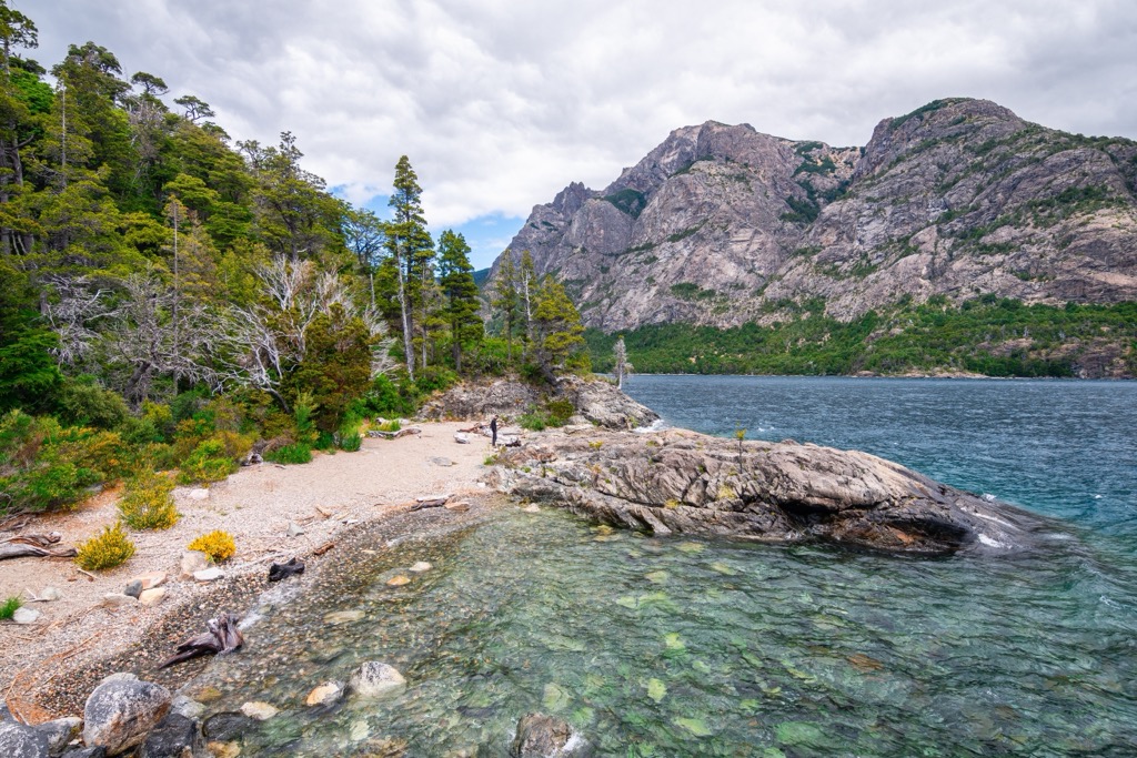
Renowned for its breathtaking landscapes, Nahuel Huapi National Park is the oldest national park in Argentina. Located in the Andean region, in the west of Rio Negro, the park encompasses pristine forests, towering mountains, and shimmering lakes.
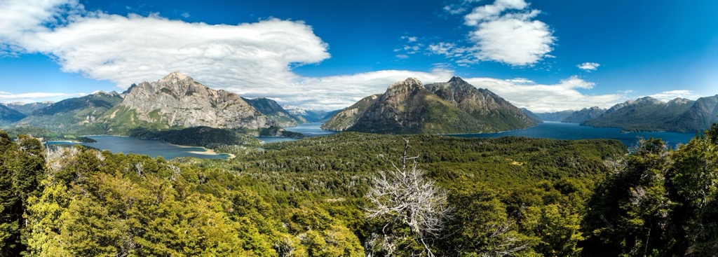
While visiting the park, there are many activities, including hiking, paddling, boating, fishing, rock climbing, mountaineering, skiing, rafting, mountain biking, and golf. Some incredible trekking routes in the park have accommodation facilities along the way. Over 500 km of roads and trails lead to various destinations, such as Mount Tronador, Cerro López, and the Challuaco Valley.
Two popular trails are the Cerro Catedral Trail and the Frey Refuge Trail. The Cerro Catedral Trail is a challenging yet rewarding trek to the summit of Cerro Catedral, where hikers can enjoy panoramic views of the surrounding peaks, lakes, and valleys.
A more moderate hike is the Frey Refuge Trail which leads to the mountain refuge nestled in a glacial cirque surrounded by jagged granite peaks. Along the trail, hikers will pass through dense forests and cross crystal-clear streams, all with stunning views of Nahuel Huapi Lake.
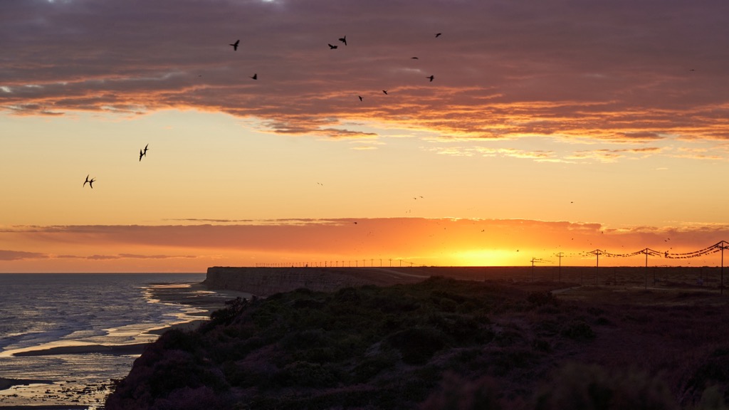
The San Antonio Bay Protected Natural Area was established in 1993 to protect and conserve the area for the feeding, rest, and reproduction of resident and migratory birds. The area is vital to the migration of several species of shorebirds and is internationally renowned as a birdwatchers’ paradise.
The main trail in the natural area is about 3 km (1.8 mi) long and leads to Punta Perdices. Along the way, visitors can spot the reddish sandpiper, double-collared plover, seagull cook, South American tern, or the common oystercatcher.
Río Azul-Lago Escondido Natural Protected Area is in the southwest of the province, near the community of El Bolsón. The area is known for its dense Andean forests, stunning mountains, and beautiful lakes and rivers.
Hiking and horseback riding are the most popular ways to explore the area. Refugios throughout the natural area are popular destinations for hikers; the best refugios include Hielo Azul, El Retamal, Cajón del Azul, and Los Laguitos.
The Somuncurá Plateau Protected Natural Area is in the south-central region of Rio Negro. The wild landscapes of the steppe stand in contrast to the nearby Andes; however, visitors will enjoy stunning vistas, viewing fossils and cave paintings, and a diversity of wildlife.
The erosion of ancient basaltic lava flows created the plateau, and it is now home to several endemic species, such as subspecies of the Patagonian armadillo and the Somnucurá frog.
The remote park is only accessible with a 4x4 vehicle, and a tour from a nearby community is the most common way to explore. Tours can last from a few hours to several days, and the guides are integral to helping visitors understand the history and unique traits of the area.
Rio Negro is one of Argentina’s least populated provinces and Bariloche and Viedma are the two largest cities.
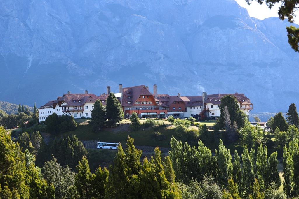
Located in the heart of the Argentine Patagonia, Bariloche is known for its natural beauty and outdoor activities. The city is surrounded by the snow-capped peaks of the Andes and nestled alongside the pristine Nahuel Huapi Lake.
The extensive network of trails around Bariloche is one of the city's main draws. The region boasts lush forests, alpine meadows, rugged mountains and glacial valleys, and hiking trails suitable for all skill levels.
Among the popular hikes around Bariloche are the Cerro Campanario Trail and the Refugio Frey Trail. The adjacent Nahuel Huapi Lake also provides kayaking, stand-up paddleboarding, and sailing opportunities. The rivers and streams are ideal for fly fishing, with the chance to catch trout and salmon.
Bariloche looks surprisingly European during the winter as its German and Swiss-styled buildings transform into a winter wonderland. The nearby Cerro Catedral Ski Resort offers world-class skiing and snowboarding.
Located along the banks of the Rio Negro, Viedma, the capital of Rio Negro, is one of the oldest European settlements in Patagonia. It is the gateway to the Patagonian Steppe, surrounded by an incredible wilderness of rolling hills and rugged mountains.
Hiking across the steppe offers vast expanses of untouched wilderness and opportunities to admire the unique flora and fauna, such as guanacos, rheas, armadillos, and the colorful wildflowers that bloom in the summer.
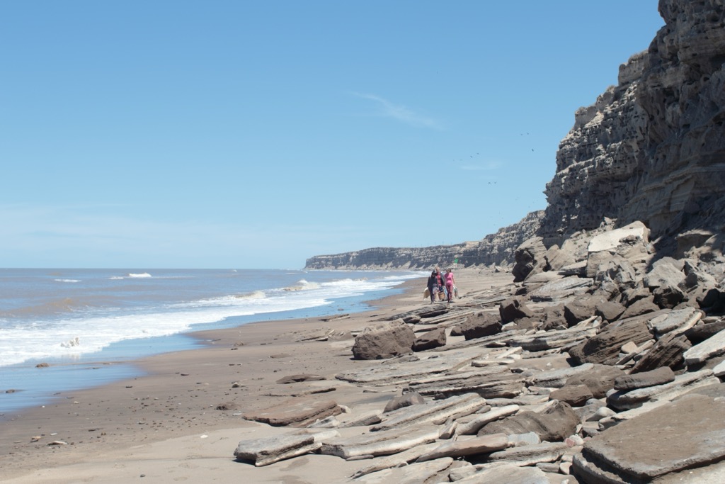
Other activities in the city include touring the old town of Carmen de Patgones or visiting the fabulous beach at El Cóndor. There are tours from the city to explore other parts of the province, or visitors can enjoy the nearby waters of the Atlantic Ocean for paddling, swimming, and SCUBA diving.