
Scan the QR code and open PeakVisor on your phone
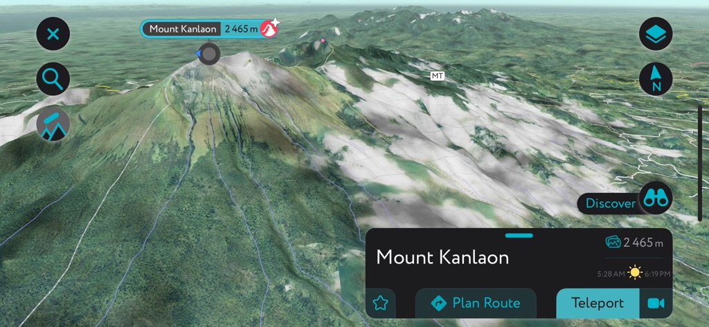
Nicknamed the "Sugarbowl of the Philippines," Negros Occidental (Nakatungdang Negros / Kanlurang Negros) offers countless sweet adventures, with sublime volcanoes, dense rainforests, and pristine beaches to discover. There are 41 named mountains in Negros Occidental. The highest and most prominent mountain is Mount Kanlaon (2,465 m / 8,087 ft).
Negros Occidental is a province of the Philippines encompassing the northwest half of Negros Island. The island forms part of the Visayas, the central region of the Philippines archipelago.
It's the fourth-largest island in the Philippines, covering an area of approximately 13,309 square kilometers (5,139 square miles). Negros Occidental is marginally larger than neighboring Negros Oriental, with an area of 7,802 sq km (3,012 sq mi). Negros Occidental is also the fourth-most populated province in the Philippines, with a population of 2,623,172.
Negros Occidental's 644 km (400 mi) of coastline borders the Visayan Sea to the north, the Panay Gulf to the west, and the Sulu Sea to the southwest. The Guimaras Strait separates Negros Occidental from the islands of Guimaras and Panay. On the east coast, the Tañon Strait lies between Negros and Cebu.
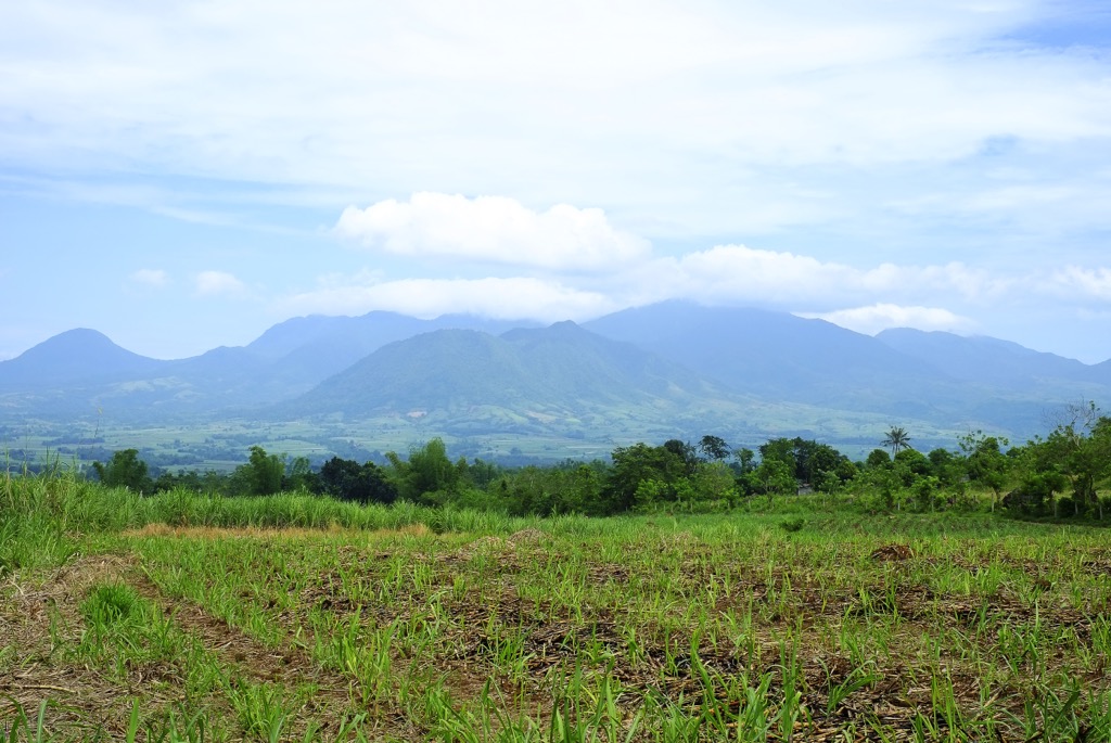
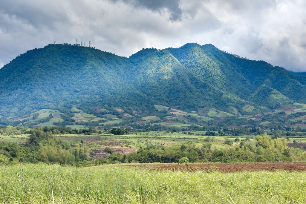
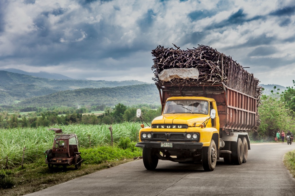
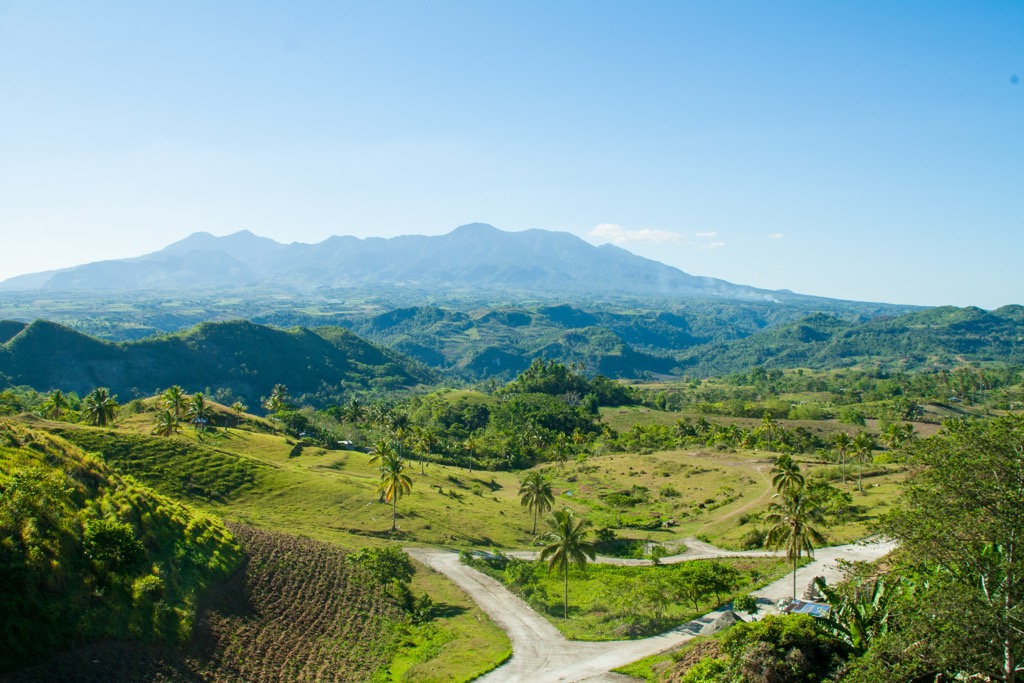
The entirety of Negros Island is volcanic, with its landscape featuring active and dormant volcanoes, calderas, and hot springs, notably in Mambukal near Bacolod. Negros Occidental's volcanic soil makes it ideal for farming — it's the Philippines' largest sugar producer, with 5,403 square kilometers (2,806 square miles) of farmable land.
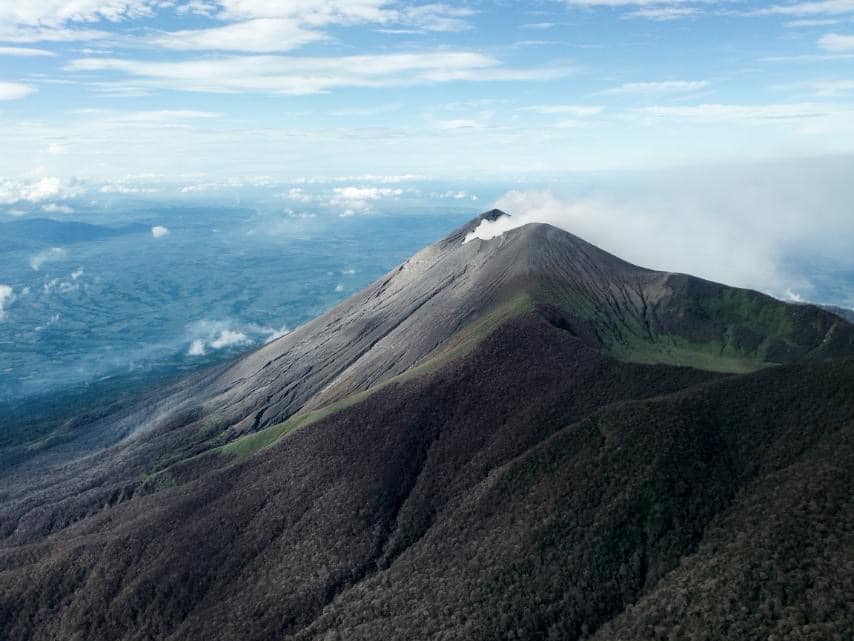
The highest mountain in the Visayas and one of the Philippines' most active volcanoes, Mount Kanlaon, sits on the border between Nergos Occidental and Negros Oriental in the north of Nergos Island.
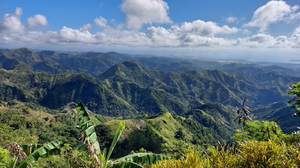
Northern Negros Natural Park — the largest protected area on Negros Island — covers 804.5 sq km (310 sq mi) of forested highlands in north-central Negros Island. Negros Island's third-highest peak, Mount Mandalagan (1,885 m / 6,184 ft), is located at the heart of the park.
As the Philippines' biggest sugar producer, Negros Occidental is heavily invested in agriculture, with 80% of all arable land used for farming. The landscape of southern Negros Occidental is predominantly flat and largely agricultural.
Negros Occidental's largest city, Bacolod, is on its northwestern coastline, roughly 25 km (15.5 mi) from Northern Negros Natural Park. Other large settlements include Cadiz, Kabankalan, and Silay.
Negros Island is formed primarily from sedimentary and volcanic rocks dating back between the Cretaceous (143 to 66 million years ago) and Pleistocene (2.5 million to 11,700 years ago).
Volcanic rocks, like andesites and dacites, are among the oldest rocks on Negros Island. The primary sedimentary rocks on Negros Island are limestone, conglomerate, shale, and sandstone. The oldest sedimentary rocks on the island are basalt from the Basak Formation, which dates back to the Late Cretaceous.
Negros Occidental forms part of the Nergos Arc, a tectonic arc chain of islands formed by the subsuction of the Sulu Sea. This subduction resulted in magmatism, with magma rising to the surface to create stratovolcanoes such as Mount Kanlaon, Mount Mandalagan, and Mount Silay. Mount Talinis (1,903 m / 6,243 ft) in Negros Oriental is also part of the Negros Arc.
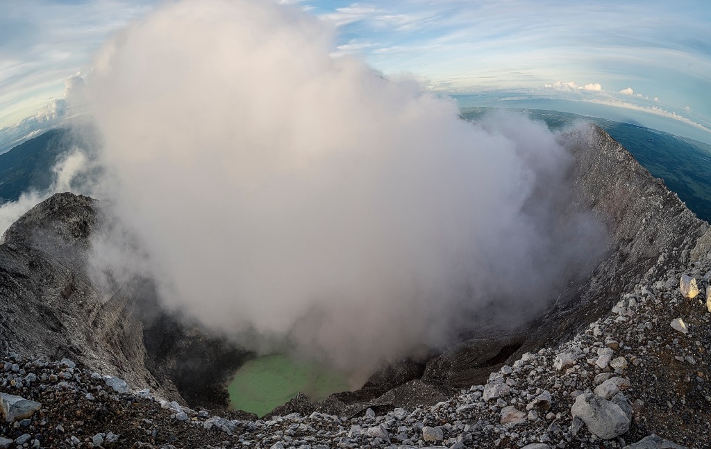
Negros Occidental is among the Philippines' most volcanically active provinces. Mount Kanlaon has erupted 40 times since 1819 and has been especially active in 2024 and 2025, with at least four eruptions, the most recent of which was on May 13, 2025. It's matched in activity only by the likes of Taal (289 m / 948 ft) and Mayon (2,462 m / 8,077 ft).
With its high levels of endemicity, Negros Occidental is a haven for nature watchers, featuring many vibrant birds and unique mammals not found anywhere else on Earth.
There are around 55 mammal species on Negros Island, several of which are endemic to Negros and neighboring Panay.
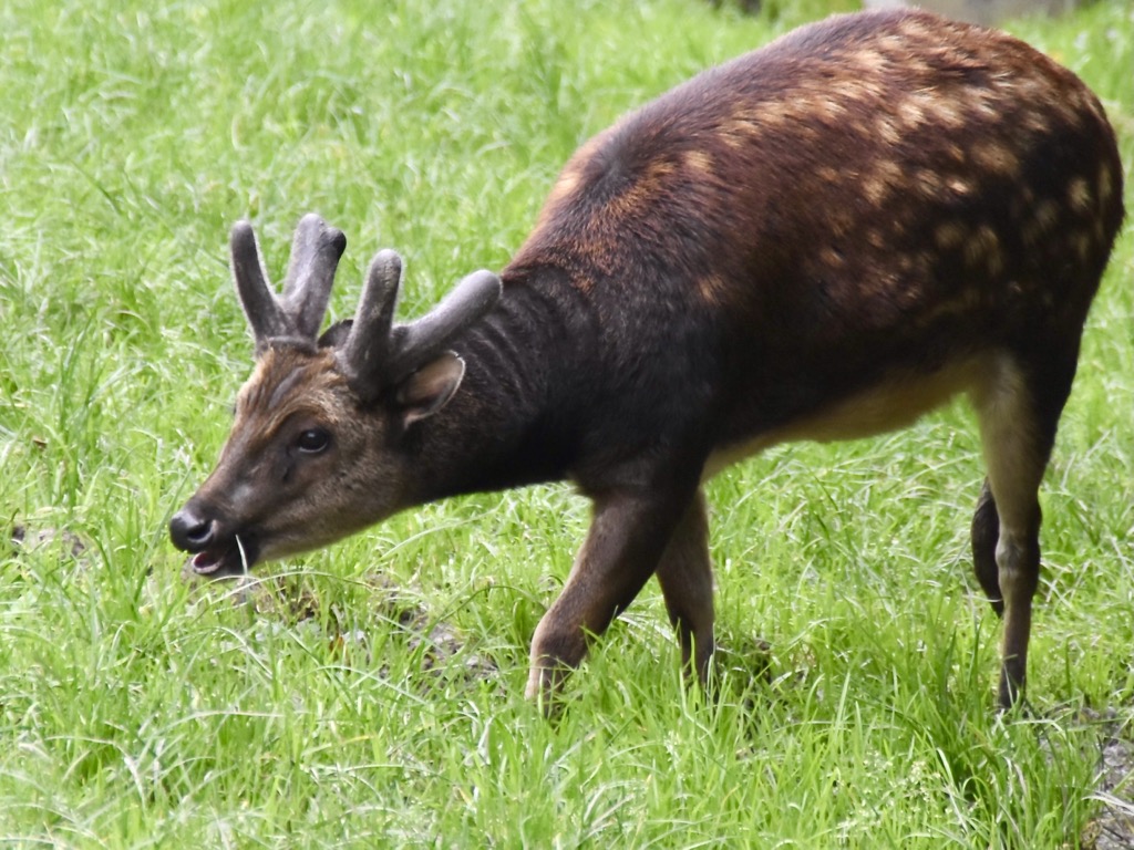
The largest mammal on Negros Island, aside from humans, is the Visayan spotted deer, which can weigh between 40 kg (88 lbs) and 60 kg (132 lbs). Humans are its main predators, with its natural predators, like leopards and sloth bears, no longer present on Negros Island.
Other notable mammals in Negros Occidental include endangered species like Visayan warty pigs, Philippine naked-backed fruit bats, giant golden-crowned flying fox, and Negros shrews. Long-tailed macaques are the only monkey species found in the Philippines, and are common in Negros Occidental.
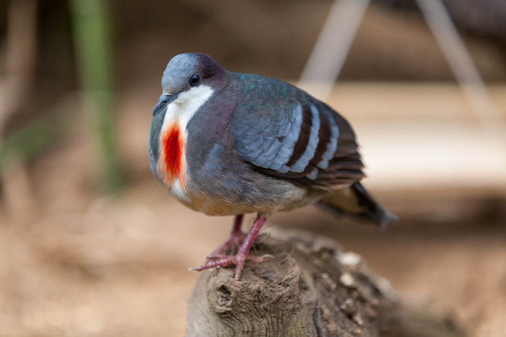
Negros Island is home to nearly 300 bird species, many of which are endemic and critically endangered. It's unclear if some species are extinct or not. The Negros fruit dove, for example, hasn't been seen since 1954. Other endemic or endangered bird species in Negros Occidental include bleeding-heart doves, Visayan flowerpeckers, Visayan hornbills, Negros scops owls, Negros striped babblers, and Pinsker's hawk-eagles.
Several venomous snake species inhabit Negros Occidental, including Philippine pit vipers, king cobras, Philippine cobras, and Samar cobras. Samar cobras are a type of spitting cobra, considered the most dangerous in Negros Occidental due to their nervous nature.
While Negros Island has a wealth of spider species — including tarantulas like the Philippine orange tarantula — none have venom that's life-threatening to humans.
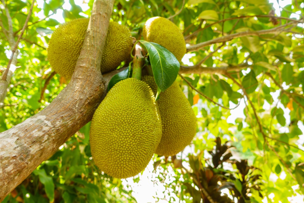
Negros Occidental is relatively heavily forested — around 29% of the province's landscape is natural woodlands. Common trees in Negros Occidental include fruit-bearing trees such as guavas, mangos, jackfruits, rambutans, and papayas.
There's only one remaining lowland forest in Negros Occidental, which is part of the Northern Negros Natural Park. Several hardwood Dipterocarpaceae species grow in these lowland rainforests, including Philippine mahogany and vaticas.
Narra, also known as amboyna wood, is the national tree of the Philippines and is found on Negros Island. Narra is endangered and no longer grows in Vietnam or areas of Malaysia and Sri Lanka.
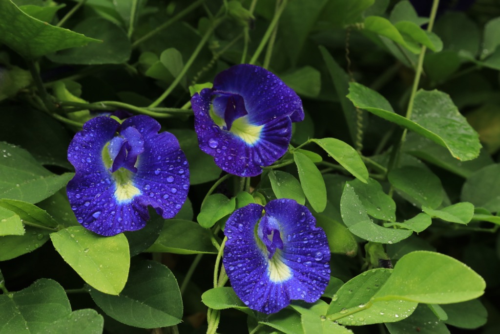
Hundreds of plant species showcase their vibrant colors across Negros Island each year. Common wildflowers in Negros Occidental include garden crotons, butterfly peas, sensitive plants, and Nepenthes negros pitcher plants.
There are no records documenting the first ascents of Negros Occidental's highest summits, including Mount Kanlaon and Mount Mandalagan. Locals have likely been scaling these peaks for centuries despite their difficulty.
Mount Kanlaon came to international attention on August 10, 1996, when it erupted without warning, killing three hikers: Filipinos Jamrain Tragico and Neil Perez and British Student Julian Green. This violent eruption sent a plume of steam and ash 1,500 m (4,921 ft) above the crater rim.
It's unclear exactly when hiking became popular in Negros Occidental; however, it became an increasingly popular area to visit with the rise of adventure tourism and hiking vacations in the early to mid-20th century.
During the American colonization of the Philippines from 1898 to 1946, numerous roads, bridges, and other infrastructure projects were built across Negros Island, making its more remote areas more accessible to hikers.
The establishment of the Mount Kanlaon Natural Park in 1934 and the Northern Negros Natural Park in 1935 helped protect and highlight the beauty of Negros Island's landscape and mountains. While hiking was popular on Mount Kanlaon in the 20th century, the first three marked trails weren't established until 2016 and 2017.
Today, Negros Occidental receives over 700,000 overnight visitors annually, many of whom hike on the highest peaks in the province.
Hiking Negros Occidental is generally considered safe, as long as you take proper precautions. You'll need to hire a local guide when climbing Negros Occidental's highest summits, including Mount Kanlaon.
Be sure to thoroughly research the trails before setting out, and consider hiking in a group to minimize potential hazards. Check weather forecasts, bring provisions, and inform others of your itinerary.
At PeakVisor, we love information. That’s why we write articles like this one.
Check out the PeakVisor app for even more information on thousands of hikes across the world. In fact, we’ve compiled information on all publicly maintained walking tracks worldwide, formatted onto our 3D maps.

PeakVisor started as a peak identification tool, but we’ve evolved into purveyors of the finest 3D maps available. We continue to expand our offerings. You can track your hikes directly on the app, upload pictures for other users, and keep a diary of all your outdoor adventures.
Most recently, the PeakVisor App has included up-to-date weather reports, including snow depths, at any destination. We've also been hard at work adding the details of hundreds of mountain huts, including information on overnight accommodation, dining options, and opening hours. You can also use our Hiking Map on your desktop to create .GPX files for routes to follow later on the app.
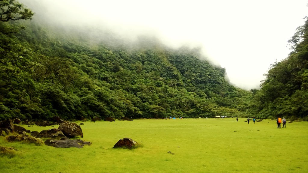
At the heart of Mount Kanlaon Natural Park is Mount Kanlaon (2,465 m / 8,087 ft), Negros Occidental's most popular hiking destination. It's located on the boundary between Western Visayas and Central Visayas, roughly a 100 km (62 mi) drive from Bacolod.
While popular, Mount Kanlaon is a challenging climb — it has a lengthy approach and a high prominence. It can take over 10 hours to reach the summit of Mount Kanlaon, with most hiking groups spending the night atop Makawiwili Peak.
It's illegal to climb Mount Kanlaon without a guide or a permit. You can purchase a permit from the DENR office in Bacolod City. It's best to arrange a guide and permit several weeks in advance of traveling to Mount Kanlaon. The best time to climb Mount Kanlaon is during the dry season from November to May.
The most popular route to Mount Kanlaon is on the Mapot Trail, which includes an overnight stay on Makawiwili Peak. The hike begins at Sitio Mapot, Barangay Maiba, Canlaon City, near Canlaon Inland Resort. From the summit, it's possible to see across the Visayas Sea to the surrounding islands. This out-and-back trail is approximately 16 km (10 mi) long.
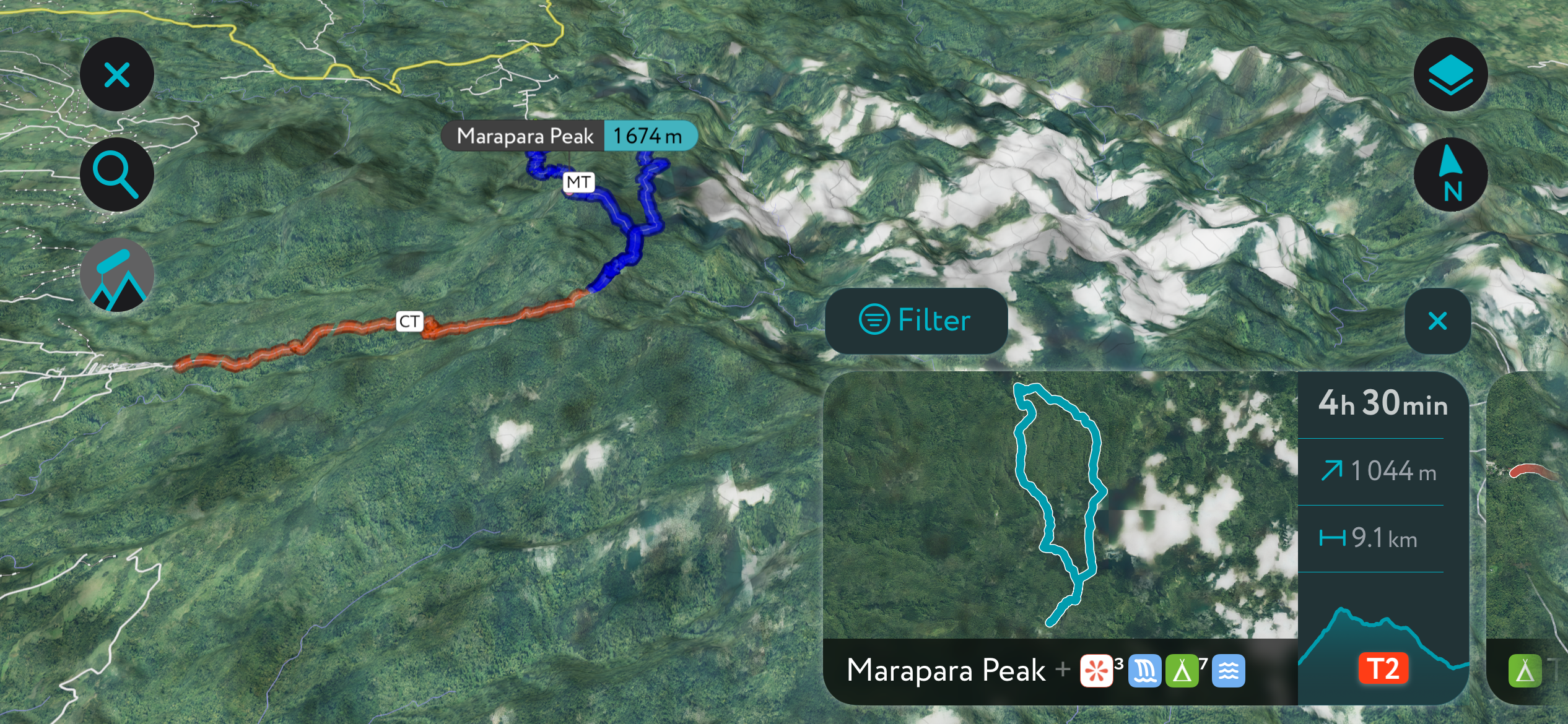
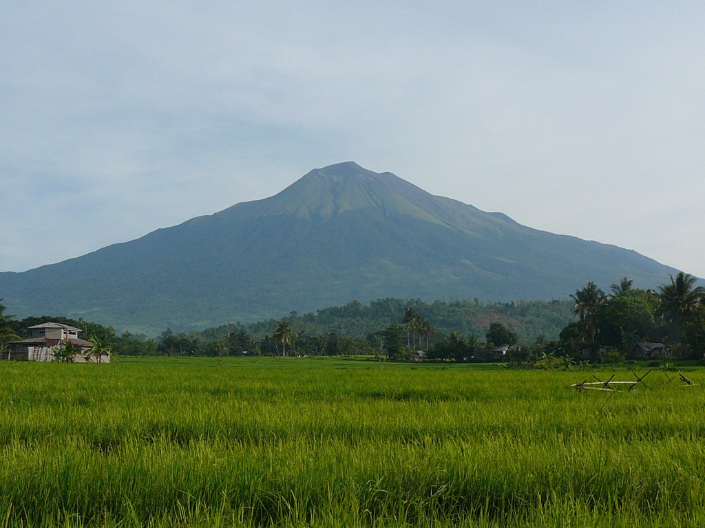
Mount Mandalagan (1,885 m / 6,184 ft) is Negros Occidental's second-highest standalone volcano. Listed as "potentially active" by the Philippine Institute of Volcanology and Seismology (PHIVOLCS), Mount Mandalagan has had no recent eruptions. It's easily accessible from Bacolod, located approximately 35 km (21 mi) to the west.
It's popular among hikers due to its location within the Northern Negros Natural Park, home to beautiful natural features, including the remarkable Tinagong Dagat caldera, a popular camping area while climbing Mount Mandalagan. It's also one of the best areas in Negros Occidental for nature watching, with as many as 140 bird species in the area.
Like Mount Kanlaon, you'll need a permit and a guide for your Mount Mandalagan hike. You can learn more information about the necessary permits and hiring a guide from the Silay City Tourism Office. It's best to make arrangements for permits and a guide several weeks in advance of traveling to Mount Mandalagan.
Mount Mandalagan is challenging to climb, but easier going than Mount Kanlaon. If you want to visit the Tinagong Dagat caldera on the way to Mount Mandalagan's summit, you'll need to follow the hiking trail from Campuestohan to the west.
Or, you can reach Mount Mandalagan's summit on the trail from near the Malatan-og Viewing Deck in Salvador Benedicto, to the south. This out-and-back trail is approximately 17.5 km (10.8 mi) long.
On the north side of Northern Negros Natural Park, around 15 km (9.3 mi) from Mount Mandalagan, is Mount Silay (1,535 m / 5,036 ft). A potentially active stratovolcano, Mount Silay is less popular than its neighbor to the south — ideal if you're looking for a quiet mountain hike away from crowds of climbers.
You'll need a permit and a guide to climb Mount Silay as it's part of the Northern Negros Natural Park. For more information, contact the Silay City Tourism Office. Work on getting permits and a guide several weeks in advance to avoid delays.
Mount Silay is lower in elevation than the likes of Mount Kanlaon, but it's still challenging due to its prominence and dense vegetation. One of the best ways to climb Mount Silay is on the paved trail from Barangay XI through the Gawahon Eco Park. After the initial paved section, the trail leads through rainforests.
From Gawahon Eco Park, this out-and-back trail to Mount Silay is approximately a 16 km (10 mi) round-trip.
Mayana Peak (786 m / 2,579 ft) is one of the best beginner mountains to climb in Negros Occidental. It's located in northeastern Negros Occidental within San Carlos City. Mayana Peak is an easy climb as there's a road - appropriately named the Road to Mayana Peak - which leads most of the way up the mountain.
Atop Mayana Peak is a café, Jilla's at the Peak, where you can enjoy a meal or drink with a view of the San Carlos City coastline and Slipway Island. You'll even be able to spot Mount Kanlaon from Mayana Peak — it's considered one of the best viewpoints in eastern Negros Occidental.
Like most hikes in Negros Occidental, a permit is required to climb Mayana Peak; at the end of the road to Mayana Peak is a permit office. It's possible to reach Mayana Peak on a bus from Bacolod City to San Carlos City.
The hike to Mayana Peak is a 2 km (1.2 mi) round-trip and only takes around 30 minutes to complete. You can extend your walk along the 2.5 km long Road to Mayana Peak, or you can hire a motorbike to take you to the trailhead.
Mount Malapantao (613 m / 2,011 ft) is one of the most challenging peaks to climb in southern Negros Occidental. Its modest elevation belies its difficulty, with its steep slopes making it best suited to experienced mountaineers. Mount Malapantao is located in Cauayan, around 7 km (4.3 mi) north of Candoni.
Mount Malapantao is often overlooked by travelers in favor of the mountains in the north of the province, making it a good choice for those who fancy a quiet hike. This route is quite long, so you may need to camp along the trail.
The hike typically begins at Cauayan Municipal Hall, located near the mouth of the Cauayan River. The trail initially follows a paved road through Abaca to Lumbia before going off-road. Mount Malapantao provides commanding views of Cauayan to the Panay Gulf. This Mount Malapantao hike is roughly 26 km (16 mi) out-and-back.
Negros Occidental is a popular tourist destination, with coastal cities filled with fun activities, friendly locals, and mouthwatering dining options.
Bacolod–Silay International Airport is the main airport on Negros Island, located 15 km from downtown Bacolod. It offers regular regional flights to Manila, Cebu, and Davao.
Bacolod is the capital and largest city of Negros Occidental, with a metropolitan population of over 1.4 million. It's the second-largest city in the Visayas after Cebu City. Bacolod is situated on the northwestern coastline of Negros Island, approximately 15 km (9.3 mi) from the Northern Negros Natural Park.
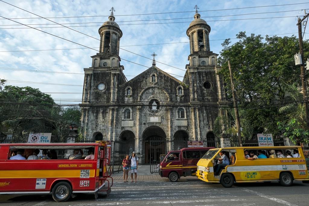
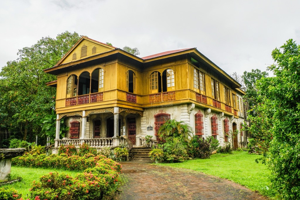
Heavily influenced by centuries of Spanish and American colonialism, Bacolod is architecturally diverse, featuring a range of styles from its Baroque San Sebastian Cathedral to its Greek Renaissance-inspired Bacolod City Government Center. It's famed for its delicious cuisine and friendly locals, earning it the nickname the "City of Smiles."
Bacolod is Negros Island's largest transport hub, with ferry and bus services connecting it to neighboring islands and inland communities, respectively.
Silay is one of the largest component cities in northern Negros Occidental, with a population of over 130,000. Nicknamed the "Paris of Negros," Silay is famed for its artistic community and European architecture.
Silay is home to Negros Island's largest airport and is conveniently located just north of Bacolod. It's among the best places to stay if you're planning to visit Northern Negros Natural Park, with Mount Silay and Mount Mandalagan within 30 km (18.6 mi) of downtown.
Kabankalan is Negros Occidental's second city, with a population of over 330,000. It's one of many component cities on Negros Island, comprising many urban areas within the Kabankalan region.
Kabankalan is in the southern half of Negros Occidental, surrounded by some of the region's best natural attractions, including Mag-aso Falls, a multi-tiered waterfall with a natural swimming pool. Other nearby outdoor attractions include the Balicaocao Eco Park, Dalicanon Falls, and Mag-aso Cave.


