Scan the QR code and open PeakVisor on your phone
Sri Lanka is a teardrop-shaped island nation in the Indian Ocean. This brilliant nation is defined by its deep history, dense jungles, steep mountains, rolling tea fields, and charismatic wildlife. It sits in the Laccadive Sea off the southern coast of India, its closest cultural cousin. Sri Lanka’s hiking is concentrated in the Central Highlands, a mountainous region southeast of the capital of Colombo. There are 982 named peaks in Sri Lanka, the highest of which is Piduruthalagala (2,527 m / 8,921 ft).
Sri Lanka is the 25th largest island on Earth by area. Most of its population (about 21 million people) lives along the west and south coasts, leaving large swaths of land virtually uninhabited. Within a few hours, you can leave the capital city of Colombo on a bus or train and find your way to uninhabited wilderness.
The north edge of the island is connected to the Indian mainland by a partly submerged bridge of rocky shoals called Adam’s Bridge. The country’s perimeter consists of coastal plains covered in dense rainforest. These lowland jungle areas include some of the country’s best wildlife hotspots, like Yala and Udawale National Parks in the southwest.
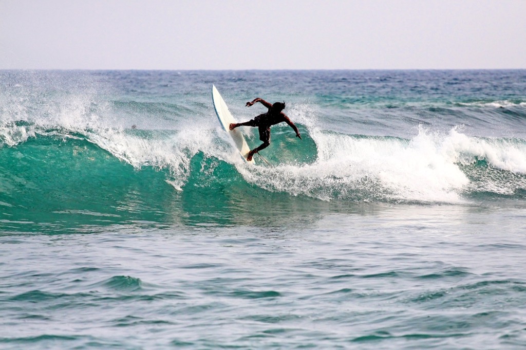
The island's north has a rich culture and religious history, with ancient Buddhist and Hindu temples. The east and south coasts are world-renowned for surfing, including some of the best point breaks on earth.
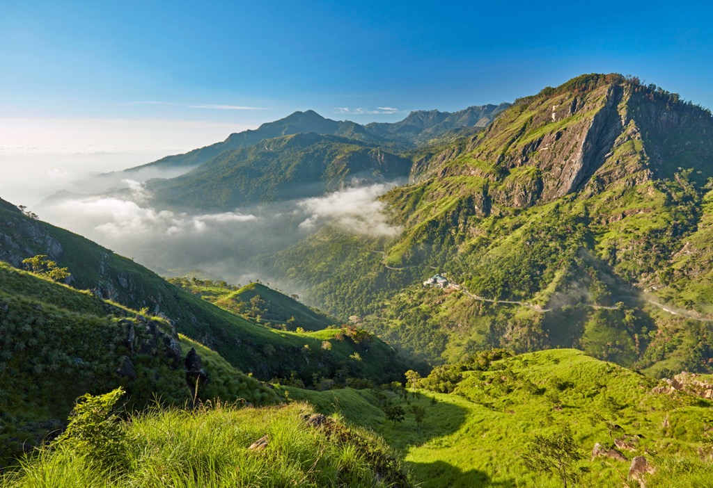
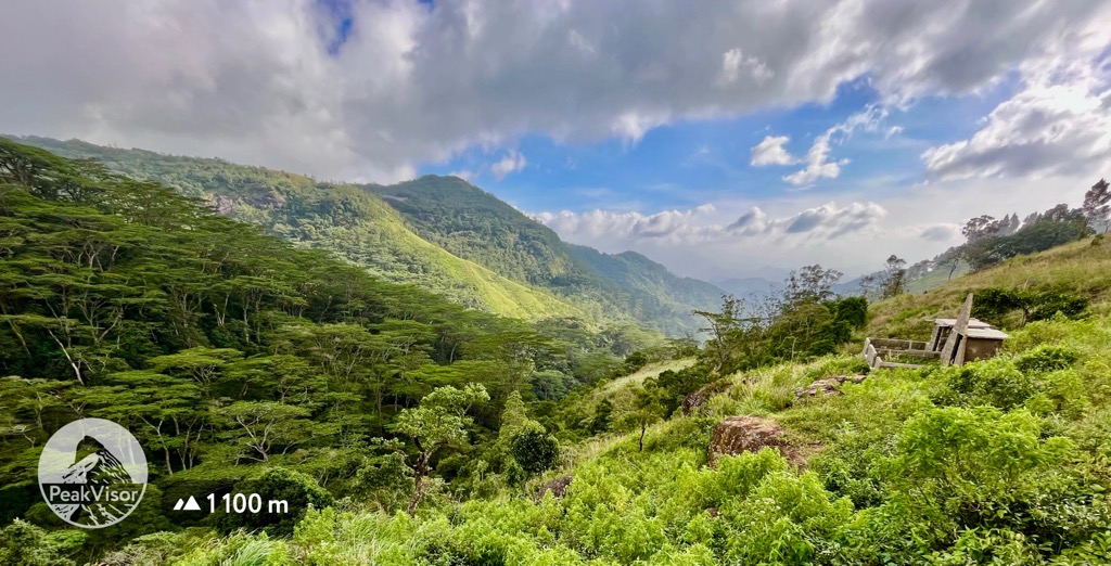
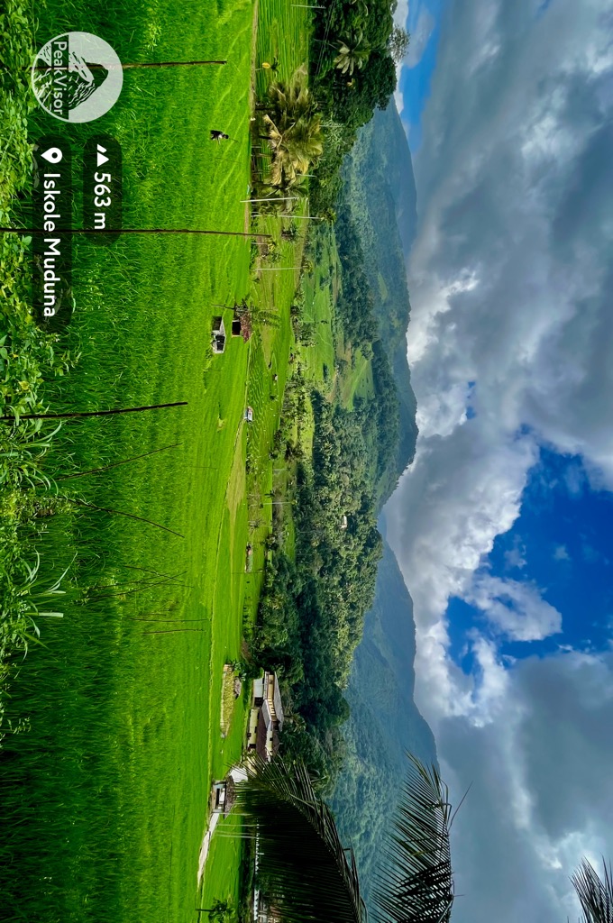
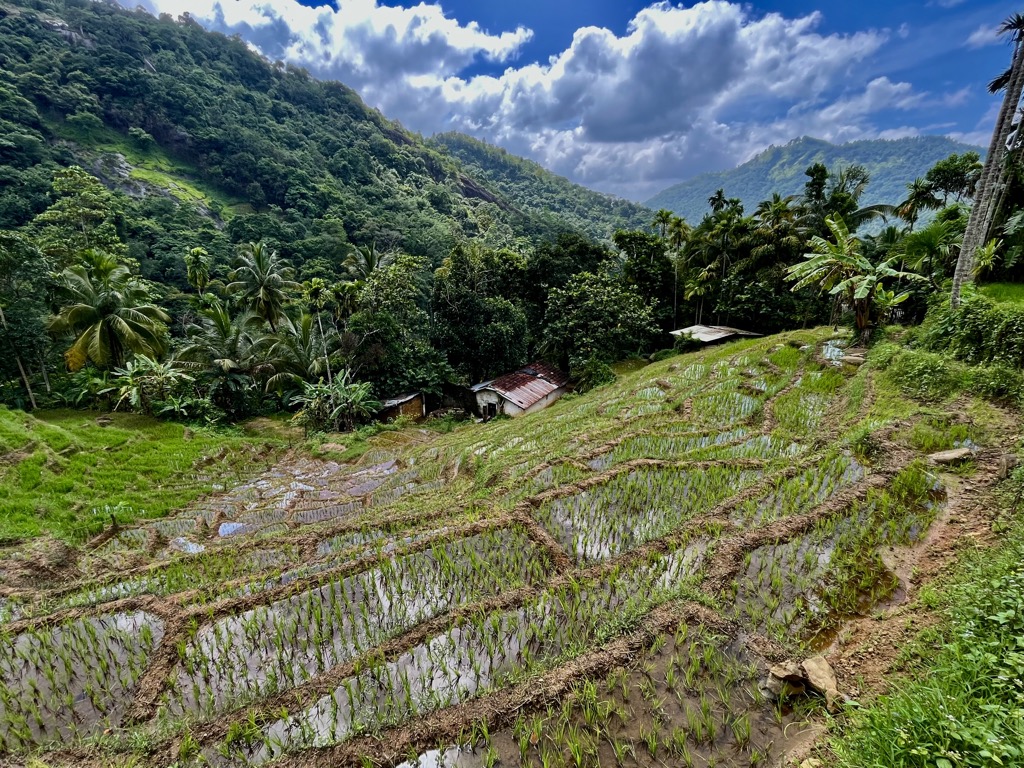
The country’s best hiking is in the south-central region, the Central Highlands. These highlands are one of Sri Lanka’s most economically important areas, producing major exports like tea, spices, and precious gems.
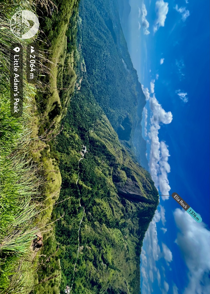
Taking a rickety colonial train from Colombo to Kandy, the terrain rises abruptly. High peaks, deep canyons, winding rivers, waterfalls, and ancient granite towers rise from the surrounding jungle. The Central Highlands are home to the country’s highest peak, Pidurutalagala (2,527 m / 8,291 ft), as well as Adam’s Peak (Sri Paadaya) (2,234 m / 7,359 ft), Kirigalpotta (2,389 m / 7,838 ft), and Knuckles Peak (1,863 m / 6,112 ft).
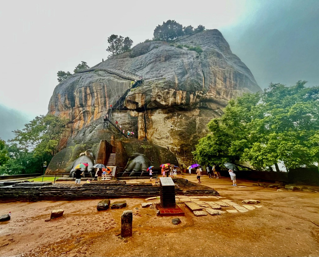
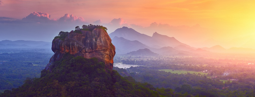
The major settlements in this area are Kandy, Dambulla, Nuwara Elia, and Ella. Kandy is the primary starting point for the Knuckles Mountains. Dambulla is a stopover for hiking some of the sentinel rocks like Sigiriya (Lion Rock) (363 m / 1,191 ft). Nuwara Eliya is central to Horton Plains National Park, Kirigalpotta, Pidurutalagala, and the Pekoe Trail. Ella is the jumping-off point for Adam’s Peak.
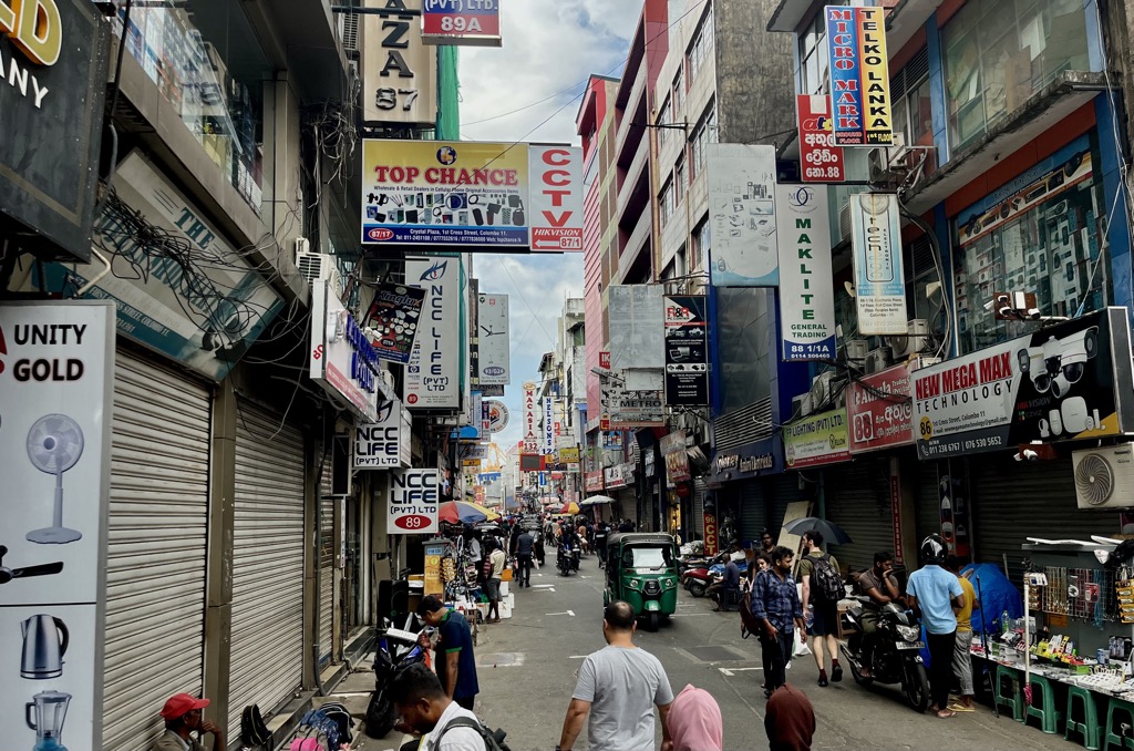
One of the best parts about visiting Sri Lanka is how well-connected everything is. Public transit is robust, with trains running between major cities and frequent buses connecting everything else. And if the bus lets you off too far from the trailhead, there’s always a tuk-tuk (or rickshaw) nearby. You can hire a tuk-tuk for around 100 LKR (roughly €.30) per kilometer.
Tourists typically take a route through the Central Highlands starting in Colombo. From here, you can take a train to Kandy. If you’re interested in some of the country’s deep history, you can take a bus north to Dambulla and then Sigiriya. Visitors commonly take a train from Kandy to Nuwara Eliya, but the locals will tell you that the views from the bus are even better.
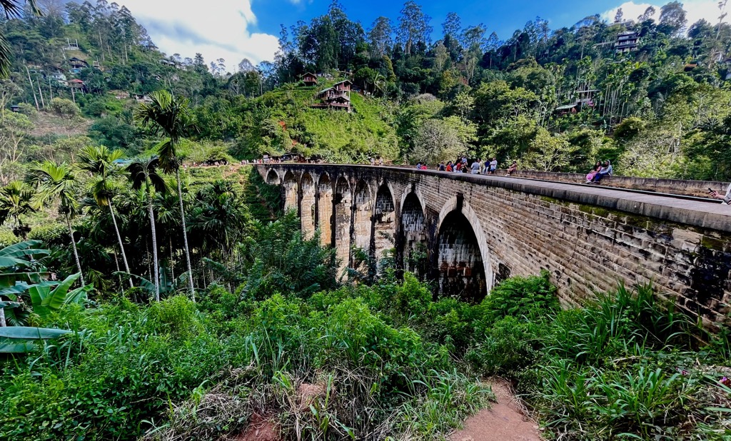
Nuwara Eliya and Ella are connected by a colonial train that winds through the jungle over the famous Nine Arch Bridge. The route is gorgeous, but getting a seat on the train can be a nightmare. In a worst-case scenario, you can always take a bus to Ella and then hike up to the bridge from town.
Sri Lanka is ancient, even on a geologic timescale. The island’s rocks formed between 500 million and 2.4 billion years ago, during the Precambrian age. Much of the island’s natural resources are a product of its geology, particularly the rich deposits of gemstones in the Central Highlands. Historical records tell of the “jewels of Serendib” as far back as the second century. Today, tourists buy sapphires, emeralds, rubies, and other precious stones.
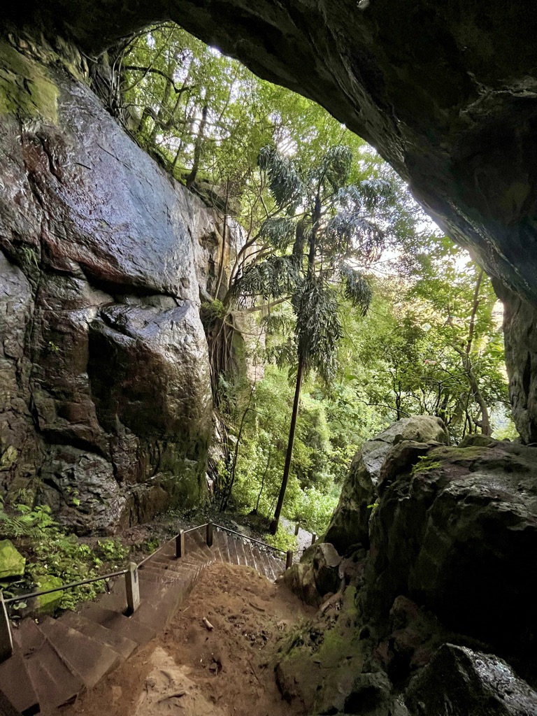
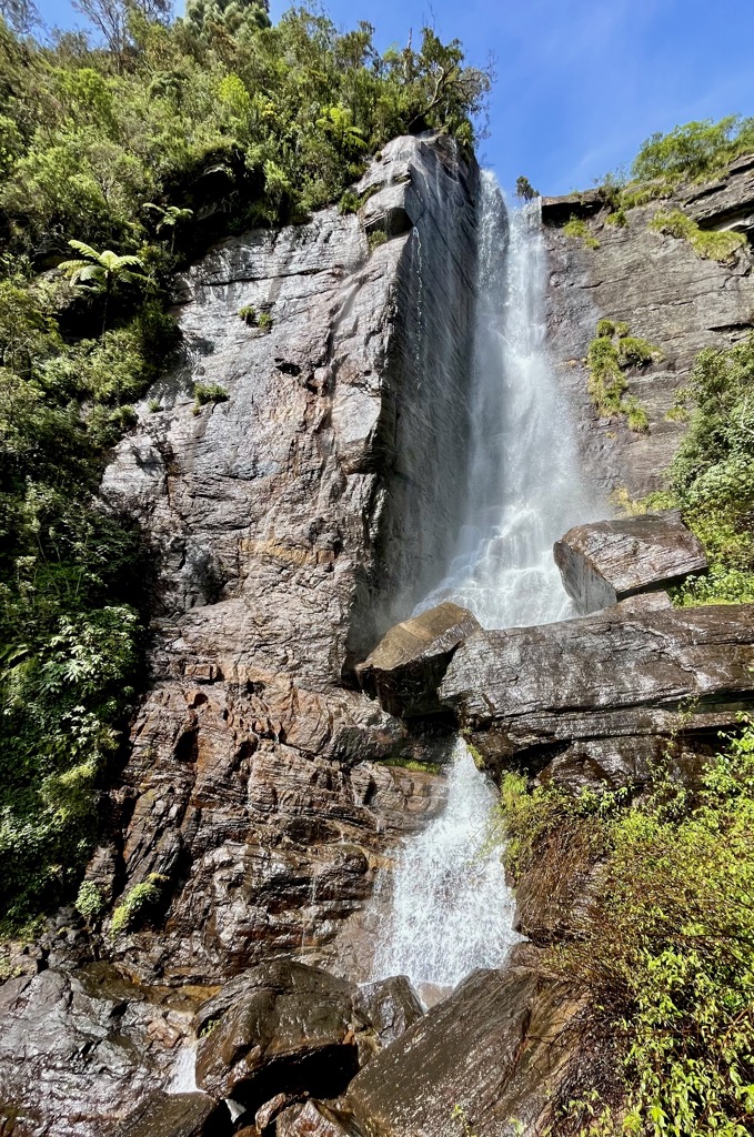
Hundreds of millions of years of erosion have also created fantastic geological features. Limestone caves, many of which have been converted to Buddhist temples, are common around the country. Also noteworthy are the conspicuous granite towers found around the Central Highlands.
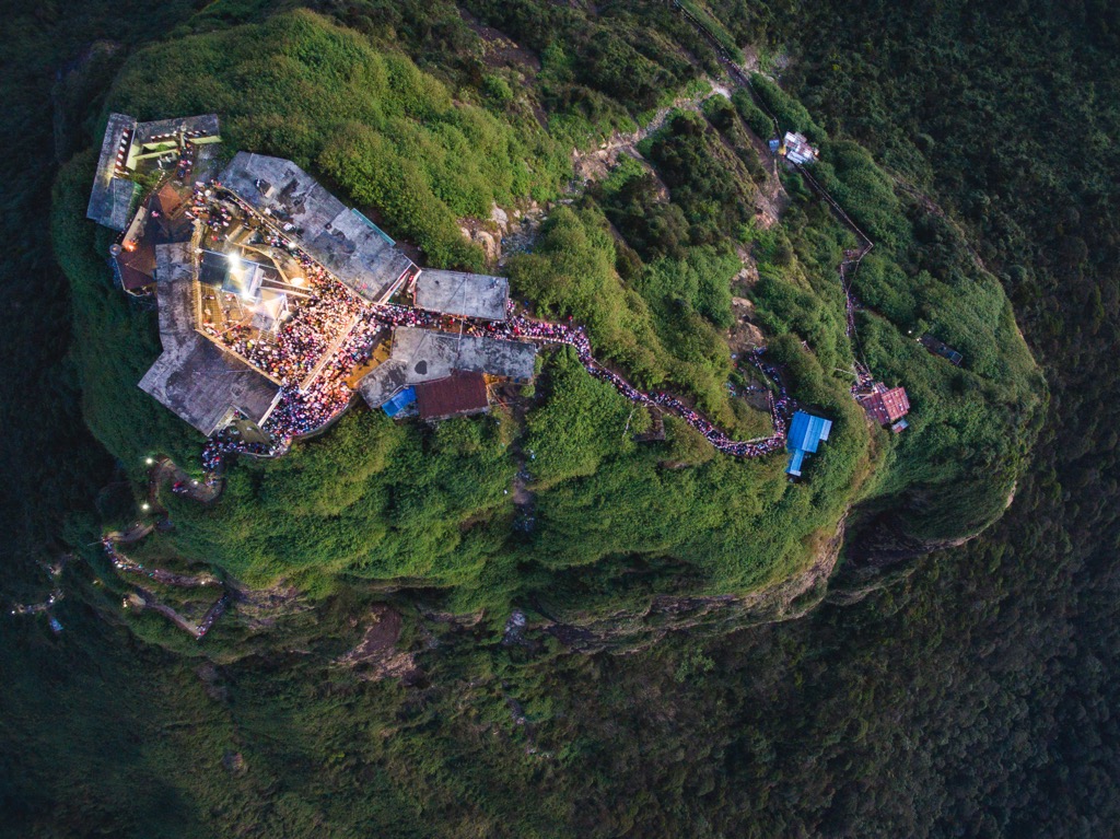
Another example is Adam’s Peak or Sri Paadaya. This conical peak is revered in Buddhist, Hindu, Christian, and Muslim faiths because of a footprint-shaped mark on the summit. Whose foot left the mark depends on who you ask. Buddhists claim it was the Buddha, Christians and Muslims claim it was Adam’s first footstep on Earth, and Hindus claim it belongs to Shiva. Either way, this conspicuous granite summit has been a spiritual pilgrimage for at least 1,000 years.
Sri Lanka is home to a diverse host of wildlife and plants. Though the forests’ exact composition depends on elevation, nearly the entire island is covered in dense, biodiverse rainforests. Generally, the climate is defined by torrential rainfall or dry heat.
The good news is that one side of the island is almost always dry because of the rotating rainy season. The peak season for hiking the Central Highlands is between December and March, during the northeast monsoon. Meanwhile, the southwest has its monsoon between June and October.
The rainforest ecosystem makes Sri Lanka a hotspot for wildlife watching. Spots like Yala, Udawale, and Bundala National Parks are famous for their large mammals, reptiles, and sea birds.
But while hiking, remember that there is dangerous wildlife throughout the country. Wild elephants are an issue in some places, particularly when they enter musth. During the mid-to-late summer, elephants’ testosterone surges, causing them to become aggressive and violent. If you’re in an area with wild elephants (particularly the north, including around Dambulla and Sigiriya), avoid hiking after dark and before dawn, when they are most active.
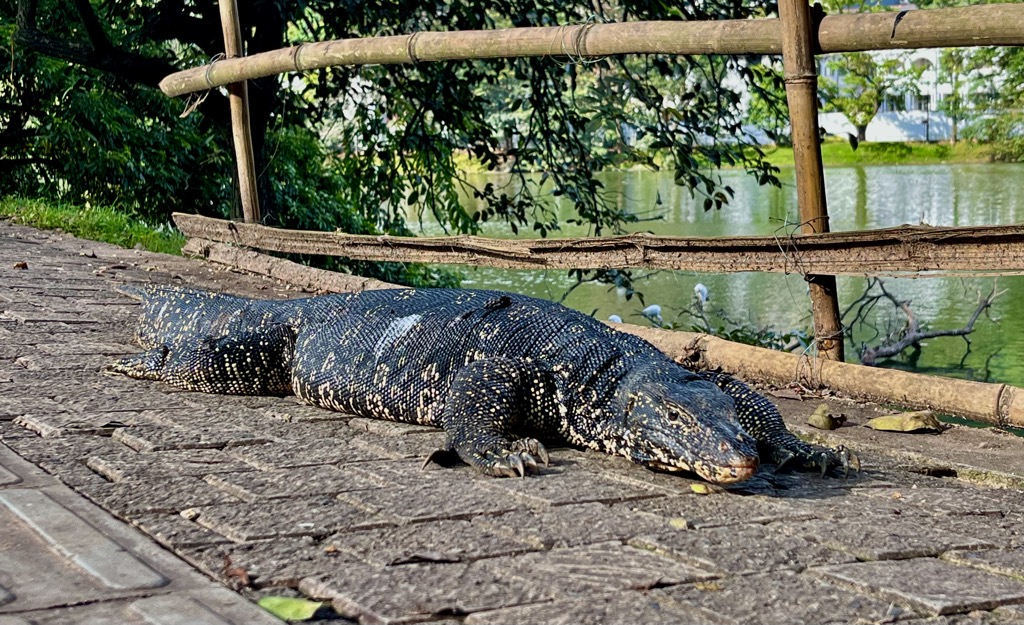
Venomous species are common in Sri Lanka. Snakes like the krait and cobra live throughout the country. They are most active around dusk and dawn and often live in piles of leaves. Deadly scorpions are common around Jaffna, in the far north. Asian water monitors, the second-largest lizards on Earth, populate the area around Kandy. While they are mildly venomous, they’re typically not aggressive unless provoked.
Less dangerous and more of a nuisance, the Central Highlands (particularly the Knuckles Mountains) are also full of leeches. Leeches live in leaf litter and are adept at getting into your shoes and under your clothes while you hike. If you go with a guide, they usually provide special anti-leech socks.
Humans have occupied Sri Lanka for hundreds of thousands of years. Some fossil evidence of homo erectus on the island may date back between 300,000 to 500,000 years. More substantial evidence for permanent human settlement dates back about 125,000 years.
In more modern times, Sri Lanka has appeared in many myths. The name “Lanka” comes from the Hindu Vedas, where it’s described as a futuristic, fortified kingdom ruled by Ravana.
One of the most interesting historical monuments in the country is Sigiriya, or Lion Rock. This granite monolith rises about 180 m (590 ft) above the surrounding jungle, providing a high vantage point. It was first inhabited by monks almost 2,000 years ago, but since then, it’s also been a royal palace. The sides of the rock are inscribed with colorful frescoes, and it’s considered one of the world’s best-preserved ancient settlements.
You can hike both Sigiriya and a neighboring granite tower from the town of Sigiriya, just east of Dambulla. The path is primarily stairs, making it a good trail for beginners who want a big payoff.
Sri Lanka is replete with wilderness and protected land. Nevertheless, finding information on hiking trails can be tricky, and in some cases, the best solution is to go with a guide. It’s easy to set out independently in other cases, provided you have some information.
Adam’s Peak is the most popular trail in Sri Lanka, if you could call it a “trail.” In reality, the summit route is a long staircase, normally choked with visitors. It’s not what you would call a hearty mountain objective, but it has undeniable mythological importance.
Starting from Nuwara Eliya, take a bus to Hatton. You will pass through Nanu Oya, where the train to Ella picks up. From Hatton, you can take a tuk-tuk to the trailhead for around 3,000 rupees (roughly €10). Hikers usually start before sunrise to maximize the view while minimizing the temperature.
While in the Nuwara Eliya area, you can also do a day trip to Horton Plains. This elevated plateau includes some of the best views in Sri Lanka. The main trail is a loop from the entrance to World’s End, a spectacular cliffside view at the very edge of the Central Highlands. The scenery along the way features alpine grasslands, cloud forests, and waterfalls.
Another option in the park is to head west from the entrance and summit Kirigalpotta (2,389 m / 7,838 ft), the second-highest peak in Sri Lanka. This trail gets much less traffic than the park’s main loop and affords excellent views of the sweeping scenery around the high plains.
Getting to Horton Plains is slightly more involved. Chances are, you will have to take a tuk-tuk from Nuwara Eliya. The going rate for a return trip in a tuk-tuk is about 8,000 rupees (about €23). You also need to pay to enter the park. The gate fee is about 25,000 LKR (or €72) for two people.
Knuckles is the most rugged and wildest hiking destination in Sri Lanka, located northwest of Kandy. While most of Sri Lanka’s hikes are simple out-and-back day trips, the Knuckles Mountains offer extensive multi-day treks. If you want to get off the beaten tourist track, see the jungle wilderness, and experience the Sri Lankan backcountry, this is the place to do it.
However, route finding is very tricky here. There isn’t much information about trails online, and routes commonly braid and wind through farmland. In any case, you need a guide to enter because the Knuckles are a UNESCO World Heritage site.
Depending on your itinerary and the conditions, there are a few options. One is the Knuckles Boundary Trek, a 16km route that begins in the rice paddies around the foothills and ends in a cloud forest. Another is the summit of Knuckles Peak (1,863 m / 6,112 ft), the highest in the range.
Longer treks can go anywhere from two days to a week. Camping in the Knuckles backcountry is a truly wild experience and a unique one in Sri Lanka.
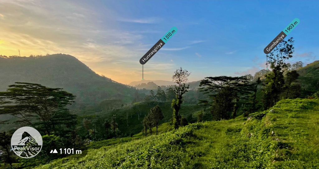
The area around Nuwara Eliya includes some of the highest elevations in Sri Lanka, equating to cooler weather and excellent hiking conditions in the dry season. There are two objectives just outside of town, both worthwhile and easy to access.
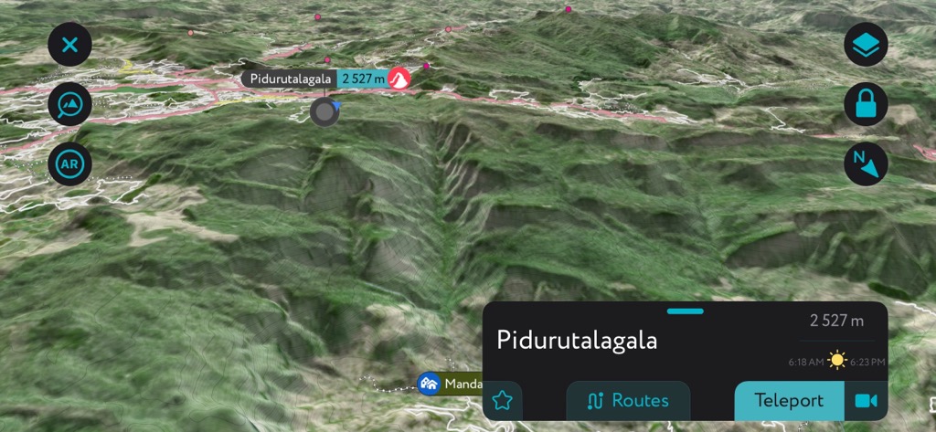
The first is Piduruthalagala (2,527 m / 8,291 ft), the highest peak in Sri Lanka. The route is a hearty day trip involving about 640 m of vertical and sublime views of the rolling tea fields surrounding the peak. On paper, this route is straightforward. You can walk to the trailhead from Nuwara Eliya.
From there, it’s more or less a straight shot due east to the summit. However, sometimes, the government restricts access to the peak without notice. Be prepared to be turned around at the trailhead.
If that happens, head to the Pekoe Trail as a backup plan. This 22-day trek starts in Kandy and traces a spiral-shaped route through the highlands. It passes through Hatton, Horton Plains, and Ella along the way before ending in Nuwara Eliya.
Most visitors don’t do the whole thing; the most popular section is the final stretch, from Kandapola to Pedro (just west of Nuwara Eliya). From Nuwara Eliya, take a bus to Kandapola for around 100 rupees.
The hiking is almost all on windy backroads, tracking through the Pedro Tea Plantation along the lower slope of Piduruthalagala. A little route-finding is involved, so keep your eye on Peakvisor while you hike to avoid getting lost.
You’ll pass through tiny villages full of friendly locals (all of whom will want to wave and say hello) and seemingly endless tea fields. This hike is largely undiscovered by tourists, and it’s a great way to get out into Sri Lanka’s beautiful tea country.
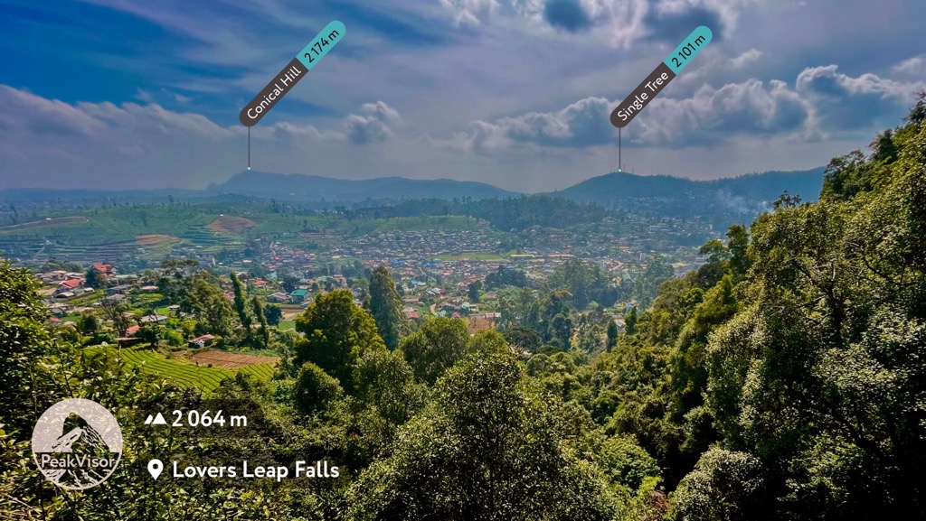
At the trail's end, you can take a slight detour to Lover’s Leap, a fantastic waterfall. After that, it’s a short tuk-tuk or hike back to town.
Yala isn’t much of a hiking destination, but it’s a must-see for nature lovers in Sri Lanka. This coastal jungle is full of charismatic wildlife. On any given day, you can spot Asian elephants, water buffalo, sloth bears, monitor lizards, crocodiles, and birds like white-bellied sea eagles and flamingos.
But the main draw for many tourists is the leopards. Yala has one of the densest leopard populations on earth, with 25 individuals in the main block. The best way to find a good safari guided by a knowledgeable local is to book lodging in Tissamaharama. Most local lodgings have connections to guides for a lot cheaper than you’ll find online.
Every trip to Sri Lanka starts in the colonial capital. Rumor has it that Colombo was the original inspiration for Singapore during its boom in the 1950s. While it’s not a megacity on the same scale, Colombo is a beautiful metropolis with colorful temples, skyscrapers, and plenty of good restaurants.
But for most, it’s just a jumping-off point. Major train routes out of Colombo head north to Jaffna, south to Galle, and east to Kandy. Sri Lanka is famous for scenic rides on rickety old colonial trains. However, most routes are painfully cramped, slow, and uncomfortable. Having done most train routes in the country, I can attest that the train from Colombo to Kandy is the best overall.
So if you take a train anywhere in Lanka, take one from Colombo to Kandy. On this route, you have a good chance of getting a seat, even in third class. The views are spectacular, climbing along the side of a cliff into the highlands. Trains leave frequently, and tickets are cheap (around 150 rupees).
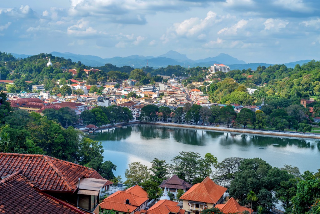
Kandy was the final capital city of Sri Lanka during the era of kings. It’s a small city with a lot of life and history. A central attraction is the Temple of the Tooth, which houses one of the teeth of the Buddha, Siddhartha Gotama. In ancient times, whoever held the tooth was king of the country, and its final stop before colonial rule was in Kandy.
And if you like wildlife, be sure to take a walk around Kandy Lake - you’ll most likely see an Asian water monitor, which can reach two meters long. At dusk, look for Indian fruit bats, one of the largest bat species on earth.
You can contact a local guide in Kandy if you want to see the Knuckles Mountains. Trips typically start before dawn, as the drive to the Knuckles is about 90 minutes from Kandy. The Knuckles are one of the most rugged parts of Sri Lanka and are the place to see natural jungle wilderness without elbowing through a long line of other hikers.
Many tourists take a train from Kandy to Nanu Oya (outside Nuwara Eliya) or Ella, the most famous route in the country. However, these trains are incredibly cramped and slow. If you don’t plan to get a reserved seat, the ride is probably not worth the trouble. And if you’re headed to Nuwara Eliya next, the locals will tell you the views from the bus are even better.
Nuwara Eliya is the most underrated destination in Sri Lanka. It sits in the heart of the tea fields of the Central Highlands, right under the country’s highest peak. Horton Plains lies to the south. To the east is the tail end of the Pekoe Trail.
You’ll find an interesting mix of high-end eats and cheap local restaurants to suit any palate in town. But in my experience, the less you pay for a meal in Sri Lanka, the better the food will be. I recommend Ambaal’s Pure Vegetarian for curry, dosa, kotthu, and roti.
If you’re leaving Nuwara Eliya by train, you must take a bus to Nanu Oya, the nearest train station and the start of the famous highlands train route. If you’re dead set on taking the train, plan ahead as much as possible. Get a reserved seat if you can, and start early. Otherwise, you may end up smashed against the bathroom door with nothing to look at but the walls.
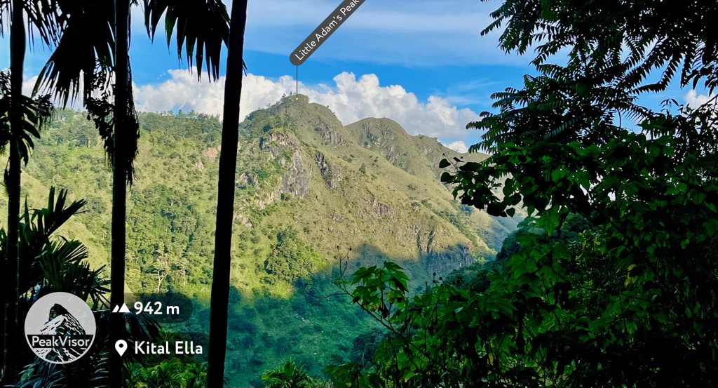
Ella is commonly the last stop that visitors make in the Central Highlands. It’s a tiny town, but there are a lot of nearby trails; you can take a short hike to Nine Arch Bridge or Little Adam’s Peak. There is also an ancient cave temple just a few kilometers down the road. Most tourists stop in Ella to set out for Adam’s Peak, located an hour or so west of town.
From Ella, you can quickly head to Tissamaharama by bus to visit Yala National Park or continue east to the coast.