Share

Scan the QR code and open PeakVisor on your phone
Scan the QR code and open PeakVisor on your phone
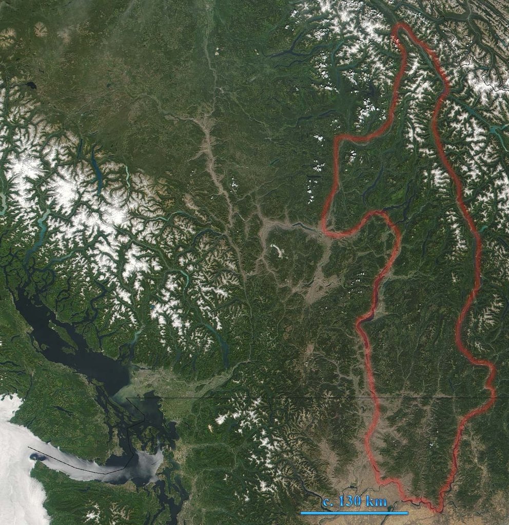
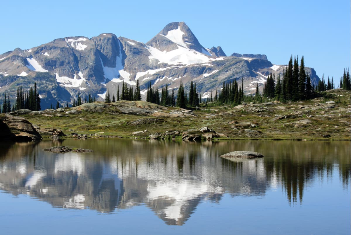
A subrange of the Columbia Mountains, the Monashee Mountains stretch for 329 miles from north to south and 93 miles from east to west. The Monashee Mountains sit mostly within British Columbia, Canada, but also reach partially into Washington in the United States. There are 307 named mountains in the Monashee Mountains.
Initially, the Monashee Mountains were known as the Gold Range. However, the range was renamed Monashee, which means “mountain of peace,” by David McIntyre, an early prospector. Although, some theories exist that the range was renamed to describe mythical fairy inhabitants of the island of Mona and the intended resurrection of old Gaelic culture.
Nevertheless, the Gold Range is now just a small, narrow stretch of mountains that sit at the eastern flank of the Monashee Mountains within the southern British Columbia Interior. The Gold Range, however, remains a popular destination for visitors to the Monashee Mountains and known for containing popular peaks like Mount Begbie, an icon that is visible from the nearby town of Revelstoke, the Trans-Canada Highway, and Revelstoke Mountain Resort.
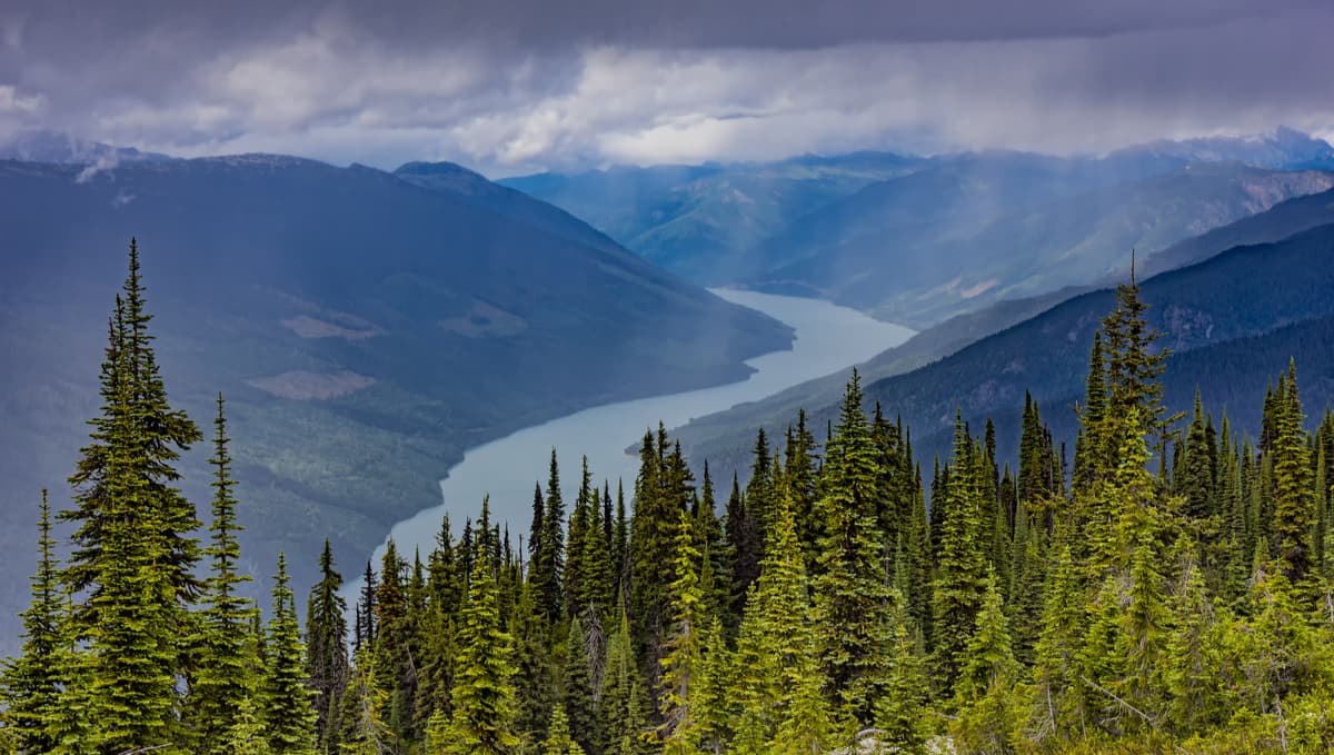
Several other noteworthy summits can be found in the Monashee Mountains, including Mount Odin, Hallam Peak, Mount Lempriere, and Dominion Mountain – all of which exceed 10,000 feet in elevation. Highway 1, also known as the Trans-Canada Highway, Highway 6, and Crowsnest Highway all cross portions the range and offer impressive views of incredible Monashee summits. Interestingly, the Canadian Pacific Railway also intersects the range south of Mount Monashee. Gold, silver, copper, lead, and zinc have been known to be mined in the southern foothills, and this section of the Monashees has historical significance to mining in the region.
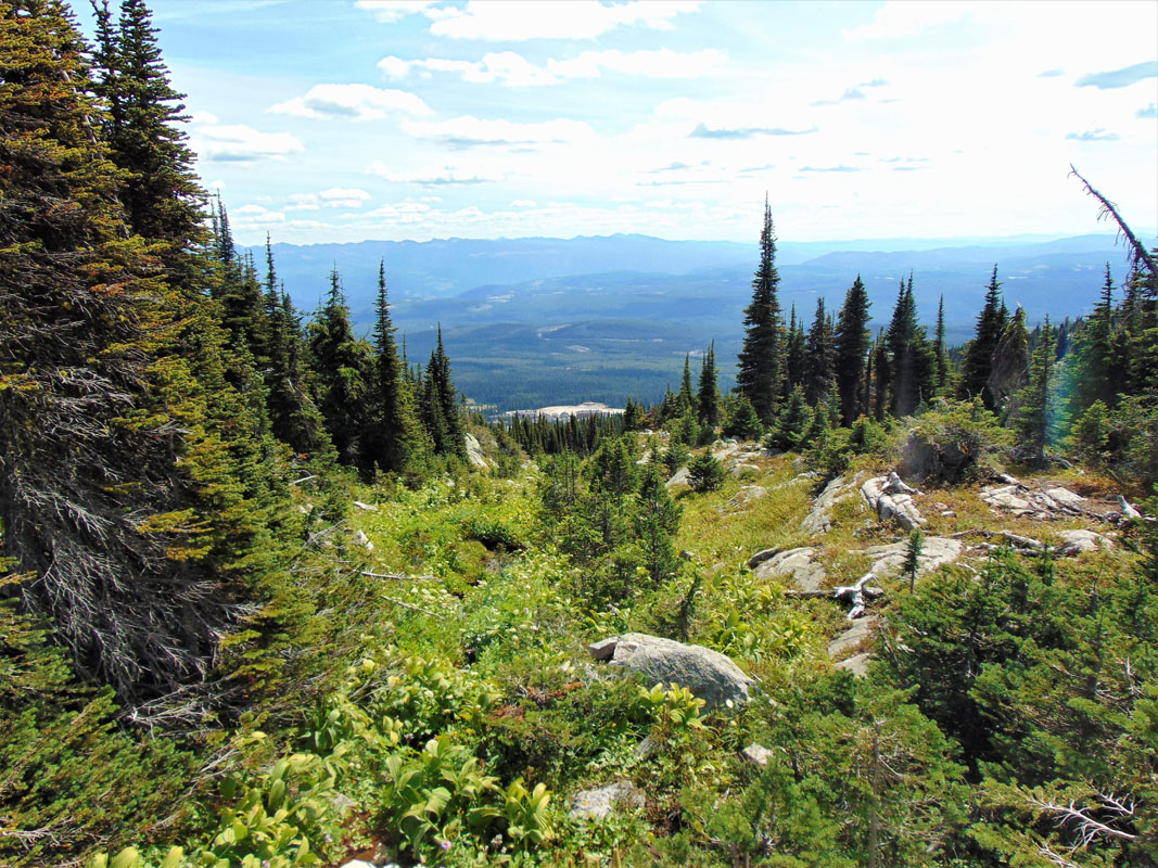
Unlike the Rocky Mountains, the Monashees are mostly metamorphic rock, with some sections of granite or igneous rock and are much easier to hike, climb, and even access by vehicle. In fact, many peaks within the Shuswap watershed and Monashee Provincial Park, like Mount Fosthall, are popular destinations for backpackers and day hikers. Visitors also travel to the Monashees to immerse themselves and explore the inland rainforest ecosystem – a type of forest ecology that is unique to this region of British Columbia. Massive trees, some older than 1,000 years, can be found in portions of the Monashee Mountains. In fact, such precious resources and minerals are found within these mountains, that parts of it, like the Anstey Range, have been set aside expressly for research purposes.
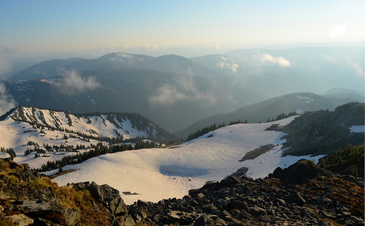
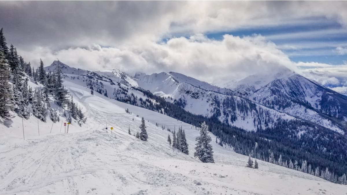
The Monashees are also renowned for creating consistently high snowpack and offer some of the best skiing conditions in British Columbia. Nordic skiing, alpine skiing, and backcountry touring are popular in the Monashee Mountains, particularly from late fall to spring.
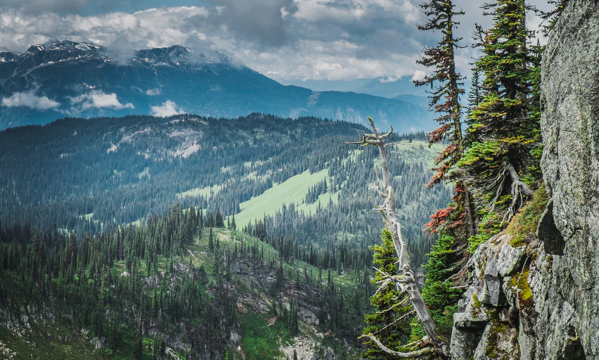
Monashee Provincial Park is a 56,000-acre park that protects substantial sections of old growth cedar, spruce, and hemlock. The park is also known to house some of the oldest rock formations in western Canada. Despite the region being largely undeveloped, Mount Fosthall, the highest peak in the park, is one of the most popular attractions in the area and both experienced and novice hikers and backpackers travel to Monashee Provincial Park to explore incredible snow-capped summits and alpine meadows. The Spectrum Lake Trail is another popular destination in Monashee Provincial Park. This 12-km trail is rated beginner to moderate and leads visitors along a path at the foothills of Mt. Fosthall, through dense forest, to the banks of picturesque Spectrum Lake.
Adventurers channel your inner stoke - Revelstoke Mountain Resort recently opened several well-maintained hiking trails that begin at the top of the Revelation gondola. The Stoke Climb begins at the gondola and traverses the incredible subalpine zone of Mount Mckenzie, traveling well above the trees and highlighting several Monashee mountaintops, as well as the Columbia River Valley below. The climb is approximately 3.3 miles roundtrip and ascends roughly 1,500 feet in elevation.
The Saddle Mountain trail climbs Saddle Mountain to the rocky knob above the treeline. The climb isn’t for the faint of heart, but after reaching the top, hikers will be rewarded with panoramic views of the surrounding Monashee peaks and valleys. Just north, hikers can continue on to Upper Saddle Mountain, which overlooks several large lakes, although this trail is notoriously difficult and not as well-marked.
The North Okanagan region is known to boast some of the most spectacular hikes in British Columbia. Popular trails in this region include:
Twin Lakes – A popular destination for hikers and backpackers looking to explore the alpine backcountry. The trail gains approximately 500 eteres over roughly 4km, spanning two open meadows before reaching the pristine shoreline of Twin Lakes. Adventurous travelers can also scramble to a couple of summits overlooking to get a better view of nearby Monashee mountain summits.
Monashee Lake – The trail to Monashee Lake climbs 700 meters in just over 4.5 km, making it a challenging ascent. However, those willing to make the climb are rewarded with a beautiful glacier-fed lake located in the Pinnacles, just south of the Monashee Mountains. Route-finding skills are helpful, as the path isn’t always well-marked.
Located near Rossland, Old Glory is the highest peak in the Rossland Range, a subrange of the Monashee Mountains. The trail travels along an open ridge, through alpine meadows and high above the treeline, offering spectacular panoramic views of the surrounding Monashee Mountains. The remains of an old weather station can be found at the summit. The hike is approximately 17 km (10.5 miles) and can take upwards of 6 or 7 hours to complete.
Over 120 years of skiing history can be traced back to Revelstoke Mountain Resort, a community that is known to “celebrate winter in all forms.” Revelstoke is home to the Canadian record for snowfall, 80 feet, and the resort itself averages 34 feet of powder each winter. The resort features a 5,620-foot vertical drop, 3,121 acres of skiable terrain, and offers nearly half a million acres of fresh powder via heli-skiing, backcountry touring, Nordic skiing, snowshoeing, paragliding, snowmobiling, and even dog sledding. During summer months, visitors can also take advantage of ample hiking, sightseeing, and mountain biking opportunities, as well as an aerial adventure park. There are several luxury slope-side hotels, like the Sutton Place Hotel, that offer impressive amenities, in addition to campgrounds, RV parks, and Airbnbs available to accommodate guests. The city of Revelstoke is known to be a year-round mountain community suited for any adventure enthusiast.
Red Mountain Resort, located on Granite, Grey, and Red Mountains in Rossland, is an old mining territory that was converted into one of the greatest ski destinations in the world. Red Mountain offers 110 runs, 3,850 skiable acres, and 2,919 feet of vertical terrain. In fact, the resort continues to add new runs and acres to explore. In 2014, nearly 1,000 acres of mostly-intermediate terrain was added to Grey Mountain. Red Mountain is just a few miles from Rossland, a natural playground that was recently voted Canada’s #1 Outdoor Town by Explore Magazine. This tiny alpine town features a variety of premium accommodations, amenities, and facilities for adventurous travelers.
Explore Monashee Mountains with the PeakVisor 3D Map and identify its summits.