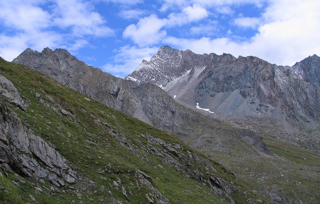
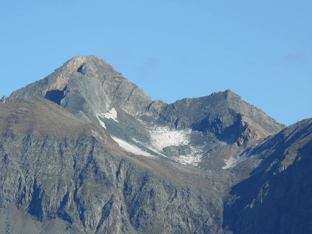
The Hoher Eichham (also Hocheichham), at 3,371 m (AA), is the most dominant mountain in the southeastern part of the Venediger Group in the High Tauern in Austria. Four arêtes radiate from its summit towards the north, east, south and southwest. To the southeast is the glacier of Nilkees and, to the northeast, is the Hexenkees. The Großer Eichhamkees to the northwest and the Kleiner Eichhamkees to the southwest have shrunk to insignificant slabs of ice. On the North Arête is a rock tower, the Eichhamturm (3,255 m (AA)). Along the continuation of the arête lies the Großer Hexenkopf (3,313 m (AA)), which is roughly 600 metres as the crow flies from the Hoher Eichham. On the East Arête is the Niederer Eichham ("Lower Eichham", 3,247 m (AA)). From this subpeak a ridge branches southeast linking it with the Sailkopf; the lowest notch on this arête being the Sailscharte (3,080 m (AA)). The Hoher Eichham may have first been climbed during a military survey using triangulation in the 1850s. The first visit to the summit by tourists was on 16 July 1887 by Berlin alpinists, Carl Benzien and Hermann Meynow using the South Arête. They were led by the Zillertal mountain guide, Hans Hörhager, from Dornauberg.
By elevation Hoher Eichham is
# 16 out of 552 in the Venediger Group # 46 out of 3311 in the Western Tauern Alps # 32 out of 1318 in High Tauern National Park # 26 out of 1030 in Bezirk Lienz # 32 out of 1786 in the Hohe Tauern
By prominence Hoher Eichham is
# 11 out of 552 in the Venediger Group # 75 out of 3311 in the Western Tauern Alps # 36 out of 1318 in High Tauern National Park # 29 out of 1030 in Bezirk Lienz # 38 out of 1786 in the Hohe Tauern
We use GPS information embedded into the photo when it is available.
3D mountains overlay
Adjust mountain panorama to perfectly match your photos because recorded by camera photo position might be imprecise.
Move tool
Rotate tool
Zoom
More customization
Choose which peak labels should make into the final photo and what photo title should be.
Next
Photo Location
Satellitte
Flat map
Relief map
Latitude
Longitude
Altitude
OR
Latitude
°'''
Longitude
°'''
Apply
Register Peak
Peak Name
Latitude
Longitude
Altitude
Register
Teleport
PeakVisor
This 3D model of Sagarmatha National Park in Nepal was made using the PeakVisor app topographic data. The mobile app features higher precision models worldwide, more topographic details, and works offline. Download PeakVisor maps today.
Download OBJ model
PeakVisor
The download should start shortly. If you find it useful please consider supporting the PeakVisor app.
PeakVisor for iOS and Android
Be a superhero of outdoor navigation with state-of-the-art 3D maps and mountain identification in the palm of your hand!