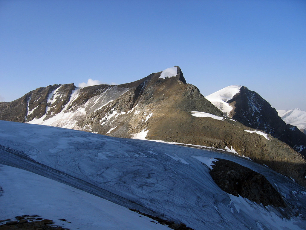
The Hinterer Bratschenkopf is a mountain in the Glockner Group on the Fusch-Kaprun ridge (Fuscher / Kapruner Kamm) in the High Tauern, a high mountain range in the Austrian Central Alps. According to the listed sources it is 3,412 metres high, but the Austrian Federal Office for Metrology and Survey gives its height as 3,413 metres. The mountain lies in the Austrian state of Salzburg. It appears from the north, east and south as a gently curved firn summit, but from the west it has a mighty, 1,400 metre high and 40 to 60° rock face. A steep, 500 metre long knife-edge ridge bears away from the mountaintop to the north. Due to its close proximity to the Heinrich Schwaiger Haus, the summit is a popular viewing point. The peak was first climbed on 18 September 1869 by the Munich Alpinist, Karl Hofmann, the Prague businessman, Johann Stüdl, and mountain guides Thomas Groder and Josef Schnell from Kals am Großglockner.
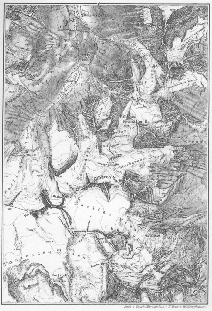
The nearest mountain hut is Heinrich Schwaiger Haus located 1 317m/4 322ft NNW of the summit.
By elevation Hinterer Bratschenkopf is
# 14 out of 362 in the Glockner Group # 33 out of 3311 in the Western Tauern Alps # 92 out of 23502 in Austria # 26 out of 1318 in High Tauern National Park # 11 out of 1291 in Zell am See # 11 out of 3018 in Salzburg # 26 out of 1786 in the Hohe Tauern
We use GPS information embedded into the photo when it is available.
3D mountains overlay
Adjust mountain panorama to perfectly match your photos because recorded by camera photo position might be imprecise.
Move tool
Rotate tool
Zoom
More customization
Choose which peak labels should make into the final photo and what photo title should be.
Next
Photo Location
Satellitte
Flat map
Relief map
Latitude
Longitude
Altitude
OR
Latitude
°'''
Longitude
°'''
Apply
Register Peak
Peak Name
Latitude
Longitude
Altitude
Register
Teleport
PeakVisor
This 3D model of Sagarmatha National Park in Nepal was made using the PeakVisor app topographic data. The mobile app features higher precision models worldwide, more topographic details, and works offline. Download PeakVisor maps today.
Download OBJ model
PeakVisor
The download should start shortly. If you find it useful please consider supporting the PeakVisor app.
PeakVisor for iOS and Android
Be a superhero of outdoor navigation with state-of-the-art 3D maps and mountain identification in the palm of your hand!