
Scan the QR code and open PeakVisor on your phone
The Sobaek Mountains include 1,606 named peaks. The highest is Cheonwangbong at 1,918 m. Other notable peaks include Jungbong, Tongcheonmun and Jeseokbong.
The Sobaek Mountains are in the Gyeongsangnam-do, Sancheong-gun, and Hamyang-gun provinces in South Korea. The range contains 1606 named peaks, of which Cheonwangbong is the tallest (1,918 m/6,293 ft) and most prominent (1,697 m/5,568 ft).
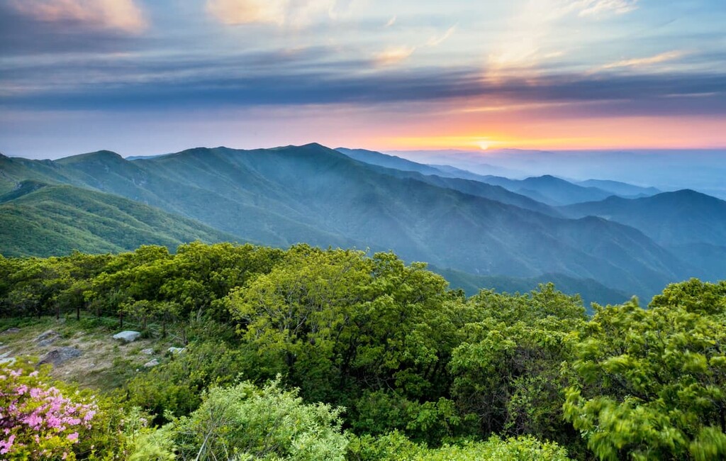
The Sobaek Mountains in South Korea trend southwest from the Taebaek Mountains and span about 350 km (220 mi). The range stretches across the Gyeongsangnam-do, Sancheong-gun, and Hamyang-gun provinces. The tallest peak is Cheonwangbong (1,918 m/6,293 ft), sometimes called Jirisan. It’s the country’s second tallest mountain after Hallasan on Jeju Island and the tallest on South Korea’s mainland.
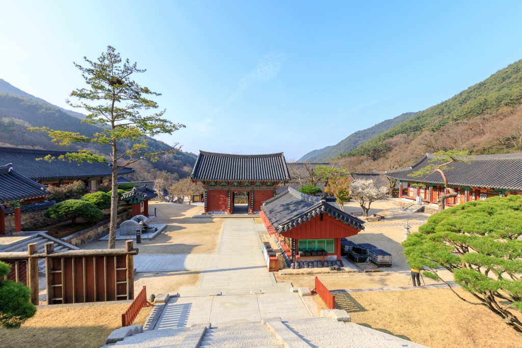
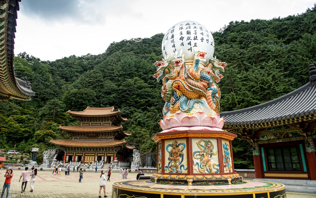
Several national parks protect portions of the Sobaek Mountains. Cheonwangbong is within Jirisan National Park. In addition to hiking opportunities, seven major Buddhist temples guard the slopes of Jirisan. The largest and most famous is Hwaeomsa.
Sobaeksan National Park is South Korea’s third-largest national park and lies slightly off the main tourist path. Chiaksan National Park is in the capital region and easily accessible by train or major highways, making it a highly visited park. It has several hiking trails and protects endangered species such as the flying squirrel and copper-winged bat.
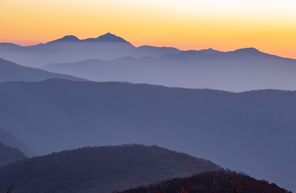
The Sobaek Mountains run 350 km (220 mi) in an S-shape, trending southwest from the Taebaek Mountains. The range is composed mainly of metamorphic and sedimentary rock. Most of South Korea’s metamorphic rocks formed during the Precambrian and consist primarily of gneiss, including schist, quartzite, phyllite, marble, and amphibolite.
Korea’s geology has been shaped by tectonic plate movement, volcanism, and erosion. The East Sea formed around 30 million years ago, separating Japan and Korea and elevating the eastern side of the Korean peninsula more than the western side in the process.
Granite is the most common igneous rock in Korea and formed as molten magma hardened underground. Most of the country’s volcanic rocks developed during the Mesozoic period between 250 and 66 million years ago.
Sedimentary rocks in Korea formed mainly during the Tertiary (66 to 2.5 million years ago) and Quaternary (2.5 million years ago to present) periods. Sedimentary rocks in Korea include shale, sandstone, conglomerates, and limestone.
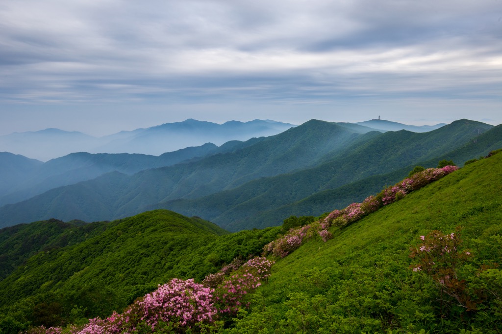
Changing elevations across the Sobaek Mountains support temperate and cold forest communities. Within the protected lands of the national parks, around 5,000 species of flora and fauna exist. Jirisan National Park houses several iconic Korean natural features, such as the Higan cherry tree by Hwaeomsa Temple and the Millennium pine tree (Waun Cheongyeongsong).
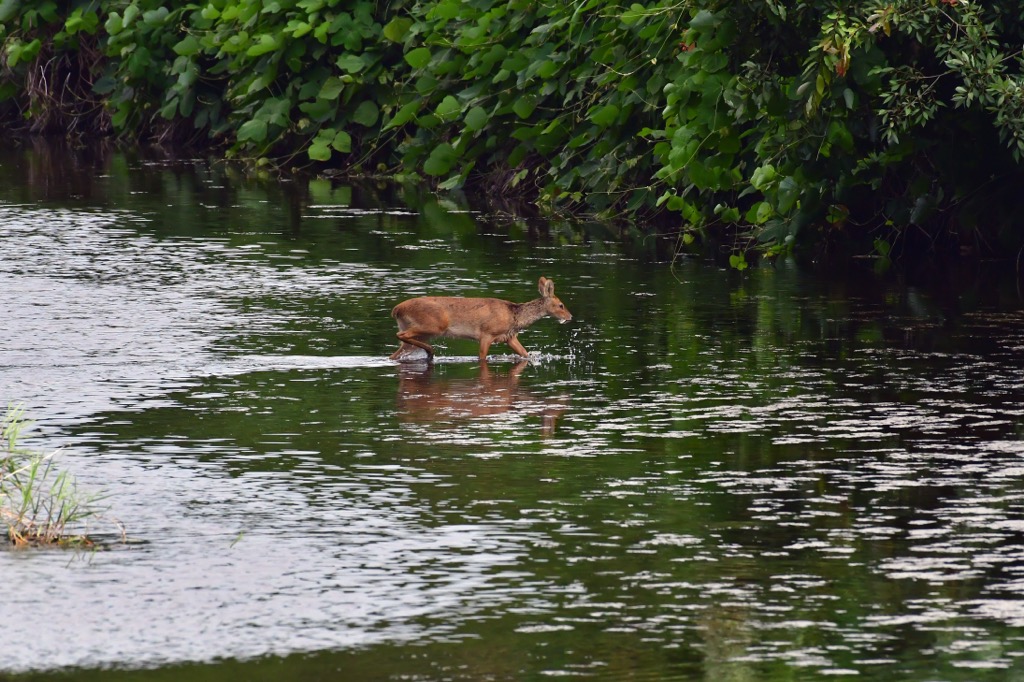
Wildlife includes hares, roes, elks, wildcats, boars, and water deer. The national parks protect endangered species such as flying squirrels and Hodgson’s bat. A project for reintroducing Asiatic black bears began in 2004 in Jirisan National Park. The efforts were successful, with the minimum viable population achieved in 2020.
Depending on the elevation and soil composition, several tree species comprise the forest communities. Species commonly found across the mountains include dark-bark spruce (Picea jezoensis), Erman’s birch (Betula ermanii), Japanese yew (Taxus cuspidata), Korean pine (Pinus koraiensis), Khingan fir (Abies nephrolepis), Korean fir (Abies koreana), Mongolian oak (Quercus mongolica), Japanese stewartia (Stewartia pseudocamellia), Japanese red pine (Pinus densiflora), Chinese cork oak (Quercus variabilis), Manchurian ash (Fraxinus mandshurica), Manchurian fir (Abies holophylla), creamy bark birch (Betula costata), and giant dogwood (Cornus controversa).
The region experiences distinct seasons. Some trails are beautiful in winter, while others are perfect in spring and summer among wildflowers and blooming shrubs. Be sure to check before planning a hike in Korean national parks because there are some seasonal closures.
In the mid-600s, competing kingdoms in the Korean peninsula united under a single regime. Successive dynasties organized and governed the region for over a thousand years, maintaining strong political and cultural independence. The Choson Dynasty was the last, ruling from 1392 to 1910.
The Hwaeomsa Temple on Jirisan Mountain contains important cultural treasures such as stone art from 600 - 900 CE. The mountain also houses the Cheonghak-dong (Azure Crane Village), which includes the Samseonggung (Three Sages Palace), traced to one of Korea’s origin myths.
During the 16th and 17th centuries, Korea survived invasions from the Japanese and Manchus of East Asia. What followed was 250 years of limited contact with the outside world. This isolationist policy began to break down in the late 1800s as Western countries attempted to open relations with Korea.
In 1905, Japan occupied the Korean peninsula and officially annexed it five years later. The following 35 years under colonial rule industrialized the country and saw brutal attempts to erase Korean culture and identity.
The Allied Powers divided Korea into North and South following Japan’s defeat in 1945, influenced by the Soviet Union and the United States, respectively. When South Korea declared independence in 1950, North Korea invaded, supported by the Soviet Union and China. The war lasted three years and ended as it began, with a divided Korea. One of the features of the armistice agreement was a demilitarized zone running along the 38th parallel.
South Korea hosted the Olympics in the summer of 1988 and elected Kim Young-sam in 1993, the first civilian president in over 30 years.
Hiking, especially in national parks, is popular in South Korea, and trails are generally well-developed and marked. They also tend to be busy; after all, South Korea is a geographically small country with a large population. Check out Jirisan, Sobaeksan, and Chiaksan National Parks to explore some of the best-preserved forests of the Sobaek Mountains. Visit the Korea National Park website to find trail descriptions within the national parks.
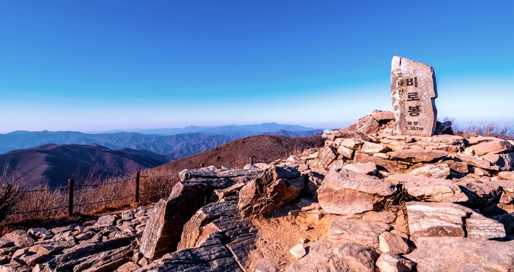
Located in Jirisan National Park, the Cheonwangbong Loop is 11.1 km (6.9 mi) with over 1,290 m (4,240 ft) of elevation gain. Cheonwangbong is the second tallest peak in South Korea at 1,918 m (6,293 ft). On its way to the summit, the trail passes by waterfalls, temples, and pagodas. The route is challenging but popular – start early to avoid the crowds.
On clear days, there are great views from the summit. Bring layers, as the upper elevations may be chilly. There are three toilets along the route, and hikers can refill water and buy snacks at a temple rest stop along the way.
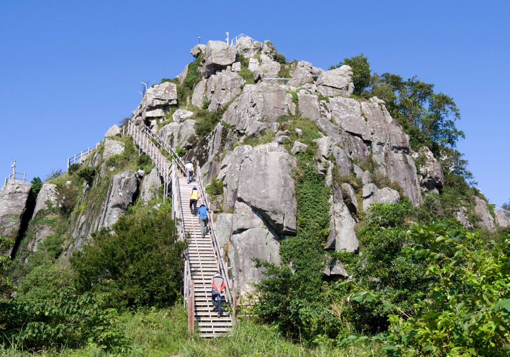
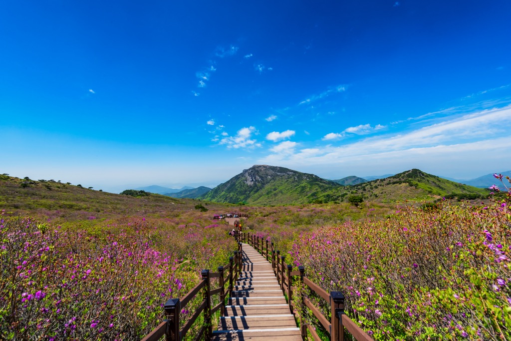
Birobong is a challenging hike in Sobaeksan National Park. The trail is 11.6 km (7.2 mi) out and back, with over 1,035 m (3,400 ft) of elevation gain. Be prepared to climb many stairs on your way up, but the summit view is spectacular on a clear day. The national park can be crowded, particularly during midday, so start early if you want less company on the trail.
Taking the Cheondong Trail to reach Birobong Peak, you’ll find a picnic area and toilets approximately halfway up. After this pit stop, the trail becomes steeper and rockier. Above the treeline, views take in the surrounding valleys, and a boardwalk path runs along the ridge to reach the peak. If you get your timing right in summer, you’ll pass royal azaleas and wildflowers blooming along the ridge.
Traveling around South Korea by car, bus, or train is relatively easy. Seoul, the country’s capital, is located in the northwest. Busan, the second largest city, is in southeast South Korea, and Daejeon, another large city, is in the country's west-central region.
South Korea has an excellent food scene and plenty of modern culture. K-Pop, one of the world's most popular music right now, was born around Seoul, but you can’t go wrong visiting any of the big cities.
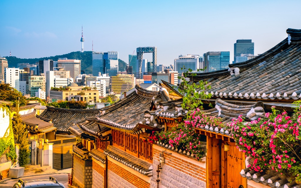
Seoul is the capital of South Korea and home to 9.78 million people. The city has a broad range of culture, from shopping centers and skyscrapers to historic temples, palaces, and pagodas. The new and the old blend seamlessly to produce “Asia’s coolest city,” a haven for innovation and creative people.
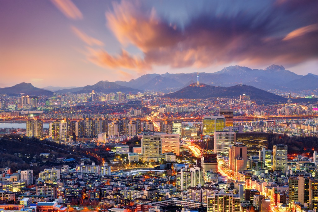
There are hundreds of things to do around Seoul. A few sites to keep in mind while planning your trip include the Gyeongbokgung museum and grounds, sampling local dishes at the teahouses of Insadong, and visiting the UNESCO World Heritage Site of Changdeokgung Palace. The city is a world food capital, so sample regional cuisines from street vendors or local restaurants.
Visit Gangnam, the neighborhood PSY raps about in his explosive 2012 hit “Gangnam Style.” It’s sort of like the Brooklyn of Seoul.
Forty-five minutes on the metro will deliver you to national parks where you can stock up on quiet, solitude, and fresh air.
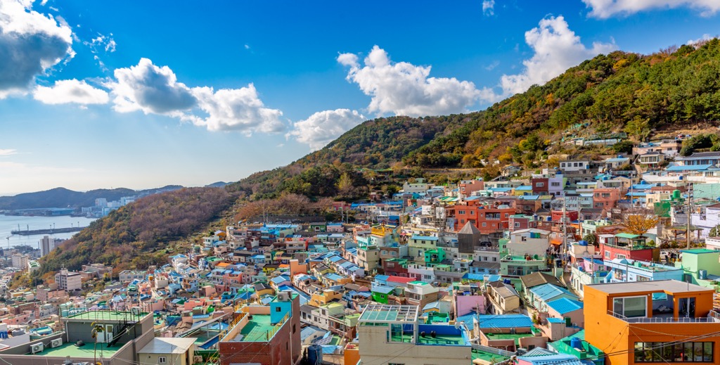
Busan has 3.43 million people and is in the southeast of South Korea. Many people, including worshippers and tourists, pass through the city on their way to visit the Buddhist temples in the surrounding mountains. Beomeosa Temple, built in 678 AD, is among the most popular.
There are a handful of museums and historical sites within the city. Those looking to get outside can go birdwatching at Nakdong River Estuary or visit Dongaek Island.
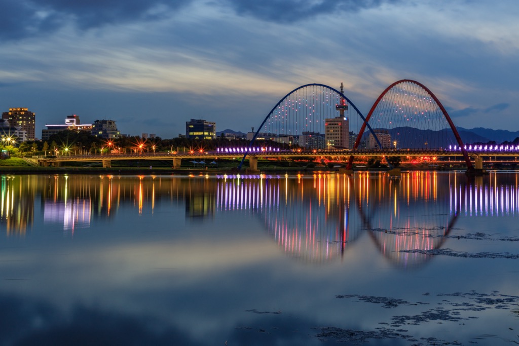
Daejeon has a population of 1.53 million and offers a variety of sites to visit, including Hanbat Arboretum, Yuseong Hot Springs, Uam Historical Park, Jangtasesan Natural Forest, and the Daejeon Museum of Art. Centrally located in the country, it can be a convenient major city to pass through on your way to the mountains.


The highest peak in the Sobaek Mountains is Cheonwangbong, at 1,918 m.
The Sobaek Mountains have 1,606 named peaks.


