
Scan the QR code and open PeakVisor on your phone
The Sapphire Range include 85 named peaks. The highest is Kent Peak at 2,744 m. Other notable peaks include Congdon Peak, Fox Peak and Bare Hill.
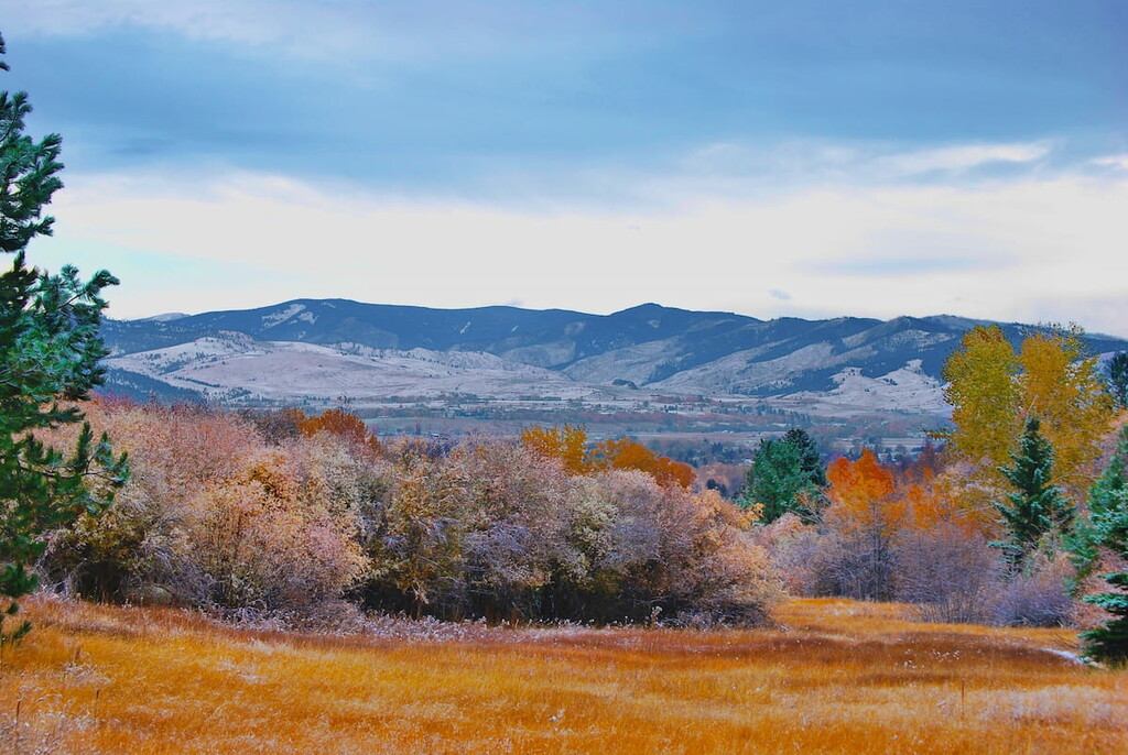
Located in southwestern Montana, the Sapphire Range (also referred to as the Sapphire Mountains) forms the eastern border of the Bitterroot Valley. The southern end of the range partially terminates with the East Fork of the Bitterroot River, while the remaining southern summits connect with the larger Anaconda Range at West Pintler Peak. The Sapphire Range is separated from the John Long Mountains to the east by Upper Willow Creek and Rock Creek.
The Sapphire Range was named for the large sapphire deposits that were mined in the area during the first part of the 20thcentury. Before the sapphire market collapsed after World War II, more than 40 tons of sapphires were mined in these mountains. Today, sapphires of gem quality can still be found in the region. In fact, Rock Creek is considered to be one of the most productive sites in Montana for mining sapphires.
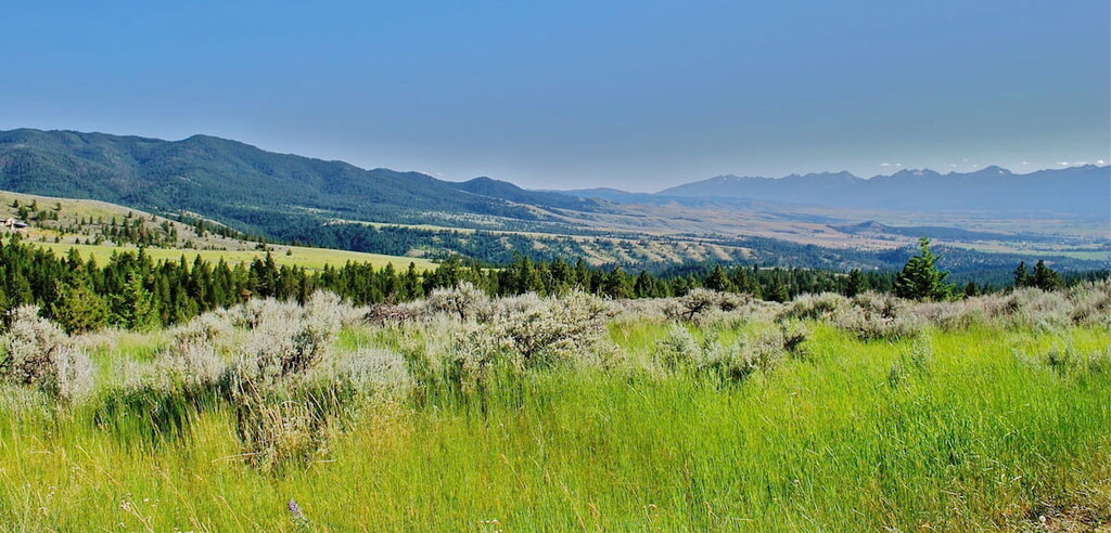
Though the Sapphires aren’t particularly high by Montana standards, many summits and ridgelines reach well above 8,000 feet, including Kent Peak, Congdon Peak, Fox Peak, Dome Shaped Mountain, and Bare Hill.
The Sapphires have an extensive logging history. While logging is no longer practiced in the area, the region is interspersed with an extensive road system that provides easy access to hiking trails and beautiful views of nearby peaks and mountain ranges.
The northern Sapphires are tucked within the Lolo National Forest and the southern Sapphires lie within Deerlodge National Forest. The range contains three large National Forest roadless areas, as well as parts of the Welcome Creek Wilderness, Threemile Wildlife Management Area, Skalkaho Game Preserve, and the Anaconda-Pintler Wilderness Area. In total, the Sapphires boast more than 320,000 roadless acres and 29,235 acres of designated wilderness.
The northernmost roadless area in the Sapphire Range is centered around Quigg Peak, the most prominent peak in the range. This 77,000-acre roadless region is characterized by sliderock and talus slopes, extensive Douglas-fir and lodgepole pine forests, and stunning glaciated ridges.
South of the Welcome Creek Wilderness, the 103,000 acre ‘Stony Mountain’ region is one of the largest roadless areas in the Sapphires. Though a ‘Stony Mountain,’ doesn’t actually exist within the Sapphires, this region of the range houses several impressive peaks, including Dome Shaped Mountain, which rises to over 8,600 feet above Stony Lake. The Stony Mountain area is easily accessible via Skalkaho Pass and contains the 25,000-acre Skalkaho Game Preserve.
In the southern Sapphires, a 117,000-acre roadless region connects to the Anaconda-Pintler Wilderness in the Anaconda Range. This region houses the Sapphire Wilderness Study Area, as well as several prominent Sapphire peaks, including Bare Hill, Kent Peak, Congdon Peak, and Signal Rock. The Sapphire Wilderness Study Area lies in the headwaters of the Bitterroot River and Rock Creek, two of Montana’s blue ribbon trout streams, and is largely undisturbed high country. This region of the Sapphires provides outstanding opportunities for primitive recreation, including hiking, camping, fishing, and cross-country skiing.
The Sapphire Range is bisected by just two roads, Route 38 at Skalkaho Pass and FS80 at Lutz Creek. Skalkaho Road climbs steeply out of the Bitterroot Valley and crosses through the heart of the Sapphires for 50 miles. This route is both scenic and boasts a number of hiking trails and primitive campsites.
Arguably one of the most popular destinations in the Sapphires Skalkaho Falls tumbles 150 feet into Skalkaho Creek. The falls are located directly beside Skalkaho Road and offer excellent views and photo opportunities. It should be noted, however, that travel on Skalkaho Road is slow due to narrow curves and limited pull outs.
The 7-mile Wyman trail leads above the Skalkaho Game Preserve to the Sapphire Divide and features incredible views of the Rock Creek drainage and the Bitterroot Mountains. The trail begins on Rock Creek Road and ends at the Skalkaho Game Preserve.
Located in the Stony Mountain Roadless Area, the 4.9-mile Palisades trail skirts the northern edge of the Skalkaho Game Preserve and features incredible views of the nearby Bitterroot Mountains. The trailhead is located on Willow Creek Road and has a developed campsite, horse-feed bunks, and hitch rails.
Established in 1978, the 28,135-acre Welcome Creek Wilderness lies in the northern Sapphires and extends east from the Bitterroot watershed divide to Rock Creek Canyon. The wilderness, which measures about nine miles by seven miles, is heavily forested and contains mostly steep ridges and narrow valleys. About 25 miles of trails provide foot and horse access to the wilderness.
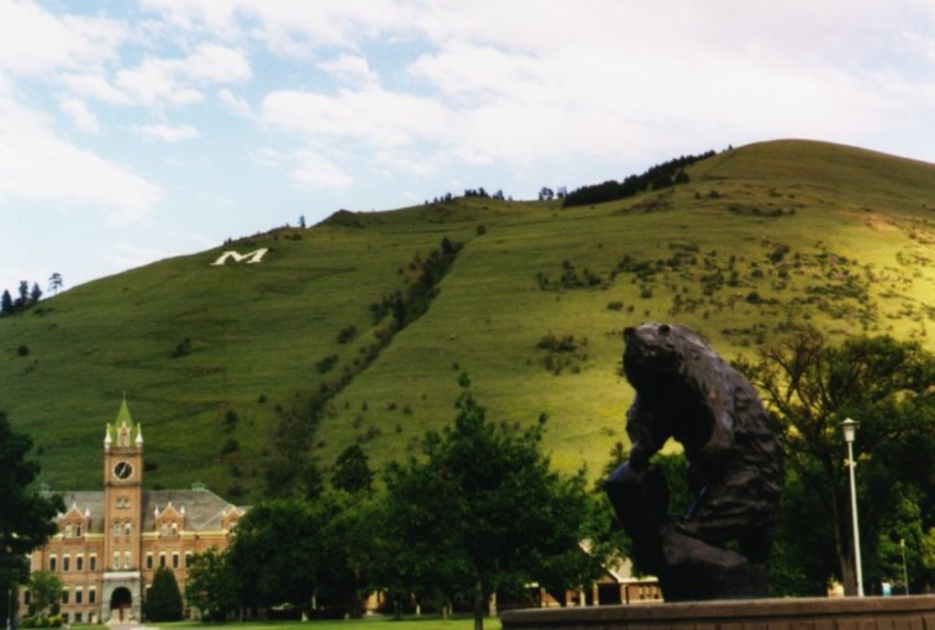
Just east of the Idaho-Montana border, Missoula lies at the convergence of five mountain ranges and is known as the “hub of five valleys.” The second largest city in Montana, Missoula is known for its access to popular outdoor recreation areas, including 22 miles of trails and 5,000 acres of conserved open space within the city itself. The city also lies at the confluence of the Clark Fork, Bitterroot, and Blackfoot rivers, making it a popular destination for white-water rafting.

Nestled in southwestern Montana, the Bitterroot Valley is a remote valley surrounded by the Bitterroot Range and Sapphire Mountains. The valley, which extends for nearly 95 miles from Lost Trail Pass in Idaho to the border of Missoula, Montana, is known for its small-town character. There are several charming communities tucked within the valley, including Darby, Hamilton, Lolo, and Florence. Each community offers a variety of accommodations and amenities. The Bitterroot Valley is an ideal destination for anyone looking to escape the hustle and bustle of nearby Yellowstone National Park and outdoor enthusiasts hoping to explore some of Montana’s most remote wilderness.


The highest peak in the Sapphire Range is Kent Peak, at 2,744 m.
The Sapphire Range have 85 named peaks.


