Scan the QR code and open PeakVisor on your phone
The Anaconda-Pintler Wilderness is located in the state of Montana in the United States. The protected area sits in the southwestern region of the state and covers 158,615 acres of land. The wilderness encompasses the Anaconda Range, covering the 40 miles of land on each side. In 1964 the wilderness was established with the Wilderness Act. Parts of the wilderness stretch into both Beaverhead-Deerlodge and Bitterroot National Forests.
There are 21 named mountains in the Anaconda Pintler Wilderness Area. The highest and the most prominent mountain is West Goat Peak standing at 10,778 feet. Elevations in the wilderness range from 5,000 feet up to the summit of West Goat Peak. North of the Anaconda range lies the Sapphire Mountains while the Big Hole Valley sits to the south. Though West Goat Peak is the tallest peak in the wilderness, West Pintler Peak is the most visited in the area, standing at 9,510 feet. The rugged range has seven peaks reaching over 10,000 feet and numerous sitting above 9,000 feet. The wilderness, along with the mountain range it protects, sits along the Great Divide.
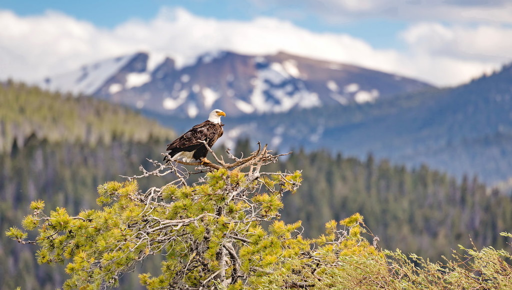
The remoteness of much of the wilderness allows wildlife to flourish, especially mountain goats and trout. This protected region is also home to elk, moose, deer, mountain lion, and bear. The landscape is defined by alpine lakes, forested valleys, and year-round glaciers that feed into the world-renowned trout streams. Forested sections are primarily made up of pine, Douglas fir, and aspen trees along with sagebrush. The southern end of the wilderness sits up against the northern tip of the Big Hole Valley. Here are vast subalpine meadows with creeks cutting through the fields.
Trails run throughout the wilderness along with a 45-mile section of the Continental Divide Trail. Many of the hiking trails sit along lower elevations with opportunities for mountaineering available upon the high peaks.
Upper Seymour Lake: Along the Continental Divide Trail lies the route to Upper Seymour Lake. This trail totals 13.7 miles out and back with just 1,610 feet of elevation gain. The trail runs through the Beaverhead National Forest and has an easy first five miles, following along Seymour Creek and other brooks. The last few miles of the trail climb up the plateau that the lake sits upon. Once at Upper Seymour Lake, hikers can enjoy a swim in the clear waters or fish in the stocked lake. Campgrounds are available at the lake.
Four Mile Basin: This popular trail offers a variety of terrain throughout. The 9.4 mile out and back trail totals 9.4 miles with just under 1,500 feet of elevation gain. The trail winds through the forest, past streams, ponds, and open basins, with the surrounding rugged mountains. The trail ends at Four Mile Basin Lakes, popular for camping and fishing. The trail also has an offshoot that leads to Storm Lake and Mount Tiny.
Phylis Lake and Johnson Lake Loop: This 15-mile loop has 2,765 feet of elevation gain. The trail winds through the wilderness, past subalpine lakes, forests, and views of the towering and rugged peaks. While the trail is used for backpacking, it is also popular amongst trail runners during the summer months.
Missoula lies an hour and a half north of Anaconda-Pintler Wilderness. Located in western Montana, this city sits at the convergence of five mountain ranges and is known as the “hub of five valleys”. The population is approximately 75,000 and is the second largest city within the state. Due to the proximity to mountains, rivers, and public lands, the city is known for its outdoor spaces. Within the city lie 22 miles of trails and 5,000 acres of conserved open space. Sitting at the confluence of the Clark Fork, Bitterroot, and Blackfoot rivers makes the city a popular white-water rafting destination. During the winter months, snow sports take center stage in the surrounding mountains, cross country skiing trails, and snowmobile routes.

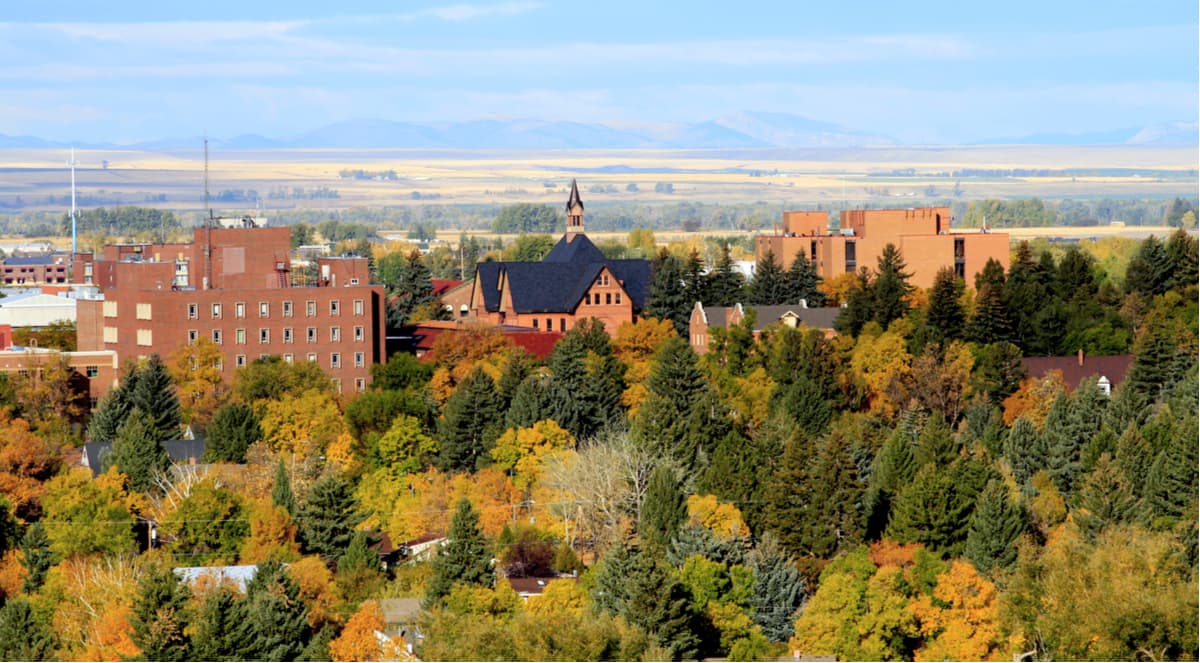
Bozeman lies an hour and forty-five minutes southeast of the Anaconda-Pintler Wilderness. The city of Bozeman is one of the largest in the state of Montana. The population is estimated to be about 50,000 as the city saw a lot of growth over the past decade. The city is home to Montana State University and was named after John M. Bozeman who in 1864 established both the town and the Bozeman Trail. At an elevation of 4,820 feet the city experiences warm summers and snowy cold winters. Weather can change drastically from day to day. Bozeman is surrounded by mountains, making it a popular destination for outdoor adventure.