
Scan the QR code and open PeakVisor on your phone
The Eastern Ghats include 4,224 named peaks. The highest is Kambatirāyan Peak at 1,699 m. Other notable peaks include Arma Konda, Devmali and Devadu Konda.
The Eastern Ghats are a vast mountain system in India's southeast, along the coast of the Indian Ocean. The range stretches across the states of Odisha, Andhra Pradesh, Tamil Nadu, Karnataka, and Telangana. It is one of two halves of the Ghats Mountains, the other being the Western Ghats. There are 4224 named peaks in the Eastern Ghats. Kāttāhi Betta (1,822 m/5,977 ft) is the highest mountain, and Arma Konda (1,680 m/5,511 ft) is the most prominent.
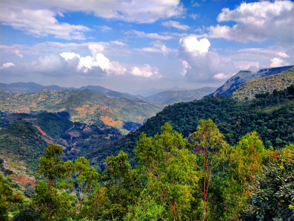
The Eastern Ghats consist of a series of low hill ranges separated by large river valleys. Some of India’s most extensive waterways are born in these mountains; the Godavari River, the second longest after the Ganges, originates here.
The range covers 75,000 sq km (28,960 sq mi) within the states of Odisha, Andhra Pradesh, Tamil Nadu, Karnataka, and Telangana. The River Mahanadi basin marks the range’s northern boundary, and the River Cauvery is the southern border. Meanwhile, the western limit lies along the Bastar, Telangana, and Karnataka plateaus, as well as the Tamil Nadu uplands. The range runs parallel to the Bay of Bengal, and coastal zones comprise the eastern boundary.
The most significant continuous section of the range lies between the Mahanadi and Godavari rivers in the Dandakaranya region. Over a dozen rivers originate in the Eastern Ghats; the major ones are the Godavari, Mahanadi, Krishna, and Kaveri. The average elevation in the range is 600 m (1,970 ft).
Three national parks and dozens of wildlife sanctuaries and reserves exist to protect the diverse flora and fauna. The parks are Bhitarkanika National Park, Simlipal National Park, and Sri Venkateswara National Park. Other wildlife reserves include Coringa Wildlife Sanctuary and Satkosia Tiger Reserve.
The formation of the Eastern Ghats dates to the separation of the Rodinia supercontinent about 750 million years ago and the creation of the Gondwana supercontinent around 250 million years ago. The range was created and shaped via magmatism, metamorphism, and deformation.
Rocks layers in the range metamorphosed and deformed about 1.4 billion years ago during the mid-Proterozoic. The formation began with the accumulation of silt, mud, carbonates, and basalt deposits. Over time, these layers metamorphosed into khondalites and calc-silicate rocks. Along the range’s western edge, volcanic sedimentary rocks were deposited and later metamorphosed into schist belts.
A mountain-building event in the Middle Proterozoic shortened the range from east to west and changed strata to northeast-aligned folds and shear zones. Strike-slip faults and thrusts are present throughout the range.
The main rock types found in the range are charnockites, granite gneisses, khondalites, metamorphic gneisses, and quartzite. Bauxite, limestone, and iron ores are present and draw mining activity to the region, such as mining sites in the Kolli Hills and Servarayan Hills. Soil types are primarily red, black, laterite, and alluvial.
The Eastern Ghats have a tropical monsoon climate, receiving rain from the southwest monsoon and the retreating northeast monsoon. Average rainfall across the zone ranges from 80 to 250 cm (31.5 to 98 in) on the eastern and western slopes. However, the central uplands are much drier.
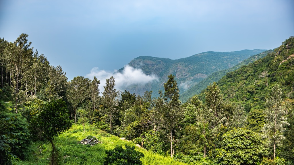
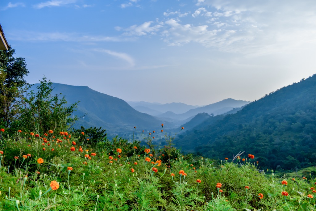
Given the variation in precipitation and the range’s long north-south reach, its numerous ecological zones are unsurprising. One primary zone is the eastern highland’s moist deciduous forest, similar to that in the Western Ghats and the eastern Himalayas.
Another zone, the East Deccan dry evergreen forest, has been drastically altered by intensive human activity. Composed initially of a tall canopy of deciduous trees and an understory of evergreens, most of this zone is now altered evergreen forest and low, closed canopies. Thorny plants are common where degradation has converted the land to tropical dry evergreen scrubland.
Other ecological zones include semi-evergreen forests, southern tropical dry mixed deciduous forests, dry savannah forests, southern tropical dry scrub forests, southern tropical thorn forests, Carnatic umbrella thorn forests, southern subtropical hill forests, southern thorn scrub, and mangrove forests.
The mountains house roughly 2,500 flowering plants, accounting for nearly 13% of India’s total. Trees like Indian rosewood, mahogany, and red sandalwood are economically valuable. Other species are harvested for their medicinal properties, such as cycad, whisk fern, vengai, and pala. Local tribes utilize the forests for food, medicine, and construction.
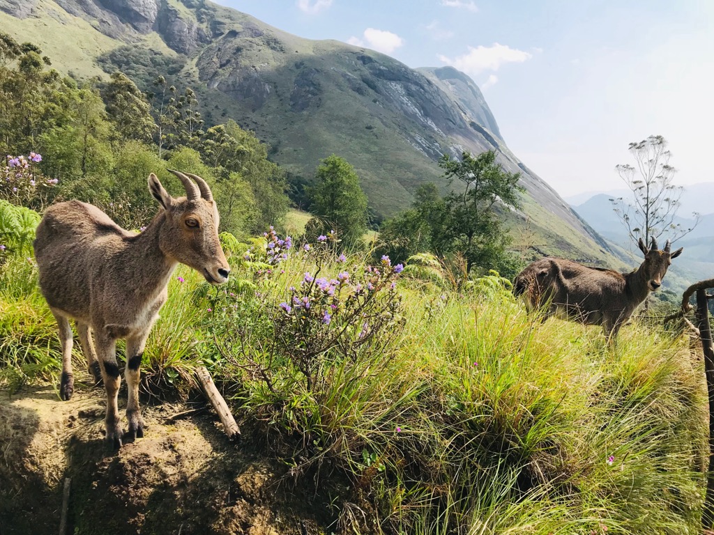
Approximately 100 species of mammals, 490 birds, 119 reptiles, and 34 amphibians live here. Some iconic species include elephants, gray slender loris, the mountain ungulate Nilgiri tahr, leopards, wild cattle known as gaurs, sambar deer, and tigers. Several endemic species can be found in the Eastern Ghats, including the rock rat, Jerdon’s courser, and several skink species. The mountains provide a habitat for rare geckos such as the Indian golden gecko, granite rock gecko, and Yercaud slender gecko.
Several factors pose a threat to the range’s ecosystems. These include monoculture plantations of rice, coffee, and tea; mining exploration and extraction; plant-based industries such as those producing plywood, pulp, and paper; logging, in particular for sandalwood and rosewood; invasive species such as Lantana camara; and the deforestation of hilltops for farmland.
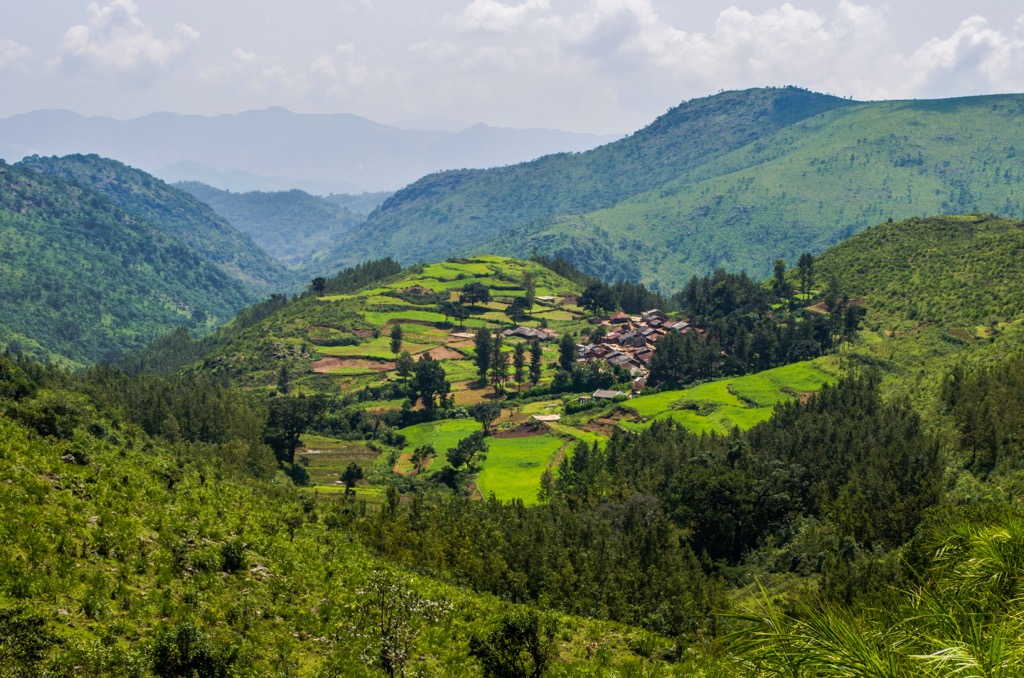
The Eastern Ghats are home to more than 50 tribal communities. Many tribal groups practice small-scale farming using slash-and-burn and shifting cultivation methods. They use forest products for food, medicine, and construction materials, as well as harvesting and selling in local markets.
In some areas, such as in Araku Valley, tribes have held firmly to their traditions, creating an environment of rich cultural diversity. Today the mountains are home to these tribes, as well as supporting economic activities, such as tourism, mining, and tea and coffee plantations.
The British began the colonization of India after the Battle of Plassey in 1757. The Crown ultimately ruled India between 1858 and 1947, when they finally gained independence. Mohandas Gandhi and Jawaharlal Nehru have cemented their status in history as vital architects and players of the independence movement.
‘Hill stations’ are the name for small mountain towns that act as a gateway to nature. The British created these during the 1800s as a summer getaway from crowded and hot cities.
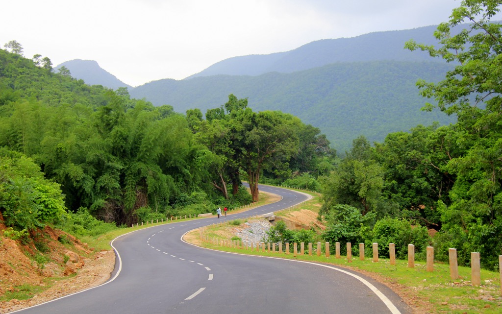
The Eastern Ghats run 430 km (265 mi) north-south, with numerous waterfalls, caves, and temples tucked into the hills. Hill stations make for the perfect home base to explore the lush green forests and ecological and cultural diversity of the mountains.
Generally, it’s best to visit during the dry seasons; monsoonal moisture can make some roads impassable. September to May offer the best chance of good weather. Check temperatures, as some higher-elevation hill stations will get chilly around January. Below are a few spots to visit in the Eastern Ghats.
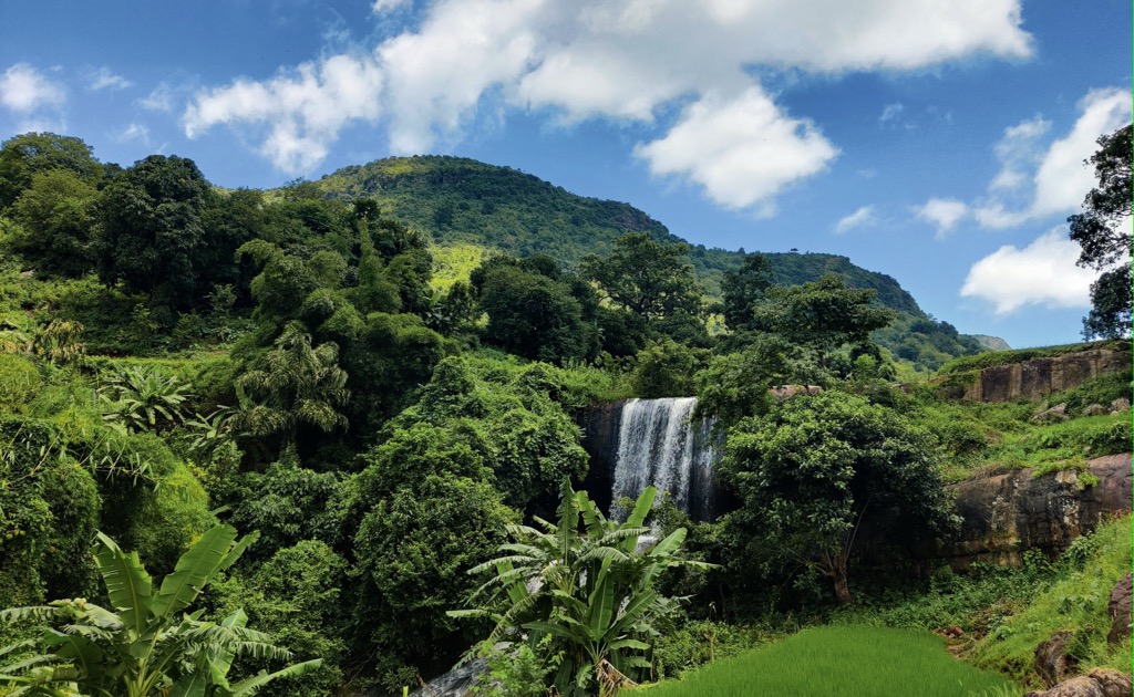
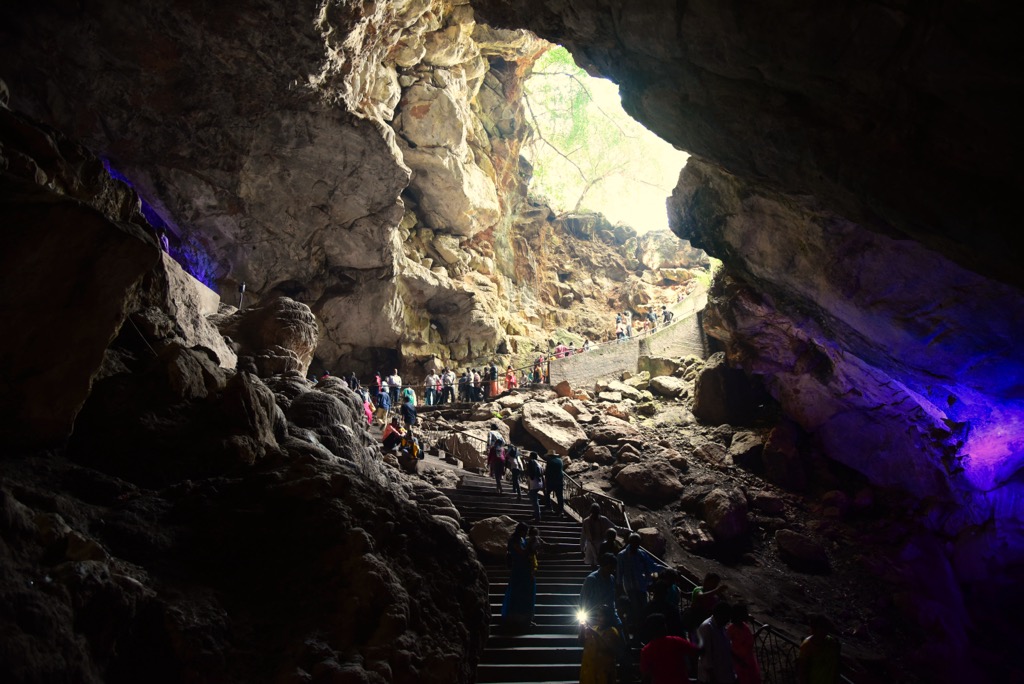
Located in the state of Andhra Pradesh in the Visakhapatnam district, the Araku Valley offers the opportunity to trek, explore caves, and visit tea and coffee plantations. There is also ample cultural immersion, should you want to taste the regional flavor. A few of the most popular spots in the valley are the Chaparai Waterfalls (sometimes called Dumbriguda Falls), the lush Ananthagiri Hills, the Padmapuram Botanical Gardens, the Araku Tribal Museum, and the 700 m (2,300 ft) limestone Borra Caves.
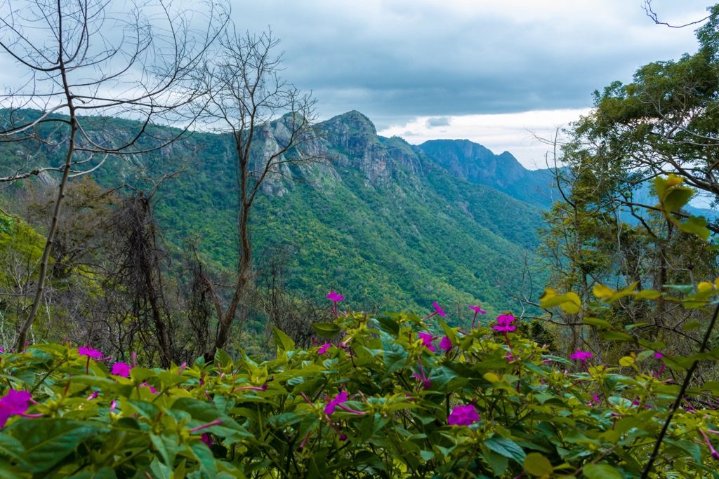
Devmali (1,675 m/5,495 ft), also called Deomali, is the highest point in the state of Odisha and is a great spot for trekking and eco-tourism. It’s possible to summit Deomali in a day or to camp overnight. Views from the flat summit take in surrounding waterfalls and rolling hills. Some companies organize hang gliding here if you’re looking for more adventure.
Yelagiri in Tamil Nadu offers hikes, lakes, waterfalls, and temples. Some of the top spots to visit here are the Jalagamparai Waterfalls, the Punganoor Lake, the Swamimalai Hills, and the Jalagandeeswarar Temple for devotees of Lord Shiva. There is rock climbing and ziplining in the area.
Yelagiri is not as well established as other hill stations; it’s a worthy option for those looking for something a little off the beaten path. That being said, it still offers adventure sports and a few modern hotels.
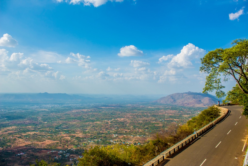
The drive to the picturesque Kolli Hills in Tamil Nadu is not for the faint of heart. The road is narrow and has dozens of hairpin turns. If you make it up, check out the Agaya Gangai Waterfalls, the Arappaleeswarar Temple, the Siddhar Caves, the botanical gardens, and the Tampcol Medicinal Farm for a trip that blends nature and culture.
The Eastern Ghats extend through five states. There are many cities and towns to stay in to access the mountains. Below are a few options near some of the most popular hill stations.
Namakkal in Tamil Nadu is a six-hour drive southwest of Chennai and a great stepping stone for reaching the Kolli Hills. The city has a population of 75,000 and is known for being a major producer of automobile parts. The city’s stunning architecture represents the luxury and style of the Atikula, Pallavas, and Vijayanagara empires.
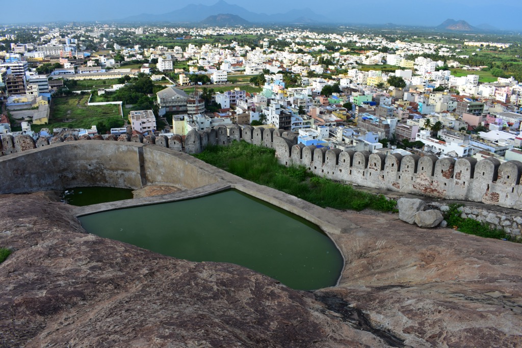
One of the city’s most well-known buildings is the Rock Fort, built on a hill formed by an enormous slab of rock. Another famous spot to visit is the Anjaneya Temple. The temple boasts impressive architecture and a massive statue of the Hindu Monkey God. The Namakkal Narasimha Temple and Ettukai Amman Temple draw many Hindu devotees.
The town offers a range of accommodation options from budget to luxury. You’ll have no shortage of local dishes to sample while visiting Namakkal.
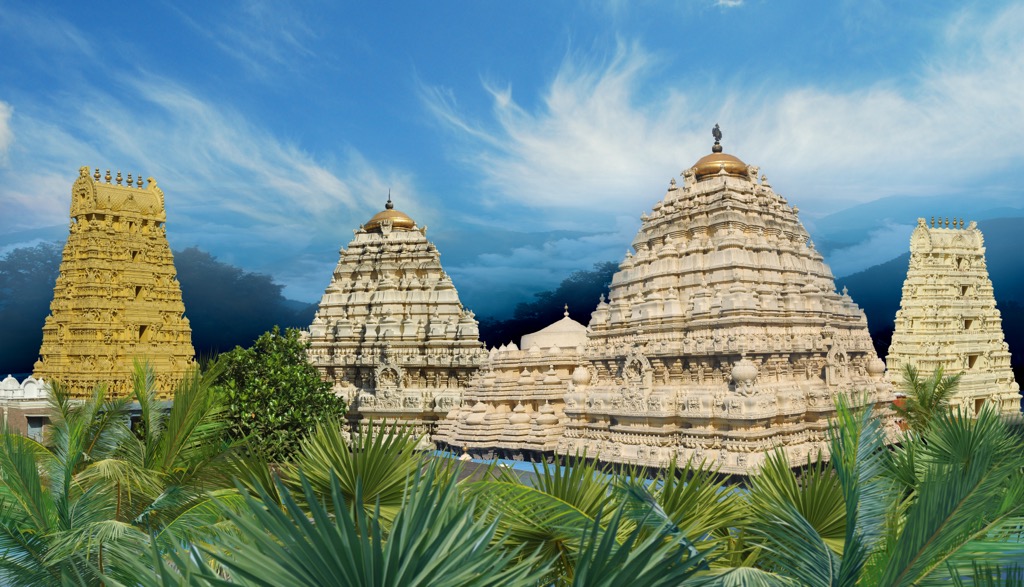
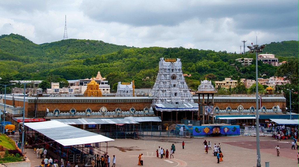
Tirupati has a population of over one million and is in the Chittoor district of Andhra Pradesh. The city is known as the home of the deity Lord Venkateswara, also known as Balaji. The Venkateswara Temple sits in the Tirumala hills at 860 m (2,820 ft). It is one of the busiest pilgrimage centers in the world. Other temples around include Padmavati Temple and the Govindaraja Swami Temple.
Tirupati lies at the southern end of the Eastern Ghats. The region boasts numerous waterfalls and lush forests. About 130 km (80 mi) away, you can visit Horsley Hills, a hill station with temples, verdant forests, and stunning lookout points.
The large city has street food, fine dining, and accommodation for all budgets.
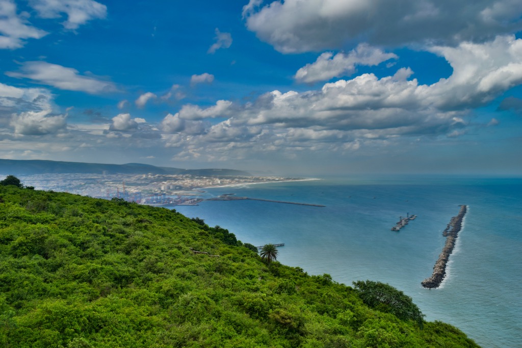
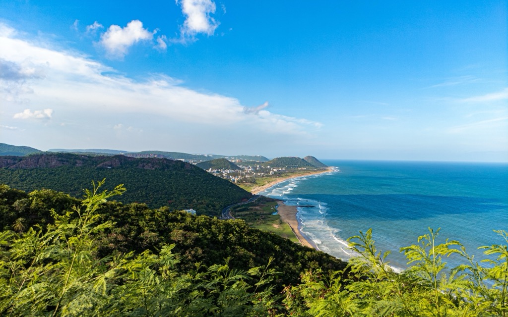
Visakhapatnam, known as Vizag for short, is home to 2,382,000 people and is in the state of Andhra Pradesh. Vizag has the oldest shipyard in all of India. The city has several less crowded beaches on the ocean than many other urban coasts. Yarada Beach is a local favorite.
Vizag is 110 km (68 m wi) east of the Araku Valley. It takes only a few hours to escape the city and be in the valley for trekking, exploring caves, and learning about the indigenous tribes that call the area home.
The city has many lodging options, from cheap to fancy hotels. Located along the ocean, there is no shortage of seafood on the local menus, along with many classic South Indian dishes.


The highest peak in the Eastern Ghats is Kambatirāyan Peak, at 1,699 m.
The Eastern Ghats have 4,224 named peaks.


