
Scan the QR code and open PeakVisor on your phone
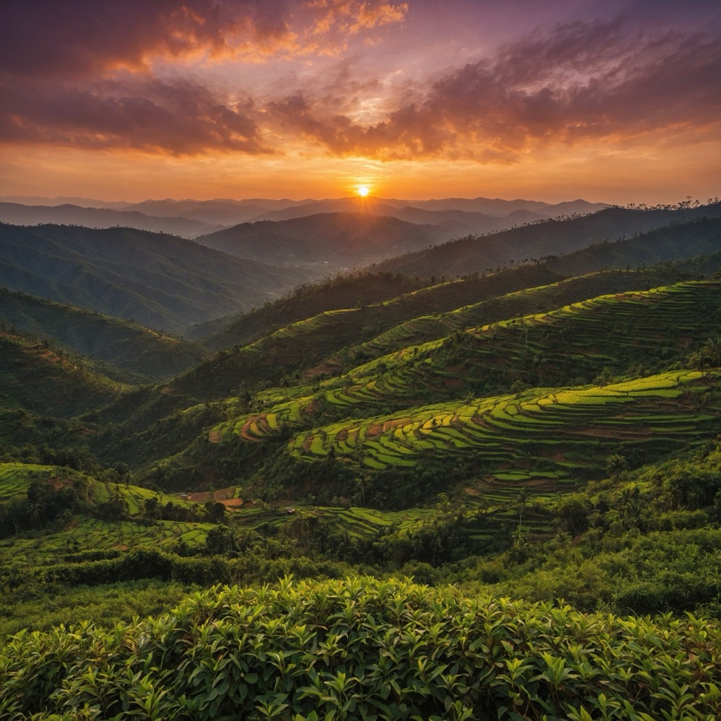
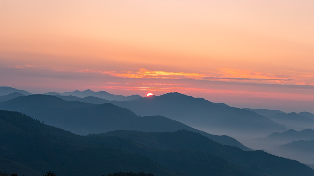
Andhra Pradesh is a state in southeastern India featuring 2199 named mountains. The region is complemented by India’s longest coastline, ancient plateaus, expansive forests, famously fertile delta regions, and several prominent river valleys that extend throughout the state. Topping out at 1,680 m (5,541 ft), Arma Konda, also known as Jindhagada, is worthy of many superlatives despite its relatively short stature. It is the loftiest summit in Andhra Pradesh and the entire Eastern Ghats range. It also stands out as the most prominent peak in the state, with a vertical relief of 1,290 m (4,232 ft). On a national scale, it’s one of the most isolated peaks in India, with an isolation of 907 km (564 mi).
Andhra Pradesh’s land area covers a sprawling 162,970 km2 (62,920 sq mi), making it the 7th largest state in the 7th largest country on Earth. For reference, it’s close in size to Tunisia and slightly smaller than the state of Florida in the United States.
The state shares national borders with Orissa to the northeast, Chhattisgarh to the north, Karnataka to the southwest, Tamil Nadu to the south, and Telangana to the northwest. To the east lies the Bay of Bengal, the northeastern arm of the Indian Ocean.
According to the last census, held in 2011, the population was 84,580,777, making Andhra Pradesh the 10th-most populous state in India. A 2021 census was planned but ultimately postponed due to COVID-19, and has not yet been completed. Even though the statistics are based on old data, with an average population density of 308 per km, Andhra Pradesh is generally less crowded than the rest of India.
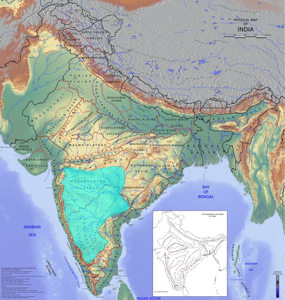
Andhra Pradesh has three primary physiographic regions: the Coastal Plains, the Eastern Ghats, and the plateau west of the Eastern Ghats.
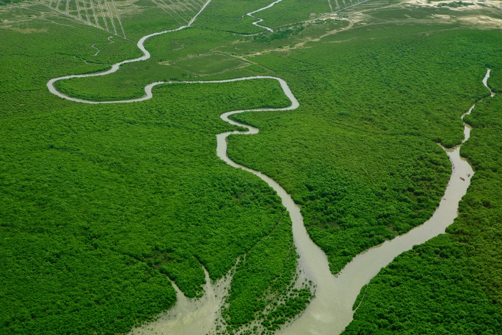
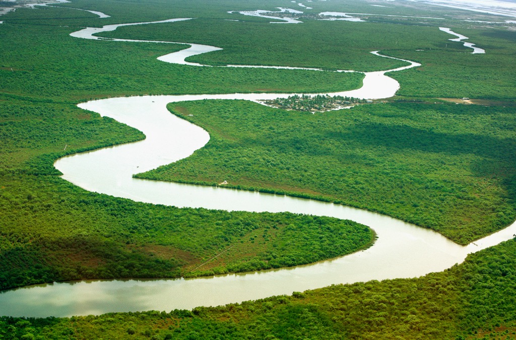
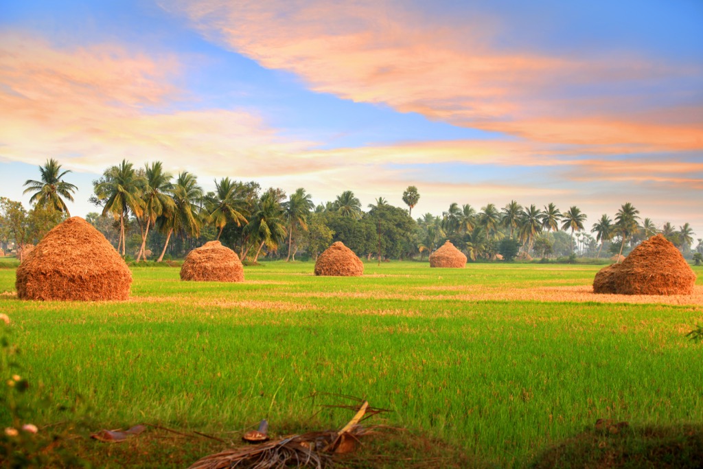
The highly fertile Coastal Plains of Andhra Pradesh run parallel to the Bay of Bengal, stretching westward from the coastline to the Eastern Ghats. The plains are divided into two main regions: the Northern Circars and the Coromandel Coast. They are shaped by continuous deposition from the Krishna, Godavari, and Penna rivers, which flow eastward to create the area’s trademark flat and low-lying terrain. The resulting river deltas and rich alluvial deposits are vital for farming crops such as rice, sugarcane, cotton, and coconut while also supporting coastal wetlands, lagoons, and mangrove forests.
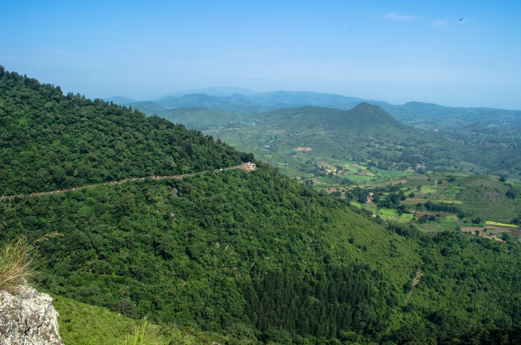
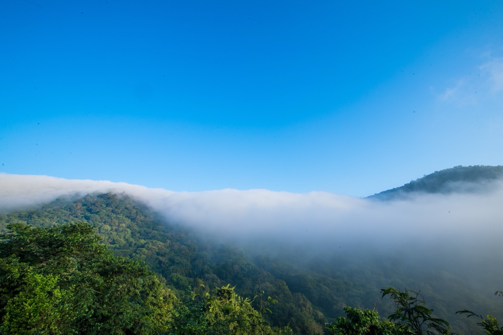
The Eastern Ghats are a narrow, hilly, discontinuous mountain range that spans five Indian states. About 40% of the range falls within the borders of Andhra Pradesh. Located at 11° 30’ to 22° N latitudes and 76° 50’ to 86° 30’ E longitudes, the range generally trends northeast. These mountains are primarily composed of igneous, metamorphic, and sedimentary rocks and are jam-packed with minerals, including bauxite, limestone, manganese, quartz, and feldspar. The Eastern Ghats are home to several indigenous communities, including the Savara, who practice a shamanistic culture, as well as Konda Dora, Gadaba, Khond, Manne Dora, and Mukha tribes.
To the west of the Eastern Ghats is the Deccan Plateau, one of India's oldest and most prominent landforms. Formed by volcanic and tectonic activity, the western side of the plateau is elevated, and as a result, nearly all the rivers flow eastward toward the Bay of Bengal. Despite limited rainfall, the region’s fertile black soil is a major producer of pulses, millet, and oilseeds.
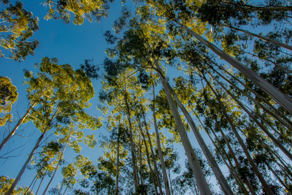
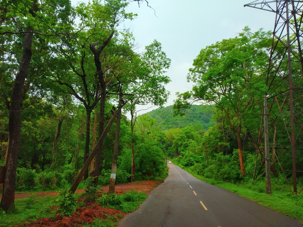
Forests comprise 37,258 km2 / (14,385 sq mi) of Andhra Pradesh, equivalent to approximately 23% of the state’s total land mass. Prominent species include bamboo, which accounts for 6,104 km2 (2,356 sq mi), mangrove, ebony, jackfruit, wild mango, teak, rosewood, and acacia. The Eastern Ghats are largely made up of dense tropical forests, while the Deccan Plateau has more than its fair share of shrub vegetation and scrub bush. Coastal regions are thick with mangrove forests, crucial to protecting the coast from erosion.
Mountainous and hilly terrain makes up roughly 30-35% of the state. It’s dominated by the Eastern Ghats, which stretch 1,750 km (1,090 mi) across the eastern coast of the Indian Peninsula. Several subranges of the Eastern Ghats are located in the state; however, due to their diminutive stature, some say they resemble hills more than mountains.
They include the Nallamala Range in the eastern part of the state, the Erramala Range in the west, the Palkonda Hills in the south, and the Velikonda Range in the southeast.
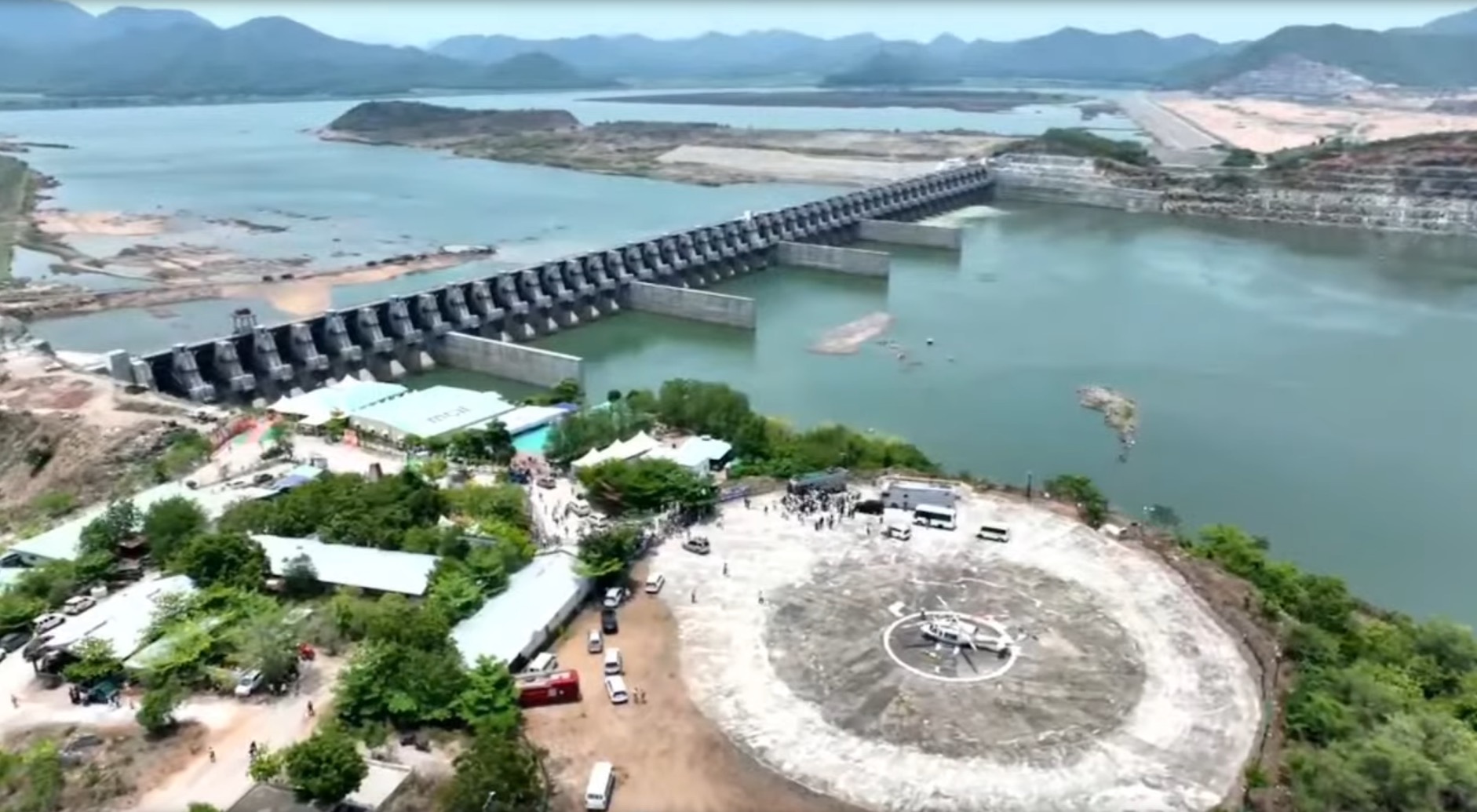
Rivers play crucial roles in irrigation, drinking water supply, and hydropower. There are 40 large and midsize rivers in Andhra Pradesh, including the three major rivers of the state: the Godavari, Krishna, and Penna Rivers:
The Godavari River, which originates in Trimbakeshwar in the Western Ghats, Maharashtra, is the second-longest river in India. It runs for about 1,465 km (910 mi) and forms one of the country’s largest deltas. The river supplies water to the East and West Godavari districts, known as the "Rice Bowl of India."
The Krishna River's headwaters are at 1,337 meters (4,386 feet) in Mahabaleshwar, a hill station in the Western Ghats of Maharashtra. The river continues 1,400 km (869 mi) to the Bay of Bengal, forming a fertile delta important for sugarcane and rice cultivation. The river is famous for its many temples and pilgrimage sites along its banks, including the world-renowned Amaravati Stupa.
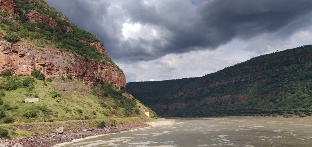
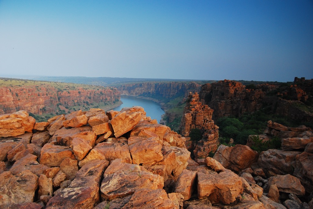
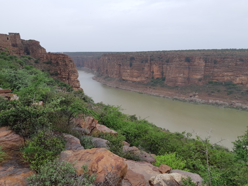
The Penna River flows for 597 km (869 mi), with headwaters in the Nandi Hills of Karnataka. It is a sacred river and the site of the Gandikota Fort, known as the "Grand Canyon of India.” The river provides a much-needed water source for drought-starved areas in the Rayalaseema region.
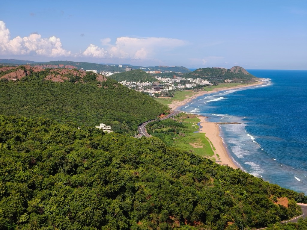
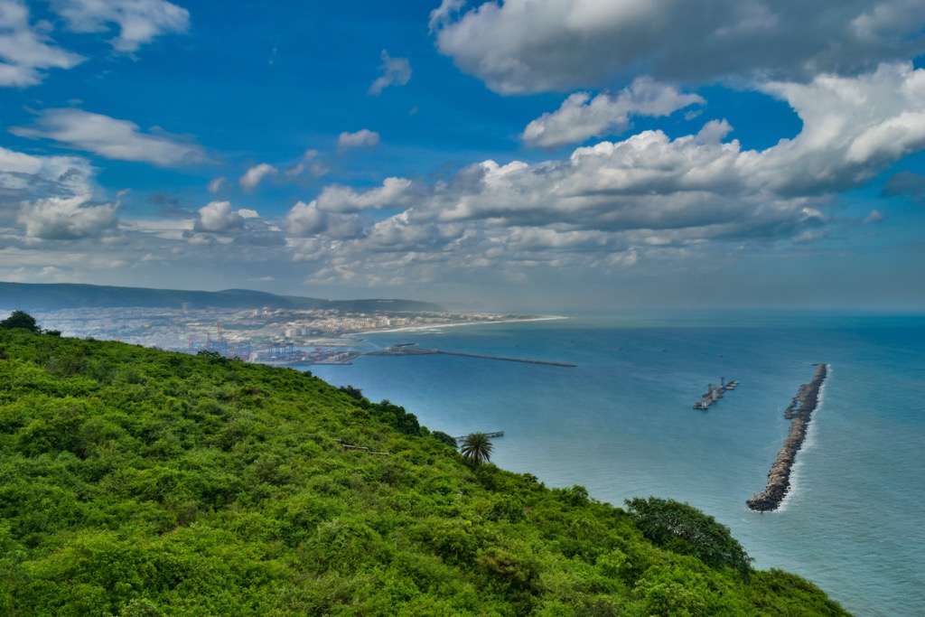
The coastline stretches across nine districts of Andhra Pradesh’s landscape, accounting for 974 km (605 mi) along the Bay of Bengal. That means it’s the second longest coastline in India and arguably the most diverse. The coastlines of Andhra Pradesh are chock-full of variety, ranging from one of the busiest ports in India (Visakhapatnam Port) and the dense mangrove forests of the Coringa Wildlife Sanctuary, to breathtakingly beautiful beaches like Rushikonda Beach, known as the “Jewel of the East Coast.” The coast is an important resource for the state’s tourism, trade, fishing, and agricultural industries, with shrimp aquaculture standing out as a major industry.
Plateaus are common in the Rayalaseema uplands and comprise about 40% of the state’s land mass. They are essential to the dryland farming of crops like groundnuts, cotton, and fruits.
Peneplains are low-grade, slightly undulating land surfaces formed by prolonged erosion of rugged terrain and hills near the foothills of the Eastern Ghats and Rayalaseema. These unique terrain features represent the final stage of millions of years of erosion and are rich in minerals like limestone, iron ore, and bauxite. Despite low rainfall and regular drought conditions, the land remains viable for farming millet, chickpeas, and cotton.
While there’s no doubt you can find plenty of advice on how to spend your time in Andhra Pradesh on the internet, it can often be of dubious reliability, out of date, or, in some cases, intentionally misleading. At Peakvisor, we always suggest that it’s best to stop by an official tourist information center to touch base on potential red flags that could affect travel or to verify specific items in question. It never hurts to ask.
If you find yourself in Vijayawada, as most travelers do, this is a good place to start:
Andhra Pradesh Tourism Office
Address:
5th Floor, Stalin Corporate Office, Ramalayam Rd, Industrial Area, Auto Nagar, Vijayawada, Andhra Pradesh 520007, India
Phone: +91 866 255 2969
Andhra Pradesh is located entirely on the hyper-stable and ancient Indian Shield, which has remarkably not experienced significant deformation in billions of years. The landscape is primarily composed of 2.5-billion-year-old Precambrian granite, gneiss, and schist rock.
While the region is considered stable, a number of fault lines and lineaments have contributed to the formation of greater southern India over time. For example, the western part of Andhra Pradesh, including the Deccan Plateau, was formed around 66 million years ago during the volcanic eruptions associated with the breakup of Gondwana.
The Eastern Ghats, on the other hand, were formed during the Proterozoic Eon. Offshore, the main geological feature is the Krishna-Godavari Basin, a sedimentary basin formed during the Mesozoic Era around 150–65 million years ago due to rifting and subsidence.
The primary mountain range in Andhra Pradesh is the Eastern Ghats, which extend along the east coast of the Indian peninsula. The state has four main subranges: the Nallamala, Erramalla, Palkonda, and Velikonda.
The Eastern Ghats, which run north to south and stretch through Visakhapatnam, Vizianagaram, East Godavari, and parts of Prakasam districts, are home to Arma Konda, the highest peak in both the range and the state of Andhra Pradesh. Galikonda Hill, at an elevation of 1,500 m (4,921 ft), is another notable peak in the region.
The Nallamala Hills (note: not peaks) run north to south for nearly 430 km (267 mi). The highest peak in the range, Bhairari Konda, clocks in at a lowly 1,110 m (3,608 ft), and the average elevation in this zone is just around 520 m (1,706) ft). These hills are not known for their elevation and are not very rugged. As with many ancient ranges, this is due to erosion during hundreds of millions of years since their formation. The main river that embarks from the Nallamalas is the Gundlakamma River, which starts its descent at 424 m (1,391 ft) above sea level. It is also worth mentioning that these hills are home to the single largest span of pristine forest in Southern India’s Eastern Ghats.
Characterized by its low hills and valleys running southwest along the Deccan Plateau, the range runs parallel to the Coromandel Coast on the Bay of Bengal. It averages only around 300-500 m (984 -1,640 ft) in height. The most popular attractions in this range are found below ground. The limestone Belum Cave system, which runs a length of 3,229 m (10,593 ft), is India’s second-largest. Unfortunately, until as recently as 1988, the caves were used as a waste dump. More recently, they have become a protected area and have developed infrastructure for proper tourism, including a hotel and toilet facilities. The caves were the recipient of the 2003 APTDC National Tourism Awards from the Ministry of Tourism and Culture and are surely worth a visit for any real or wannabe spelunkers. The other subterranean site you’ll find in the Earramalla Range is the Gandikota Gorge, a deep gorge through granite and sedimentary rocks known as the Grand Canyon of India.
Forming the central part of the Eastern Ghats, the Palkondas are an arc-shaped range that runs northwest-to-southeast between the Penneru and Palar rivers. The name Palkonda means “milk hills.” They consist of low-lying hills that reach just 914 m (3,000 ft) at their maximum elevation and are mostly made up of quartzite, slate, and lava.
Located east of the Nallamala Range, this heavily folded and faulted range runs north to south in the southeastern part of Andhra Pradesh. The tallest peak and namesake is Velikonda, at 1,110 m (3,610 ft). The range is more remote than the rest of the area, and aside from the Chenchu people, an Indigenous tribe, it is mostly devoid of human life.
The climate of Andhra Pradesh ranges from tropical, with generally hot and humid conditions along the coast, to semi-arid further inland on the plateaus. In general, the state has three main seasons: Summer, Monsoon, and Winter.
That said, temperatures and overall weather patterns will vary between the coast, plains, and mountains due to elevation differences, proximity to the Bay of Bengal, and other factors related to the region's geography.
The summer season here begins in March and lasts through June. Temperatures range from 20°C - 40°C (68 °F - 104 F°) with very high humidity, especially on the coastal plains.
From July through September, Andhra Pradesh experiences the effects of the southwest monsoons, which account for the majority of annual rainfall: as much as 75% along the coast and Eastern Ghats and up to 60% on the plateaus.
Winter in Andhra Pradesh lasts from October through February and is the most popular time to visit. Temperatures generally range from 10°C-30°C (50°F - 86°F) and are usually very comfortable. In early Winter, from October to December, the northeast monsoon impacts southern India, bringing welcome precipitation that’s crucial for agriculture. The only place in the state that experiences any snow is Lambasingi, known as the “Kashmir of Andhra Pradesh.”
Thanks to the great diversity found across the landscape of Andhra Pradesh, the state has incredibly varied ecosystems that are home to more than 3,000 plant species, including 600 varieties of trees, and more than 800 species of vertebrates, including 100 mammals, 400 birds, and 200 fish.
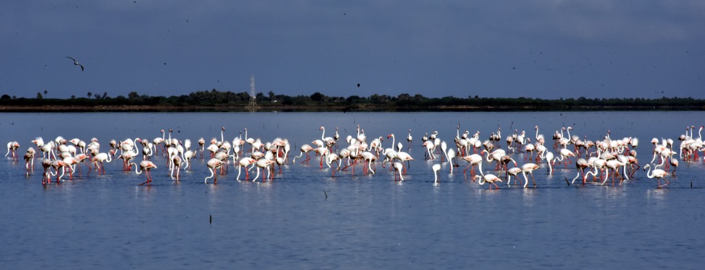
Spotted deer, peacocks, wild boars, monkeys, jackals, and Indian hares live in the mountains, hills, plateaus, and forests. At the same time, coastal areas and wetlands are home to numerous flamingos, crocodiles, herons, turtles, sardines, and shrimp.
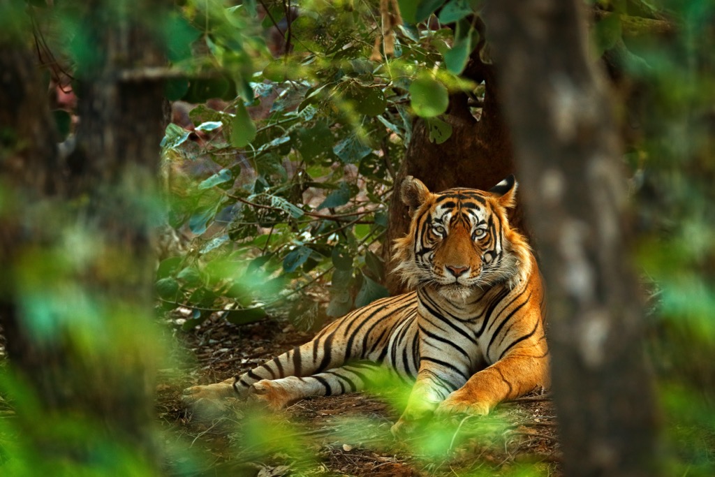
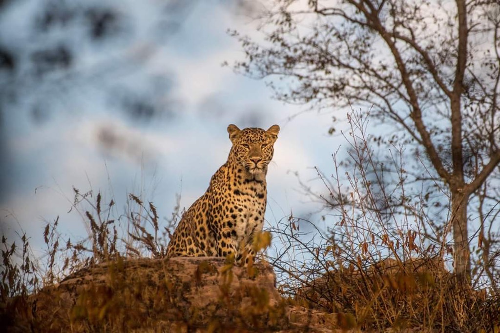
Some of the more unique and rare animals you may be lucky enough to encounter on your journeys include the endangered and protected Bengal Tiger and Indian Elephant, as well as the more common leopard, sloth bear, or guar (Indian Boson).
Depending on where your travels take you, Andhra Pradesh plays host to a wide range of tree species. You’re most likely to find mangroves, coconut, and mango trees in the brackish sandy soils of the coastal plains.
Among the highest peaks of the Eastern Ghats, deciduous trees like teak, the endemic red sander, rare Indian frankincense, and Indian Rosewood are common.
Back down to the Western Plateaus, drought-resistant species like acacia and eucalyptus have adapted to the semi-arid climate and are quite abundant.
Notably, Andhra Pradesh contains many unique and powerful medicinal plants, including neem, tulsi, ashwagandha, turmeric, and aloe.
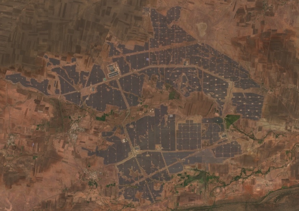
Since the early 2000s, the Indian government has supported the state’s renewable energy programs, with wind and hydropower at the forefront. The Kurnool Ultra Mega Solar Park, which aims to create carbon-neutral energy systems, has 4 million panels, each generating 315-320 watts of power. When it was commissioned in 2017, it was the largest solar power plant in the world.
Another major project is the Zero-Budget Natural Farming program, which promotes chemical-free and sustainable agriculture. Adopted by the state in 2015, the program has gained widespread support from the government and more than 500,000 farmers across Andhra Pradesh. It aims to eliminate synthetic fertilizers and pesticides, use diversity planting to enhance soil fertility, and reduce overall costs. The initiative's ultimate short-term goal is to transition the entire state to natural farming by 2027.
Beginning with the Indian Forest Act of 1927, basic conservation efforts were instituted. However, their effectiveness was reduced due to the ongoing progress of farming and industry and the growth of urban areas. In 1972, the Wildlife Protection Act was implemented to protect endangered species and their habitats.
Today, there are 3 National Parks and 13 wildlife reserves in the state of Andhra Pradesh:
Papikonda National Park was formed in 2008 and is designated an important bird and biodiversity area with many endangered species.
Unfortunately, the construction of the Polavaram Dam has considerably limited recent conservation efforts near the pristine conservation zone.

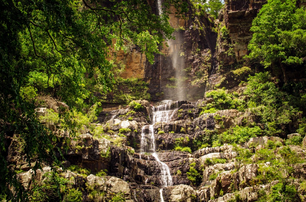
Sri Venkateswara National Park, located in the Eastern Ghats, was established in 1989 and is famous for its many waterfalls, including Talakona, Gundalakona, and Gunjana.
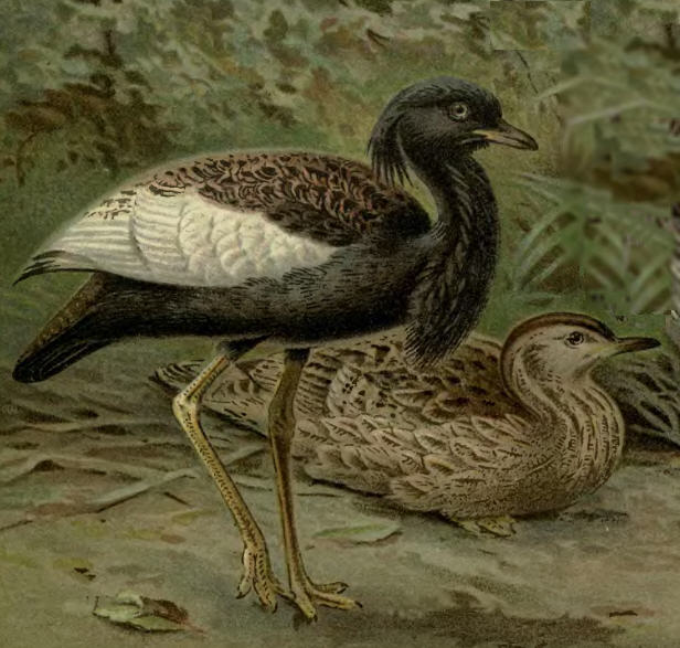
Rajiv Gandhi National Park, formerly Rameshwaram National Park, is located on the north bank of the Penna River. It is home to a reported 284 species of birds, including five critically endangered species: Baer's pochard, Bengal florican, Red-headed vulture, White-rumped vulture, and Slender-billed vulture. By all accounts, there is also an overabundance of creepy crawlers like scorpions, spiders, and other devilish insects.
Nagarjunsagar-Srisailam Tiger Reserve covers 3,728 km² (1,439 sq mi) of dense forests, valleys, and plateaus in the Nallamala Hills, making it the largest tiger reserve in India. Other species, including guars, sambar deer, and sloth, as well as copious medicinal plants, share the habitat with the tigers. According to a recent report, 360 leopards live in the protected habitat.
While some examples of rock art and tools from prehistoric settlements in the Nallamala Hills date back to the Stone Age, the first definitive evidence of human existence in the land we now call Andhra Pradesh refers to a people known as “Andhras” during the Mauryan dynasty, which occurred from the late 4th to early 2nd centuries BCE.
The powerful Satavahanas dynasty ruled much of the Deccan plateau around the 1st century CE and is remembered for inventing their own style of architecture, international trade with the Romans, a flourishing arts scene, and religious diversity, although Buddhism prospered. Later, in the 11th century, during the Chalukya dynasty, the language of Telugu was first used in literature, most of the region was unified, and Hinduism took its place as the dominant religion.
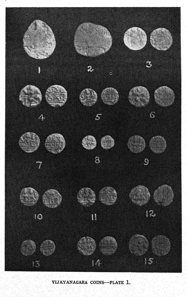
The Andhras flourished for hundreds of years, but easily the most impressive kingdom was the Vijayanagara Empire, famous for military, economic, and artistic supremacy, until their fall in 1565, when they lost control to the Muslims.
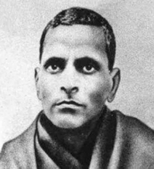
In the 17th century, the British took over under the Madras Presidency, introducing crops like cotton and indigo and irrigation projects on the Godavari River. In 1947, India gained independence from Great Britain. However, the region remained divided until the Andhras demanded statehood. In 1952, in dramatic fashion, a local leader and designer of the state flag, Potti Sreeramulu, fasted to death to draw attention to the Andhras' desire for an independent state of Telugu-speaking people.
On October 1 of the following year, Andhra Pradesh finally gained independence and statehood based on its unique linguistic identity.
On June 2, 2014, the state was divided into two separate states, Andhra Pradesh and Telangana. This finalized a decades-long political dispute that briefly left the former without a capital city until the powers that be decided to develop Amaravati as its new capital.
There is certainly no shortage of hiking opportunities for motivated adventurers. This is just a tiny sampling of some favorites:
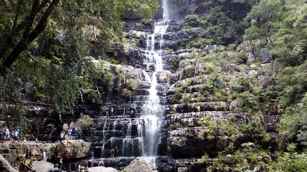
Talakona Double Waterfall Loop: This 6.7 km (4.2 mi) trek meanders through dense forest to the state’s tallest waterfall, where Talkona plunges 270 ft. The trail also runs close to Siddeswara Swamy TempleIt, which is a fun side trip if you have the time and energy. Either way, most hikers will take about three hours to complete the round trip to one of the prettiest spots in the Eastern Ghats.
Tirumala Tirupati Balaji Temple
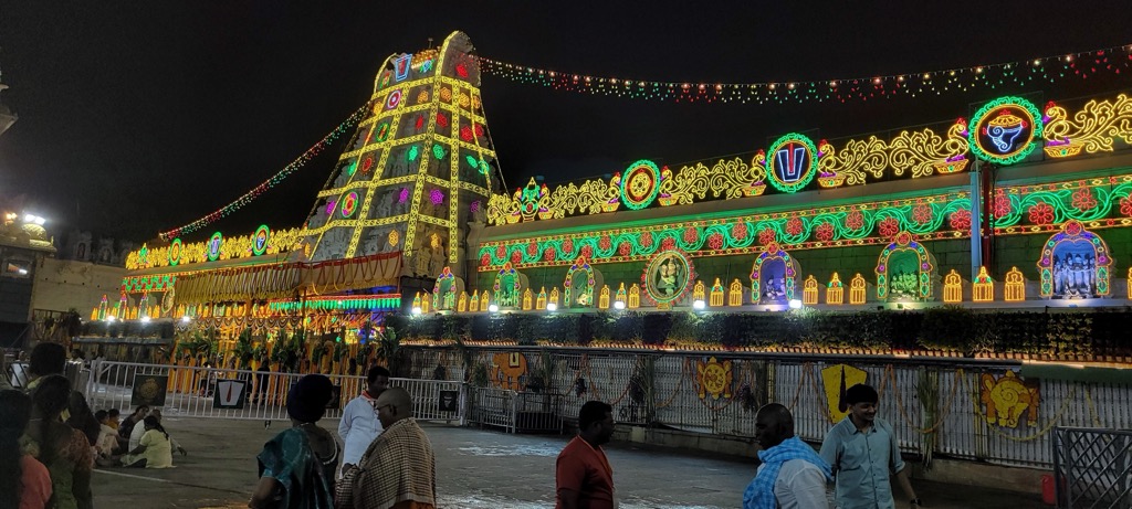
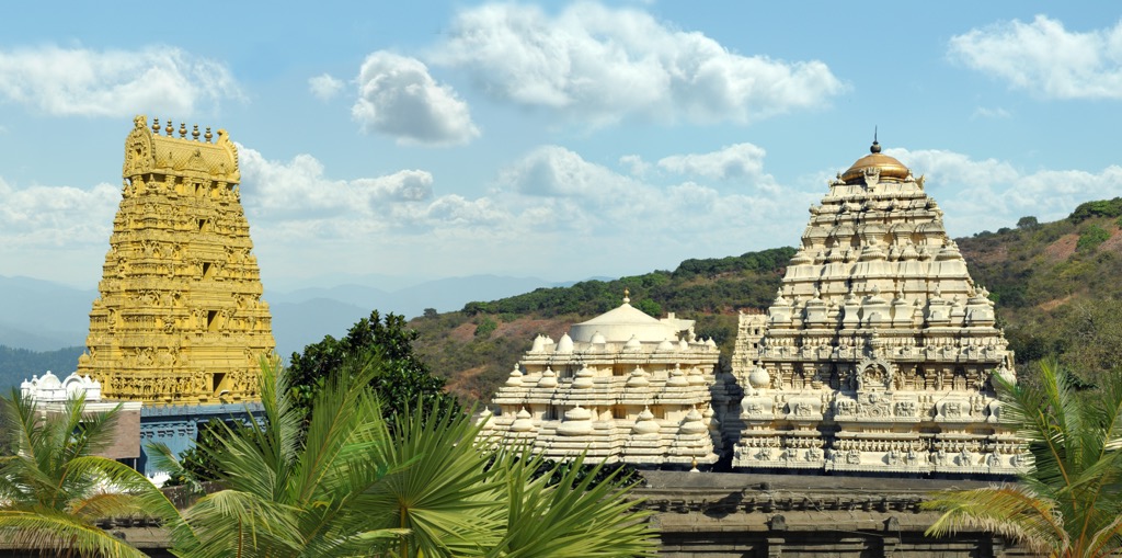
Part spiritual pilgrimage, part adventure, this trek takes you to one of the wealthiest and holiest places in all of Andhra Pradesh. Two traditional footpaths lead to the legendary temple, Alipiri Mettu, the longer trail at 9 km (5.5 mi) or 3500 steps, or Srivari Mettu, the steeper, more direct route at 2.1 km or 2,380 steps. Devoted pilgrims will share your journey, regardless of your route choice, which is just part of the beauty of the trip.
Simhachalam Trail
A moderate trail leads pilgrims and hikers on a spiritual journey to Sri Varaha Lakshmi Narasimha Swamy Temple in Visakhapatnam. Meaning "Hill of the Lion," the namesake temple was built at the top of the Simhachalam at an elevation of 800 meters (2,624 feet).
Papikonda National Park
Part of the Eastern Ghats biodiversity hotspot along the Godavari River, the park spans 1,012.86 sq km (390 sq mi) and encompasses parts of the Alluri Sitharama Raju and Eluru districts.
There are several different hikes, with a local favorite being Koyyalagudem to Tadivada. This challenging 23.5 km (14.6 mi) out-and-back is a great choice for fit mountain bikers and hikers looking for a big day of adventure. The best time to visit is during the Winter (October to March). Permits are required, so be sure to stop at the gate and get up-to-date information from the local authorities.
Borra Caves
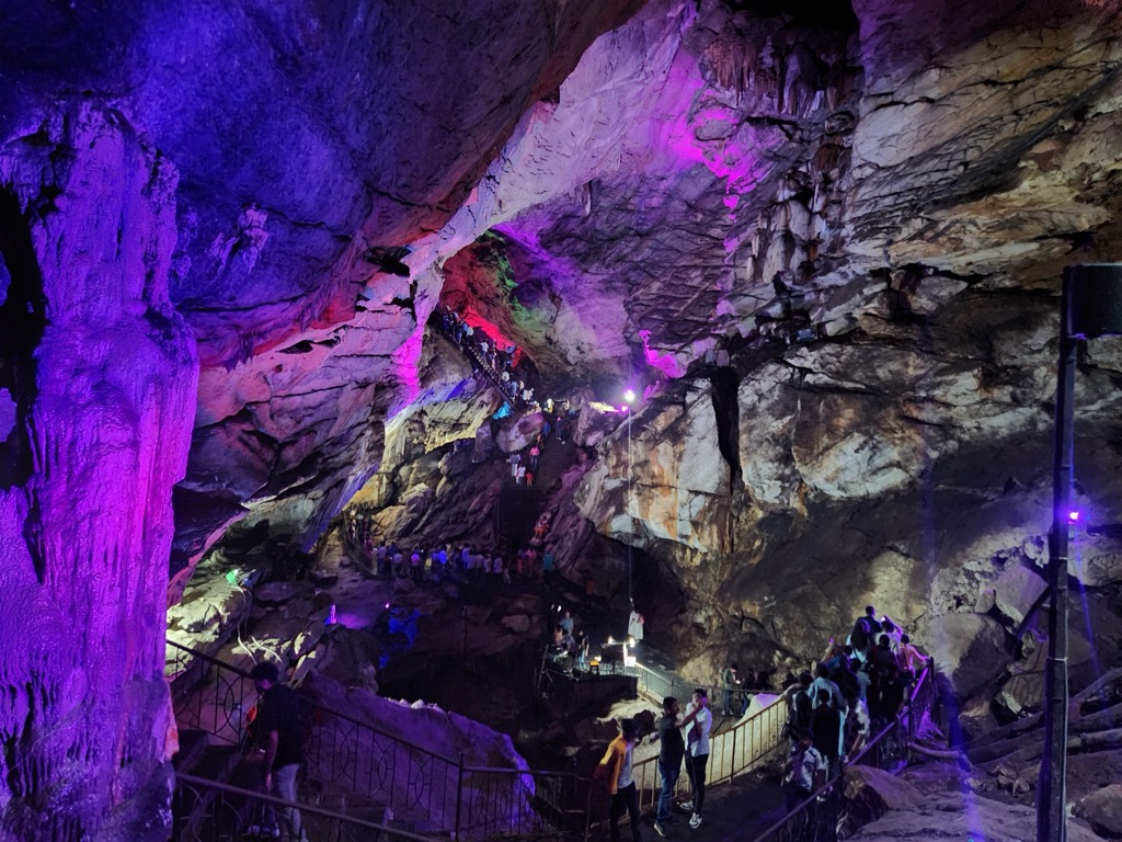
Discovered in 1807 by British geologist William King George, the 80-meter-deep Borra Caves are among the deepest caves in India and certainly one of the most iconic destinations. This million-year-old limestone cavern is abundant in stalactites and stalagmites, but one of the most popular points in the cave is the Shiva Lingam, a naturally formed temple. Keep your expectations in check; this is a major tourist attraction. The caves are illuminated with artificially colored lights, to the delight of some and the dismay of others.
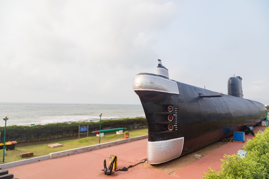
A major industrial hub with a thriving port, Visakhapatnam, also known as Vizag, is the state’s largest city and is nicknamed “the City of Destiny.” It is home to the oldest shipyard in India, Hindustan Shipyard Limited, and as a result, it is known as India's shipbuilding capital. It is also home to the wonderful INS Kursura (S20) Submarine Museum and headquarters of the Eastern Naval Command of the Indian Navy. Aside from its storied maritime history, the aspiring “smart city” has many Buddhist temples worth a visit, including Thotlakonda and Bavikonda.
One of the fastest growing cities in India – and the world – also known by its colonial name, Bezawada, Vijayawada is, in a word, crowded. In fact, it is the third most densely populated city in the entire world. Located on the banks of the Krishna River, the bustling city is known as the Business Capital of Andhra Pradesh. It has all the infrastructure to live up to this nickname, serving as a key transportation, education, and industrial hub for southern India.
Following the historic bifurcation in 2014, Andhra Pradesh named Amaravati its new capital city. Not to be confused with the city by the same name in Maharashtra, Andhra Pradesh's Amaravati is located on the right bank of the Krishna River and until recent events turned the city on its head, it was historically an agrarian economy. As the newly named capital city, it is now being reimagined as an urban smart city, with aspirations of being the world’s happiest city.


![[1]](https://commons.wikimedia.org/wiki/File:Potti_Sreeramulu.png)