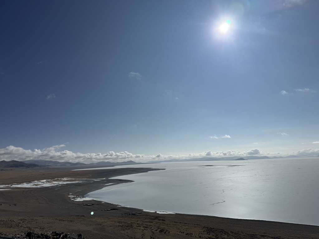
Zhari Namco or Zhari Nanmu or Lake Trari Nam (Tibetan: བཀྲ་རི་གནམ་མཚོ, Wylie: bkra ri gnam mtsho, Chinese: 扎日南木错) is a salt lake in Tibet, China. It is bounded on the west by Coqên County of Ngari Prefecture, and on the east by Ngamring County of Shigatse Prefecture. Zhari Namco is 996.9 square kilometres (384.9 sq mi), with a drainage area of 15,433.2 square kilometres (5,958.8 sq mi), an elevation of 4,613 metres (15,135 ft), length 54.3 kilometres (33.7 mi) and mean width 18.36 kilometres (11.41 mi) (maximum width 26.2 kilometres [16.3 mi]). It is located east of Coqên Town in southern Tibet.
We use GPS information embedded into the photo when it is available.
3D mountains overlay
Adjust mountain panorama to perfectly match your photos because recorded by camera photo position might be imprecise.
Move tool
Rotate tool
Zoom
More customization
Choose which peak labels should make into the final photo and what photo title should be.
Next
Photo Location
Satellitte
Flat map
Relief map
Latitude
Longitude
Altitude
OR
Latitude
°'''
Longitude
°'''
Apply
Register Peak
Peak Name
Latitude
Longitude
Altitude
Register
Teleport
PeakVisor
This 3D model of Sagarmatha National Park in Nepal was made using the PeakVisor app topographic data. The mobile app features higher precision models worldwide, more topographic details, and works offline. Download PeakVisor maps today.
Download OBJ model
PeakVisor
The download should start shortly. If you find it useful please consider supporting the PeakVisor app.
PeakVisor for iOS and Android
Be a superhero of outdoor navigation with state-of-the-art 3D maps and mountain identification in the palm of your hand!