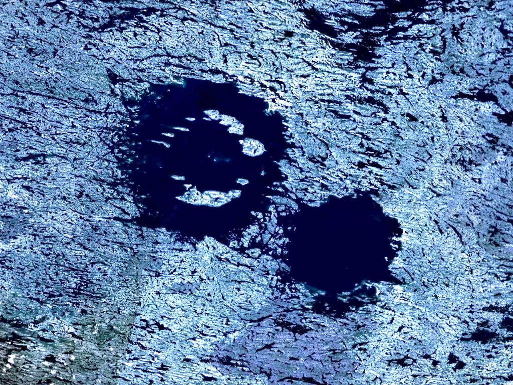
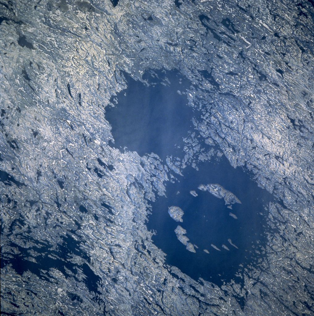
The Lac Wiyâshâkimî (the official name, in French, formerly Lac à l'Eau Claire, a calque of the lake's name, Wiyâšâkamî, in Northern East Cree, changed form of wâšâkamî or wâšekamî in more southerly Cree dialects), also called the Clearwater Lakes in English and Allait Qasigialingat by the Inuit, are a pair of annular lakes and impact structures on the Canadian Shield in Quebec, Canada, near Hudson Bay. The lakes are actually a single body of water with a sprinkling of islands forming a "dotted line" between the eastern and western parts. Its name in Cree is due to the clear water it holds. There are actually 25 lakes with names that mean "Clearwater Lake" in the province (26 if the Petit lac à l'Eau Claire — the Small Clearwater Lake — is included). Collectively, this body of water is the largest, northernmost and the second-largest natural lake in Quebec after Lake Mistassini. In 1896, the explorer and geologist Albert Peter Low, a member of the Geological Survey of Canada, provided a probable explanation for the lakes' descriptive Cree name by highlighting the extraordinary clarity and depth of their icy waters.
Show more
Sun and Moon
Mon
Tue
Wed
Thu
Fri
Sat
Sun
May 2022
Date and time
00:00
06:00
12:00
18:00
Today
--
--
Sunrise
--
Sunset
--
Moonrise
--
Moonset
Phase
🌔 Waxing Gibbous
The perfect light time for beautiful photos:
--
Sunrise
--
Sunset
PeakVisor app
Get the app on your smartphone
New Panorama Tools
Trace location on the map
Measure distances
All the instruments are available in the context menu as well.
We use GPS information embedded into the photo when it is available.
3D mountains overlay
Adjust mountain panorama to perfectly match your photos because recorded by camera photo position might be imprecise.
Move tool
Rotate tool
Zoom
More customization
Choose which peak labels should make into the final photo and what photo title should be.
Next
Photo Location
Satellitte
Flat map
Relief map
Latitude
Longitude
Altitude
OR
Latitude
°'''
Longitude
°'''
Apply
Register Peak
Peak Name
Latitude
Longitude
Altitude
Register
Teleport
PeakVisor
This 3D model of Sagarmatha National Park in Nepal was made using the PeakVisor app topographic data. The mobile app features higher precision models worldwide, more topographic details, and works offline. Download PeakVisor maps today.
Download OBJ model
PeakVisor
The download should start shortly. If you find it useful please consider supporting the PeakVisor app.
PeakVisor for iOS and Android
Be a superhero of outdoor navigation with state-of-the-art 3D maps and mountain identification in the palm of your hand!