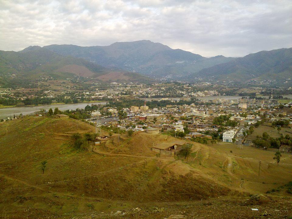
Timergara (Pashto: تيمرګره, Urdu: تیمرگرہ) is a city and the district headquarters of the Lower Dir District and temporary headquarter of newly established Central Dir District in Khyber Pakhtunkhwa, Pakistan. Timergara city is located on the east bank of the Panjkora River. It lies at an altitude of 823 metres (2,700 ft). The town is the site of excavated graves of Indo-Aryans, dating from 1500 to 600 BC. On the west side of the Panjkora River is the excavated site of Balambat. The site has been occupied continuously since the time of the Indo-Aryans in 1500 BC. Discoveries included houses dating from 500 BC and fire altars, showing that the people followed early form Aryan religion which revolved around fire worship. The area's early political history is defined by the control of the Bactrians, Scythians and Hepthalites, and artifacts and ruins from these periods are found throughout the region. At the 1998 Census, the town had a population of 43,774. Most of the main city lies on the bank of the river Panjkora, which separates Balambat from the main city.
We use GPS information embedded into the photo when it is available.
3D mountains overlay
Adjust mountain panorama to perfectly match your photos because recorded by camera photo position might be imprecise.
Move tool
Rotate tool
Zoom
More customization
Choose which peak labels should make into the final photo and what photo title should be.
Next
Photo Location
Satellitte
Flat map
Relief map
Latitude
Longitude
Altitude
OR
Latitude
°'''
Longitude
°'''
Apply
Register Peak
Peak Name
Latitude
Longitude
Altitude
Register
Teleport
PeakVisor
This 3D model of Sagarmatha National Park in Nepal was made using the PeakVisor app topographic data. The mobile app features higher precision models worldwide, more topographic details, and works offline. Download PeakVisor maps today.
Download OBJ model
PeakVisor
The download should start shortly. If you find it useful please consider supporting the PeakVisor app.
PeakVisor for iOS and Android
Be a superhero of outdoor navigation with state-of-the-art 3D maps and mountain identification in the palm of your hand!