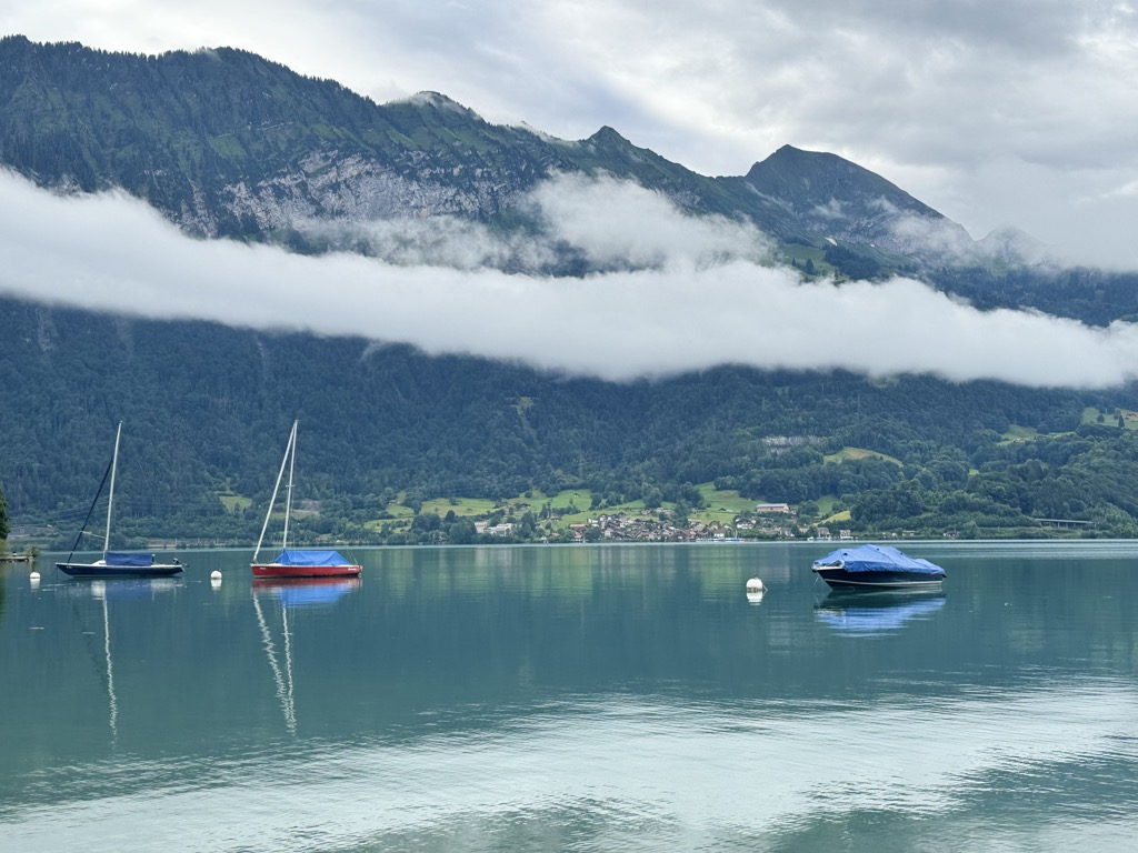
Lake Thun (German: Thunersee) is an Alpine lake in the Bernese Oberland in Switzerland named after the city of Thun, on its northern shore. At 48.3 km2 (18.6 sq mi) in surface area, it is the largest Swiss lake entirely within a single canton. The lake was created after the last glacial period. After the 10th century, it split from Lake Brienz, before which the two lakes were combined, as Wendelsee ("Lake Wendel"). The culminating point of the lake's drainage basin is the Finsteraarhorn at 4,274 metres (14,022 ft) above sea level. Lake Thun's approximate 2,500 square kilometres (970 sq mi) catchment area frequently causes local flooding after heavy rainfalls. This occurs because the river Aare (German: Aare), which drains Lake Thun, has only limited capacity to handle the excess runoff. The lake is fed by water from Lake Brienz to the southeast, which is 6 metres (20 ft) higher than Lake Thun, and various streams in the Oberland, including the Kander. In 1835, passenger steamships began operating regularly on the lake. Ten passenger ships, operated by the local railway company BLS AG like Blümlisalp, serve the towns of Interlaken and Thun; the Interlaken ship canal and Thun ship canal connect the lake to Interlaken West railway station and Thun railway station respectively. Following World War II and up until 1964, the Swiss Government disposed of unused munitions into Lake Thun. The quantity of munitions dumped is reported to be from 3,000 to more than 9,020 tons.
We use GPS information embedded into the photo when it is available.
3D mountains overlay
Adjust mountain panorama to perfectly match your photos because recorded by camera photo position might be imprecise.
Move tool
Rotate tool
Zoom
More customization
Choose which peak labels should make into the final photo and what photo title should be.
Next
Photo Location
Satellitte
Flat map
Relief map
Latitude
Longitude
Altitude
OR
Latitude
°'''
Longitude
°'''
Apply
Register Peak
Peak Name
Latitude
Longitude
Altitude
Register
Teleport
PeakVisor
This 3D model of Sagarmatha National Park in Nepal was made using the PeakVisor app topographic data. The mobile app features higher precision models worldwide, more topographic details, and works offline. Download PeakVisor maps today.
Download OBJ model
PeakVisor
The download should start shortly. If you find it useful please consider supporting the PeakVisor app.
PeakVisor for iOS and Android
Be a superhero of outdoor navigation with state-of-the-art 3D maps and mountain identification in the palm of your hand!


.jpg)


