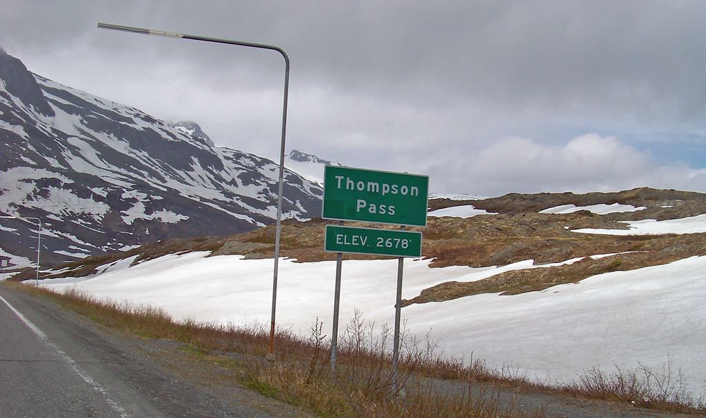
Thompson Pass is a 2,600 foot-high (855 meter-high) gap in the Chugach Mountains northeast of Valdez, Alaska. It is the snowiest weather station in Alaska, recording 500 inches or 13 metres of snow per year on average. In the winter of 1952–1953, 974.1 inches or 25 metres of snow fell—the most ever recorded in one season at one location in Alaska. It is not the most snow ever recorded in one season at one location anywhere in the fifty states as that record belongs to Mount Baker Ski Resort at 1,140 inches or 29 metres in 1998–99. The pass also holds the Alaska record for the most snow in a single day: 62 inches or 1.6 metres fell on December 29, 1955. The pass was named in 1899 by U.S. Army captain William Abercrombie "in compliment to Hon. Frank Thomson, of Pennsylvania", but he spelled the name "Thompson" on his sketched map, and that spelling stuck. The pass had been used by Alaska Native Ahtna people for generations prior to Abercrombie's arrival, but he marked and defined a trail through the pass for use by Klondike Gold Rush miners. His route, which became the Valdez-Eagle Trail, later was used by the Washington-Alaska Military Cable and Telegraph System, which strung cables through Thompson Pass. The path through the pass continued to be improved, and automobiles first drove the entire length of the trail in 1913. By that point, it had become the Valdez-Fairbanks Trail, and it was renamed the Richardson Road in 1919. Because of heavy snowfall in Thompson Pass, the Richardson Highway was used only in summer. Not until 1950, when a freight company foreman demonstrated that the pass could be kept open with snowplows, was the road drivable year-round. The trail through the pass remained gravel until 1955, when the Alaska Road Commission (part of the US Department of the Interior) paved it.
We use GPS information embedded into the photo when it is available.
3D mountains overlay
Adjust mountain panorama to perfectly match your photos because recorded by camera photo position might be imprecise.
Move tool
Rotate tool
Zoom
More customization
Choose which peak labels should make into the final photo and what photo title should be.
Next
Photo Location
Satellitte
Flat map
Relief map
Latitude
Longitude
Altitude
OR
Latitude
°'''
Longitude
°'''
Apply
Register Peak
Peak Name
Latitude
Longitude
Altitude
Register
Teleport
PeakVisor
This 3D model of Sagarmatha National Park in Nepal was made using the PeakVisor app topographic data. The mobile app features higher precision models worldwide, more topographic details, and works offline. Download PeakVisor maps today.
Download OBJ model
PeakVisor
The download should start shortly. If you find it useful please consider supporting the PeakVisor app.
PeakVisor for iOS and Android
Be a superhero of outdoor navigation with state-of-the-art 3D maps and mountain identification in the palm of your hand!