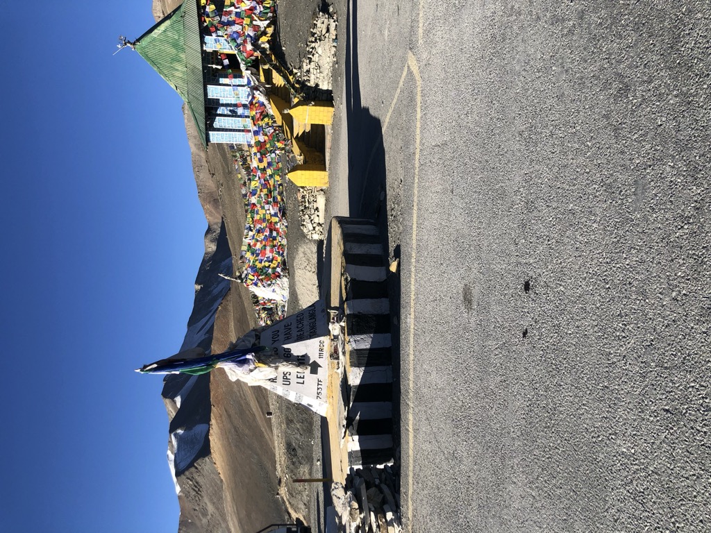
Taglang La or Tanglang La, elevation 5,328 metres (17,480 ft), is a high altitude mountain pass in the Indian union territory of Ladakh. It is located on the NH3 Leh–Manali Highway. Rail-cum-road tunnels are being constructed under the Taglang La, Lungalacha La (87 km south of Taglang La) and Bara-lacha la (171 km south of Taglang La) to cater for the traffic from existing NH3 & under-construction Bhanupli–Leh line. The elevation in metres on the local signboard is in agreement with SRTM data, however the claim of being world's second highest motorable pass is no longer accurate after construction of several other higher motorable passes and it was the 12th highest motorable pass in 2015.
We use GPS information embedded into the photo when it is available.
3D mountains overlay
Adjust mountain panorama to perfectly match your photos because recorded by camera photo position might be imprecise.
Move tool
Rotate tool
Zoom
More customization
Choose which peak labels should make into the final photo and what photo title should be.
Next
Photo Location
Satellitte
Flat map
Relief map
Latitude
Longitude
Altitude
OR
Latitude
°'''
Longitude
°'''
Apply
Register Peak
Peak Name
Latitude
Longitude
Altitude
Register
Teleport
PeakVisor
This 3D model of Sagarmatha National Park in Nepal was made using the PeakVisor app topographic data. The mobile app features higher precision models worldwide, more topographic details, and works offline. Download PeakVisor maps today.
Download OBJ model
PeakVisor
The download should start shortly. If you find it useful please consider supporting the PeakVisor app.
PeakVisor for iOS and Android
Be a superhero of outdoor navigation with state-of-the-art 3D maps and mountain identification in the palm of your hand!