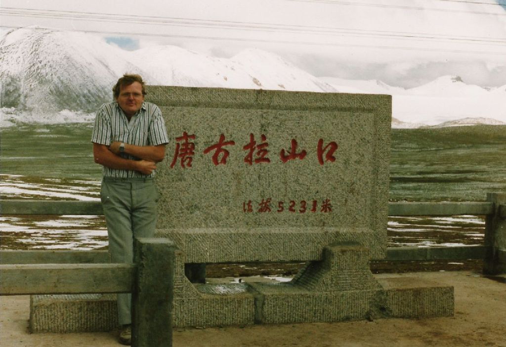
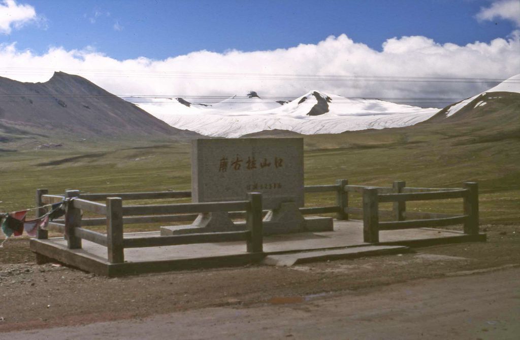
The Tanggu La, Tangla Pass, or Tanggu Pass (Chinese: 唐古拉山口; Standard Tibetan: གདང་ལ) is a wide mountain pass in Southwest China over 5,000 meters (16,000 ft) in elevation, used by both the Qinghai–Tibet Highway and Qinghai–Tibet Railway to cross the Tanggula Mountains. These mountains on the Tibetan Plateau separate the Tibet Autonomous Region from the Qinghai province, and also form part of the watershed separating the Yangtze River to the north from a zone of endorheic basins with internal drainage to the south. The Qinghai–Tibet Highway reaches its highest elevation of 5,231 meters (17,162 ft) in the Tanggu Pass at 32°52′24″N 91°55′03″E. On August 24, 2005, rail track for the Qinghai–Tibet Railway was completed 28 kilometers (17 mi) to the WNW of the highway, reaching 5,072 meters (16,640 ft) at 33°00′38″N 91°39′51″E. The Tanggula railway station 1 km from this summit is the world's highest at 5,068 meters (16,627 ft), 255 meters (837 ft) higher than that of Ticlio, Peru. The Qinghai–Tibet railway connects the provincial capitals of Xining to Lhasa. The 1,080-kilometer (670 mi)-long section from Golmud to Lhasa was opened on July 1, 2006. The rail cars are equipped with personal oxygen supplies to prevent altitude sickness.
We use GPS information embedded into the photo when it is available.
3D mountains overlay
Adjust mountain panorama to perfectly match your photos because recorded by camera photo position might be imprecise.
Move tool
Rotate tool
Zoom
More customization
Choose which peak labels should make into the final photo and what photo title should be.
Next
Photo Location
Satellitte
Flat map
Relief map
Latitude
Longitude
Altitude
OR
Latitude
°'''
Longitude
°'''
Apply
Register Peak
Peak Name
Latitude
Longitude
Altitude
Register
Teleport
PeakVisor
This 3D model of Sagarmatha National Park in Nepal was made using the PeakVisor app topographic data. The mobile app features higher precision models worldwide, more topographic details, and works offline. Download PeakVisor maps today.
Download OBJ model
PeakVisor
The download should start shortly. If you find it useful please consider supporting the PeakVisor app.
PeakVisor for iOS and Android
Be a superhero of outdoor navigation with state-of-the-art 3D maps and mountain identification in the palm of your hand!