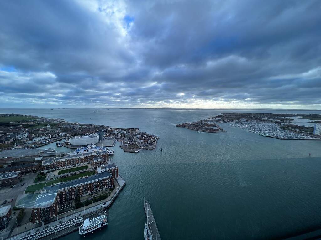
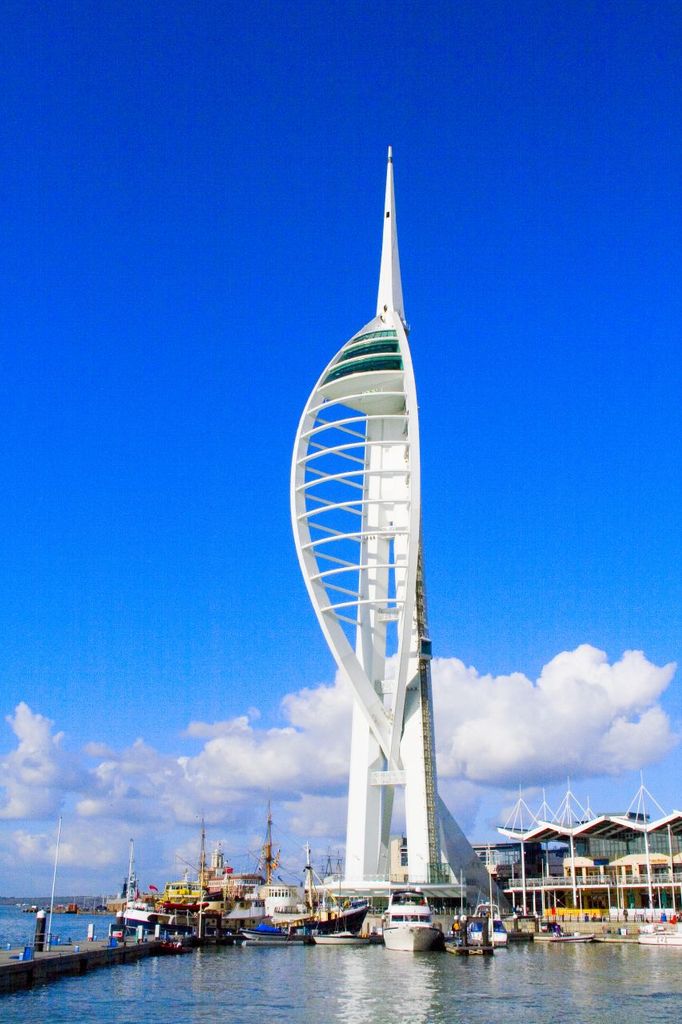
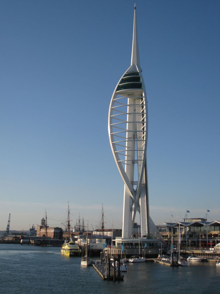
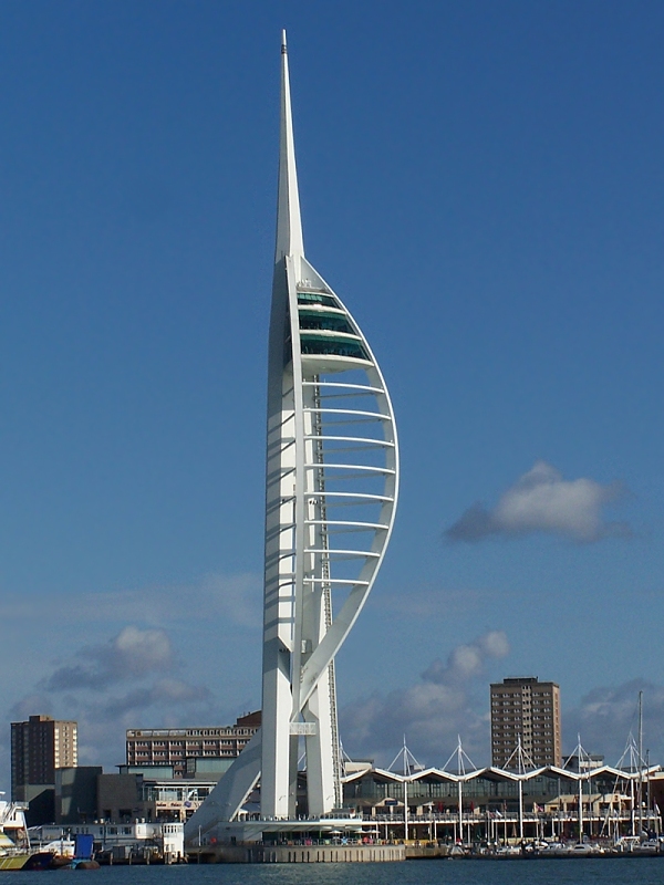
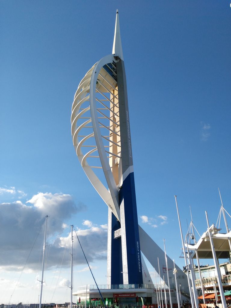
The Spinnaker Tower is a 170-metre (560 ft) landmark observation tower in Portsmouth, England. It is the centrepiece of the redevelopment of Portsmouth Harbour, which was supported by a National Lottery grant. The tower's design was chosen by Portsmouth residents from a selection of three different designs in a 1998 public poll. It has three viewing platforms one on top of the other at heights of 100 m, 105 m and 110 m. The tower was designed by local firm HGP Architects and engineering consultants Scott Wilson and built by Mowlem. The Spinnaker Tower reflects Portsmouth's maritime history through its design and is named after a spinnaker, a type of sail that balloons outward. The tower was opened on 18 October 2005. The tower is owned by Portsmouth City Council and is operationally managed by Continuum Leading Attractions, a cultural attractions group based in York. Continuum also runs five other visitor attractions across the country. The Spinnaker Tower was repainted and rebranded as the "Emirates Spinnaker Tower" from July 2015 following a five-year commercial sponsorship deal with Dubai-based Emirates airline. The Emirates sponsorship deal expired in 2020 and the tower reverted to its original all-white paint scheme and name in April 2021. On 5 May 2023, it was announced that Macmillan Cancer Support would become the tower's new sponsor beginning in June.
Show more
Sun and Moon
Mon
Tue
Wed
Thu
Fri
Sat
Sun
May 2022
Date and time
00:00
06:00
12:00
18:00
Today
--
--
Sunrise
--
Sunset
--
Moonrise
--
Moonset
Phase
🌔 Waxing Gibbous
The perfect light time for beautiful photos:
--
Sunrise
--
Sunset
PeakVisor app
Get the app on your smartphone
New Panorama Tools
Trace location on the map
Measure distances
All the instruments are available in the context menu as well.
We use GPS information embedded into the photo when it is available.
3D mountains overlay
Adjust mountain panorama to perfectly match your photos because recorded by camera photo position might be imprecise.
Move tool
Rotate tool
Zoom
More customization
Choose which peak labels should make into the final photo and what photo title should be.
Next
Photo Location
Satellitte
Flat map
Relief map
Latitude
Longitude
Altitude
OR
Latitude
°'''
Longitude
°'''
Apply
Register Peak
Peak Name
Latitude
Longitude
Altitude
Register
Teleport
PeakVisor
This 3D model of Sagarmatha National Park in Nepal was made using the PeakVisor app topographic data. The mobile app features higher precision models worldwide, more topographic details, and works offline. Download PeakVisor maps today.
Download OBJ model
PeakVisor
The download should start shortly. If you find it useful please consider supporting the PeakVisor app.
PeakVisor for iOS and Android
Be a superhero of outdoor navigation with state-of-the-art 3D maps and mountain identification in the palm of your hand!


.jpg)


