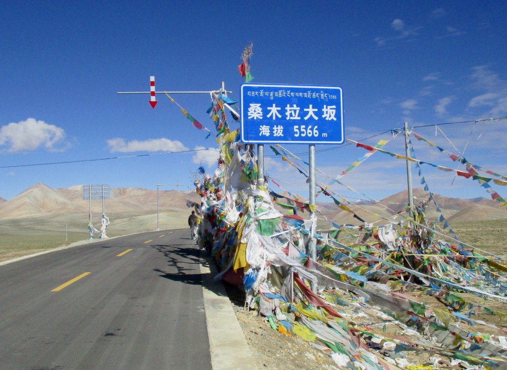
Semo La (Chinese: 桑木拉大坂; Standard Tibetan: བཟར་མོ་ལ) is a mountain pass situated in Coqên County, Ngari Prefecture in the central part of Tibet and gives access to the Changtang region. It is found on the so-called Northern Route, north of Raka and south of Town of Coqên in Central Tibet. Travellers use this route as an alternative access route to western Tibet and Mount Kailash, especially when mud makes access by the more southern route difficult. The road crossing the pass was once an old unsurfaced track travelled only by a weekly bus and trucks heading west to avoid the boggy parts of the south of the country. The construction of paved road through the pass, Tibet Provincial Road S206, was finished in late 2015.
We use GPS information embedded into the photo when it is available.
3D mountains overlay
Adjust mountain panorama to perfectly match your photos because recorded by camera photo position might be imprecise.
Move tool
Rotate tool
Zoom
More customization
Choose which peak labels should make into the final photo and what photo title should be.
Next
Photo Location
Satellitte
Flat map
Relief map
Latitude
Longitude
Altitude
OR
Latitude
°'''
Longitude
°'''
Apply
Register Peak
Peak Name
Latitude
Longitude
Altitude
Register
Teleport
PeakVisor
This 3D model of Sagarmatha National Park in Nepal was made using the PeakVisor app topographic data. The mobile app features higher precision models worldwide, more topographic details, and works offline. Download PeakVisor maps today.
Download OBJ model
PeakVisor
The download should start shortly. If you find it useful please consider supporting the PeakVisor app.
PeakVisor for iOS and Android
Be a superhero of outdoor navigation with state-of-the-art 3D maps and mountain identification in the palm of your hand!