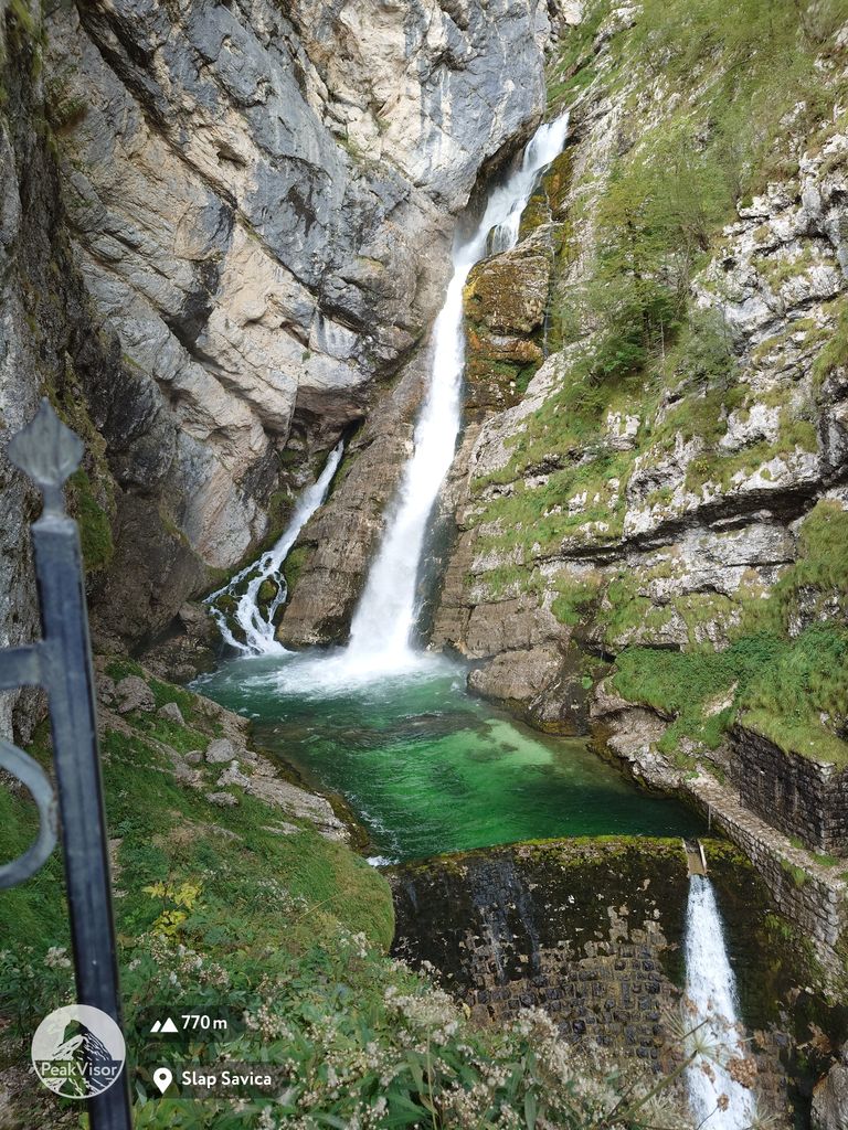
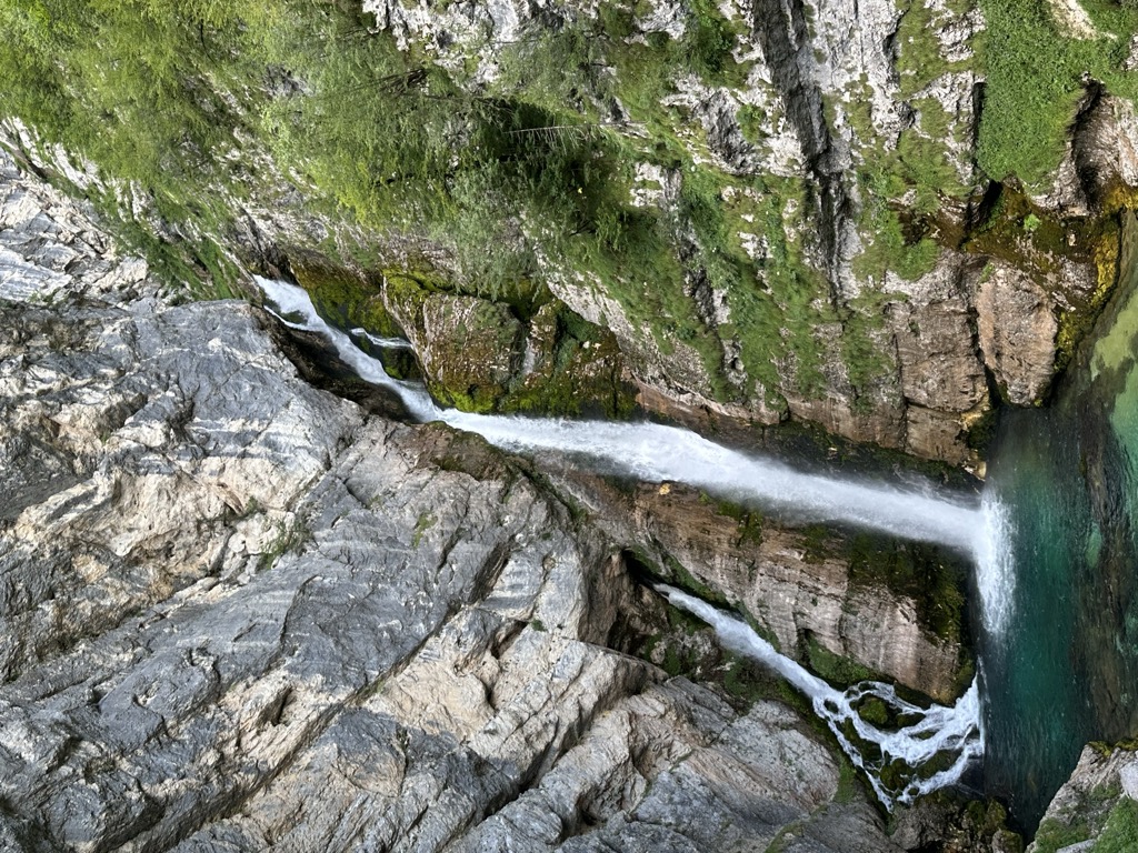
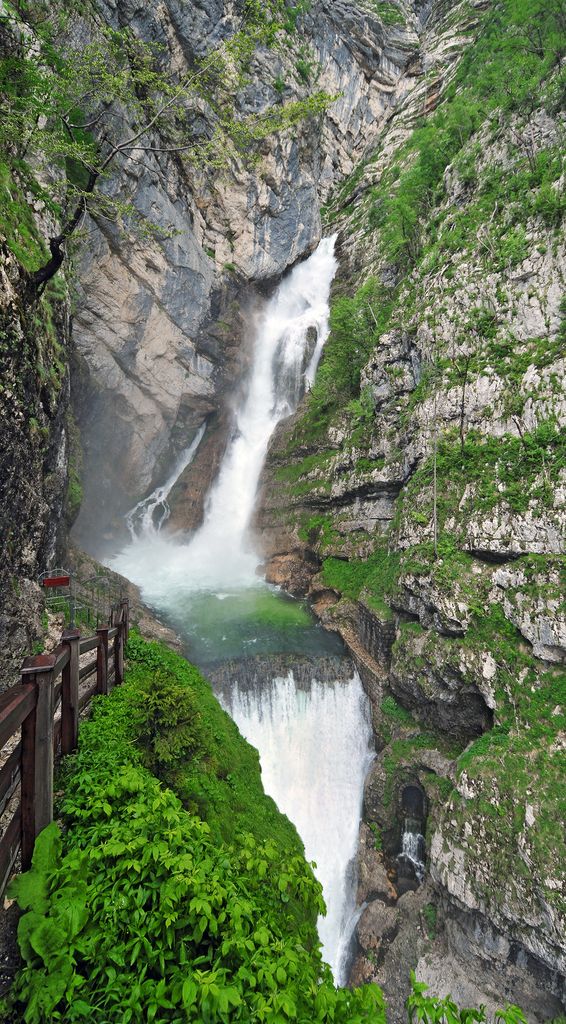
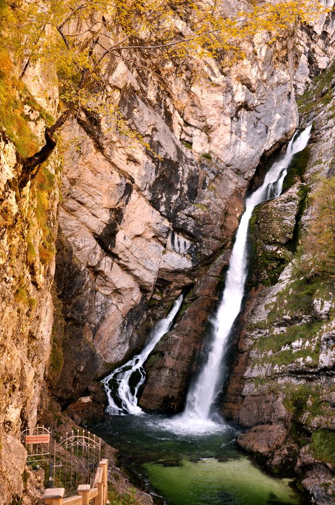
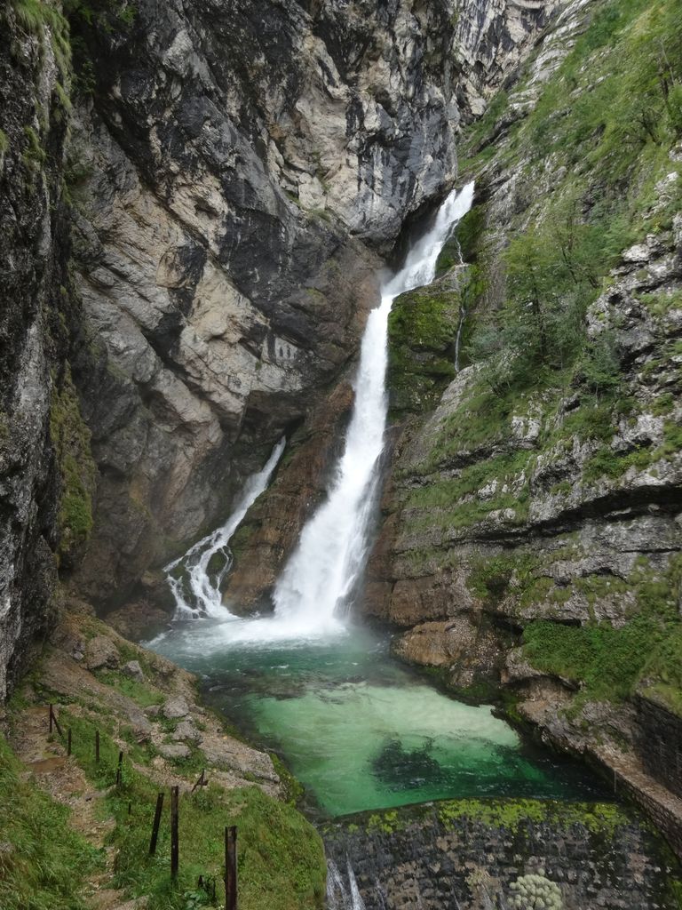
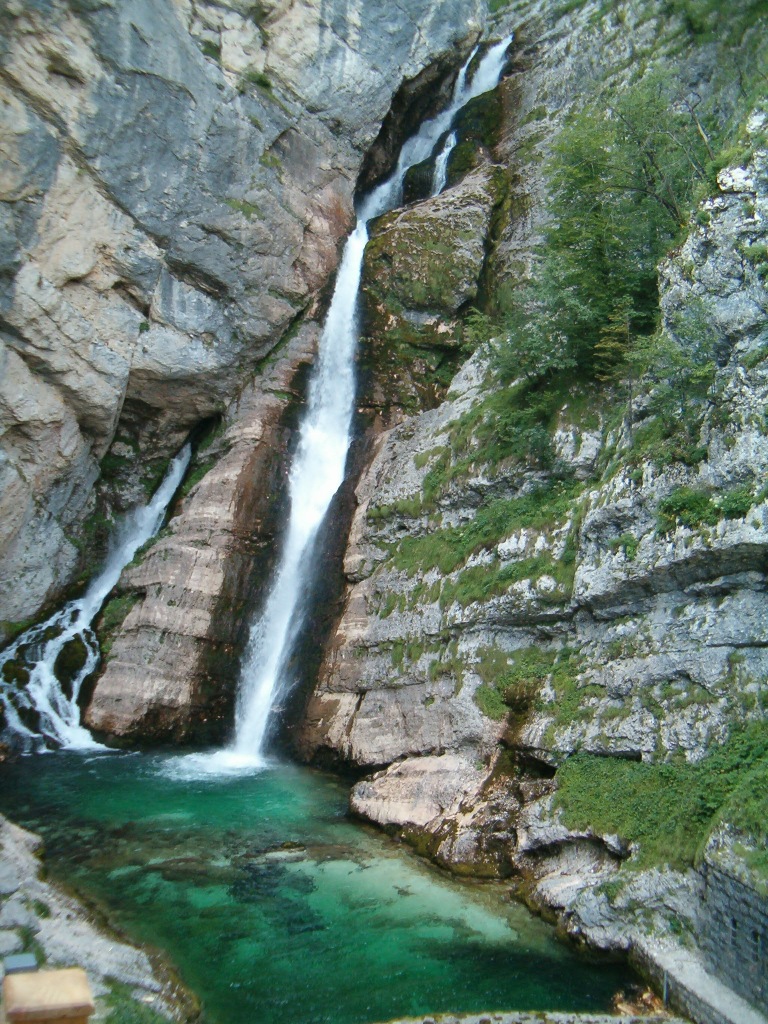
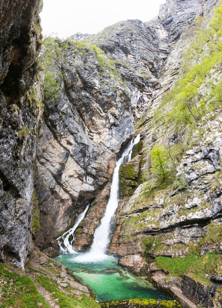
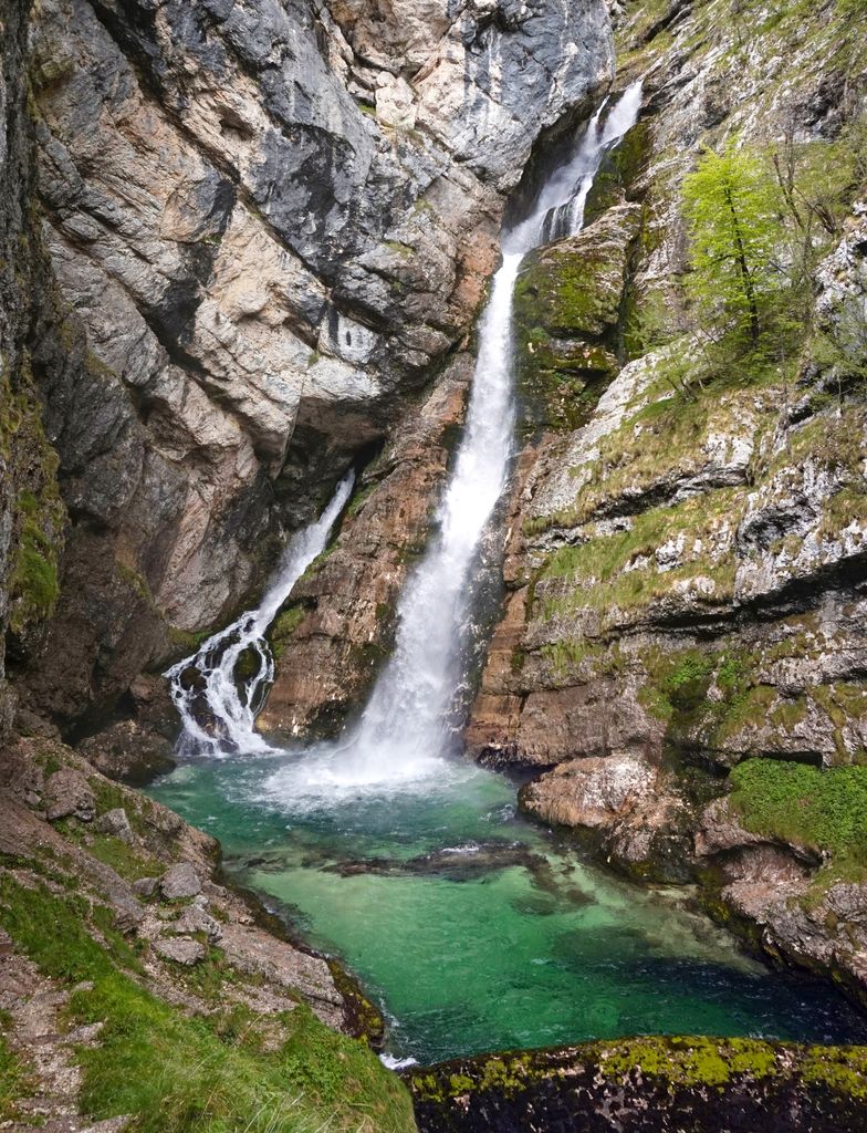
Savica Falls is a waterfall in northwestern Slovenia. It is 78 meters (256 ft) high and is fed by a karst spring also called Savica just above the waterfall. A large portion of water is sourced from a karst basin around Black Lake, which lies around 500 meters (1,600 ft) higher above the waterfall, because of which the spring has a relatively steady and strong flow. Water flows to the spring below the ground, where it splits into two parts. After heavy rains, the water supply from the lake and its surroundings may exceed the capacity of tunnels, and a portion of water flows on the surface in cascading waterfalls 600 meters (2,000 ft) high. The waterfall continues in a stream of the same name, which flows into Lake Bohinj as its main source. Water from Lake Bohinj is further a source of the Sava Bohinjka, which forms the Sava River after joining with the Sava Dolinka.
We use GPS information embedded into the photo when it is available.
3D mountains overlay
Adjust mountain panorama to perfectly match your photos because recorded by camera photo position might be imprecise.
Move tool
Rotate tool
Zoom
More customization
Choose which peak labels should make into the final photo and what photo title should be.
Next
Photo Location
Satellitte
Flat map
Relief map
Latitude
Longitude
Altitude
OR
Latitude
°'''
Longitude
°'''
Apply
Register Peak
Peak Name
Latitude
Longitude
Altitude
Register
Teleport
PeakVisor
This 3D model of Sagarmatha National Park in Nepal was made using the PeakVisor app topographic data. The mobile app features higher precision models worldwide, more topographic details, and works offline. Download PeakVisor maps today.
Download OBJ model
PeakVisor
The download should start shortly. If you find it useful please consider supporting the PeakVisor app.
PeakVisor for iOS and Android
Be a superhero of outdoor navigation with state-of-the-art 3D maps and mountain identification in the palm of your hand!


.jpg)


