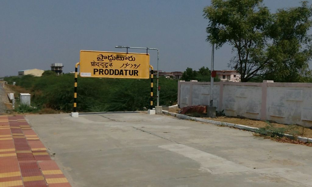
Proddatur (1915) is a city in the YSR Kadapa District of Andhra Pradesh, located on the banks of the Penna River. The city is a municipality, and also the mandal headquarters of Proddatur mandal. It is the second-largest town in former Kadapa District. It is the oldest municipality which formed before Independence. Proddatur got its name from the history of Ramayana, where Lord Ram resided.Many Good and old temples are located here. The temple where Lord Rama resided is located on the banks of Penna River, known as Rameshwaram. It is known as Second Bombay for Gold business. Thousands of Gold and Clothes shops are located in Proddutur.It is also known as Second Mysore for its grandeur in Dussehra celebrations. It is 13th largest urban agglomeration in Andhrapradesh.It became municipality in 1915 later it is upgraded from 3rd to 2nd,1st. In 1998, it became a Special Grade Municipality.Proddatur–to–Cumbum railway section was sanctioned in 2010 which plays as strategic importance for the town. National Highway 67 passes through this town. Multiple number of Schools,Collegs and Widerange of Good Hospitals are located here along with 350 bed Government Hospital.This town is centre for small towns like Jammalamadugu, Mydukur Chagalamarri, Yerraguntla and major center for Near by other small towns in kadapa district.Large number of people from these small towns commute to Proddatur for their livelihoods. A district government hospital (350 beds) is located in Proddatur. It also has a forest division—Proddatur Forest Division.
We use GPS information embedded into the photo when it is available.
3D mountains overlay
Adjust mountain panorama to perfectly match your photos because recorded by camera photo position might be imprecise.
Move tool
Rotate tool
Zoom
More customization
Choose which peak labels should make into the final photo and what photo title should be.
Next
Photo Location
Satellitte
Flat map
Relief map
Latitude
Longitude
Altitude
OR
Latitude
°'''
Longitude
°'''
Apply
Register Peak
Peak Name
Latitude
Longitude
Altitude
Register
Teleport
PeakVisor
This 3D model of Sagarmatha National Park in Nepal was made using the PeakVisor app topographic data. The mobile app features higher precision models worldwide, more topographic details, and works offline. Download PeakVisor maps today.
Download OBJ model
PeakVisor
The download should start shortly. If you find it useful please consider supporting the PeakVisor app.
PeakVisor for iOS and Android
Be a superhero of outdoor navigation with state-of-the-art 3D maps and mountain identification in the palm of your hand!