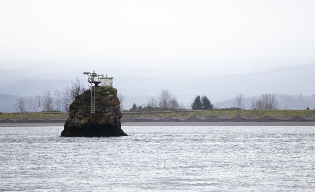
Pillar Rock is a pillar-like monolith in the Columbia River, near its mouth in the state of Washington. Originally rising 75-100 feet, it was dynamited and reduced in height to about 25 feet above the water to serve as a navigational aid and light. The Lewis and Clark Expedition camped twice near the rock, on November 7 and November 25, 1805. The name "Pillar Rock" also refers to a small village on the river's north shore, opposite the rock. As recently as 1851, the village was home to a small group of the Kathlamet band of Chinook Indians under the headship of a man named Tolillicum.
We use GPS information embedded into the photo when it is available.
3D mountains overlay
Adjust mountain panorama to perfectly match your photos because recorded by camera photo position might be imprecise.
Move tool
Rotate tool
Zoom
More customization
Choose which peak labels should make into the final photo and what photo title should be.
Next
Photo Location
Satellitte
Flat map
Relief map
Latitude
Longitude
Altitude
OR
Latitude
°'''
Longitude
°'''
Apply
Register Peak
Peak Name
Latitude
Longitude
Altitude
Register
Teleport
PeakVisor
This 3D model of Sagarmatha National Park in Nepal was made using the PeakVisor app topographic data. The mobile app features higher precision models worldwide, more topographic details, and works offline. Download PeakVisor maps today.
Download OBJ model
PeakVisor
The download should start shortly. If you find it useful please consider supporting the PeakVisor app.
PeakVisor for iOS and Android
Be a superhero of outdoor navigation with state-of-the-art 3D maps and mountain identification in the palm of your hand!