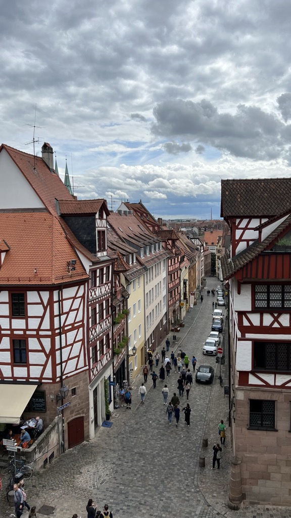
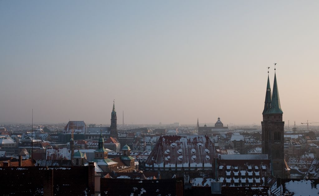
Nuremberg ( NURE-əm-burg; German: Nürnberg [ˈnʏʁnbɛʁk] ; in the local East Franconian dialect: Nämberch [ˈnɛmbɛrç]) is the largest city in Franconia, the second-largest city in the German state of Bavaria, and its 544.414 (2023) inhabitants make it the 14th-largest city in Germany. Nuremberg sits on the Pegnitz, which carries the name Regnitz from its confluence with the Rednitz in Fürth onwards (Pegnitz→ Regnitz→ Main→ Rhine→ North Sea), and on the Rhine–Main–Danube Canal, that connects the North Sea to the Black Sea. Lying in the Bavarian administrative region of Middle Franconia, it is the largest city and unofficial capital of the entire cultural region of Franconia. The city is surrounded on three sides by the Reichswald (de), a large forest, and in the north lies Knoblauchsland (garlic land) (de), an extensive vegetable growing area and cultural landscape. The city forms a continuous conurbation with the neighbouring cities of Fürth, Erlangen and Schwabach, which is the heart of an urban area region with around 1.4 million inhabitants, while the larger Nuremberg Metropolitan Region has a population of approximately 3.6 million. It is the largest city in the East Franconian dialect area (colloquially: "Franconian"; German: Fränkisch). Nuremberg and Fürth were once connected by the Bavarian Ludwig Railway, the first steam-hauled and overall second railway opened in Germany (1835). Today, the U1 of the Nuremberg Subway runs along this route. Subway lines U2 and U3 are the first German driverless subway lines, automatically moving railcars. Nuremberg Airport (Flughafen Nürnberg "Albrecht Dürer") is the second-busiest airport in Bavaria after Munich Airport, and the tenth-busiest airport in the country. Institutions of higher education in Nuremberg include the University of Erlangen-Nuremberg (Friedrich-Alexander-Universität Erlangen-Nürnberg), Germany's 11th-largest university, with campuses in Erlangen and Nuremberg and a university hospital in Erlangen (Universitätsklinikum Erlangen), Technische Hochschule Nürnberg Georg Simon Ohm, Hochschule für Musik Nürnberg and the newly founded University of Technology Nuremberg (de). The Nuremberg exhibition centre (Messe Nürnberg) is one of the biggest convention center companies in Germany and operates worldwide. Nuremberg Castle, its medieval old town and the city's walls, with their many towers, are among the most impressive in Europe. Staatstheater Nürnberg is one of the five Bavarian state theatres, showing operas, operettas, musicals, and ballets (main venue: Nuremberg Opera House), plays (main venue: Schauspielhaus Nürnberg), as well as concerts (main venue: Meistersingerhalle). Its orchestra, the Staatsphilharmonie Nürnberg, is Bavaria's second-largest opera orchestra after the Bavarian State Opera's Bavarian State Orchestra in Munich. Nuremberg is the birthplace of Albrecht Dürer and Johann Pachelbel. 1. FC Nürnberg is the most famous football club of the city and one of the most successful football clubs in Germany. Nuremberg was one of the host cities of the 2006 FIFA World Cup.
Show more
Sun and Moon
Mon
Tue
Wed
Thu
Fri
Sat
Sun
May 2022
Date and time
00:00
06:00
12:00
18:00
Today
--
--
Sunrise
--
Sunset
--
Moonrise
--
Moonset
Phase
🌔 Waxing Gibbous
The perfect light time for beautiful photos:
--
Sunrise
--
Sunset
PeakVisor app
Get the app on your smartphone
New Panorama Tools
Trace location on the map
Measure distances
All the instruments are available in the context menu as well.
We use GPS information embedded into the photo when it is available.
3D mountains overlay
Adjust mountain panorama to perfectly match your photos because recorded by camera photo position might be imprecise.
Move tool
Rotate tool
Zoom
More customization
Choose which peak labels should make into the final photo and what photo title should be.
Next
Photo Location
Satellitte
Flat map
Relief map
Latitude
Longitude
Altitude
OR
Latitude
°'''
Longitude
°'''
Apply
Register Peak
Peak Name
Latitude
Longitude
Altitude
Register
Teleport
PeakVisor
This 3D model of Sagarmatha National Park in Nepal was made using the PeakVisor app topographic data. The mobile app features higher precision models worldwide, more topographic details, and works offline. Download PeakVisor maps today.
Download OBJ model
PeakVisor
The download should start shortly. If you find it useful please consider supporting the PeakVisor app.
PeakVisor for iOS and Android
Be a superhero of outdoor navigation with state-of-the-art 3D maps and mountain identification in the palm of your hand!


.jpg)


