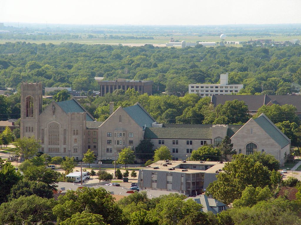
Norman () is the 3rd most populous city in the U.S. state of Oklahoma, with a population of 128,026 as of the 2020 census. It is the most populous city and the county seat of Cleveland County and the second-most populous city in the Oklahoma City metropolitan area after the state capital, Oklahoma City, 20 miles (32 kilometers) north of Norman. The city was settled during the Land Run of 1889, which opened the former Unassigned Lands of Indian Territory to American pioneer settlement. It was named in honor of Abner Norman, the area's initial land surveyor, and was formally incorporated on May 13, 1891. Norman has prominent higher education and related research industries, as it is home to the University of Oklahoma, the largest university in the state, with nearly 32,000 students. The university is well known for its sporting events by teams under the banner of the nickname "Sooners", with over 85,000 people routinely attending football games. The university is home to several museums, including the Fred Jones Jr. Museum of Art, which contains the largest collection of French Impressionist art ever given to an American university, as well as the Sam Noble Oklahoma Museum of Natural History. Norman's National Weather Center (NWC) houses a unique collection of university, state, federal, and private-sector organizations that work together to improve the understanding of events related to the Earth's atmosphere. Norman lies within Tornado Alley, a geographic region colloquially known for frequent and intense tornadic activity. The Storm Prediction Center (SPC), a branch of the National Oceanic and Atmospheric Administration (NOAA) that delivers forecasts for severe thunderstorms, tornadoes, and other high-impact hazardous weather in the contiguous United States, is located at the NWC. Additionally, research is conducted at the co-located National Severe Storms Laboratory (NSSL), which operates various experimental weather radars and develops innovative tools, applications, and techniques aimed at improving forecasts and warnings of severe weather.
Show more
Sun and Moon
Mon
Tue
Wed
Thu
Fri
Sat
Sun
May 2022
Date and time
00:00
06:00
12:00
18:00
Today
--
--
Sunrise
--
Sunset
--
Moonrise
--
Moonset
Phase
🌔 Waxing Gibbous
The perfect light time for beautiful photos:
--
Sunrise
--
Sunset
PeakVisor app
Get the app on your smartphone
New Panorama Tools
Trace location on the map
Measure distances
All the instruments are available in the context menu as well.
We use GPS information embedded into the photo when it is available.
3D mountains overlay
Adjust mountain panorama to perfectly match your photos because recorded by camera photo position might be imprecise.
Move tool
Rotate tool
Zoom
More customization
Choose which peak labels should make into the final photo and what photo title should be.
Next
Photo Location
Satellitte
Flat map
Relief map
Latitude
Longitude
Altitude
OR
Latitude
°'''
Longitude
°'''
Apply
Register Peak
Peak Name
Latitude
Longitude
Altitude
Register
Teleport
PeakVisor
This 3D model of Sagarmatha National Park in Nepal was made using the PeakVisor app topographic data. The mobile app features higher precision models worldwide, more topographic details, and works offline. Download PeakVisor maps today.
Download OBJ model
PeakVisor
The download should start shortly. If you find it useful please consider supporting the PeakVisor app.
PeakVisor for iOS and Android
Be a superhero of outdoor navigation with state-of-the-art 3D maps and mountain identification in the palm of your hand!


.jpg)


