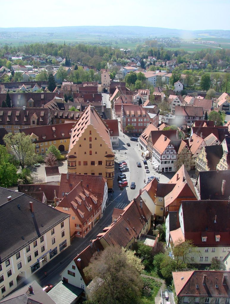
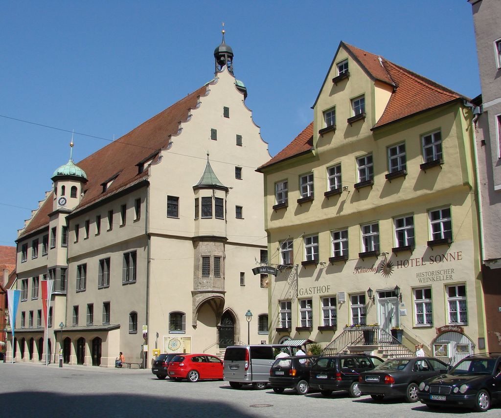
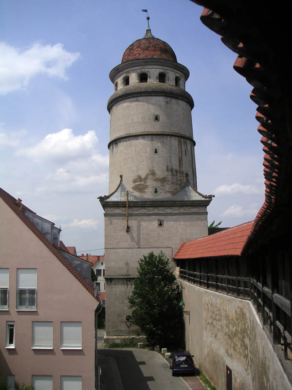
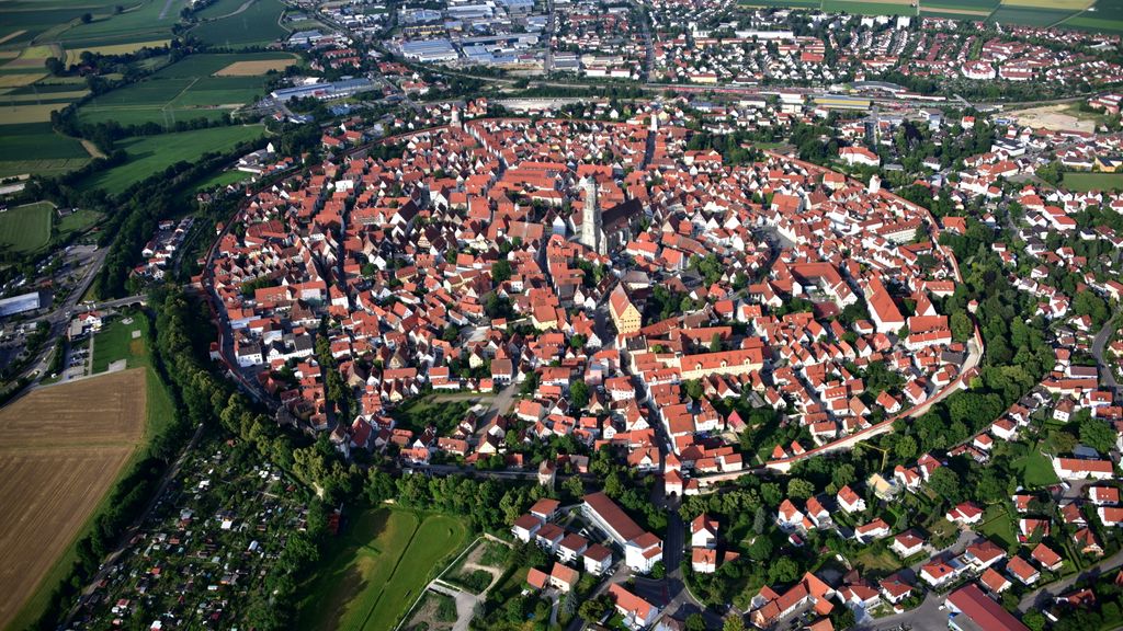
Nördlingen (German: [ˈnœʁt.lɪŋ.ən] ; Swabian: Nearle or Nearleng) is a town in the Donau-Ries district, in Swabia, Bavaria, Germany, with a population of approximately 20,674. It is located approximately 115 km (71 mi) east of Stuttgart, and 145 km (90 mi) northwest of Munich. It was built in an impact crater 15 million years old and 25 km in diameter—the Nördlinger Ries—of a meteorite which hit with an estimated speed of 70,000 km/h, and left the area riddled with an estimated 72,000 tons of micro-diamonds. Nördlingen was first mentioned in recorded history in 898. The town was the location of two battles during the Thirty Years' War, which took place between 1618 and 1648. Today it is one of very few towns in Germany that still have completely intact city walls - joining the ranks of Rothenburg ob der Tauber, Dinkelsbühl and Berching. Another attraction in the town is Saint George's Church's 90-metre (300 ft) steeple, called "Daniel", which is made of a suevite impact breccia that contains shocked quartz. Other notable buildings are the town hall (which dates to the 13th century), St. Salvator church and the Spital, a former medieval hospital. The Ries crater museum is located in the well-preserved medieval tanners' quarter. The city is home to several other museums, such as the Bavarian Railway Museum, the Nördlingen city museum (Stadtmuseum), the city wall museum (Stadtmauermuseum) and Augenblick museum. The latter has panoramas, magic lanterns, silent films, barrel organs, pianolas, music boxes and gramophones. Nördlingen is also known for the Scharlachrennen (Scarlet Race), a horse race tournament that was first mentioned in 1463. Since World War II, it has expanded to include eventing, jumping and dressage.
Show more
Sun and Moon
Mon
Tue
Wed
Thu
Fri
Sat
Sun
May 2022
Date and time
00:00
06:00
12:00
18:00
Today
--
--
Sunrise
--
Sunset
--
Moonrise
--
Moonset
Phase
🌔 Waxing Gibbous
The perfect light time for beautiful photos:
--
Sunrise
--
Sunset
PeakVisor app
Get the app on your smartphone
New Panorama Tools
Trace location on the map
Measure distances
All the instruments are available in the context menu as well.
We use GPS information embedded into the photo when it is available.
3D mountains overlay
Adjust mountain panorama to perfectly match your photos because recorded by camera photo position might be imprecise.
Move tool
Rotate tool
Zoom
More customization
Choose which peak labels should make into the final photo and what photo title should be.
Next
Photo Location
Satellitte
Flat map
Relief map
Latitude
Longitude
Altitude
OR
Latitude
°'''
Longitude
°'''
Apply
Register Peak
Peak Name
Latitude
Longitude
Altitude
Register
Teleport
PeakVisor
This 3D model of Sagarmatha National Park in Nepal was made using the PeakVisor app topographic data. The mobile app features higher precision models worldwide, more topographic details, and works offline. Download PeakVisor maps today.
Download OBJ model
PeakVisor
The download should start shortly. If you find it useful please consider supporting the PeakVisor app.
PeakVisor for iOS and Android
Be a superhero of outdoor navigation with state-of-the-art 3D maps and mountain identification in the palm of your hand!