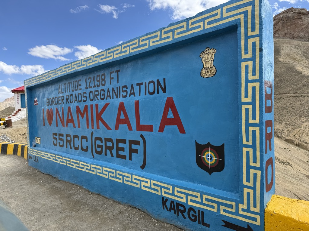
Namika La (Wylie: gnam gyi ka la; "Pillar of the Sky Pass") is a high mountain pass in the Zaskar Range of the Himalayas in Ladakh, India, at an elevation of 3,700 m or 12,139 ft. It is traversed by the Srinagar-Leh highway. Namika La is one of two high passes between Kargil and Leh. The other is the even higher Fotu La Pass. The western approach to the pass is via the Wakha Rong valley, making a detour to a waterless branch valley of it above the village of Mulbekh. To the east of the pass is another branch valley (Saraks Lungpa) of the Sangeluma river valley in the vicinity of Bodh Karbu.
We use GPS information embedded into the photo when it is available.
3D mountains overlay
Adjust mountain panorama to perfectly match your photos because recorded by camera photo position might be imprecise.
Move tool
Rotate tool
Zoom
More customization
Choose which peak labels should make into the final photo and what photo title should be.
Next
Photo Location
Satellitte
Flat map
Relief map
Latitude
Longitude
Altitude
OR
Latitude
°'''
Longitude
°'''
Apply
Register Peak
Peak Name
Latitude
Longitude
Altitude
Register
Teleport
PeakVisor
This 3D model of Sagarmatha National Park in Nepal was made using the PeakVisor app topographic data. The mobile app features higher precision models worldwide, more topographic details, and works offline. Download PeakVisor maps today.
Download OBJ model
PeakVisor
The download should start shortly. If you find it useful please consider supporting the PeakVisor app.
PeakVisor for iOS and Android
Be a superhero of outdoor navigation with state-of-the-art 3D maps and mountain identification in the palm of your hand!