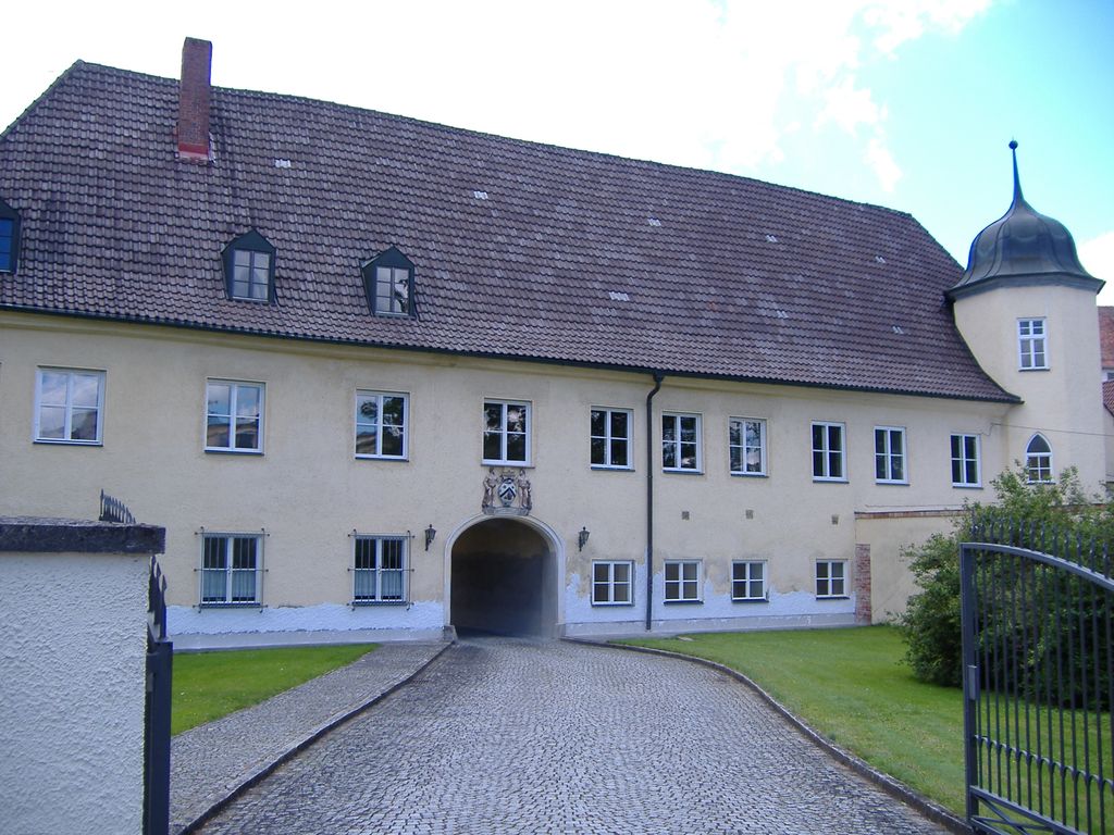
Mering is a municipality in the district Aichach-Friedberg, in Bavaria, Germany. It is located on the river Paar. First mentioned in records in 1021, Mering has a long history. The growing town with its nearly 15,000 inhabitants (2021) profits from its good location between Munich and Augsburg. Engine of this growing popularity is the main railway station which connects Mering directly within 30 minutes to Munich and within 15 minutes to Augsburg. Although it profits from being in easy reach of big cities, one can easily get anything in Mering, from ice cream to cars. Mering is a lovely small town with many shopping facilities within easy walking distance. Its motto is "Ihr Einkaufsort der kurzen Wege" (Your shopping centre of short distances). Worth a visit is the baroque main Catholic church St. Michael built in 1789 with its magnificent building and interior. A popular place is the recently redesigned main square (Marktplatz) with shops and restaurants in ancient buildings surrounding the fountain. Every Friday the local farmers' market takes place here when inhabitants and guests meet to buy fresh vegetables, fish and so on, or just relax by having a coffee. Next to the river Paar, a nice area to go for a walk is by the old mill where the privately owned castle of Mering is located.
Show more
Sun and Moon
Mon
Tue
Wed
Thu
Fri
Sat
Sun
May 2022
Date and time
00:00
06:00
12:00
18:00
Today
--
--
Sunrise
--
Sunset
--
Moonrise
--
Moonset
Phase
🌔 Waxing Gibbous
The perfect light time for beautiful photos:
--
Sunrise
--
Sunset
PeakVisor app
Get the app on your smartphone
New Panorama Tools
Trace location on the map
Measure distances
All the instruments are available in the context menu as well.
We use GPS information embedded into the photo when it is available.
3D mountains overlay
Adjust mountain panorama to perfectly match your photos because recorded by camera photo position might be imprecise.
Move tool
Rotate tool
Zoom
More customization
Choose which peak labels should make into the final photo and what photo title should be.
Next
Photo Location
Satellitte
Flat map
Relief map
Latitude
Longitude
Altitude
OR
Latitude
°'''
Longitude
°'''
Apply
Register Peak
Peak Name
Latitude
Longitude
Altitude
Register
Teleport
PeakVisor
This 3D model of Sagarmatha National Park in Nepal was made using the PeakVisor app topographic data. The mobile app features higher precision models worldwide, more topographic details, and works offline. Download PeakVisor maps today.
Download OBJ model
PeakVisor
The download should start shortly. If you find it useful please consider supporting the PeakVisor app.
PeakVisor for iOS and Android
Be a superhero of outdoor navigation with state-of-the-art 3D maps and mountain identification in the palm of your hand!