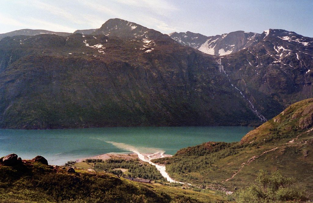
Memurubu is a tourist hut in Norway, at the end or start of the famous Besseggen hiking trail. Memurubu is originally an old mountain pasture dating back to 1872, but has had tourists just as long. Cows are still grazing around the tourist hut, which lies at the mouth of the river Muru in the valley Memurudalen. After a fire destroyed the original lodge in 1998 it was rebuilt. The new facility has a few family rooms with shower and bathrooms, although most of the 150 bunks are in double or quadruple occupancy rooms. Memurubu was the fourth cabin in Norway set up by Norwegian Mountain Touring Association (DNT) but is now privately owned, though members of DNT obtain cheaper prices. The lodge produces its own green power from its hydroelectric generator. Hiking along the Besseggen trail, one ends at Gjendesheim at the eastern end of the lake Gjende. Hiking westwards along Gjende over Bukkelægret, one ends at Gjendebu at the western end of Gjende. From Memurubu, the mountain Surtningssue is also accessible through the valley Memurudalen
We use GPS information embedded into the photo when it is available.
3D mountains overlay
Adjust mountain panorama to perfectly match your photos because recorded by camera photo position might be imprecise.
Move tool
Rotate tool
Zoom
More customization
Choose which peak labels should make into the final photo and what photo title should be.
Next
Photo Location
Satellitte
Flat map
Relief map
Latitude
Longitude
Altitude
OR
Latitude
°'''
Longitude
°'''
Apply
Register Peak
Peak Name
Latitude
Longitude
Altitude
Register
Teleport
PeakVisor
This 3D model of Sagarmatha National Park in Nepal was made using the PeakVisor app topographic data. The mobile app features higher precision models worldwide, more topographic details, and works offline. Download PeakVisor maps today.
Download OBJ model
PeakVisor
The download should start shortly. If you find it useful please consider supporting the PeakVisor app.
PeakVisor for iOS and Android
Be a superhero of outdoor navigation with state-of-the-art 3D maps and mountain identification in the palm of your hand!